
Hi all,
Meteorological summer is coming and it’s turning warmer, but for how long?
Thursday: Warmer air is now in place which will lead to a very mild start but with it a lot of cloud and damp conditions with some drizzle. Cloud will break up into the afternoon in some places and in any sunshine it will feel warm and humid. Some brief showery rain for northern parts towards evening. Max 19°C
Friday: Mostly cloudy and dry conditions with a few bright spells. Again, warm and muggy especially where the cloud breaks. Max 19°C
Weekend: Breakdown on Sunday
Saturday: Bright or sunny spells with some thicker cloud at times. Very warm and humid. Max 22°C
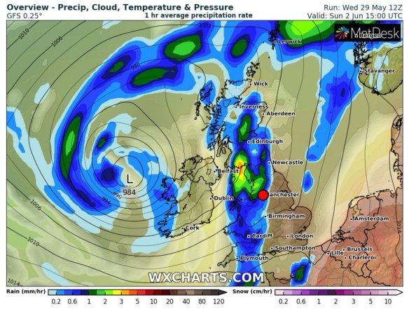
Possible thunderstorms on Sunday
Sunday: Change on the way as a cold front pushes in from the west. Warm to start but then showers will develop, possibly thundery, although these look more likely to develop to our east. Becoming cooler. Max 18°C
Outlook: Turning cooler and windier with showers at times. No sign of our first Summer heatwave.
Follow @ChadWeather on Twitter for your latest local weather forecasts.
Thanks,
Jon
Forecast Issued on Wednesday the 29th of May 2019 at 5:15pm
Image: www.wxcharts.com
