Hi all,
Change on the way to colder weather this week and then high pressure takes control to bring some late-Autumn frosts and fog. Almost winter and the talk of significant snow next week according to the social media jokers but I can confirm no sign of that within the next 7 days for sure.
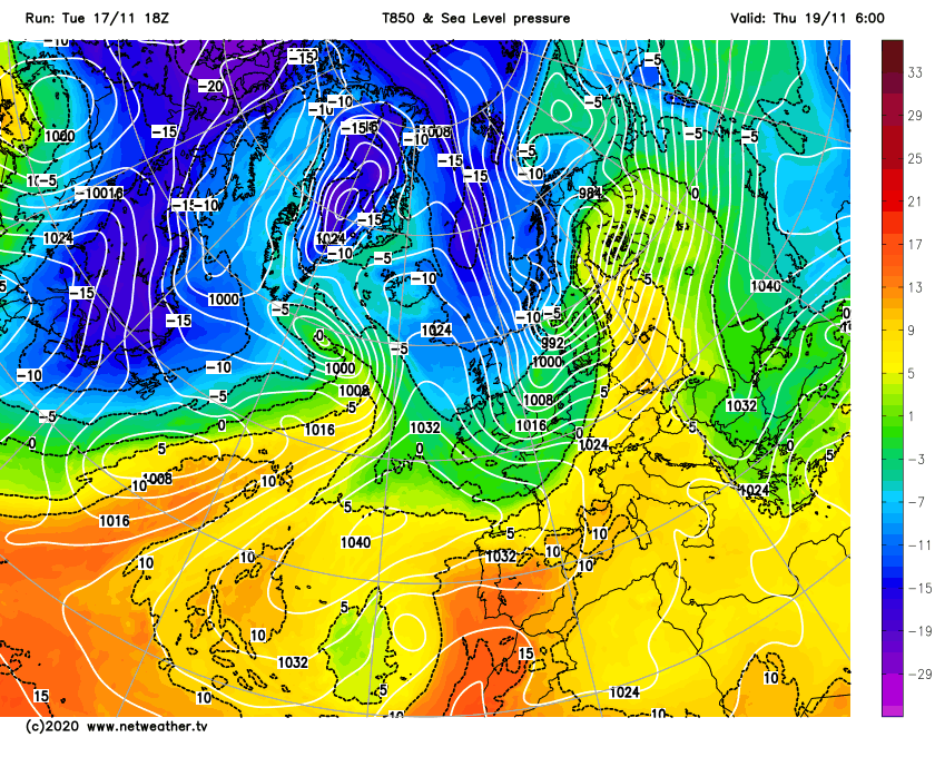
Thursday: Colder air has now reached all parts of the UK feeding down from the NW so we start the day with a frost and even patchy fog. Sunny spells should break through eventually for all leading to a decent day apart from a few showers out to the West. Max 8°C
Friday: High pressure in charge now so light winds means another morning of mist and fog, some of it dense and a frost. The foggy conditions look set to stay for most, even if it lifts into low-cloud it will remain cold and dank. Max 5°C
Weekend: High pressure drifts into Scandinavia leading to a chilly breeze.
Saturday: Likely to start misty and frosty again. Mostly cloudy as the mist lifts but hopefully some bright spells coming through into the afternoon as the south-easterly breeze picks up. Still cold. Max 6°C
Sunday: Patchy frost to start then bright spells. Cloud thickening into the afternoon but it should remain dry. A little less cold. Max 7°C
Outlook: High pressure builds in again from the West so mostly settled and cloudy with a few bright spells. Milder for a time too with the frosty nights disappearing. Towards the back end of the week it could turn colder from the NW with wintry showers.
Thanks for reading.
Jon
Forecast Issued: Wednesday the 25th of November 2020 at 10am.