Hi all,
So be honest how many of you actually enjoyed the heatwave last week? With record dew points and an oppressive feel it was not for me. Money was spent on new fans but all they did was blow around hot air and I really struggled to sleep for at least 4 or 5 days. Purchasing an air-con unit may not be far away.
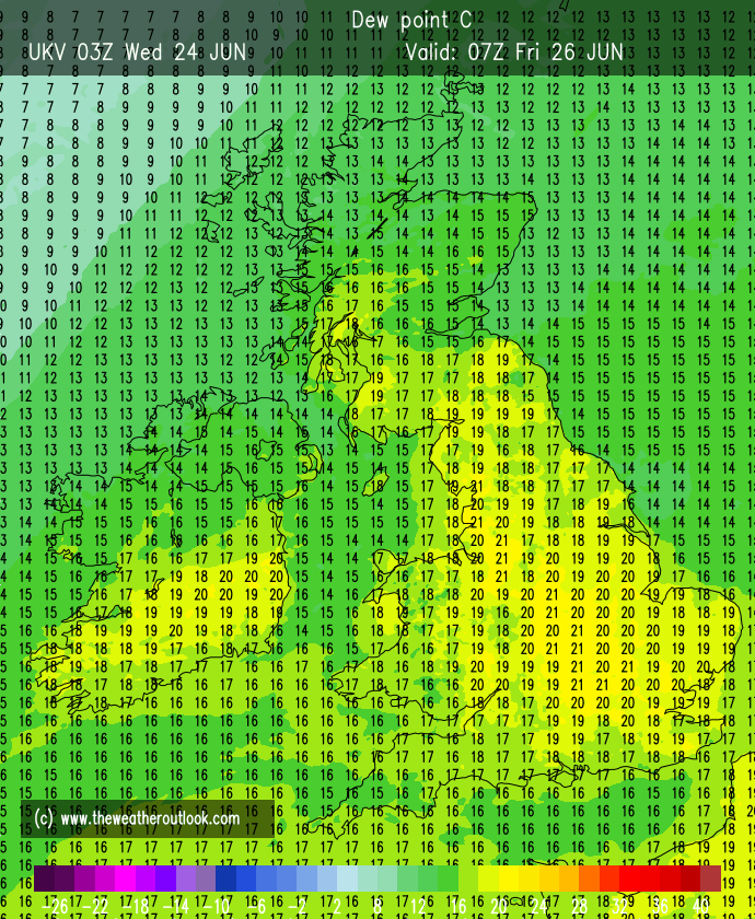
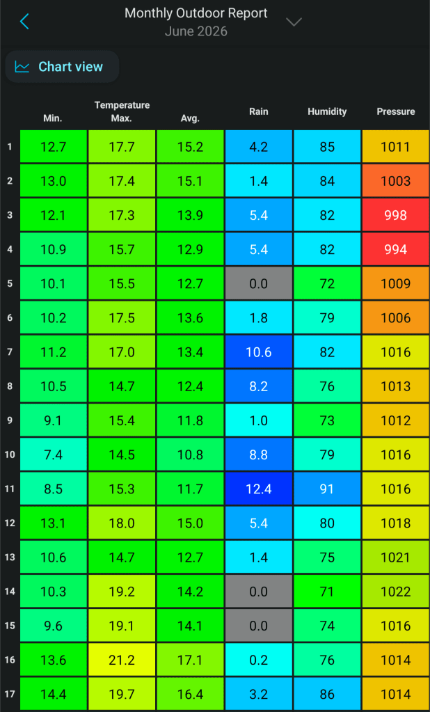
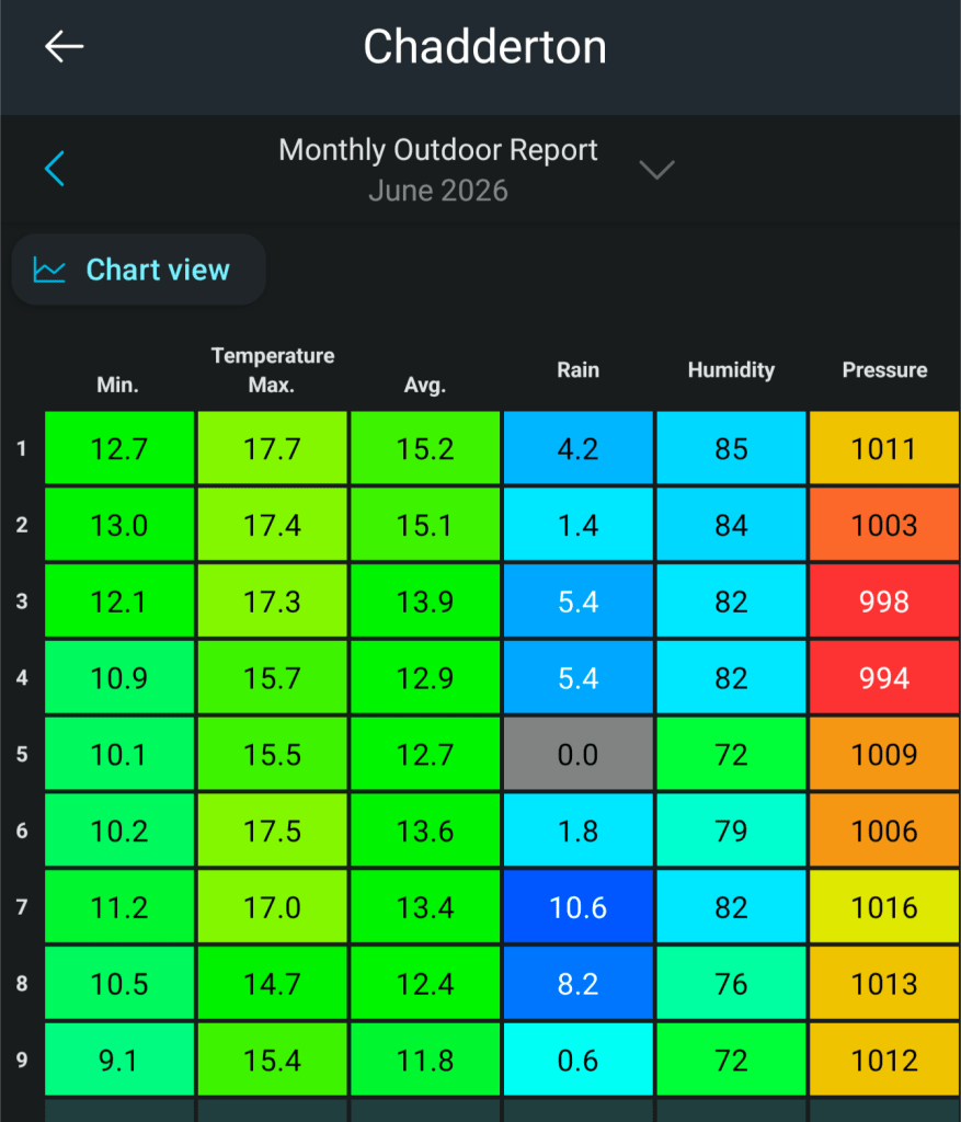
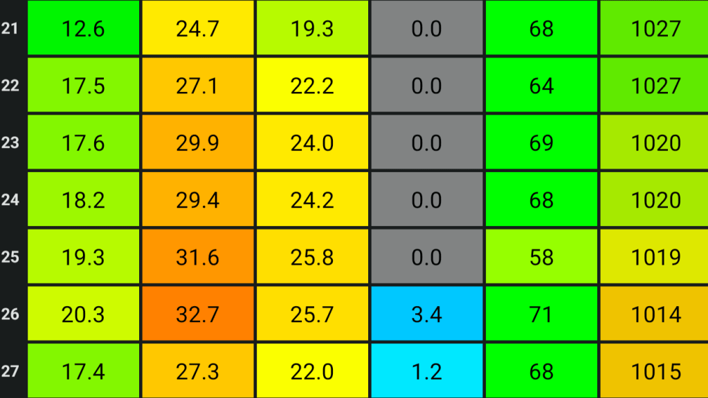
Below are the maximums and minimums that were recorded during the heatwave and as you might have seen, the old dew point record (20.7°C) was smashed. Also, I recorded my 3rd hottest day since records began (August 2012). In this country, it’s rare to see a dew point over 20°C. It’s humid enough when dew points start to get into the mid-teens, but last week this was one of the main reasons why it felt so awful.
Min | Max | Av. | Rain | Av. Humidity| Av. Pressure
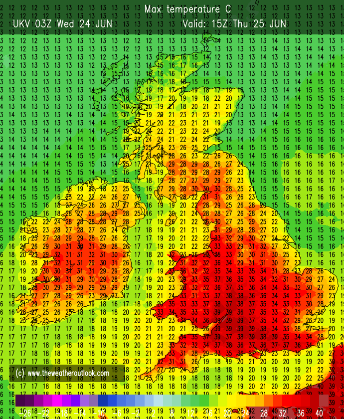
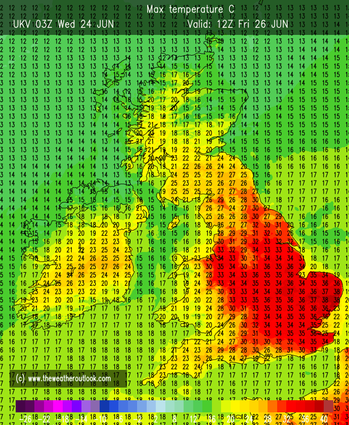
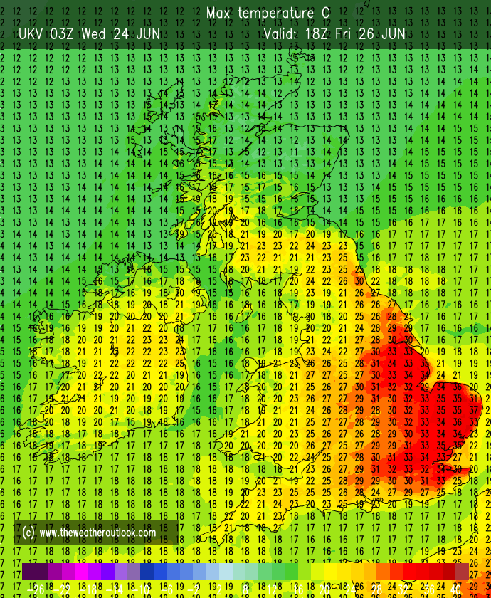
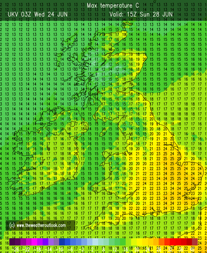
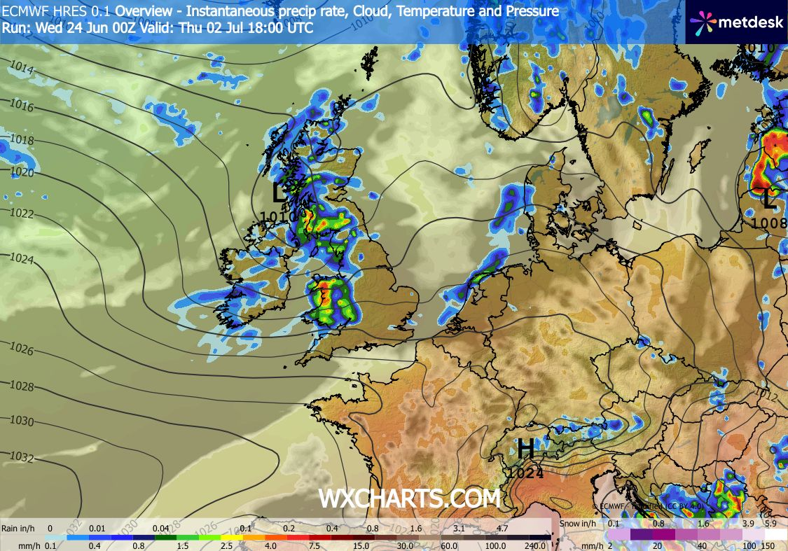
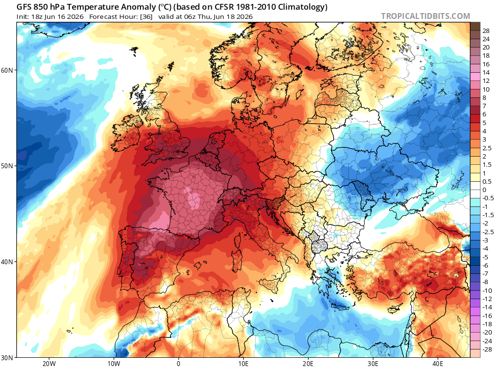
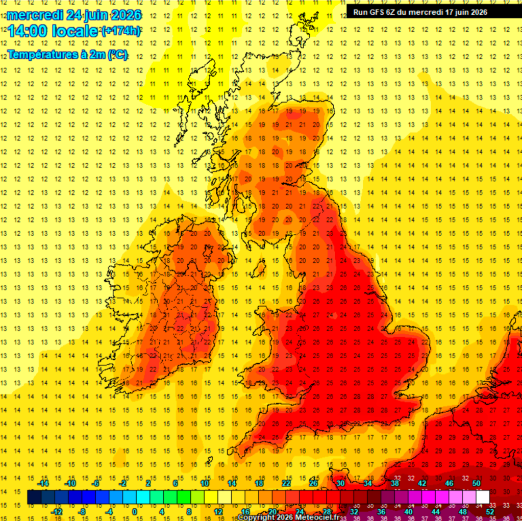
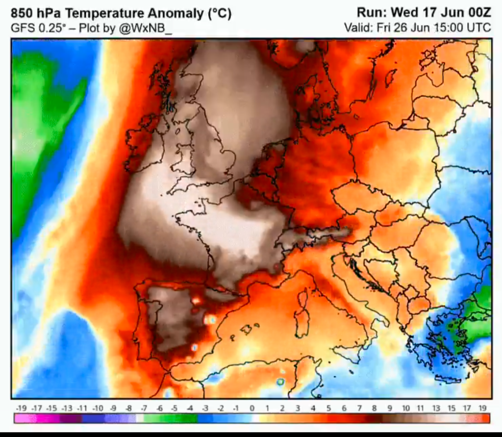
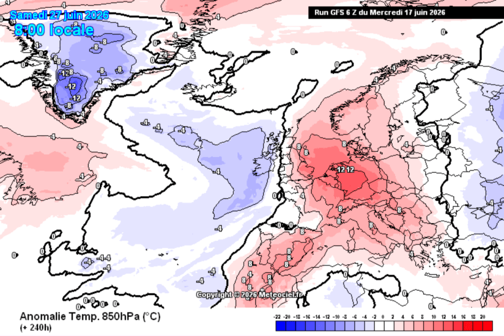
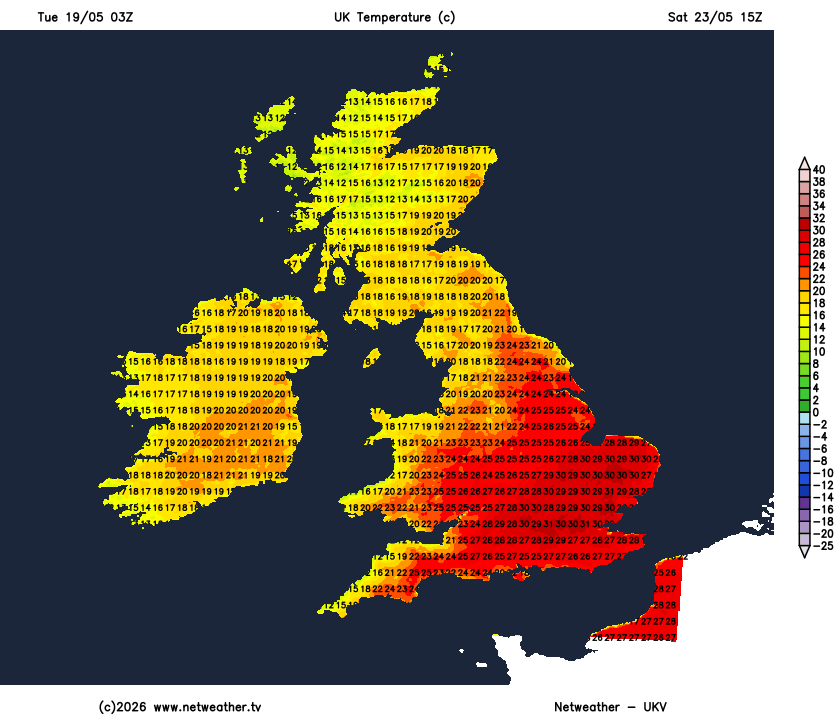
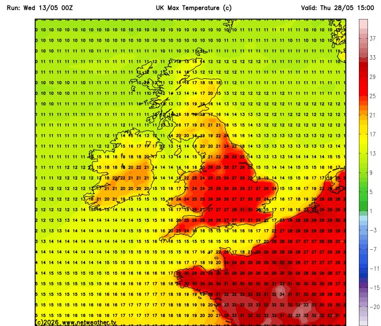
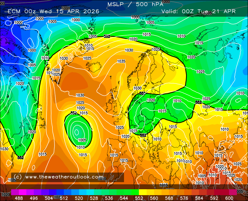
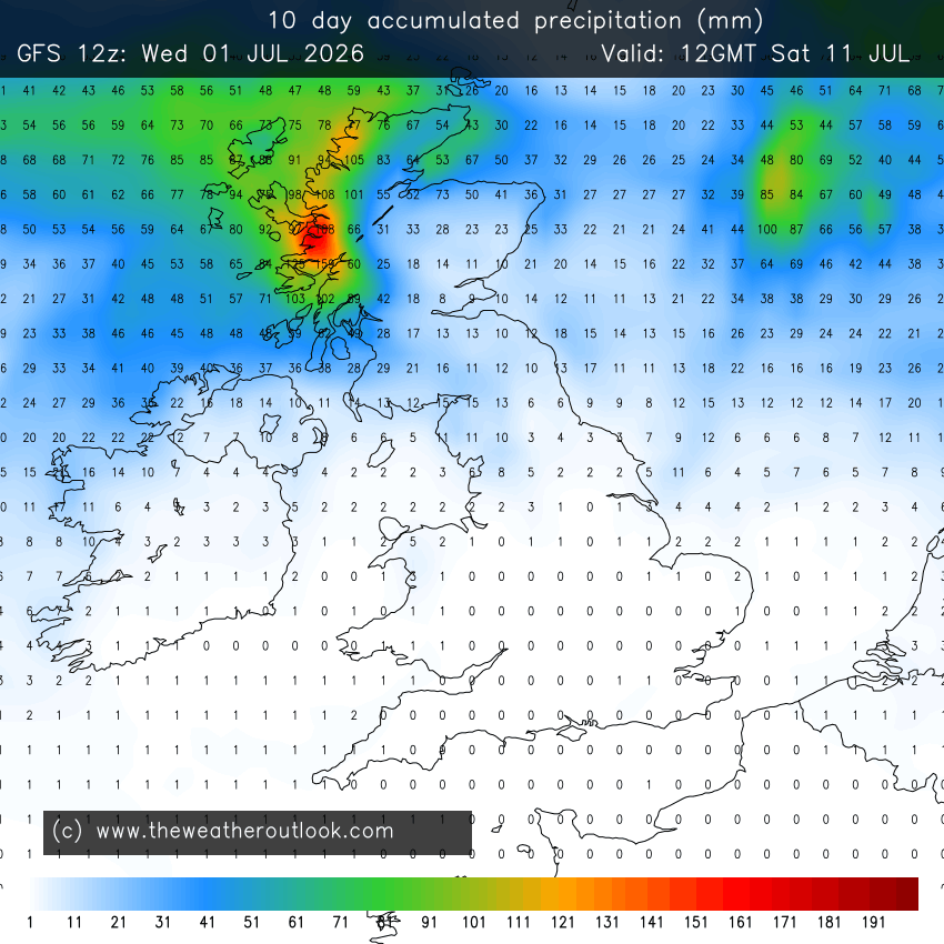
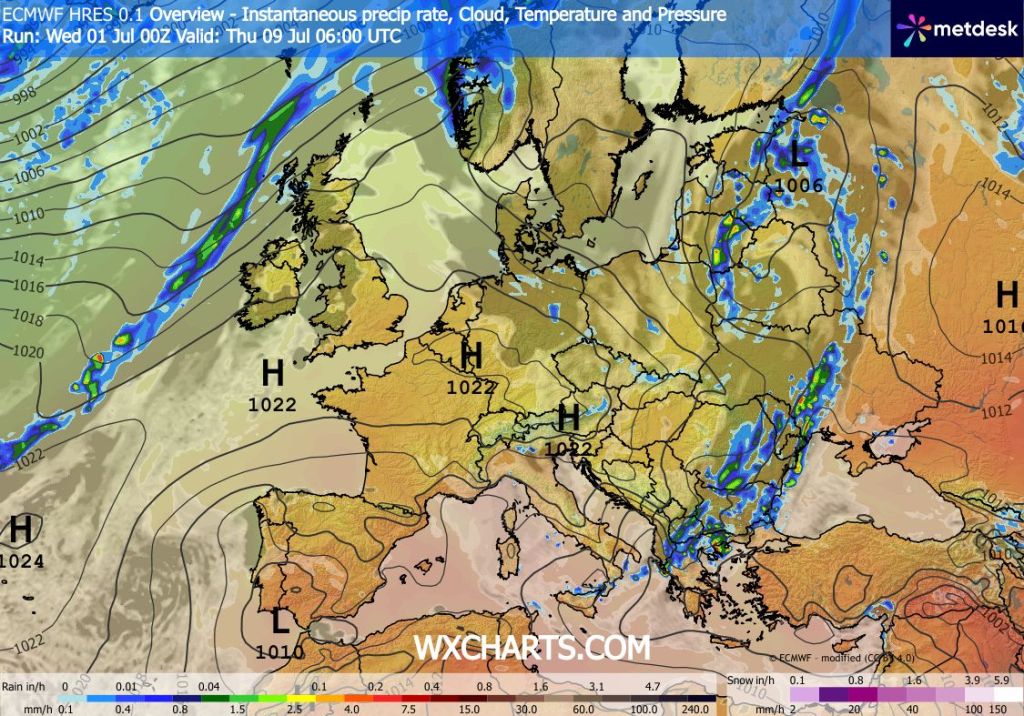
Not long soon after that heatwave ended, there were already long-range weather charts showing another heatwave on the way and some charts did show temperatures close to 40°C or above. Of course, looking at a chart this far out should always be taken with a pinch of salt and since then those high temperatures have downgraded. Also, the heatwave that is coming to parts of the UK is not expected to be as widespread as it was looking to be. That said, places in the south will still see temperatures close to or above 30°C for possibly 7 days. Also, looking ahead there will be occasional cloudy spells and patchy rain from the north or west but there is not much in the way of total rainfall for the foreseeable.
UV levels remain high.
Thursday: Perhaps a few showers to start then sunny spells developing. Quite windy at times but feeling warm in the sunshine. Max 20°C Min 12°C Max Gusts 30mph
Friday: A decent day with sunny spells hopefully becoming more widespread later in the day. Feeling warm and breezy at times. Cloud increasing overnight. Max 22°C Min 13°C Max Gusts 20mph
Weekend: Variable cloud, thickest in the morning.
Saturday: Cloudy to start, risk of drizzle especially on high ground followed by brighter spells. Windy. Max 22°C Min 14°C Max Gusts 30mph
Sunday: A very similar day, cloudy to start, a bit stubborn to break up, but eventually sunny spells will break through and feeling warm. A risk of some patchy drizzle or rain early on. Otherwise a dry day ahead. Max 23°C Min 14°C Max 25mph
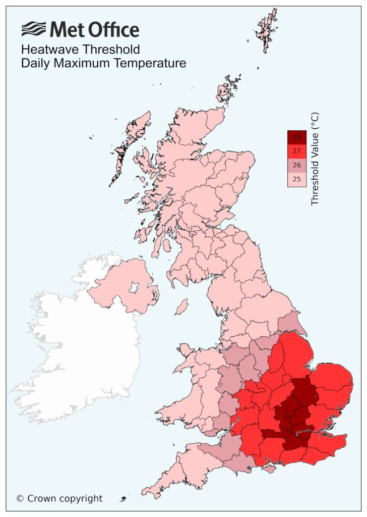
Outlook: High pressure to our south, which will be bringing a heatwave to southern parts of the UK, should start to drift eastwards. This will allow for the warmer air to drift northwards so I’m expecting a few days next week of temperatures close to the mid-20s. Depending on these values, would decide whether we meet the threshold for a heatwave. It looks like we will probably have 2 or 3 days of sunny hot weather, but then the weather will break down from the west later in the week with cloud and rain eventually returning.
Follow @ChadWeather on X and Bluesky for the latest forecasts and warnings.
Thanks,
Jon
Forecast Issued: Wednesday the 1st of July 2026 at 6:15pm
Images: http://www.theweatheroutlook.com & http://www.wxcharts.com