
Hi all,
A quick blog this week as it’s been a busy Wednesday. You’ll have noticed that it has been cloudier and quite chilly this week at times with only a high of 13°C on Tuesday and winds from the north-east. There will be a warmer couple of days to come leading up to this weekend so take advantage.
Thursday: Bright spells with cloud bubbling up during the day producing some showers. Winds switching to a southerly so not as cool. Max 15°C Min 6°C Max Gusts 20mph
Friday: Warmer with sunny spells, especially during the morning. Clouds again bubbling up and with the warmth there could well be some localised hefty showers falling. Max 17°C Min 8°C
Weekend: Cooler again into Sunday.
Saturday: Apart from a bit of a nagging wind it looks a reasonable morning and early-afternoon. Bright spells and warm but it is expected to cloud over with rain arriving, albeit patchy, later in the day. Max 19°C Min 10°C Max Gusts 25mph
Sunday: Cooler and uncertainty in the forecast. Looks like low pressure will try to develop but with high pressure close by and ridging in, we could well be in between weather systems. Plenty of cloud around just the risk of the odd shower. Chilly wind. Max 14°C Min 7°C Max Gusts 20mph
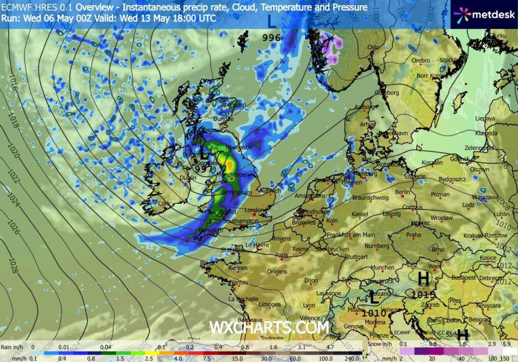
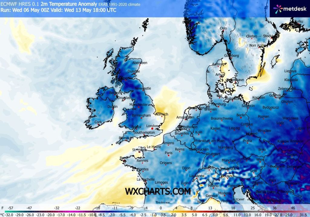
Outlook: Turning unsettled and cooler with temperatures below average.
Follow @ChadWeather on X and Bluesky for the latest forecasts and warnings.
Thanks,
Jon
Forecast Issued: Wednesday the 6th of May 2026 at 5:41pm.
Images: http://www.wxcharts.com
