A winter-chill has its firm grip across the region but it’s not severe cold and we’re not exactly hiding from a Beast from the East, yet! It’s been nice to see some snow and winter-cold over the festive period and not only that but a few flurries on Christmas Day brought us a White Christmas. I hope you all had a fantastic Christmas and didn’t eat too much!
Thursday: Early fog and some localised wintry showers, falling as snow for some, favourably above 150M. These showers will ease as we head into the afternoon so turning drier but remaining cold. Max 3°C
Friday: During the early hours a band of rain, sleet and snow will come down from the north but it will be breaking up and weakening all of the time so not much snow is expected. Bright spells later, especially in the north. Frosty overnight. Max 4°C
Weekend: Dry and cold
Saturday: A mostly bright day with some sunny spells in the morning. Cloudier later. Feeling cold with frost morning and night. Max 4°C
Sunday: Overcast, dry and cold. Max 4°C
Outlook: Sleet and snow showers expected during the week but details uncertain at this stage. Some bright spells too, frosty nights remain and temperatures stay cold during the daytime, max 3-5°C. A raw north-easterly breeze. No sign of the cold weather easing.
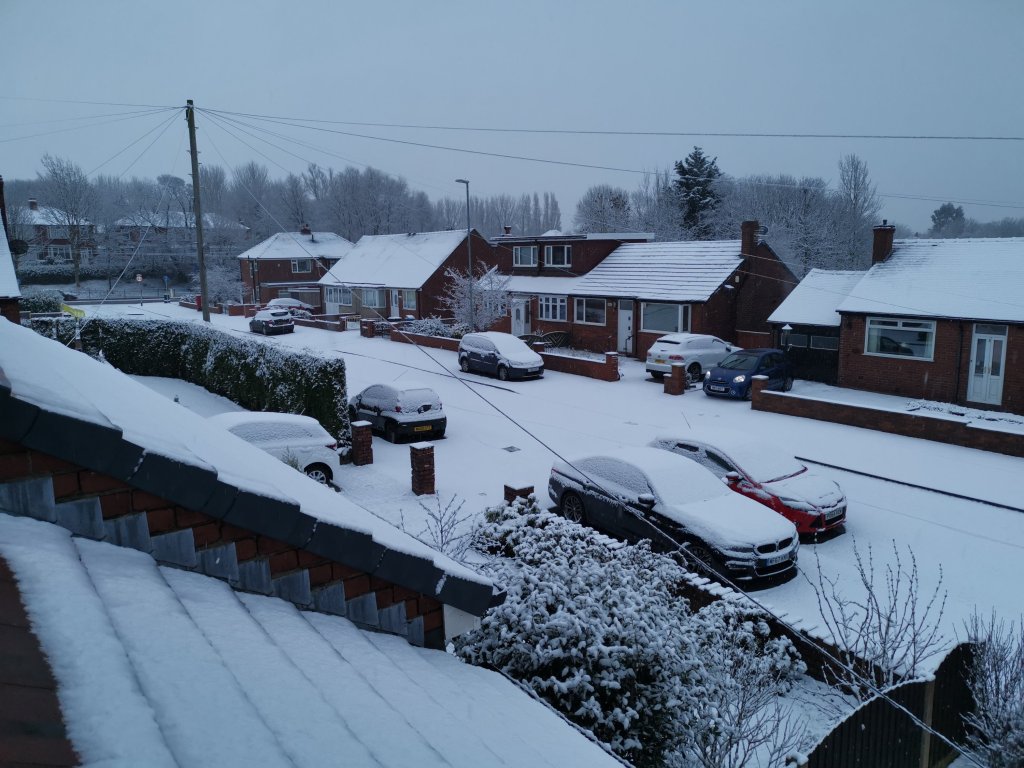
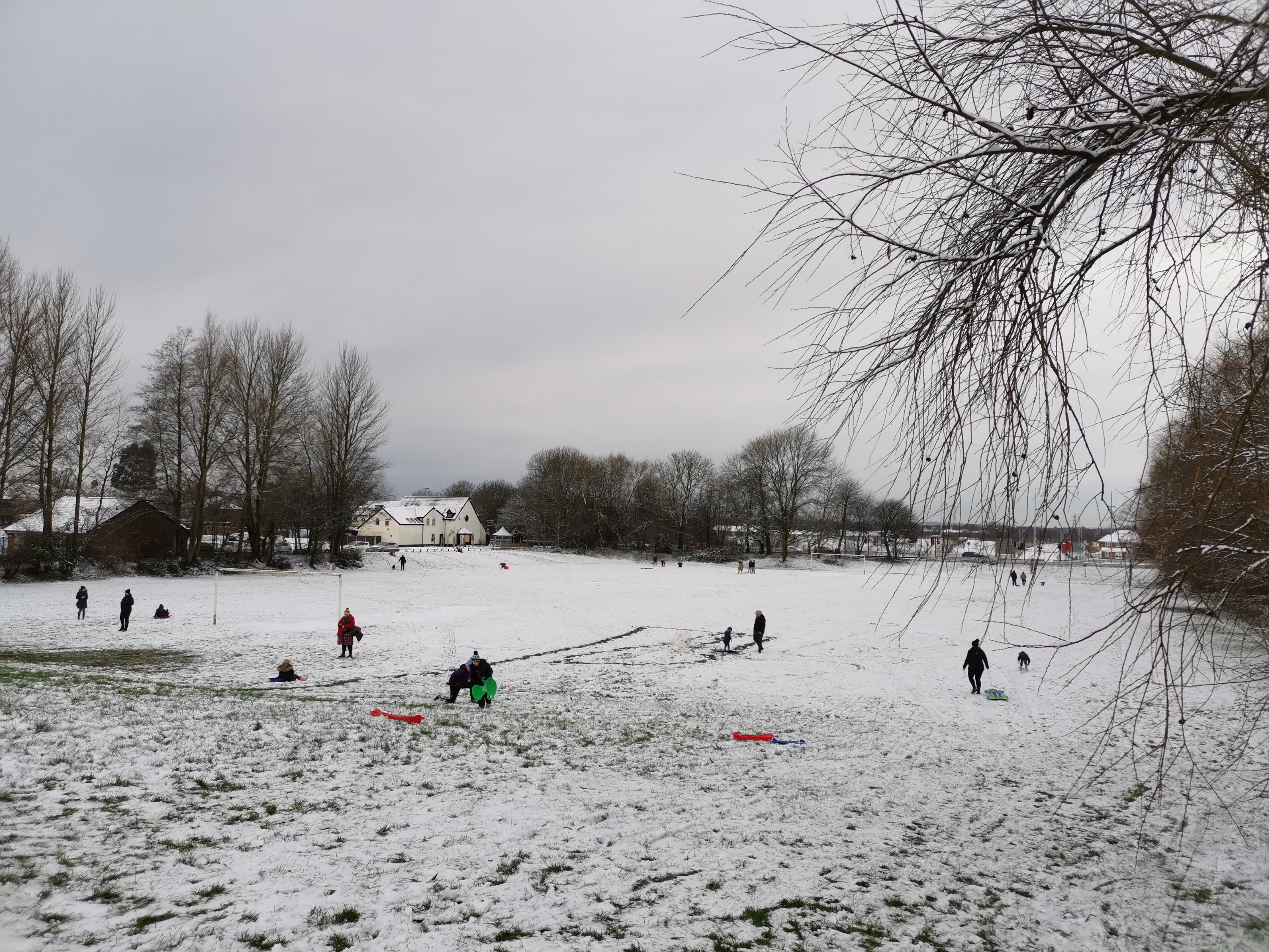
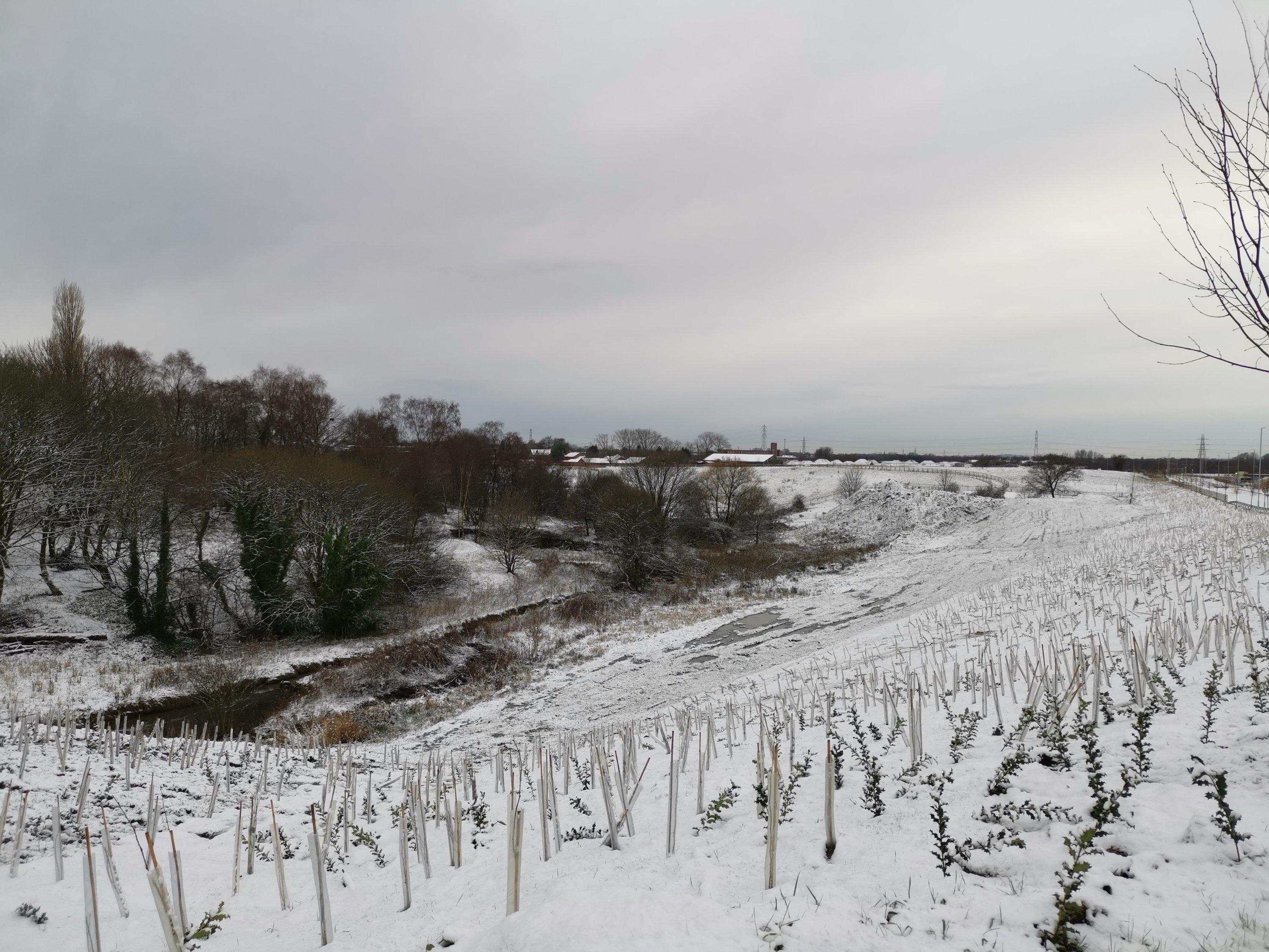
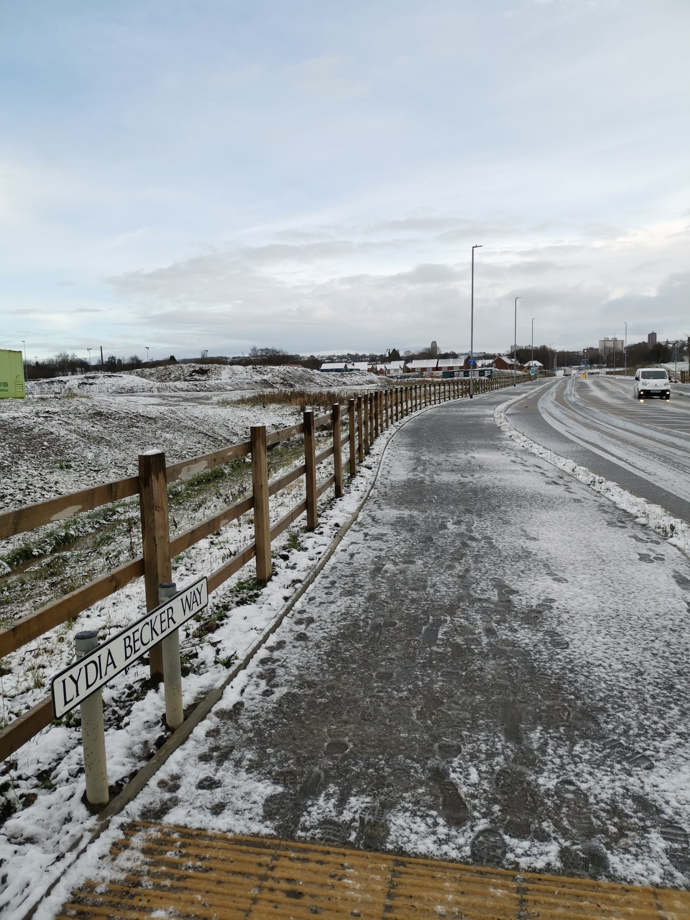
Snow on the morning of the 29th of December 2020Sledging on Ancora playing fieldsSnow on the verge by the new Broadway Link RoadCharlie the snowmanIcy conditions underfoot
Social media has been touting the ‘Beast from the East is coming’. Can’t be ruled out but no concrete signs of it happening just yet.
All the best for 2021 – surely it can only be better than 2020.
Thanks for reading, Jon
Forecast Issued: Wednesday the 30th of December 2020 at 18:25.
First off, apologies for the lack of weekly blogs over the past few weeks but at least they are back! Now wouldn’t it be nice to deliver some good news with the current climate – i.e. some snowfall (not everyone’s cup of tea I know) but I can’t promise anything widespread. The best I can offer is there’s a good chance we will see some snowflakes over the coming days and that the weather will feel a bit more seasonal. Winters aren’t what they used to be but it’s nice to have a cold and frosty 25th of December. Look out for some 2020 weather stats soon!
Christmas Eve (Thursday) – A frosty morning with some lovely winter sunshine. Feeling sub-zero throughout the day and breezy at times. Cloud increasing during the day but remaining dry for most with sunny spells (Small chance of a wintry shower in the East during the day). Cold – as it should be for this time of the year. Widespread frost overnight. Max 4°C
Christmas Day (Friday) – High pressure builds from the west so a calm, frosty start with some rural spots down to -4°C. Plenty of sunshine for the morning but cloud will increase from the north-west as a weather front topples over and down through the high pressure. Becoming breezy and milder later in the day and some rain overnight. Max 5°C (occurring much later in the day)
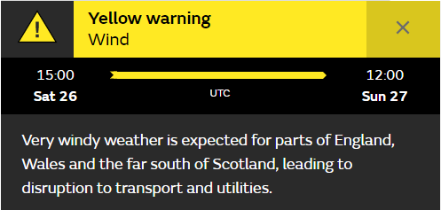
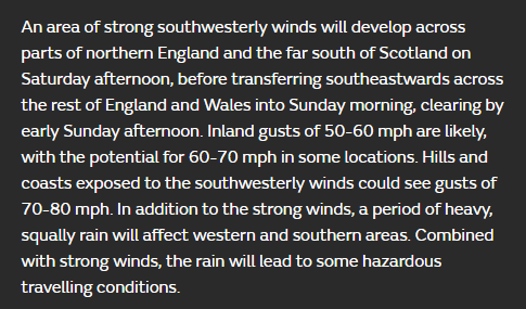
Boxing Day (Saturday) – Back to what we are used to. More mobile weather now as bands of showery rain move south-east with winds increasing quickly. Heavy rain for a time during the evening. Currently we have a weather warning in place (see below) with gusts expected to exceed 50mph quite widely later in the evening and overnight. Milder. Max 8°C
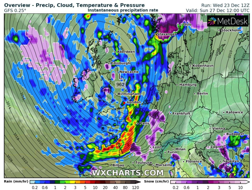
Sunday – A big area of low pressure now dominates our weather and with the Jet Stream slipping South, it means we are in colder air once more. Expect some morning rain, sleet and hill-snow turning to wintry showers as the day progresses, all packing in on keen north-westerly airflow. Much colder and a significant wind-chill. Some lying snow above 300M can’t be ruled out. Max 5°C
A messy picture on Sunday – very windy, cold with wintry showers, snow on the hills
Bank Holiday Monday – Remaining cold with low pressure in charge. Mostly cloudy with a chance of further wintry showers, perhaps the snow won’t just be confined to high ground. One to watch. Max 5°C
Outlook for the rest of 2020: Staying cold with a feed of northerly\north-westerly winds. Some wintry showers but it tends to favour drier weather, some frost at night where cloud breaks.So with colder air remaining, snow can’t be ruled out if anything develops. Looks like it will even stay cold, max temperatures 4-6°C for the first few days of the new year.
Follow @ChadWeather on Twitter for the latest weather forecasts! Even ask for a personalised forecast!
I would like to wish you all a very Merry Christmas and after what has been a year to never forget, for all the wrong reasons, I wish you a better and enjoyable 2021!
Thanks as always for reading, Jon
Forecast Issued: Wednesday the 23rd of December 2020 at 7:20pm Images: Met Office & https://wxcharts.com/
Winter’s only just arrived and we have our first chance of some snowfall, albeit on the Pennines and surrounding hills but it’s a start. No repeat of December 2010 at this point!
Thursday: A cloudy and cold day with bits and pieces of rain or showers. Some of this falling as sleet or wet-snow above 350M and on the Pennines but it’s not expected to amount to much. Max 5°C
Friday: A day to keep an eye on if you’re travelling on the tops. Rain looks set to come in from the east during the day and with cold air in place this is likely to turn to snow. The snow will be mostly confined to above 250M but don’t be surprised to see some sleet and wet-snow to lower-levels at times. Slightly less cold air towards evening will mean the snow-level will rise. Max 4°C
Weekend: Remaining mostly cloudy and slowly drier. Below average temperatures.
Saturday: Any early rain, sleet and Pennine-snow soon fading away. Staying generally cloudy with limited brightness. Cold and a patchy frost likely overnight. Raw breeze. Max 5°C
Sunday: Drier with bright or sunny spells developing. Odd shower. Lighter winds. Max 5°C
Outlook: Slowly it will become less cold with temperatures returning to a maximum of 8°C. A lot of cloud about with some patchy rain/showers. No sign of conditions cold enough to bring a snow-risk.
November 2020 Stats
Max 16.2°C (1st) Min 1.6°C (23rd) Av. 8.3°C Av. Dew Pt 6.3°C Wettest 13.4mm (15th) Av. Humidity 88% Av. Barometer 1016.9 hPa Max Gust 33.4 mph (1st) Av. Wind Direction SW Rain 82.2mm Rain Registered Days 23 Dry Days 7
Thanks, Jon
Forecast Issued: Wednesday the 2nd of December 2020 at 8:40pm