Thursday 30th March 2017 – Sunday 2nd April 2017

Hi all,

Well that’s March almost done with. Where are these months going? Another disappointment regarding snow and we’re now well into Spring. We did see some snow late-April last year so don’t rule out seeing some over the coming weeks but I think it’s time to rule out any proper cold after a winter that never delivered. 

Meanwhile, we’ve been basking in some early-Spring sunshine and it’s been very pleasant indeed. For now though we’re back to the doom and gloom and rain. 

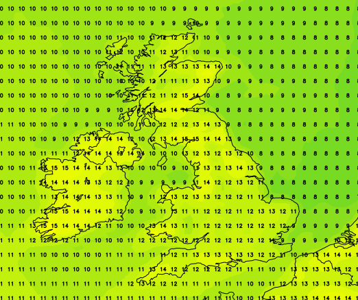
Thursday: A very mild day, even feeling muggy in any brightness but generally it’s a cloudy day with some showery rain at times. Max 16°C

Low pressure bringing heavy rain in from the west on Friday


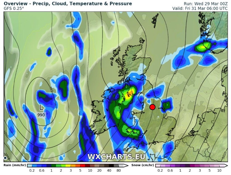
Friday: A spell of rain during the morning, some heavy. The afternoon looks likely to improve with some showers but pleasant sunny spells as well. Max 16°C

Weekend: A showery start then improving. 

Saturday: Low pressure close by bringing a cooler day with showers at times. Max 12°C

Sunday: For some of you doing the Manchester Marathon conditions are looking perfect. A little ridge of high pressure should come into play. A chilly start but bright spells will follow and feeling pleasant with light winds. Max 13°C

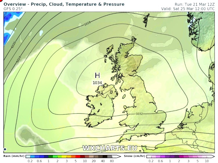
Fingers crossed for high pressure to return next week with plenty of dry weather and pleasant sunny spells


Looking ahead: Next week should become settled with mild southwesterlies keeping the temperatures towards the midteens. Sunny spells by day and dry so feeling pleasant once again. 

There’s been a lot of media lies flying around (the norm) about a Boiling Easter. It really is just made-up nonsense. It is far too early to tell what the weather will be like so look out for my updates via @ChadWeather on Twitter as we approach the Easter break. 

Thanks,
Jon

Forecast Issued: Thursday the 29th of March 2017 at 8:30am

Images: http://wxcharts.eu

Thursday 23rd March 2017 – Sunday 26th March 2017

Hi all,

Since I last blogged, it feels like it’s never stopped raining. It’s been an awful spell of weather (50mm of rain in the last 6 days) but finally we have some drier and sunnier weather on the way as we enter a settled spell with some warm-feeling Spring sunshine.

Thursday: Rain that moved through on Wednesday will return and be around in the morning but turn patchy during the day with bright or sunny spells developing. A cool northeasterly wind. Max 11°C

Friday: Low pressure moves away and high pressure topples in and starts to develop across the UK. Sunny spells and dry throughout with the breeze easing. Starting to feel pleasant. A slight frost overnight. Max 11°C

A dry weekend ahead. Yes, dry !

Well Hello High Pressure

Saturday: High pressure firmly in charge. Sunny spells after a cold start with a touch of frost in places. Dry and pleasant in the sunshine with another slight frost overnight. Max 14°C but feeling much warmer in the direct sunshine. [In fact temperatures in the direct sunshine will be around 30°C so it will be nice for sitting out]

Weekend Temps

Weekend temperatures looking good – perhaps a little cooler on Sunday

Sunday: The high might slip away slightly. Western areas likely to remain sunnier but cloud could encroach from the east spoiling the sunshine, lets hope it doesn’t. Remaining dry and a slight frost early and later where skies are clear. Max 12°C but cooler where the cloud appears.

Looking ahead: High pressure set to hang around into next week, so more dry conditions and chilly nights. Pleasant by day where the sun shines but still a chance of cloud now and again from the east. Where the sun is out temperatures could get close to the mid-teens.

Follow @ChadWeather on Twitter for the very latest weather updates for in and around Manchester.

Thanks,
Jon

Forecast Issued: Wednesday at 11:30am March 22nd 2017
Images: wxcharts.euhttp://www.netweather.tv

Thursday 16th March 2017 – Sunday 19th March 2017

Hi all,

Halfway through March and no sign of a late-winter chill or snowfall just yet. However, after a reasonably bright and mild few days, it will be cooler and wetter towards and over the weekend.

Thursday: High pressure slips away into Europe allowing a weak weather front to come in from the west. A cloudy day with some rain, especially on higher ground and later in the afternoon. Breezy. Max 11°C

Friday: The Atlantic influences our weather over the coming days. Another cloudy one on Friday with rain at times spreading in from the west on a freshening wind making it feel much cooler. Max 8°C

Little change into the weekend.

A windy Saturday & Sunday with 35-40mph gusts

Saturday: Early rain clears then sunny spells and showers. It will be cool and quite windy at times with 35mph gusts. A little milder but not that noticeable. Max 10°C

A wet weekend at times – not very Spring-like

Sunday: Cloudy with some more rain at times and again a brisk, westerly wind possibly gusting to 40mph. Max 12°C

Looking ahead: A little cooler with rain easing away to give some drier and more settled days but with some chilly nights.

Follow @ChadWeather on Twitter for the latest forecasts.

Thanks,
Jon

Forecast Issued: Wednesday the 15th of March 2017 at 11am
Images: www.theweatheroutlook.com

Thursday 9th March 2017 – Sunday 12th March 2017

Hi,

We’ve actually had a couple of reasonable days this week with the recent heavy rain coming overnight last night and tomorrow sees the sunshine continue. 

Thursday: Dry with sunny spells throughout the day. Windy at first but this easing. Feeling pleasant into the afternoon. Max 11°C

Friday: A cloudy day with some hill-fog and rain at times. Most of the rain will be patchy with some drier spells in between. Likely to be drizzly most of the day on the hills. Max 11°C

Saturday: Showery rain likely during the morning but some brighter, drier spells for later in the day. Breezy. Max 10°C

Cooler as the weekend goes on after a mild few days


Sunday: Rain will come in from the west then turn showery and introduce cooler air with some sunny spells. Max 9°C

Looking ahead: Little change at first with similar temperatures and some showery rain. Later in the week perhaps a few days of drying conditions. 

Thanks,
Jon

Forecast Issued: Wednesday the 8th of March 2017 at 8:30pm


Thursday 2nd March 2017 – Sunday 5th March 2017

Hi all,

Winter has gone, meteorologically-speaking of course, but we all know we tend to see snow in March at some point, so don’t unpack the garden furniture just yet. Speaking of snow, there could be some overnight on Wednesday with up to 7cm possible above 300M. See Twitter for updates.

Rain likely to turn to snow Wednesday night.


Thursday: Cloudy with rain, sleet and snow during the morning. Drier into the afternoon with some brightness. Breezy too making it feel cold. Some more rain late-evening. Max 7°C

Friday: Some drier, bright spells during the day, but later cloud will thicken with a risk of more rain coming up from the southwest. A cold breeze. Max 7°C

Saturday: A messy picture on Saturday as low pressure from the south swings up another weather front which could stall over the region bringing a wet day with rain at times. There is some uncertainty how far north it gets so watch for updates on my Twitter, @ChadWeather. Max 6°C

Sunday: I’m hoping a little ridge of high pressure builds for Sunday so we have a drier day with some brightness. Temperatures remaining similar values.  Max 7°C

Looking ahead: Temperatures around average, bright spells but also a lot of cloud which will limit the frost-risk. Some showers.

February 2017 Stats

Max 13.1°C (20th)
Min -0.1°C (28th)
Wettest 18.8mm (23rd)
Windiest 49mph (23rd)
Rain 101.8mm (above average)
Rainy Days 23
Dry Days 5
Snow Falling Days 4
Snow Lying Days 1

Thanks,
Jon

Image: http://www.netweather.tv
Forecast Issued: Wednesday 1st of March at 2pm