Is that the last of the snow? – Thursday 16th March 2023 – Sunday 19th March 2023

Hi all,

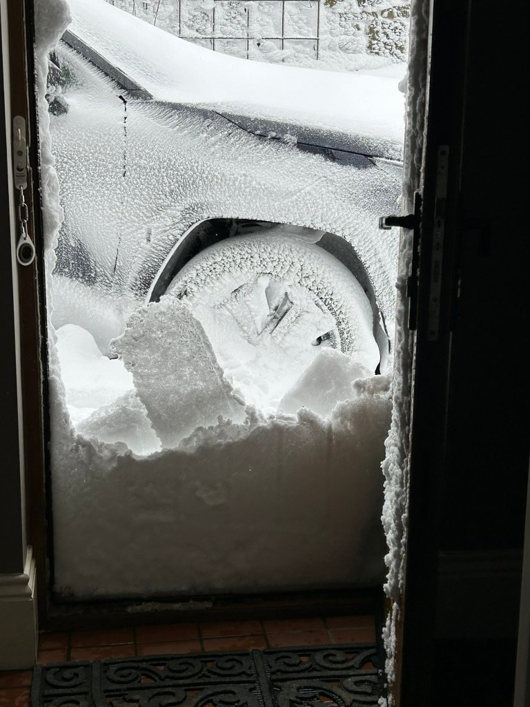
It’s certainly been a wintry week with Thursday and into Friday morning seeing some large snowfall totals, and drifts, especially so to the north-east of Manchester. We also saw some sleet & snow showers in days that followed and then a lovely hailstorm (graupel) with snow and thundersnow on its back edge on Tuesday morning. But, with milder air now in place and rain and more rain to come, have we seen the last of the snow?

A couple of photos of the snow drifts up in the hills last Friday morning. Images: @RhodesRuth and @Hoggy80 on Twitter
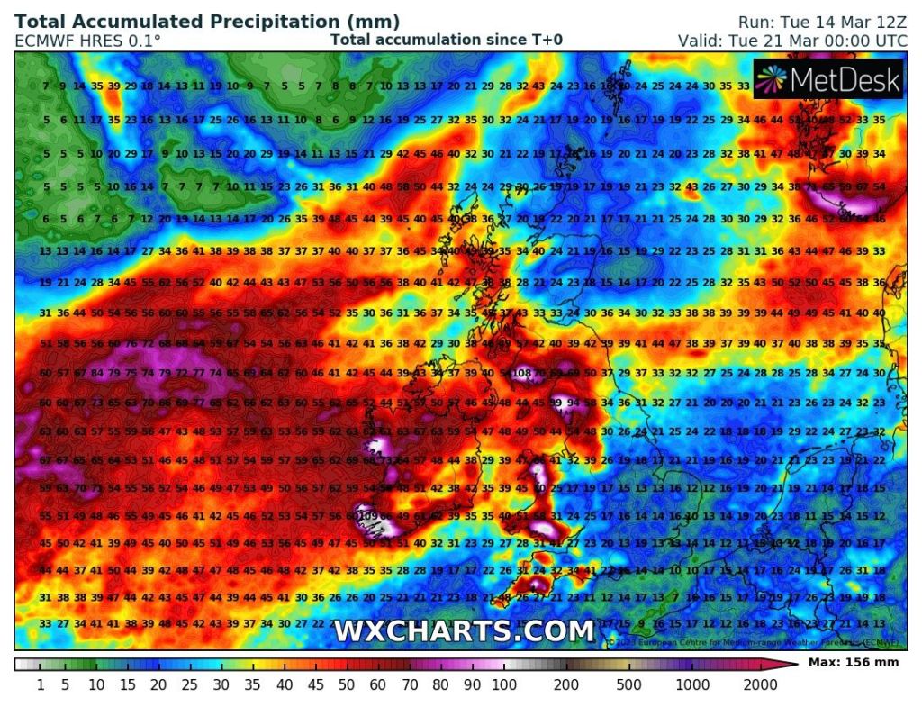
But now a change with 35-50mm of rain expected over the next 6 days.
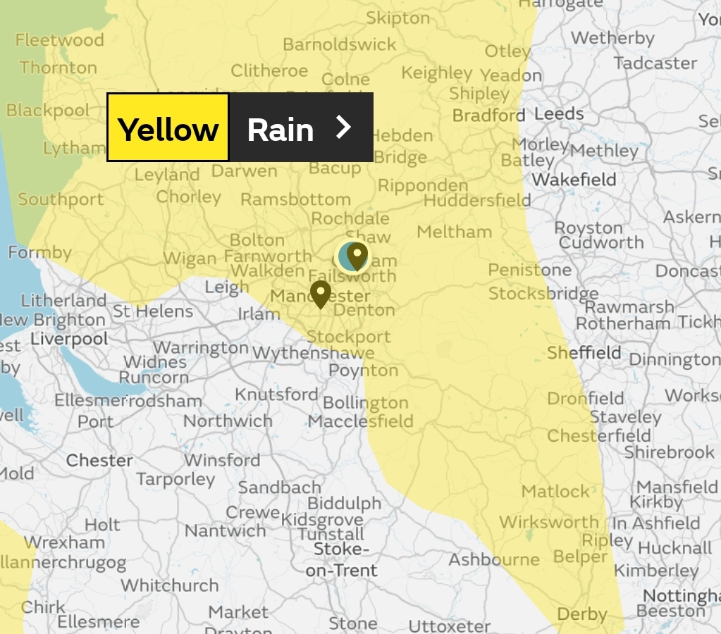
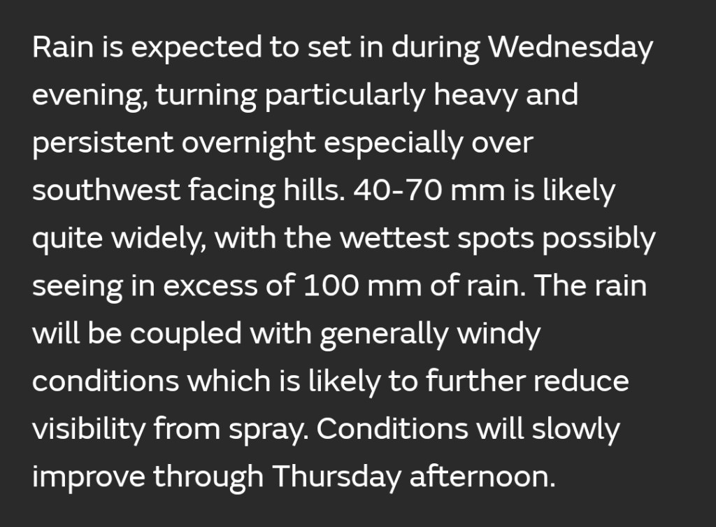
We have a weather warning in place for persistent rain: Wednesday evening and into Thursday.

Thursday: Cloudy with heavy rain continuing for the morning at least. It should eventually ease during the late-afternoon to leave some patchy drizzle. Windy and mild with a south-westerly airflow. Max 11°C

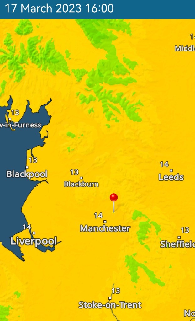
Friday: A fresh southerly breeze will bring up some showers into the afternoon after a mostly dry and cloudy morning. Very mild for the time of year with some favourable spots seeing the mid-teens. Max 14°C

Very mild on Friday making it the warmest day of the year so far but don’t be expecting wall-to-wall sunshine.

Weekend: More rain to come.

Saturday: Low pressure and with winds eventually swinging more westerly it won’t be quite as mild. Generally cloudy with scattered showers. Max 12°C

Sunday: The lack of sunshine continues with mostly cloudy skies. Although the morning seems dry for some, the cloud will tend to thicken quickly and bring a spell of rain, heavy at times from the southwest which could warrant a warning. Cooler but not by much. Max 10°C

Outlook: Staying generally unsettled and rainfall amounts totting up. Temperatures remaining just above normal or even mild at times. Further spells of showers or rain with snow very unlikely. Could well be the last of it, but you know, we always get the odd wintry shower even in early-April so never say never.

Follow @ChadWeather on Twitter for the latest forecasts and warnings.

Thanks for reading as always and for everyone’s input over the past week with their snowy photos, videos and reports on local conditions on the roads.

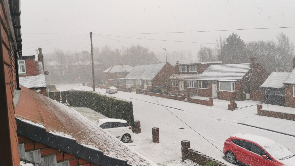
Chadderton – Lovely scene after heavy graupel on Tuesday. Image: @ChadWeather.

Thanks,
Jon

Forecast Issued: Wednesday the 15th of March 2023 at 4:52pm.

Images: BBC Weather, Weather and Radar UK, http://www.wxcharts.com & off Twitter @RhodesRuth and @Hoggy80.

Disruptive snow for some before milder air wins – Thursday 9th March 2023 – Sunday 12th March 2023

Hi all,

It’s been an up-and-down few days of forecasts, with disruptive snow due on Thursday one minute, then not the next, now it’s on the cards again, but as it goes with snow events; there can be a massive difference between locations depending on the height above sea level. Don’t be surprised to see sleet/wet-snow in Manchester city centre with not much on the ground compared to snow ankle-deep just a few miles away towards, and on the Pennine routes.

This is a great website for working out your height above sea level which could make all the difference between rain or snow tomorrow.

https://en-gb.topographic-map.com/map-kb57/England/

So, what does the next 4 days and beyond have in store?

This forecast is subject to change as is the current set-up of the weather with cold and mild air battling it out across our shores. You can always see the very latest on Twitter.

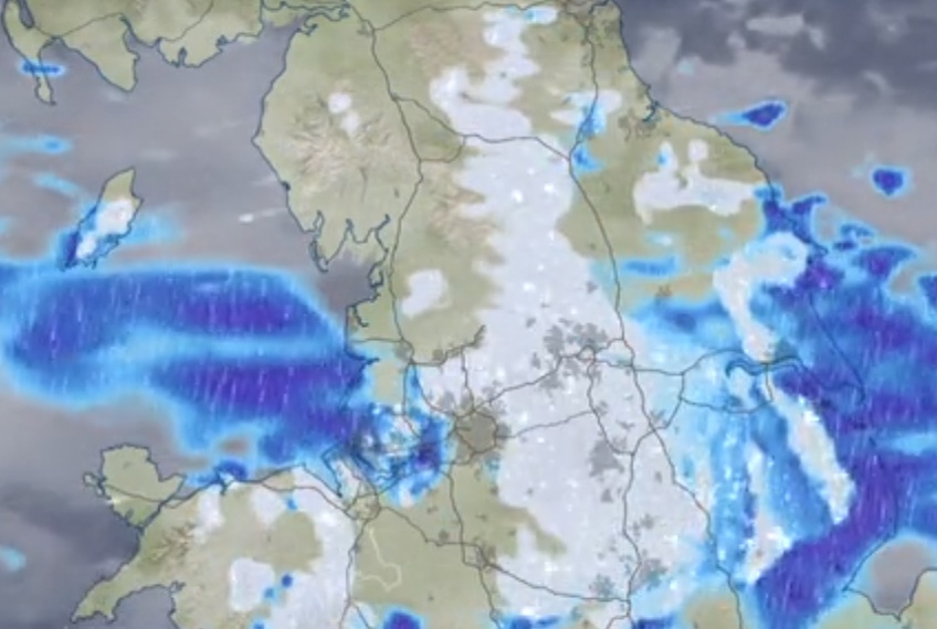
Thursday: AM: Cloudy with rain, sleet and snow. A graphic from BBC Weather highlights this well. Rain (W) Snow (E – hillier). Pulses of precipitation patchy at times especially so in the west. PM: Snow is expected to continue & perhaps become more extensive (late-evening) to lower-levels that saw rain/sleet earlier. It will also be windy with gusts on the western side of the Pennines exceeding 40mph later in the day leading to blizzard-conditions. Windchill of -6°C.

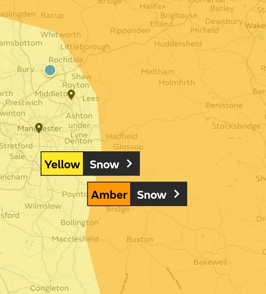
Yellow & Amber warnings in place.

The snow is likely to cause travel disruption.

Max 2°C Min 0°C

A snowy Thursday (lunchtime) map especially across Pennine routes. Rain for the morning is more favourable out west.
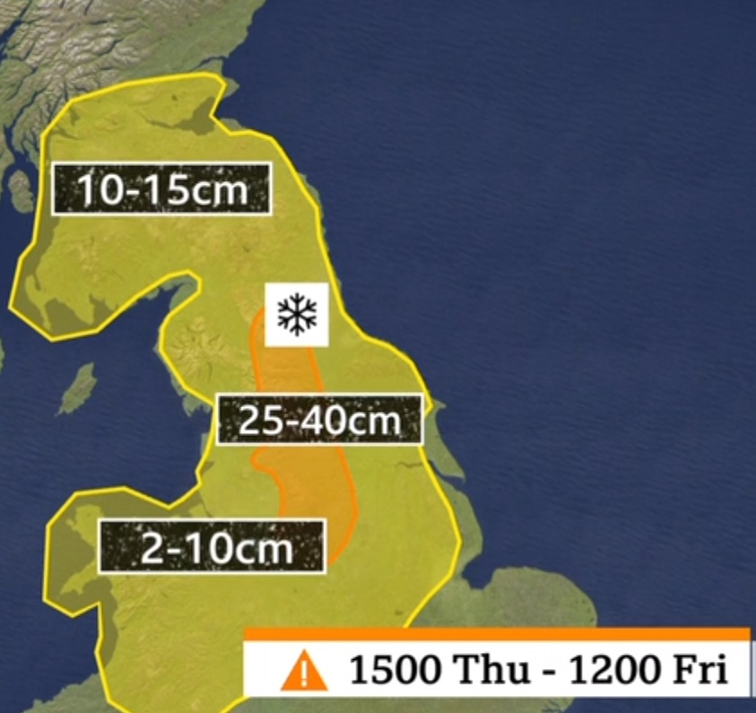
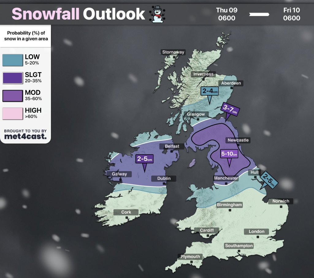
Predicted snow depths by Friday morning. Over a foot is possible in places across the hills. If you plan to drive over the M62 on Thursday PM/Friday AM, maybe change your plans.
Another idea on snow depths from @Met4CastUK on Twitter. This is for areas < 200M giving you an idea of what the accumulations might be.
Here’s a close-up of the boundary of the yellow and amber warnings.

Friday: Early sleet and snow fading during the morning after leaving a good dumping in places. Sunny spells arriving into the afternoon. Clear skies overnight leading to widespread ice and a hard frost. Max 4°C Min -4°C

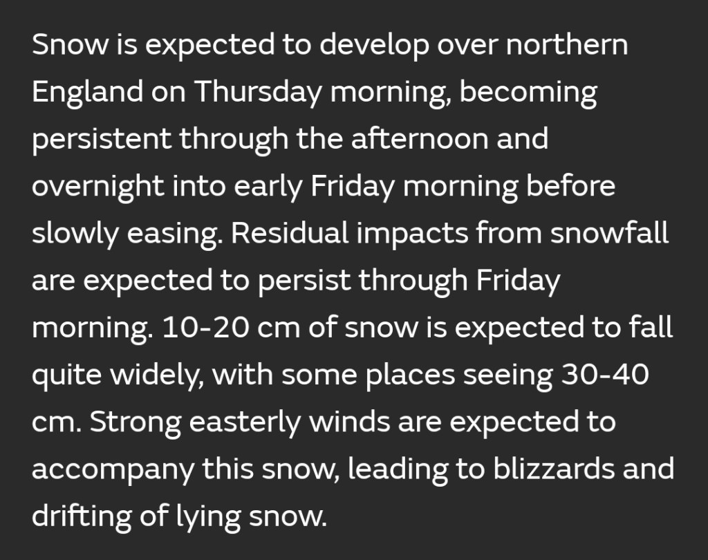
Yellow warning...
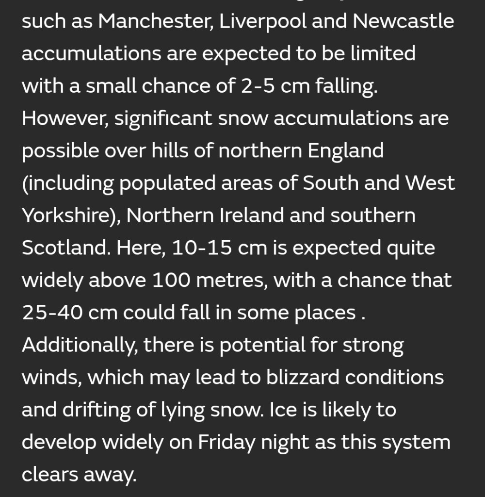
Yellow warning continued.
Amber warning

Weekend: Risk of hill-snow then milder.

Saturday: After a dry, icy and frosty start with some sunny spells, cloud amounts will increase as another weather-front swings in from the west, albeit slowly and will bump into the cold air. Hazy bright spells into the afternoon but it should stay dry until overnight when patchy rain, and some hill-snow moves in. Max 5°C Min 1°C

Sunday: Finally much milder air returns from the south-west with windy conditions and showers at times, especially later. A thaw of any snow left on the hills. Max 10°C Min 6°C

Outlook: Remaining unsettled with spells of rain/showers at times and breezy. Incursions of colder air means snow on the hills can’t be ruled out. I’ve been putting off cutting the lawns and planting seeds etc., holding out for warmer weather but there’s certainly no sign of that yet! It’s not unusual to have a chilly March and this one, so far, is no exception.

Follow @ChadWeather on Twitter for the latest forecasts and warnings.

Thanks as always for reading.
Jon

Images: http://www.wxcharts.com, BBC Weather, Met Office and @Met4CastUK on Twitter.
Forecast Issued: Wednesday the 8th of March 2023 at 9pm.

A blast of winter on the way but no Beast from the East – Thursday 2nd March 2023 – Sunday 5th March 2023

Hi all,

Welcome to Spring. In weather terms, this is the new season but it never means warm weather overnight. It’s not unusual to get a cold spell in March and this year looks like being no different as computer models are now coming to an agreement for colder weather, yes cold enough for frost and snow, next week. Tuesday/Wednesday seem to be the days when the cold spell will peak.

Forecasting the exact areas of where snow will fall is very tricky and it’s hard to predict even at 48 hours out. So look out on Twitter for updates as we have one final wintry spell before I can plant my seeds and cut the lawns.

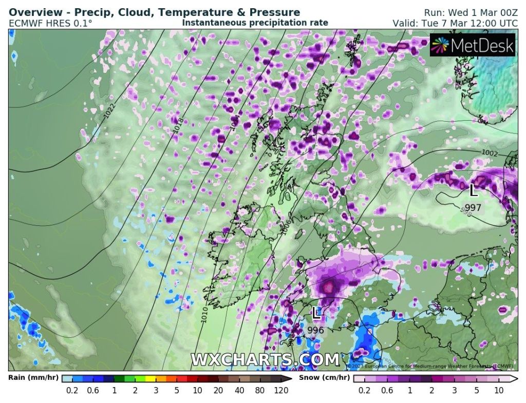
Snow showers – Colder next week with wintry showers from the NNE on a bitter wind.
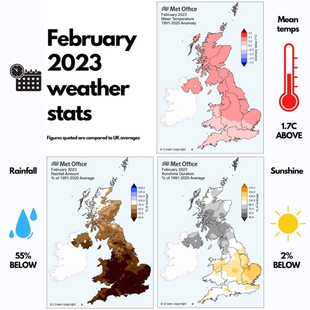
February 2023 Weather Statistics from the Met Office

Thursday: After a cloudy start it looks a better day than recently with some sunny spells. Also, it shouldn’t be as windy as it’s been recently. Still feeling chilly. Max 7°C

Friday: Back to the overcast days by the looks of it with limited brightness and just the chance of drizzle here and there. Max 8°C

Weekend: Starting to get cooler.

Saturday: More of a northerly flow now but still a lot of cloud. Some bright spells sheltered from the breeze. Max 7°C

Sunday: Mostly cloudy and cold with the wind picking up again. Chance of a few wintry showers, especially in the east, falling as snow above 300M. The beginning of the cold snap. Max 6°C

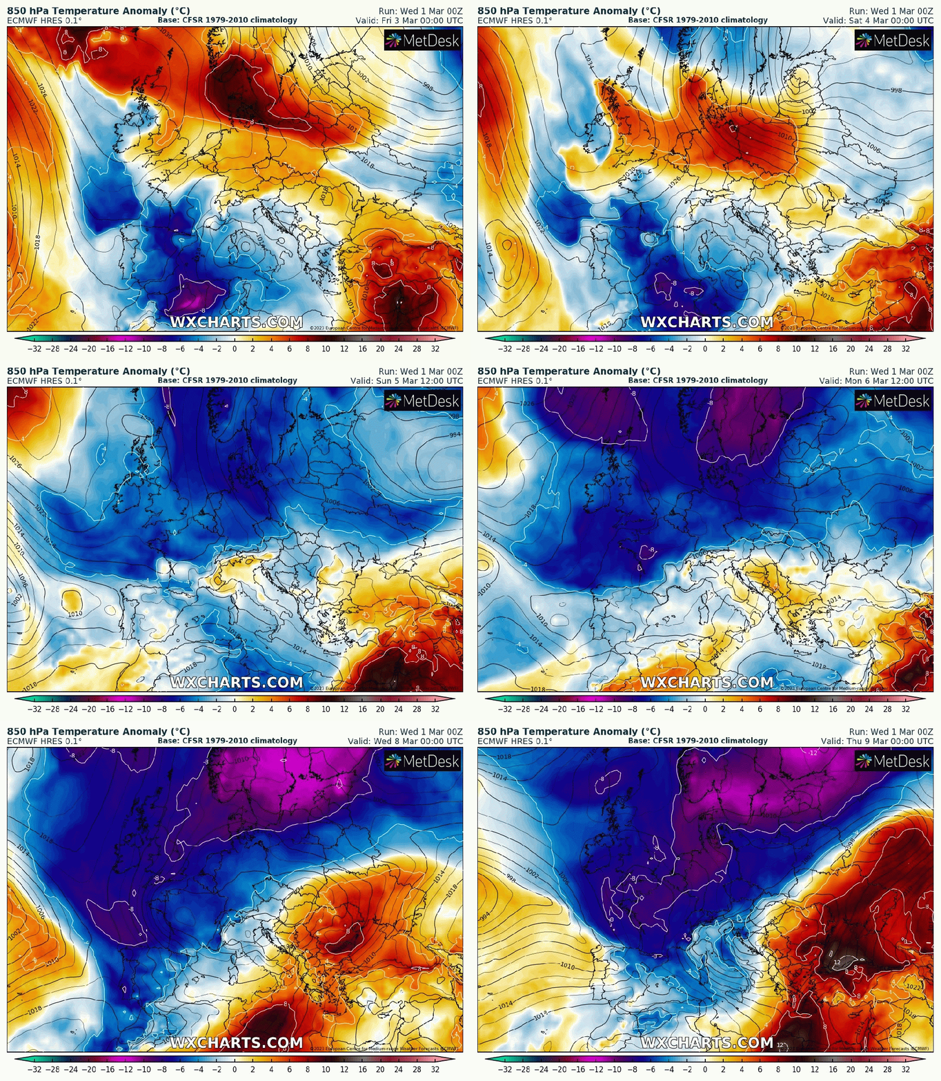
After the recent SSW, cold air looks set to flood down across the UK into next week with the risk of snow.

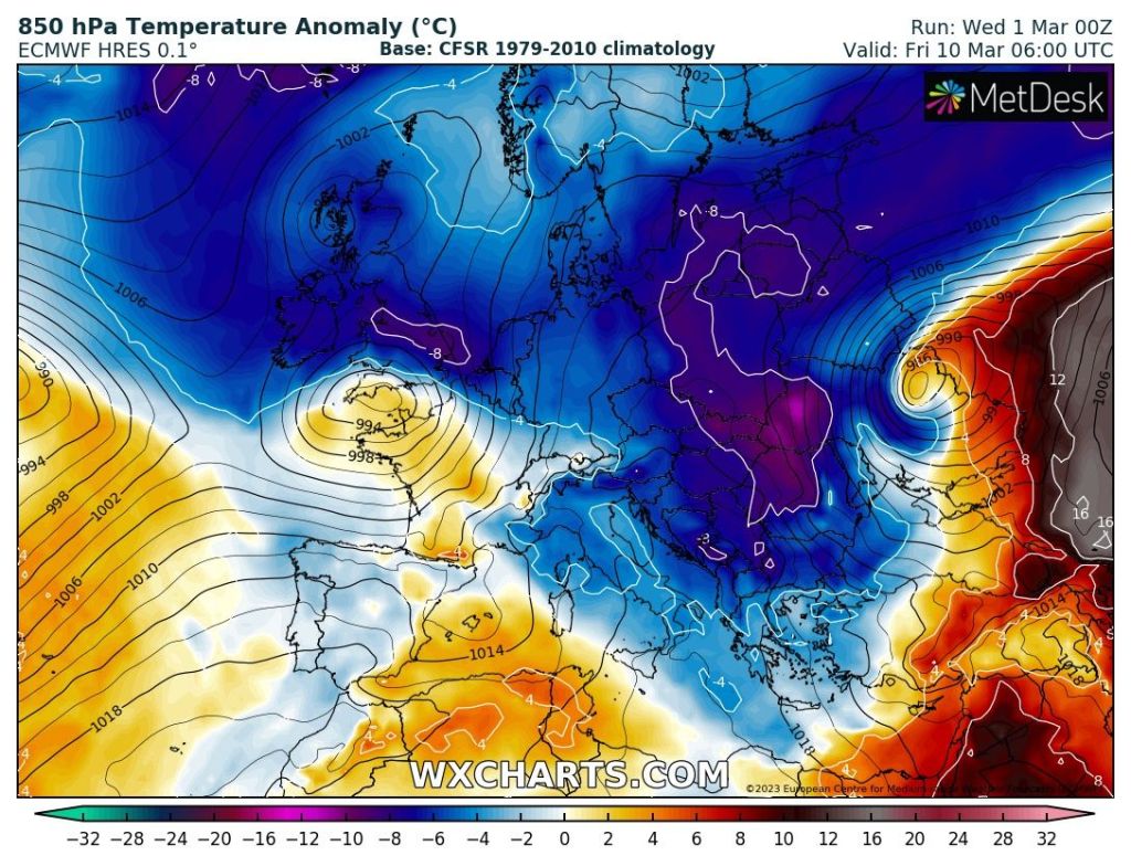
Outlook: Now this is where it gets interesting. High pressure that’s been around for a good while (check out my av. pressure value for February below) will push away to sit to our NW and allow colder air to feed down from the Arctic (so not a Beast from the East set up). So, temperatures dropping and with low pressure close by to our east, we could see some wintry showers move in with a biting wind-chill. Too early to say who will see snow and how much but it will favour higher ground intitially.

Later in the week, with the cold air in place, milder air will try to bring bands of rain in from the south-west, which could lead to some significant snowfall as it bumps into the colder air. Again, details far too uncertain at this stage but we could well see a snowfall event before the new season springs into action.

Low pressure & milder air pushing in from the SW and bumping into the cold air means the chance of some significant snow is possible. When, where and how much is still unknown.

February 2023 Stats – Chadderton

Max 11.6°C (17th)
Min -0.7°C (6th)
Av. 6.2°C
Wettest 5.4mm (10th)
Av. Humidity 84%
Av. Barometer 1028.4 hPa
Max Gust 28mph
Av. Wind Direction W
Rain 16.6mm (only 18% of average)
Rain Registered Days 13
Dry Days 15

Follow @ChadWeather on Twitter for the latest forecasts and warnings.

Thanks,

Jon

Forecast Issued: Wednesday the 1st of March 2023 at 7:15pm

Images: http://www.wxcharts.com & The Met Office.