Hi all,
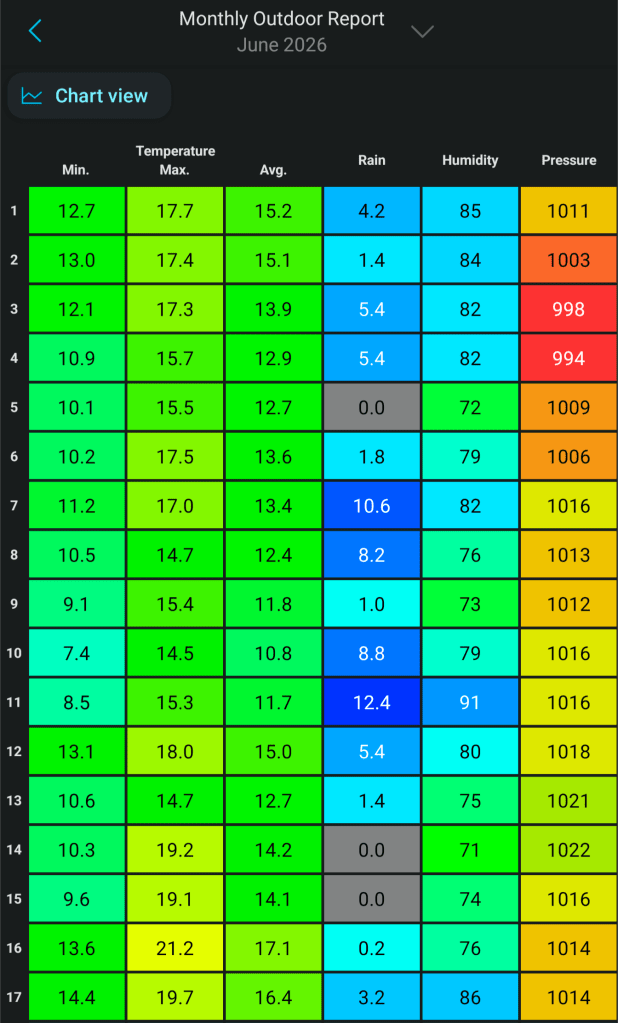
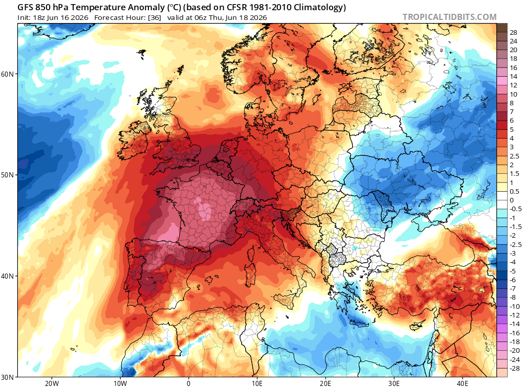
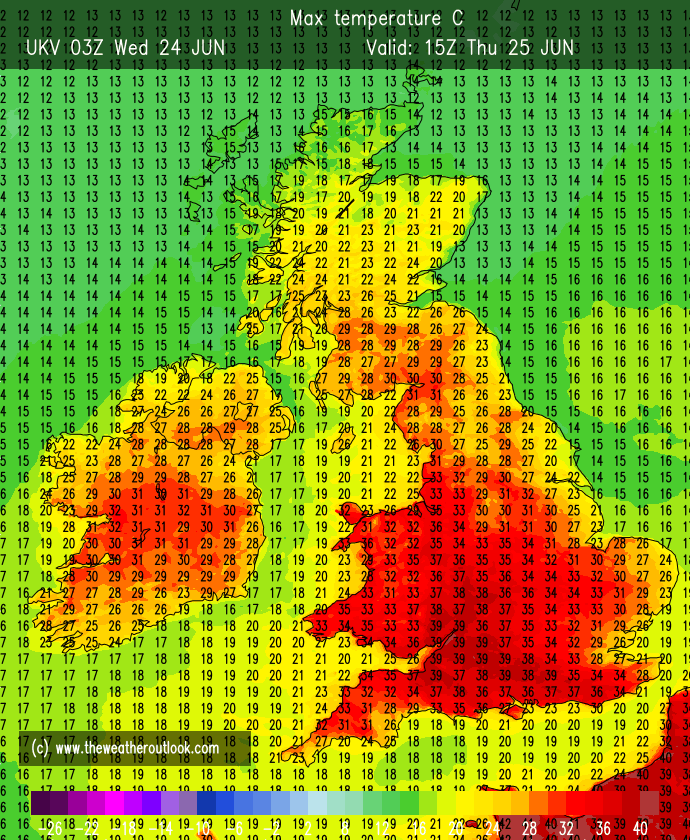
We are currently in a heatwave with 4 days over 25°C (rounded) and above.
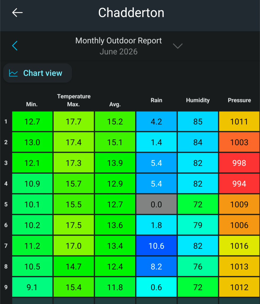
Sunday: 24.7°C
Monday: 27.1°C
Tuesday: 29.9°C
Wednesday: 29.4°C
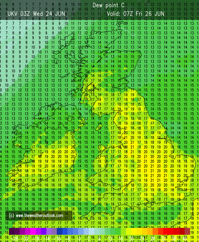
It has felt especially hot due to the high dew points making it feel awfully humid and that humid feel won’t really be gone until Sunday.
In fact on Tuesday I broke my all-time (records since August 2012) Highest Dew Point record.
Previous: 20.7°C on the 1st of August 2013 at 2:51pm.
New Record: 21.8°C on the 23rd of June 2026 at 4:44pm.
Remember UV levels are HIGH, 7-8, which is expected at this time of the year, regardless of temperature.
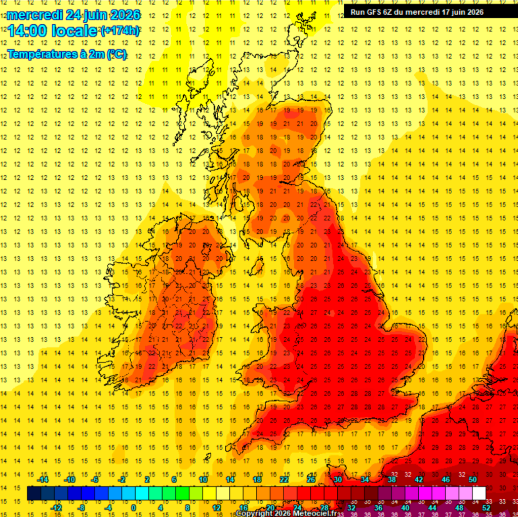
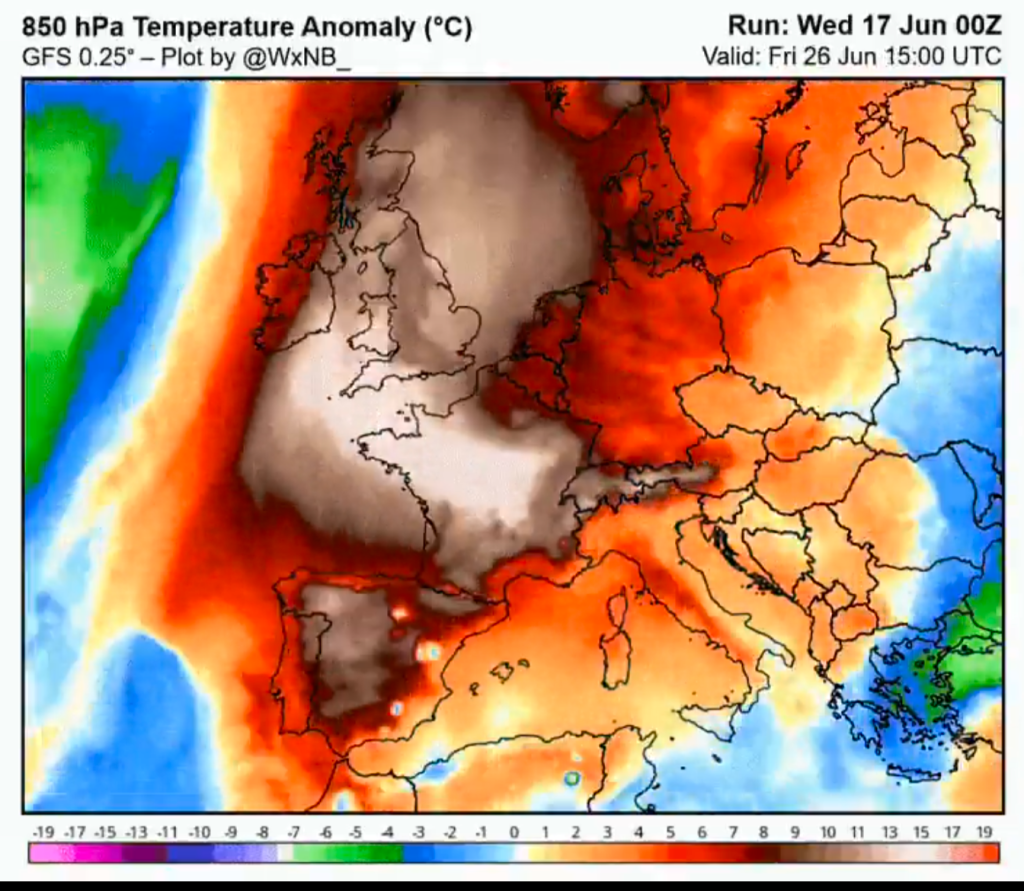
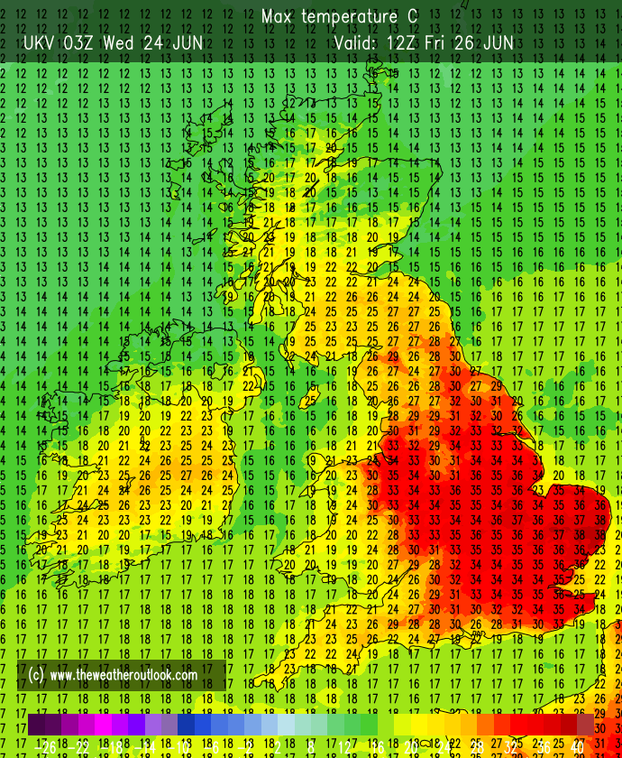
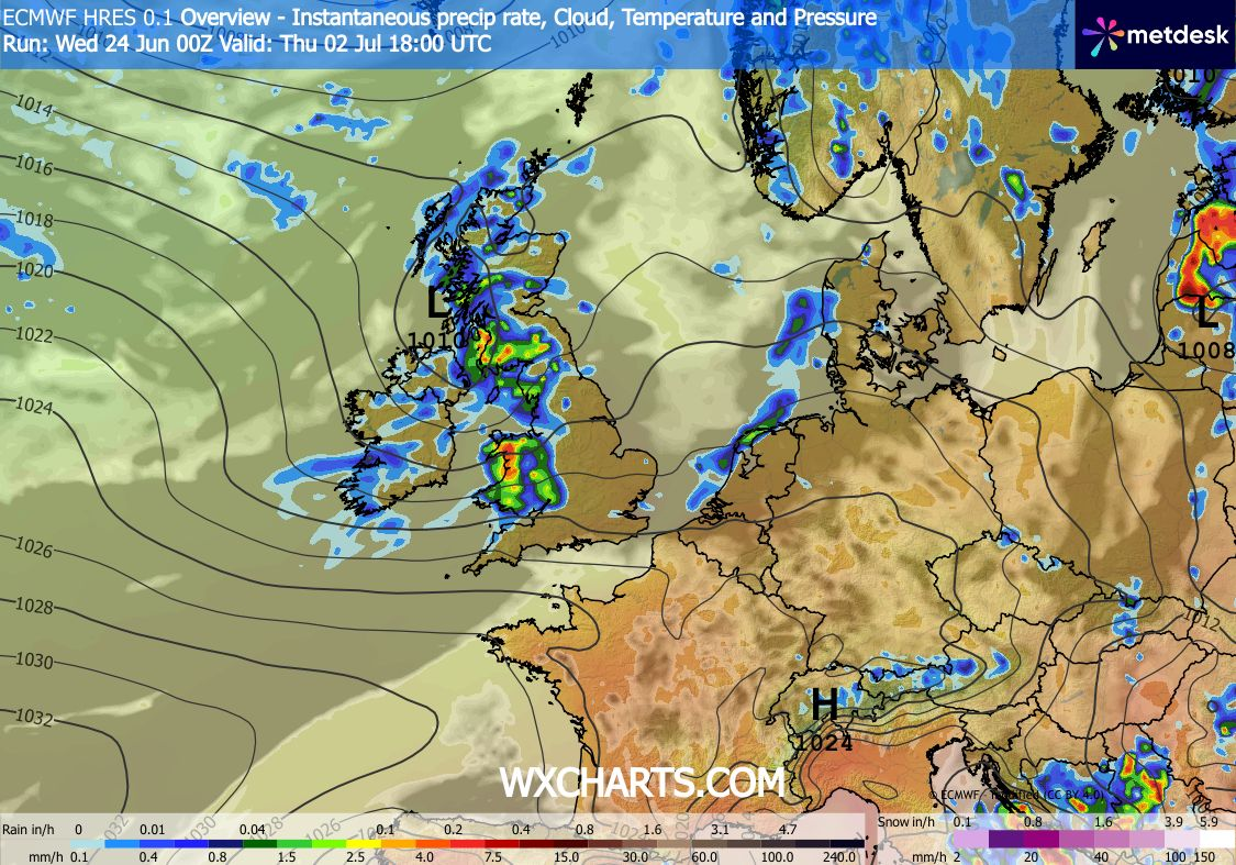
So when will the heatwave end? Originally it looked like Friday but now it will be Sunday when max temperatures return to the early-20s and fresher air arrives. Before then, there is the potential for some strong or severe thunderstorms breaking out. These could start as early as Thursday evening and Friday across the UK and continue to brew into Saturday. As you know, pin-pointing the exact location of these storms is hard and near-impossible as this stage but they could well be significant. It’s not really been mentioned on the TV forecasts yet. So be prepared for some severe weather and look out for the latest forecasts and warnings.
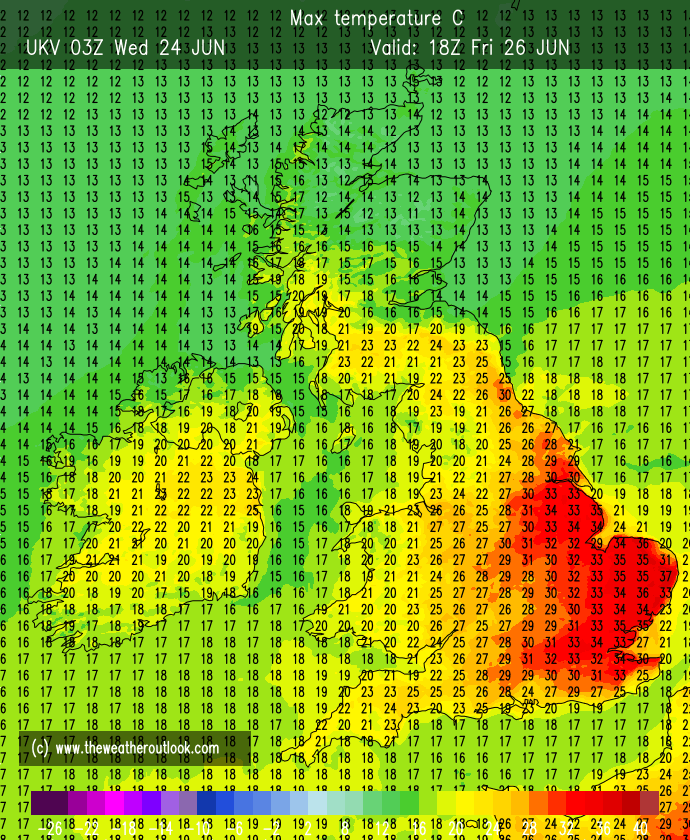
Thursday: A hot and sunny day with some fair-weather cloud bubbling up. Becoming windy into the afternoon with a hair-dryer southeasterly. Very humid. Variations in temperatures across the region. A tropical night and uncomfortable for sleeping with temperatures expected to still be 23-24°C at midnight. Risk of some big thunderstorms later in the night (maybe more so up the western side of the region). Max 28-33°C Min 21°C Max Gusts 25mph
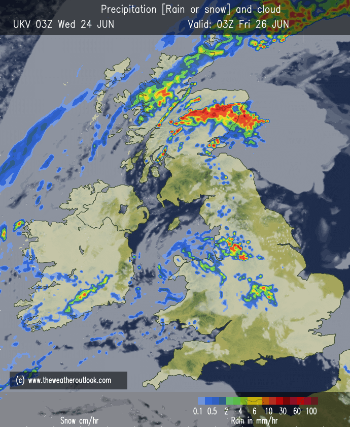
Friday: The heat remains, and the humid feel will again be through the roof. There is a chance of a few thundery showers in the morning but these will move away to allow for some hazy sunny spells to develop. As the afternoon wears on there could be a thunderstorm or two that pop up as clouds develop and the air gets unstable. Lower night temperatures than recently. Max 31-33°C Min 16°C Max Gusts 20mph
Weekend: Relief will arrive eventually.
Saturday: Potential for some thundery downpours, so look out for updated forecasts/warnings on social media nearer the time. Otherwise another hot day with sunny spells and maximum temperatures will keep some areas in the heatwave threshold. Windy. Max 24-27°C Min 16°C Max Gusts 25mph
Sunday: Finally – some relief as fresher air moves in and we have a day of sunny spells and showers, some heavy, perhaps thundery. Windy again but you will appreciate the wind to cool the house down. Max 21°C Min 12°C Max Gusts 30mph
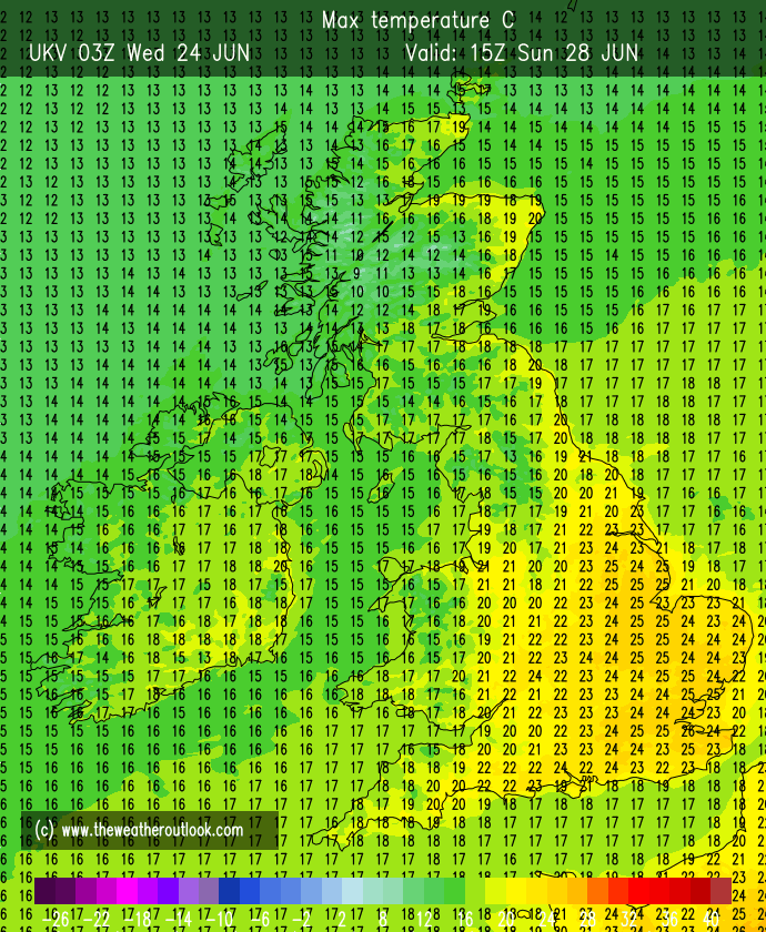

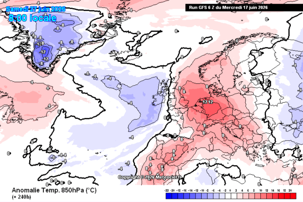
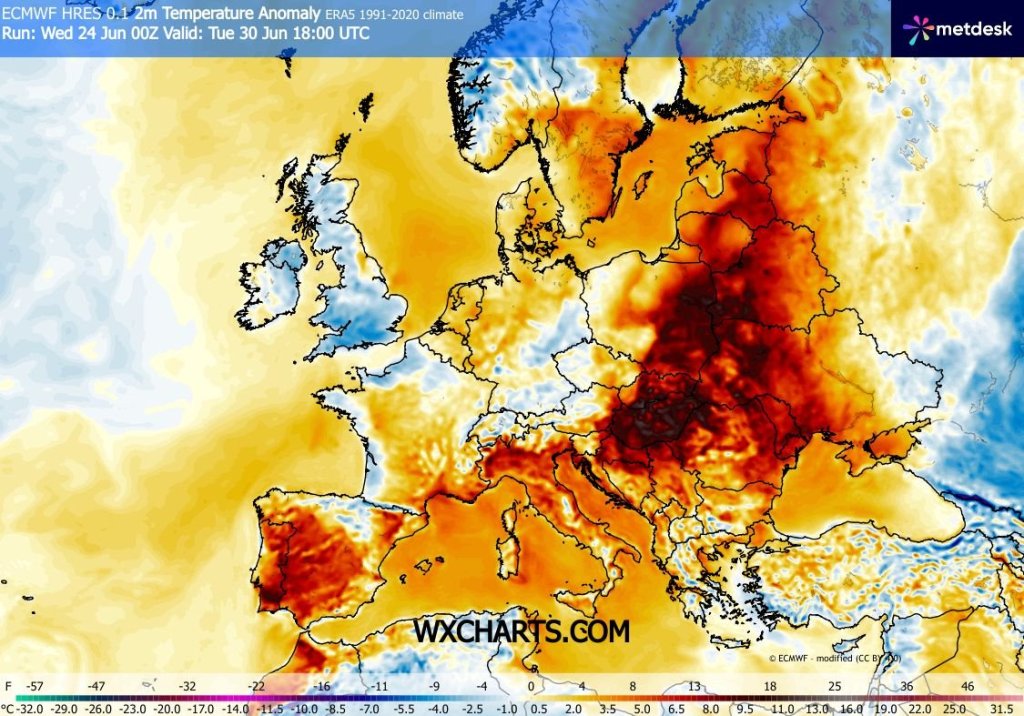
Outlook: Temperatures will return to normal next week but pleasant enough for the first few days with sunny spells and a few showers. As we head into July it looks like it will turn more unsettled with spells of rain and temperatures dropping to below average for a time.
Follow @ChadWeather on X and Bluesky for the latest forecasts and warnings.
Thanks as ever for popping by to read.
Thanks,
Jon
Forecast Issued: Wednesday the 26th of June 2026 at 5:05pm
Images: http://www.theweatheroutlook.com and http://www.wxcharts.com.