Thursday 25th February 2016 – Sunday 28th February 2016

Hi all,

OK, I’m not getting the snow I’m hanging desperately on to this winter for, but at least it feels more like winter now, with frosty mornings and some wintry sunshine.

It looks like the current cold spell is set to continue into March with just the odd milder day thrown in, so this keeps the door open for a snow-risk.

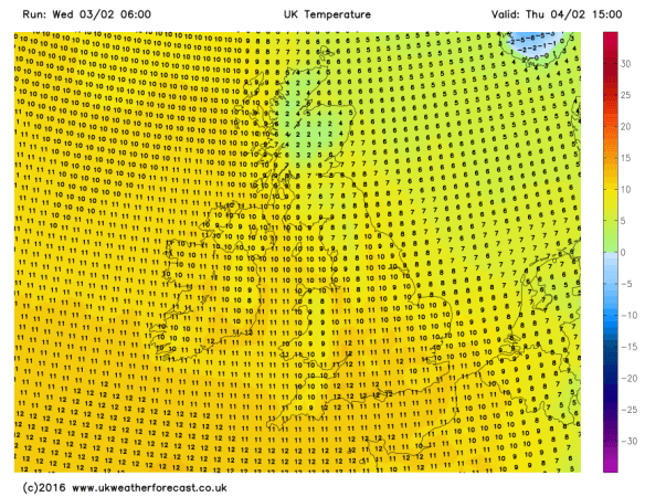
Thursday will start with a widespread frost and some rural spots may have had their coldest night of the winter with -6°C possible. There is also a risk of some patchy dense freezing fog, so something to be aware of on the roads in the morning. Once this clears we’ll have a day of sunny spells and it will be dry. Cold though. Max 4°C.

NEW Thu AM

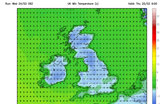
A freezing start to Thursday – coldest temperatures of the winter possible

Another frosty morning possible on Friday but not as severe as cloud is expected to push in from the west. Chance of some wintry showers later in the day from the south-west but the focus remains on a mainly dry picture but with more cloud than yesterday. Max 5°C.

Finally a weekend without a washout day and non-stop rain. I promise.

Saturday and Sunday similar actually, with a lot of dry weather around as high pressure builds over the UK. It will also introduce a bitter easterly breeze at times. OK, we might see the odd sleet or snow flurry, or spot of rain but overall it will be dry with sunny spells and some frost to start the mornings. Max 5-6°C.

high pressure

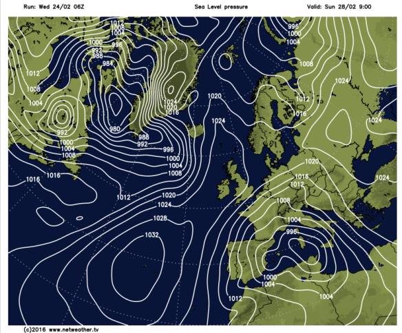
Settled Conditions – A ridge of high pressure over the UK at the weekend

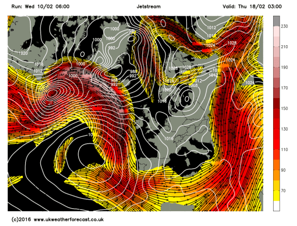
Looking ahead and as we enter March, meteorologically-speaking the start of Spring, it remains cold at first, but there are some signs that the Atlantic will try to come back to bring slightly milder conditions and some rain. If so, it could be preceded by some snow. One to watch next week.

Remember to follow @ChadWeather on Twitter to catch all the latest weather updates for Manchester and its surrounding boroughs.

Thanks for reading and feel free to share.

Jon

Photos/Data: http://www.netweather.tv

Forecast issued at 2:00pm on Wednesday 24th of February 2016.

Thursday 18th February 2016 – Sunday 21st February 2016

Hi all,

Welcome to another weather outlook for across our region.

Finally we managed some dry weather. Last Friday (12th) to this Tuesday evening we managed almost 5 dry days. Quite an achievement after 19 days of consecutive registered rainfall, but as I write this, we are again plagued by persistent rainfall.

The weather is heading back into a topsy-turvy flow with the Jet stream back in charge as we head towards the weekend and then introducing colder air when it dips away to the south next week.

After we experienced a miserable, wet and cold Wednesday, we will see a much improved day on Thursday. However, with clear skies to start the day we must be aware of ice after all of yesterday’s rain. During the day, plenty of sunny spells with the risk of a light afternoon shower but well-scattered. Max 6°C.

A chilly start to Friday with another localised frost but cloud will soon thicken, and rain, some heavy is expected to arrive as the day progresses giving us a wet afternoon. Temperatures will lift as winds turn south-westerly introducing milder air. Max 9°C.

milder air returns

Milder air returns from Friday and into the weekend


We head into the weekend with grim prospects.

Any early brightness on Saturday doesn’t last long and rain will move in from the Atlantic. It will also be mild and breezy at times. Max 10°C. 

I wish I could say something better about Sunday but I can’t. More rain is expected and windy for a time too. The exact timing of the rain over both weekend days is not nailed on but it’s not a weekend that will be remembered for decent weather. Later in the day, the rain is likely to move away towards the south-east and be replaced by much colder weather and wintry showers, with snow on the hills above 250M. Again, some uncertainty on timing and it might not even happen until we enter Monday. Max 12°C.

Snow Showers

Colder later on Sunday and into Monday; could mean hail, sleet & snow showers to follow


A lot of rain fell today (Wednesday the 17th) and with more rain between Friday and Sunday; there could be a concern again for local football matches to have waterlogged pitches.

Total Rainfall

Another inch of rain expected between now and Monday


Looking ahead and next week will be colder than the mild weekend with wintry showers at times and some chilly nights with a risk of localised ice and frost.
Remember to follow @ChadWeather on Twitter to catch all the latest weather updates for Manchester and its surrounding boroughs.

Thanks for reading,

Jon

Photos/Data: http://www.ukweatherforecast.co.uk; http://www.netweather.tv and http://www.weatheronline.co.uk

Forecast issued at 15:00 on Wednesday 17th of February 2016


Thursday 11th February 2016 – Sunday 14th February 2016

Hello again,

Another week has gone by and more rain has fallen across the region. In fact, Monday (8th Feb) was the 4th wettest day since my records began here in August 2012, with 31.4mm of rain recorded. This all came from Storm Imogen which brought almost 100mph gusts to the south coast. Although we didn’t feel much impact from the winds [41mph recorded Monday night] it never stopped raining.

All this wet weather led BBC Radio Manchester to get in touch, as they had a feature on the show this morning (10th) regarding the non-stop wet weather we have been having. I was unable to attend as I was on the school run but it did give me the opportunity to dig out some statistics for them.

  • We are today (10th) likely to have our first dry day for 17 days!
  • Since November the 1st 2015 we have had 635mm (25 inches) of rain and in that time 90% of the days recorded rainfall. That’s 6mm a day on average.
  • We have only had 10 dry days since the end of October 2015.

The Jet stream is now slightly further south so we are experiencing some colder air and some welcome sunny spells. Not only does it look like today will be dry, Thursday and Friday could follow suit.

Jet stream

The Jet stream has dipped south into the back end of this week

A cold start to Thursday with local fog and frost, so you could be deicing before work. A mainly dry dry to follow with sunny spells and a low risk of a fleeting wintry shower. Max 6°C.

Similar on Friday, cold start, some localised frost but more cloud is expected later in the day. Beforehand, plenty of bright spells and again we should escape with a dry day. A cold easterly breeze arriving. Max 5°C.

Now into the weekend, Saturday, it gets a little tricky.

Saturday will be cold with a mainly cloudy picture across the region. There is a risk of rain coming in from the south-west, the track of this and how far north it gets is still uncertain. It could turn to snow in places as the milder air meets the cold air. My feeling is that it will stay further south but one to watch for updates via Twitter and I should know more by Thursday evening. Bitter easterly breeze. Max 4°C.

rain or snow

A risk of rain turing to snow on Saturday – where, is still uncertain

cold v mild

Snow could occur where the mild air meets the cold air

The low pressure and its mix of rain or snow moves away south into Sunday allowing the winds to switch from an easterly to an Arctic northerly bringing the risk of scattered hail, sleet or snow showers but sunny spells as well. A low windchill. Max 4°C.

Both nights over the weekend will be cold with a risk of ice and frost.

windchill

Sub-zero windchill of -5 by the end of Sunday

frosty early next week

Settled, drier but frosty as we head into next week

Looking ahead and early next week sees some settled weather with sunny spells by day and cold frosty nights. Later in the week it looks likely that the winds will return to bring the Jet stream back over us and with it some wetter milder weather but there is some question mark over the timing of this. For now though, the good news is, no significant rainfall or another named-storm on the cards.

will the jet come back

But when will that Jet stream and the wetter/milder weather return?

Remember to follow @ChadWeather on Twitter to catch all the latest weather updates for Manchester and its surrounding boroughs.

Thanks for reading,

Jon

Photos/Data: http://www.ukweatherforecast.co.uk; http://www.netweather.tv and http://www.theweatheroutlook.com

Forecast issued at 14:15 on Wednesday 10th of February 2016

Thursday 4th February 2016 – Sunday 7th February 2016

Hi all,

Two named-storms in a short period of time and even some snow showers last weekend confirms our weather remains in an unsettled state. As we enter the final meteorological winter month, I am still hopeful of some prolonged cold during mid-February and we can also always rely on March to bring us some wintry weather; so don’t put your sledges away yet.

Rain and milder conditions arrive once again on Thursday after recent cooler conditions. With this comes rain, initially heavy, but easing later on. Hill-drizzle may remain into the evening. Max 11°C.

milder thur

Max Temperatures for Thursday – back to double-figures

The flip-flop pattern continues into Friday as cooler air comes in from the north-west. This doesn’t look like arriving until later on into the late-evening, after a mainly cloudy day with some showery rain and hill-drizzle. Max 10°C.

cold front

A cold front will sink SE slowly on Friday bringing rain then cooler air

The weekend will be chilly and windy with showers at times and some cool nights. To be honest forecasting this weekend has been a bit of a headache with several what-if scenarios to deal with.

For Saturday, bright spells and some showers early on and it will feel colder than recently. Later on there is a good chance rain will spread in from the west and winds increase. Max 7°C.

Bright spells and showers on Sunday after early rain clears. If anything, maybe feeling a little cooler, especially in the fresh wind. Again, more general rain and wind later or overnight. Max 7°C.

Looking at early next week it seems to remain chilly with some showers, which could be wintry at times over the hills. The week looks breezy throughout and there is a good chance we will see some more windy weather later on; perhaps another named-storm?

named storm imogen

Another named-storm later next week – Storm Imogen?


colder

If the stormy weather comes off it could be followed by much colder Arctic air


January 2016 Stats

Av. Temp 5.3°C 
Max Temp 13.2°C (24th)
Min Temp -2.7°C (16th)
Wettest Day 13mm (27th)
Highest Gust 45mph (27th)
Rainfall 129.8mm
Rainy Days 26 

Follow @ChadWeather on Twitter to catch all the latest weather updates for Manchester and its surrounding boroughs.

Thanks for reading,

Jon

Photos/Data: http://www.ukweatherforecast.co.uk

Forecast issued at 16:30 on Wednesday 3rd of February 2016