
Hi all,
Welcome to another weather outlook for across our region.
Finally we managed some dry weather. Last Friday (12th) to this Tuesday evening we managed almost 5 dry days. Quite an achievement after 19 days of consecutive registered rainfall, but as I write this, we are again plagued by persistent rainfall.
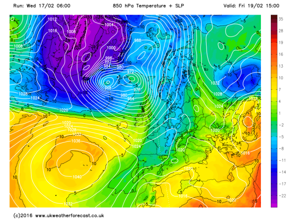
The weather is heading back into a topsy-turvy flow with the Jet stream back in charge as we head towards the weekend and then introducing colder air when it dips away to the south next week.
After we experienced a miserable, wet and cold Wednesday, we will see a much improved day on Thursday. However, with clear skies to start the day we must be aware of ice after all of yesterday’s rain. During the day, plenty of sunny spells with the risk of a light afternoon shower but well-scattered. Max 6°C.
A chilly start to Friday with another localised frost but cloud will soon thicken, and rain, some heavy is expected to arrive as the day progresses giving us a wet afternoon. Temperatures will lift as winds turn south-westerly introducing milder air. Max 9°C.
Milder air returns from Friday and into the weekend
We head into the weekend with grim prospects.
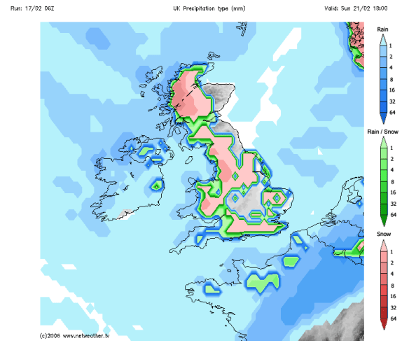
Any early brightness on Saturday doesn’t last long and rain will move in from the Atlantic. It will also be mild and breezy at times. Max 10°C.
I wish I could say something better about Sunday but I can’t. More rain is expected and windy for a time too. The exact timing of the rain over both weekend days is not nailed on but it’s not a weekend that will be remembered for decent weather. Later in the day, the rain is likely to move away towards the south-east and be replaced by much colder weather and wintry showers, with snow on the hills above 250M. Again, some uncertainty on timing and it might not even happen until we enter Monday. Max 12°C.
Colder later on Sunday and into Monday; could mean hail, sleet & snow showers to follow
A lot of rain fell today (Wednesday the 17th) and with more rain between Friday and Sunday; there could be a concern again for local football matches to have waterlogged pitches.
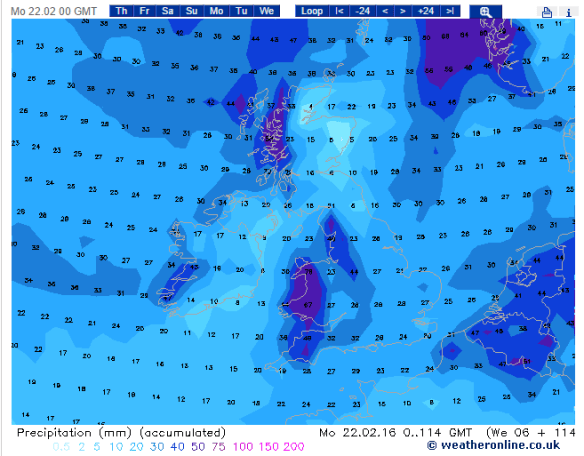
Another inch of rain expected between now and Monday
Looking ahead and next week will be colder than the mild weekend with wintry showers at times and some chilly nights with a risk of localised ice and frost.
Remember to follow @ChadWeather on Twitter to catch all the latest weather updates for Manchester and its surrounding boroughs.
Thanks for reading,
Jon
Photos/Data: http://www.ukweatherforecast.co.uk; http://www.netweather.tv and http://www.weatheronline.co.uk
Forecast issued at 15:00 on Wednesday 17th of February 2016
