Start of Autumn to bring rain, thunderstorms and wind – Thursday 1st September 2022 – Sunday 4th September 2022

Hi all,

I think it’s safe to say that Summer 2022 was decent. Plenty of dry weather with very warm sunny spells and a lot of settled conditions. Most notable was the record-breaking July heatwave (36.6°C) and the well below-average rainfall. We also had much more warmer evenings than usual and even a nice August (normally a bad month). With it being settled we did lack in thunderstorm activity but we could well see some action over the coming week.

Summer 2022 delivered only 39% of the average rainfall.

June 2022 31.6mm (av. 79mm)
July 2022 35mm (av. 92mm)
August 2022 38mm (av. 95mm)

Meteorological autumn starts on Thursday and we’ll squeeze in another decent day but then it’s all about low pressure and an unsettled theme. Exact timings and the finer details of the coming days will change, so always look out for updates on Twitter.

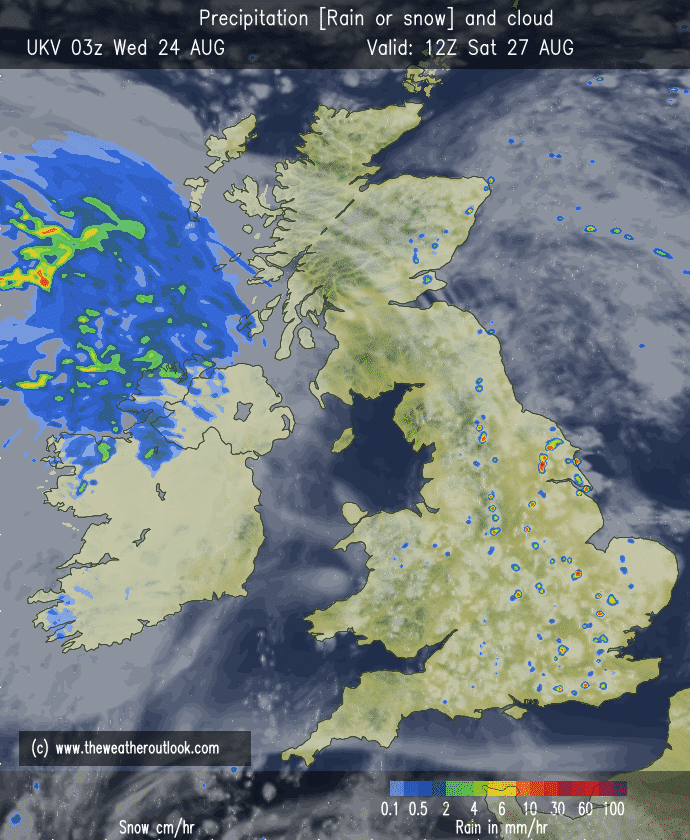
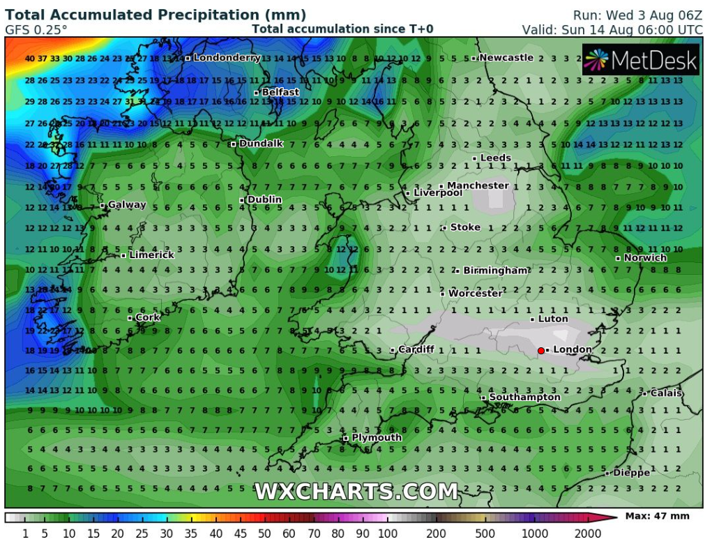
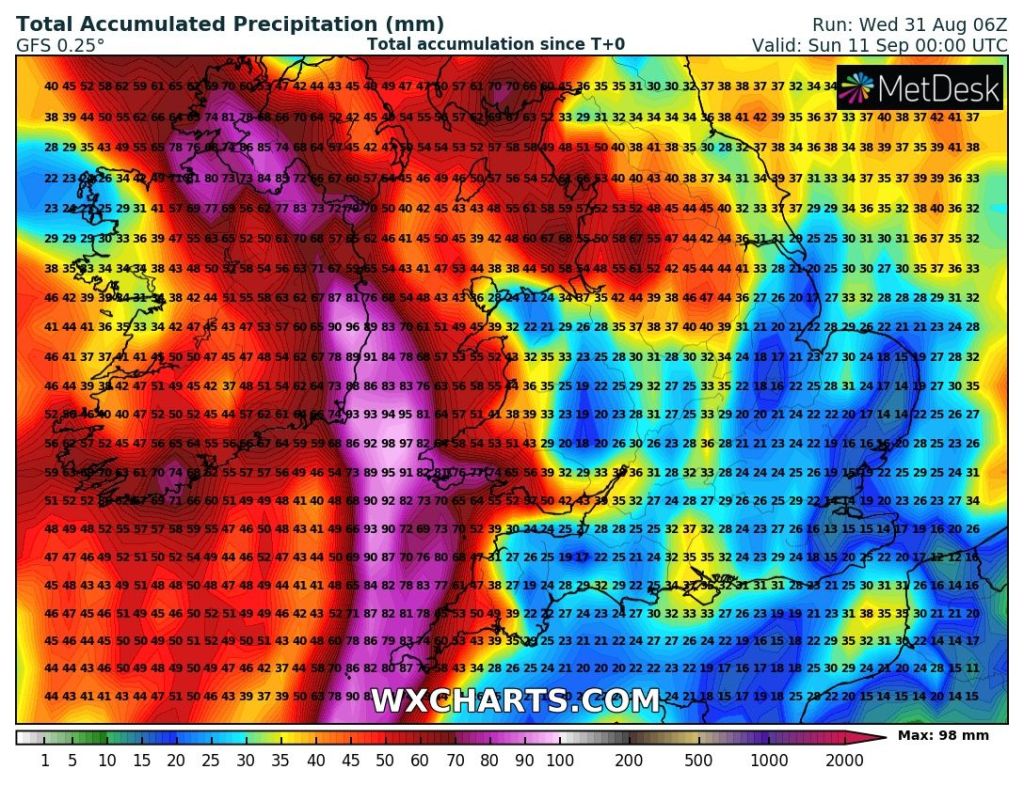
As is the nature of showers, some areas will see more rain than others but the general overall thinking is; 40-50mm of rainfall is likely in the first 10 days of autumn. These totals could be higher in some spots if we see some torrential thundery showers develop.

Up to 2 inches (50mm) of rain expected during the first 10 days of September. That’s about half of what we received throughout the whole 3 months of summer.

Maximum UV levels are now down to medium between 10am-3pm.

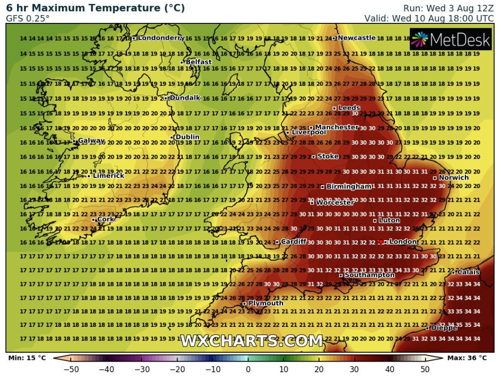
Thursday: Low pressure is beginning to develop to the west of the UK but it won’t influence us just yet. So another mostly dry day with warm sunny spells. Outside chance of a shower later, especially over the hills. Winds still quite breezy. Max 22°C

Friday: The low will creep closer and a squeeze in the isobars will mean another breezy or even windy day. Sunny spells and feeling warm but isolated beefy showers are expected later in the day. Max 21°C

Weekend: Turning more unsettled.

Saturday: A showery day, some likely to be thundery as the atmosphere becomes more unstable. There could well be a band of more persistent rain strewn across the region but the location of this at this stage is uncertain. Breezy. Max 20°C

Sunday: Bright spells, especially to start, then heavy and again possibly thundery showers will develop and becoming widespread. These showers could well be more focused to the south and west. Still feeling quite warm in any sunshine but like previous days it will be windy. Max 20°C

Over the weekend and into early next week low pressure to our southwest will be pushing bands of heavy showers north-eastwards across the region

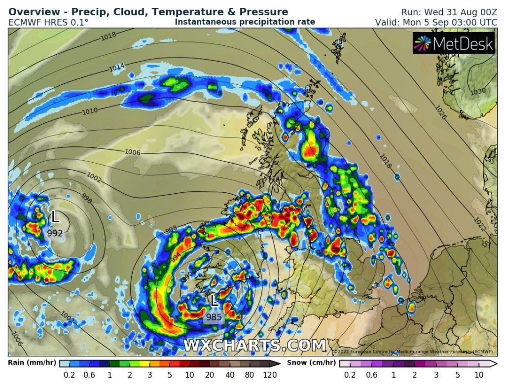
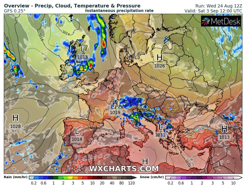
Outlook: Low pressure remaining pretty much in charge with spells of bright spells and showers, some beefy with thunder and lightning. It will tend to become a little cooler as the week goes on with maximum temperatures back into the teens.

Follow @ChadWeather on Twitter for the latest forecasts and warnings.

Thanks,
Jon

Forecast Issued: Wednesday the 31st of August 2022 at 1:15pm
Images: http://www.wxcharts.com

Sunny spells, mostly dry and warm but no heatwave expected – Thursday 25th August 2022 – Bank Holiday Monday 29th August 2022

Hi all,

Apologies for no weekly blog last week. I had some family-time away in the Cotswolds. Back this week with some good news as high pressure brings us a settled period of weather, perfect timing for a Bank Holiday weekend. Temperatures will be pleasant and still feeling very warm in the sunshine.

UV levels are no longer HIGH, but MEDIUM, which is still strong enough for you to get sunburnt easily without sun-cream between 11am and 2pm.

Thursday: Fresher air has arrived so we lose the muggy and humid conditions that we’ve had this week. Early cloud will eventually break to a dry day with sunny spells. Max 21°C

Friday: Sunny spells for the morning. A band of cloud will arrive into the afternoon which just might be thick enough to give some patchy rain to the west, but the main thinking is most will stay dry. Max 20°C

Weekend: High pressure takes charge and temperatures rising a touch. Depending on the location of the high pressure we might sneak into the mid-20s for Bank Holiday Monday.

Saturday: Sunny spells and pleasant with warmer temperatures. A bit of cloud will bubble up here and there meaning we have the low risk of an isolated shower, especially towards the hills. Max 22°C

Isolated showers possible this weekend but a lot of dry weather with hazy sunny spells.

Sunday: Very similar to Saturday. Perhaps the sunshine turning hazy. Max 23°C

Bank Holiday Monday: A slight northeasterly breeze but plenty of dry weather and warm sunny spells once more. Even though the high pressure has drifted away a little it is still in charge. Max 23-25°C

Outlook: It seems that the high pressure will hold for most of the week but with a northeasterly airflow temperatures will range from 19-22°C. Plenty of dry weather, local shower possible. Again, a shift in wind direction could easily lift temperatures. More unsettled by the weekend looks on the cards but it could be short-lived with another high pressure following .

More unsettled for the opening weekend of September?

Follow @ChadWeather on Twitter for the latest forecasts and warnings.

Thanks,
Jon

Forecast Issued: Wednesday the 24th of August 2022 at 7:05pm.

Images: http://www.wxcharts.com & http://www.theweatheroutlook.com

7-day heatwave to end early next week with a risk of thunderstorms – Thursday 11th August 2022 – Monday 15th August 2022

Hi all,

Well well well. Another heatwave. August normally disappoints, and OK there is still time left for August to be wet and miserable for the latter part of the month, but the next 5 days are set to be hot and increasingly humid after maximum temperatures reached 25°C on Tuesday and have risen since. Temperatures will make it into the 30s but it will not be as hot as the heatwave of July.

An amber weather warning for extreme heat is in force for Thursday to Sunday – issued by the Met Office

**UV levels are still HIGH (6/7) mostly between 12pm-2pm**

Nights will be warm and a little uncomfortable for sleeping but with relatively low dew points and humidity (until later in the weekend) it could have been a lot worse.

Thursday: The heatwave is in control now, as is high pressure, slam bang across the country bringing a hot day with plenty of sunshine. If you do head to the coast there will be some sea breezes. Max 30°C Min 17°C

Friday: Little change. Hot and sunny with a slight breeze from the east to north-east. Max 31°C Min 18°C

Weekend: More heatwave conditions.

Saturday: Yep, you guessed it another hot and sunny day with a breeze picking up. Max 31°C Min 17°C

Sunday: Sunny spells with cloud bubbling up during the day; the sign of change. This will be the first signs of a breakdown to the current heatwave as low pressure drifts up from the south. Chance of some thundery showers breaking out later in the day but very isolated. Muggy. Max 31°C Min 18°C

Monday: A cooling theme with scattered thundery showers breaking out. Sunny spells in between. More bearable temperatures but it will be humid as fresher air will slowly arrive on Tuesday. Max 25°C

Outlook: A cooling trend as the weather turns showery with the high slipping away to the east and low pressure coming up from the south or south-west. Locally some hefty downpours and finally some relief from what was a prolonged dry and hot spell of weather. Temperatures returning to around normal values, max 20°C, with the Atlantic driving our weather during the latter part of the week.

The heatwave begins to break: Hit-and-miss thundery showers on Monday

Follow @ChadWeather on Twitter for the latest forecasts and warnings.

Thanks,
Jon

Forecast Issued: Wednesday the 10th of August 2022 at 3:05pm
Images: Met Office and http://www.wxcharts.com

Recent much-needed rain to ease, as August shows hints of warming and drying up once more – Thursday 4th August 2022 – Sunday 7th August 2022

Hi all,

Last month was the driest July in England since 1935 according to the data collated by the Met Office. I mentioned numerous times that we were on for well below-average rainfall and even though we ended the month with 11 consecutive days of measurable rainfall, we only saw 38% of the average. August has started with two days of rain and a total of 16mm already. But, despite a few showers, the main trend now is to much drier conditions once more and warmer temperatures into next week.

Some computer models are certainly hinting at a heatwave returning from the second week of August and perhaps lasting 7-10 days, especially in southern (mostly SE) England. I did post a chart on Twitter the other day to show that a model predicts 40°C again. Of course this is an outlier and very unlikely, or in my own words last time, “will never happen”. My thoughts are again very similar, I can’t see it happening but with temperatures into the 30s looking likely once more, never say never.

It’s been a muggy few days but we are slowly slipping into fresher air now and the next few days will see temperatures below-average but I’ll take that as it will be matched with brighter skies and drier weather. Before today we have seen welcome rainfall deliver 46mm on 13 consecutive days.

Dove Stone reservoir earlier last week in need of rain. Image: @Edwards_TE on Twitter.
Here’s how July 2022 compared to previous years

Thursday: Fresher air under a north-westerly airflow. Morning-showers move through quickly leaving a breezy day with sunny spells and a few scattered showers. Max 19°C

Friday: A similar day. No humid air so pleasant in the sunshine as we see a day of bright spells and isolated showers. Most staying dry. Max 18°C

Weekend: Slowly warmer with high pressure building.

Saturday: Perhaps disappointing cloud amounts at times, limiting the amount of sunshine but dry and bright. Max 18°C

Sunday: Sunny spells and warmer. Slight breeze, again from the north-west so not feeling humid. Max 21°C

Outlook: A lot of dry weather with high pressure in control. The position of the high and the wind-flow will be important and determine how quickly temperatures rise. Temperatures expected to be in the early-20s with the chance of them creeping into the mid-20s later in the week. The warmth could introduce more in the way of humid air and this could set off an isolated home-grown shower, otherwise warm and dry.

Not a lot of rainfall expected over the next 10 days – any rain will now be in the form of showers
Another heatwave on the cards for parts of England & Wales? How far north and west the heat gets is still uncertain but it does look favourable that mid-August will be very warm to hot.

July 2022 Stats

Max 36.6°C (19th)
Min 9.7°C (16th)
Av. 17.0°C
Wettest 10mm (24th)
Av. Humidity 75%
Av. Barometer 1021.2 hPa
Max Gust 21.9mph
Av. Wind Direction W
Rain 35mm (38% of av.)
Rain Registered Days 15
Dry Days 16

Follow @ChadWeather on Twitter for the latest weather forecasts and warnings.

Thanks,
Jon

Forecast Issued: Wednesday the 3rd of August 2022 at 5:50pm
Image: http://www.wxcharts.com