
Hi all,
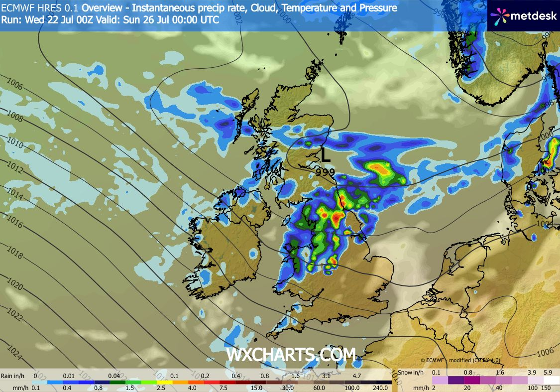
July has been very dry. Our average rainfall for July is 89.1mm. So far we have only had 4mm with the last measurable rainfall being on the 2nd of July (3.8mm). There is plenty of dry weather in the next 10 days but we will see some rainfall this weekend. It certainly won’t be as much as the fire-fighters and local golf clubs will be hoping for.
Thursday: Similar to recent days. A cloudy start with very warm sunny spells eventually breaking through. Pleasant temperatures. Low risk of a shower towards the hills and turning breezy later in the day. Max 23°C Min 12°C Max Gusts 20mph
Friday: Little change. Sunny to start but cloud will bubble up but some sunny spells continuing. Dry but with a keen west-to-northwesterly wind picking up later, especially out west and ahead of change. Max 22°C Min 12°C Max Gusts 25mph
Weekend: First unsettled spell for a while.
Saturday: A dry start but cloud thickening and any brightness fading as patchy rain, with some brief heavier bursts, moves southeast through the region from mid-afternoon onwards. The rain and drizzle will continue to come in pulses overnight. Temperatures down but quite muggy especially overnight. Max 20°C Min 14°C Max Gusts 30mph
Sunday: Cloudy with still some patchy rain around for the morning. Bright spells for the afternoon but also with some showers at times. Another windy one at times. If temperatures don’t reach 20°C (rounded) this will be first time this has happened since July the 2nd. By our standards, that’s a decent run. Max 19°C Min 14°C Max Gusts 25mph
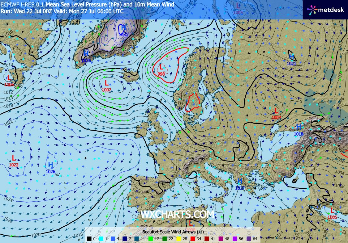
Outlook: High pressure to the southwest and low pressure close by to the northwest. This means we will continue to see temperatures around normal with a westerly airflow. Mostly dry with sunny spells but a risk of some rain and windy conditions later in the week. After that it looks like, at this stage, that high pressure will build and the second week of August could be very warm and sunny with an increased chance of seeing heatwave no. 4 but this far out it’s impossible to say.
That’s all for this week. Follow @ChadWeather on X and Bluesky for the latest forecasts and warnings.
Thanks,
Jon
Forecast Issued: Wednesday the 22nd of July 2026 at 6:18pm.
Images: http://www.wxcharts.com

