
Hi all,
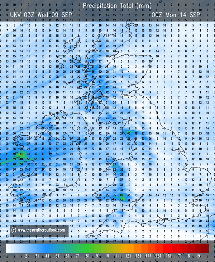
The spells of rain keep coming and it’s now rained every day so far in September and rained on the last 14 days out of 15. There is more rain to come but to be fair the outlook isn’t too bad and rainfall amounts won’t be as high as recently.
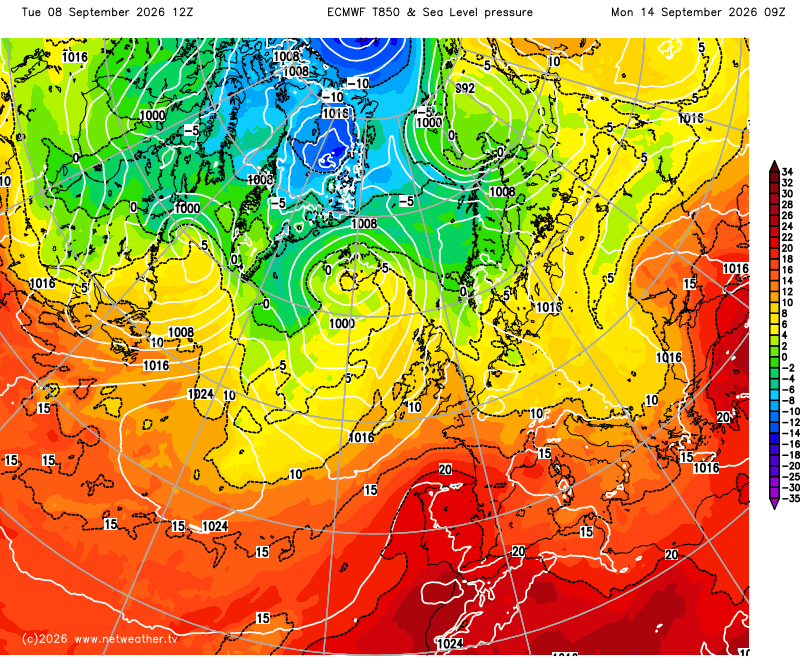
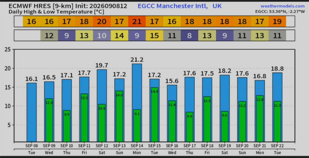
There were signs of a few days of summer-like warmth returning but for now, any warmer air looks brief, very brief.
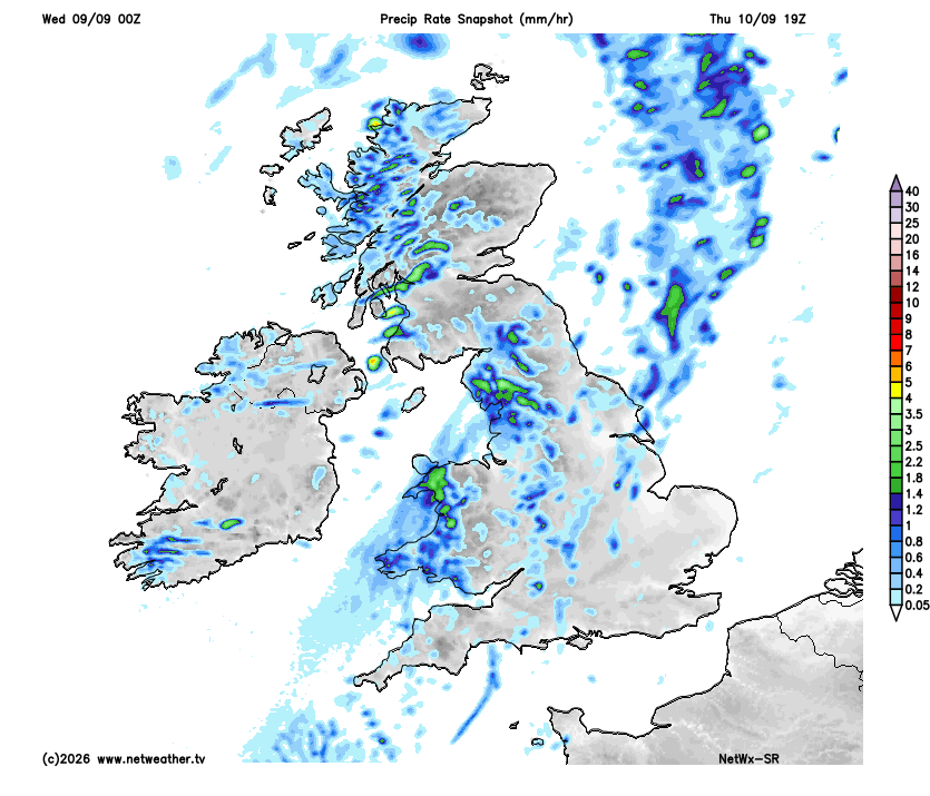
Thursday: A cool start with some hazy bright spells in places. Clouds will soon thicken to bring some patchy rain later in the afternoon and then some heavier rain into the evening becoming breezy. Max 18°C Min 13°C Max Gusts 20mph
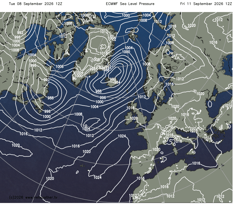
Friday: A cloudy start with a few showers to get out of the way first, but late-morning and into the afternoon will turn drier with sunny spells developing. Breezy at times. Clear spells overnight will lead to a chilly one. Max 19°C Min 8°C Max Gusts 20mph
Weekend: Sunday looks best.
Saturday: A cloudy and windy day on Saturday but quite warm and muggy. It might start dry but patchy rain will arrive into the morning and pretty much last on and off during the day. Drier as we head towards evening. Max 18°C Min 14°C Max Gusts 25mph
Sunday: Mist and fog overnight Saturday, might be slow to clear in a few places as we head into Sunday but once it does, it should be a decent day with sunny spells developing and feeling warmer. Max 20°C Min 11°C Max Gusts 20mph
Outlook: Reasonably warm on Monday but bright spells will fade with a few showers possible later. After that, it looks like we return to slightly unsettled conditions. Windy with spells of showers from the west and some chilly nights inland where skies clear and showers ease. No sign of any summer-like heat returning but maybe more in the way of sunshine as we head towards the weekend.
Follow @ChadWeather on X and Bluesky for the latest forecasts and warnings.
Thanks,
Jon
Forecast Issued: Wednesday the 9th of September 2026 at 6:50pm.
Images: http://www.weathermodels.com, http://www.theweatheroutlook.com and http://www.netweather.tv.
 Oldham Weather