Thunderstorms warning and further rain expected over the coming days – Thursday 27th August 2026 – Bank Holiday Monday 31st August 2026

Hi all,

It’s fair to say that our weather has now changed and we have had some welcome rain. Parts of England and Wales further south from our region are still in desperate need of some rain but there will be rain arriving over the coming days. Although it will be the type of rain that we don’t need, torrential and falling in a short space of time which will cause flash-flooding, especially where surfaces are rock hard.

Currently we have two thunderstorm warnings in place for today (Wednesday) and Thursday. As is always the case with thunderstorms, a lot of people do moan when they don’t happen and say the warning was not needed. But it’s a bit different if you do end up being under a thunderstorm where you do see surface-water flooding.

Thursday: A cloudy start with perhaps the odd shower but as we head towards lunchtime and around lunchtime there will be an area of thundery rain spreading up from the south. This is expected to last into the evening before clearing away northwards. It will be a humid day despite all the rain. Occasionally breezy. Max 21°C Min 15°C Max Gusts 25mph
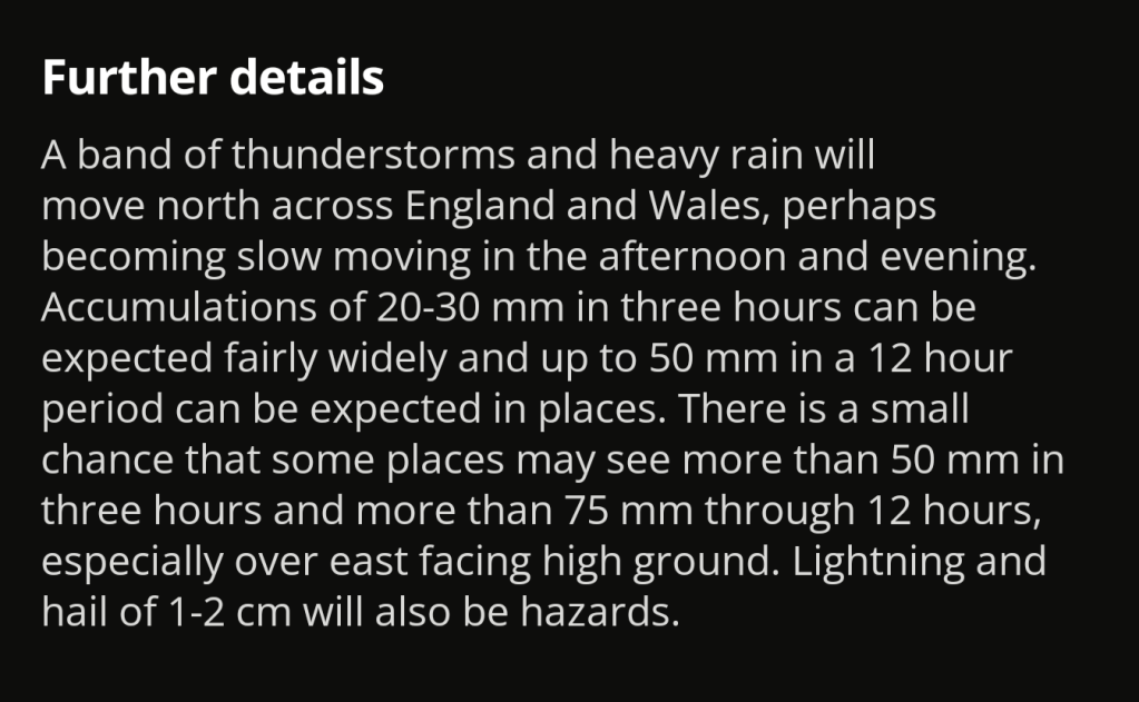
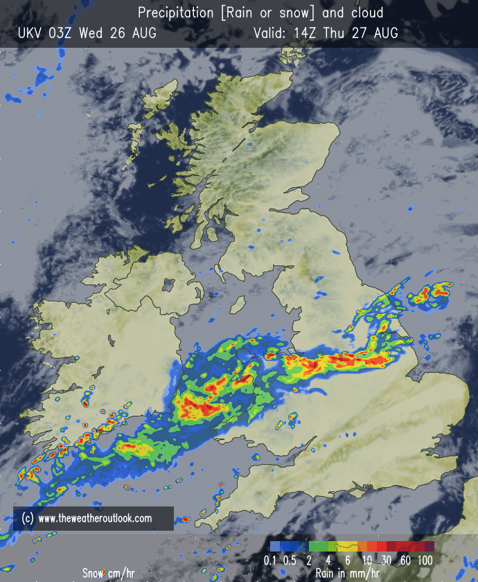
Thursday’s thunderstorm warning
An area of heavy thundery rain moving north around Thursday lunchtime. Followed by thundery showers towards evening.

Friday: The low pressure system across the UK will pivot, meaning that heavy thundery showers will move in from the northwest during the morning easing away into the afternoon. Still a little humid and breezy. Max 20°C Min 13°C Max Gusts 20mph
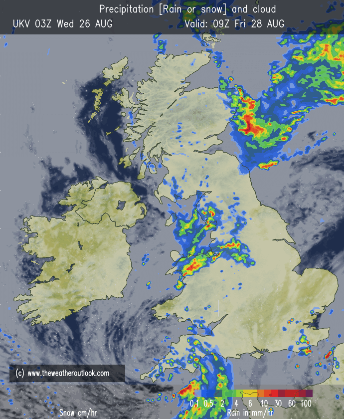
Further hefty showers on Friday morning

BH Weekend: Rain at some point on all days.

Saturday: After a dry start, cloud will thicken from the southwest and an area of rain will move across the region. There might be the odd heavy burst before it turns patchy and showery and drier towards evening. Max 19°C Min 14°C Max Gusts 20mph
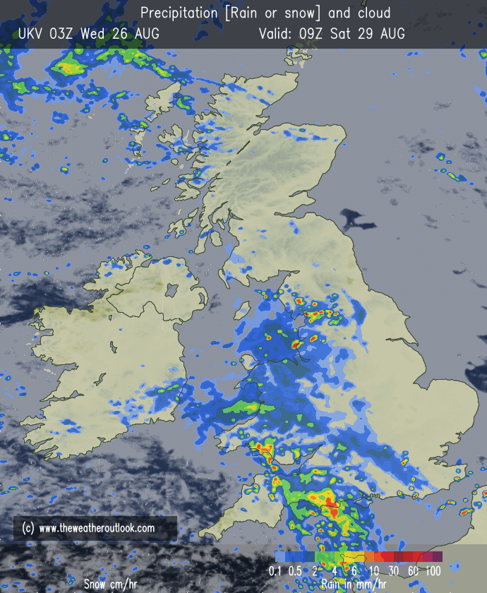
Rain moving northeast across the region during Saturday morning turning showery later

Sunday: At this stage it’s a little bit tricky to predict the weather on Sunday, but what I’m expecting is a few showers around which should then ease away but more persistent rain arriving as we head towards evening. A little cooler and breezy. Look out for updates on social media. Max 19°C Min 12°C Max Gusts 25mph

Bank Holiday Monday: Much fresher and cooler. Sunny spells and showers and pretty windy at times, especially during any downpours. Max 17°C Min 12°C Max Gusts 30mph

Outlook: Looks unsettled with bright spells and heavy showers, sometimes merging together into longer spells of rain. Temperatures around average. I wouldn’t be surprised to see the weather settle down again as we head towards the second week of September and temperatures could well rise in this period. Confidence is low at this stage but I’ll keep my eye out for any developments.

Follow @ChadWeather on X and Bluesky for the latest forecasts and warnings.

Thanks as always for following and reading.

Thanks,

Jon

Forecast Issued: Wednesday the 26th of August 2026 at 3:45pm

Images: http://www.theweatheroutlook.com
Heat out of the way, what now? Some welcome rain but high pressure and sunny spells to return briefly, but will another heatwave arrive? – Thursday 20th August 2026 – Sunday 23rd August 2026

Hi all,

At the time of writing we have a weather warning coming into force this evening and into Thursday for thunderstorms. This will bring much-needed rain but perhaps too much rain in a short space of time which could lead to some flash-flooding given how hard the ground is. It’s been a prolonged dry spell but we have now recorded rain on the last 4 out of 5 days with a total of 15mm recorded at HQ.

There is a bit more rain on the way but high pressure should start to nudge in towards the weekend and bring a settled spell of weather which should last until early next week. Here’s the forecast for the next 4 days and the outlook in detail.

Thursday: There will be some heavy rain around for the morning which could be thundery and there will be a cool north-to-northeasterly breeze developing. Into the afternoon the heavy rain will break up and become more showery. Breezy and a cold one overnight. Cool. Max 17°C Min 8°C Max Gusts 20mph

Friday: A chilly start with sunny spells for the morning but cloud will bubble up into the afternoon with a few showers. Still the odd heavy one but nothing like recent days. Clear spells overnight and again another cool one. Autumn is not far away. Max 18°C Min 7°C Max Gusts 15mph

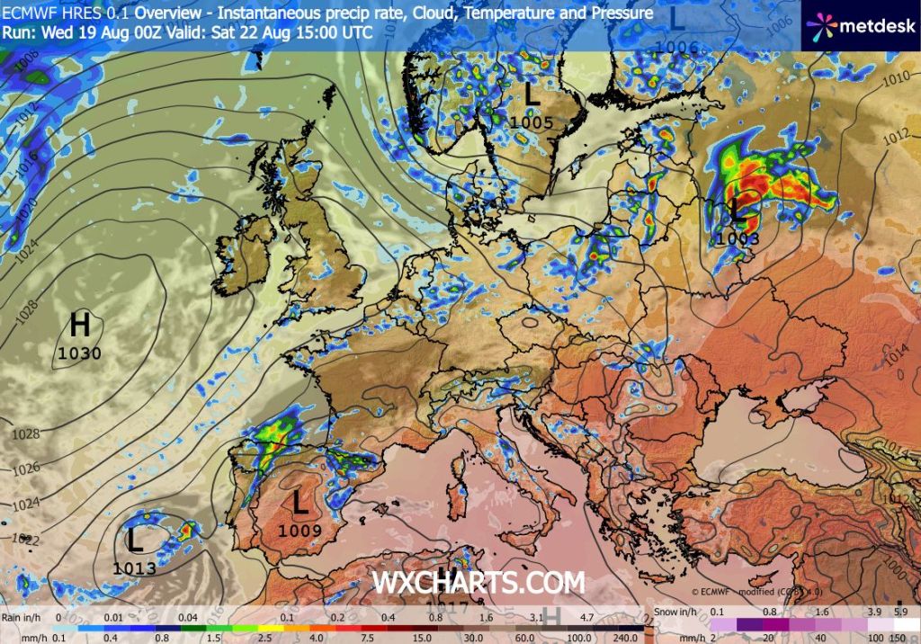
Weekend: High pressure is back.

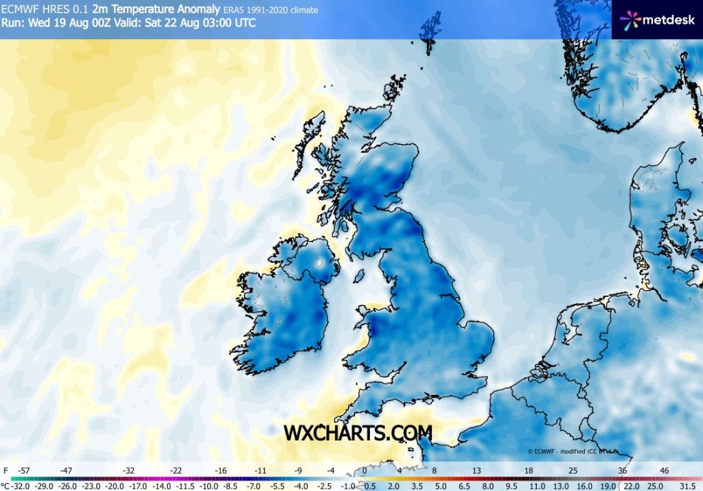
Some cool nights to come with temperatures below average

Saturday: Mostly dry with sunny spells and light winds. Feeling pleasant in the sunshine and don’t forget that UV levels are still high at around 6. I can’t rule out a shower though. Max 18°C Min 8°C

Sunday: Very similar to Saturday but hopefully all places will be dry with sunny spells and feeling pleasant but still temperatures on the cool side compared to recent weeks but warm in the sun. Max 19°C Min 9°C Max 15mph

High pressure ridges in this weekend but we could still see the odd shower

Outlook: Warm and sunny on Monday but after that the weather slowly goes downhill with cloudy conditions and rain or showers developing, again possibly thundery. No heatwave on the horizon.

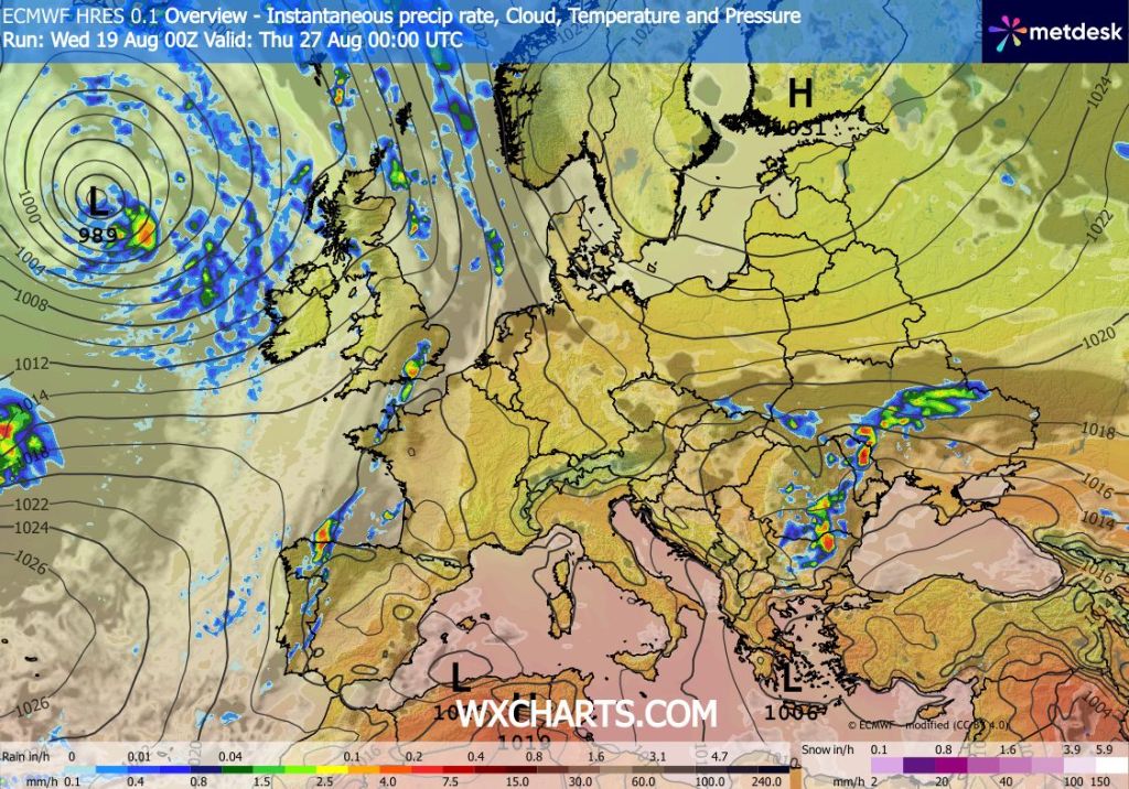
Low pressure will eventually return as we progress through next week

Follow @ChadWeather on X and Bluesky for the latest forecast and warnings.

Thanks as always, for popping by to read.

Jon

Forecast issued: Wednesday the 19th of August 2026 at 5:30pm

Images: http://www.wxcharts.com

Some welcome rain for a time before warmer, possible hot, and drier weather returns – Thursday 6th August 2026 – Sunday 9th August 2026

Hi all,

Thundery showers have been around recently and further showers around today, but some places stayed completely dry, others seeing some welcome downpours after a very dry July.

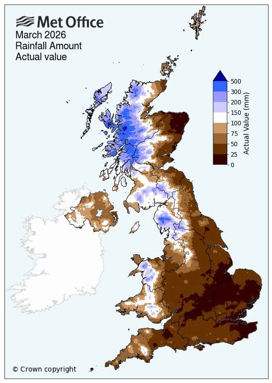
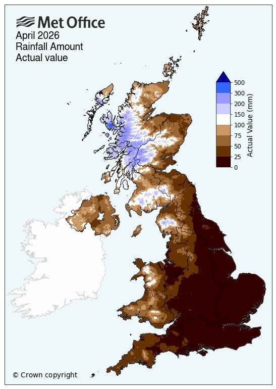
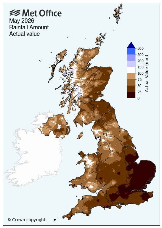
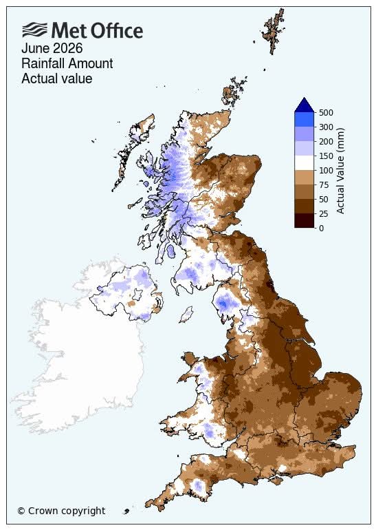
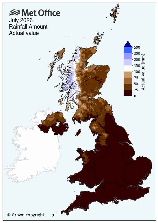
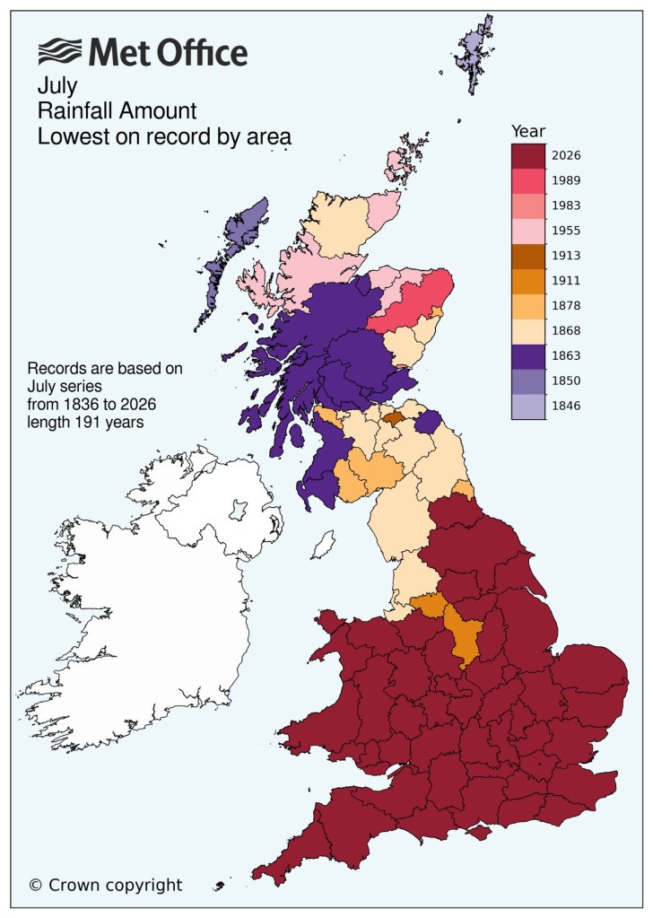
The Met Office’s charts below are staggering, showing how dry it has been over several months, mostly across England and Wales and it’s clear to see why areas are in drought.

Drought conditions are concerning for parts of England with little rainfall to come here over the coming weeks after the driest July on record.

Thursday: Bright spells and showers especially so for the morning and lunchtime. Tending to become drier for the afternoon with sunnier skies and winds easing eventually, feeling fresh out of any sunshine. Max 18°C Min 10°C Max Gusts 30mph

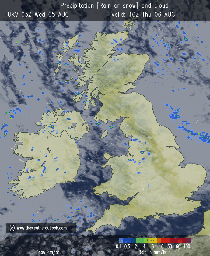
Some showers around on Thursday, especially in the morning

Friday: Warmer with sunny spells and just the chance of an isolated shower. Still a little breezy. Max 22°C Min 10°C Max Gusts 20mph

Weekend: Saturday’s best.

Saturday: Very warm with sunny spells to start but cloud will bubble up and cloudy at times later could bring a localised sharp shower. Windy later. Max 25°C Min 14°C Max Gusts 25mph

Sunday: Winds switching westerly so turning less warm again with bright spells and the possibility of showers too. Max 20°C Min 13°C Max Gusts 20mph

Outlook: High pressure returns into next week and it’s likely that parts of the UK will see another heatwave with 30°C+ down south. Here, plenty of dry weather again, hazy sunny spells and very warm, perhaps hot at times. It’s been some summer! Temperatures should peak on Wednesday then perhaps turning unsettled from the west later bringing thundery showers.

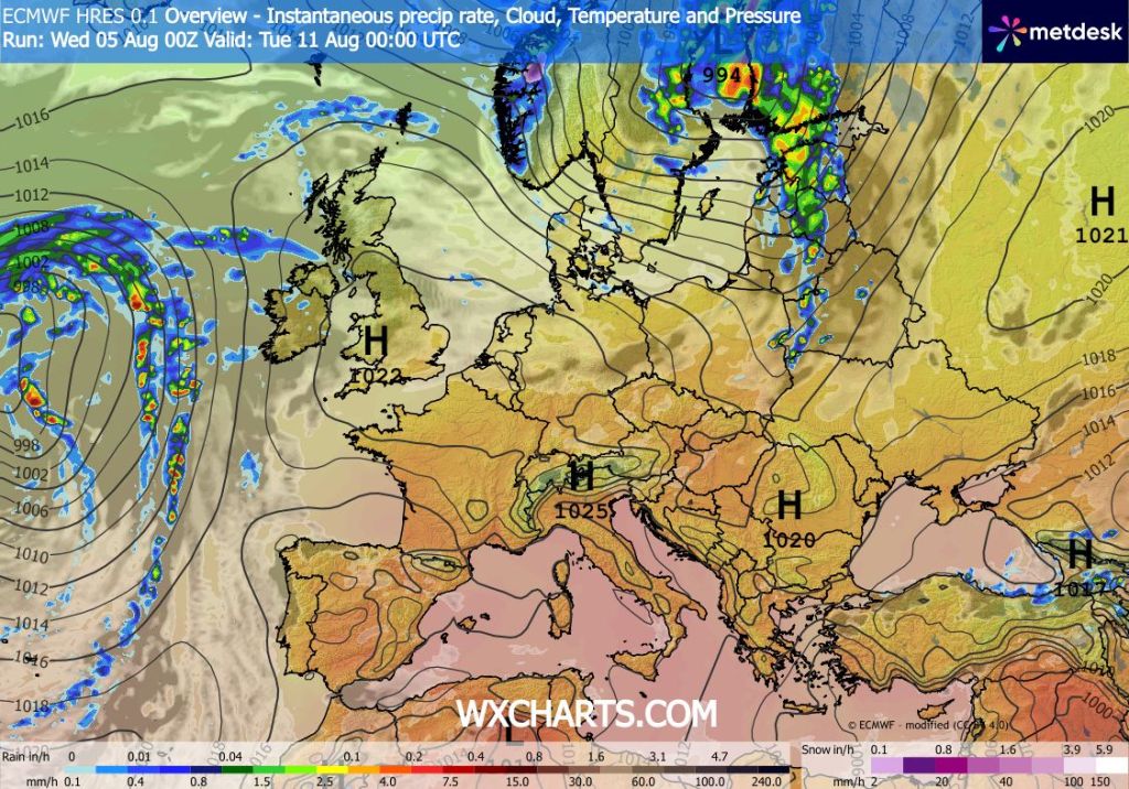
High pressure into next week
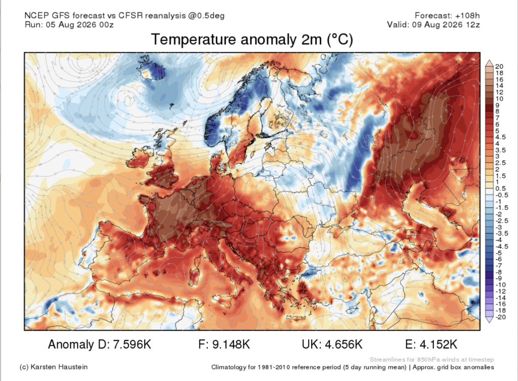
England & Wales seeing temperatures well above average next week. Sorry Scotland. Image from X from @Met4CastUK’s.

Follow @ChadWeather on X and Bluesky for the latest forecasts and warnings.

Thanks,

Jon

Forecast Issued: Wednesday the 5th of August 2026 at 5:22pm.

Images: Met Office & http://www.wxcharts.com, http://www.theweatheroutlook.com and @Met4CastUK.