Hi all,
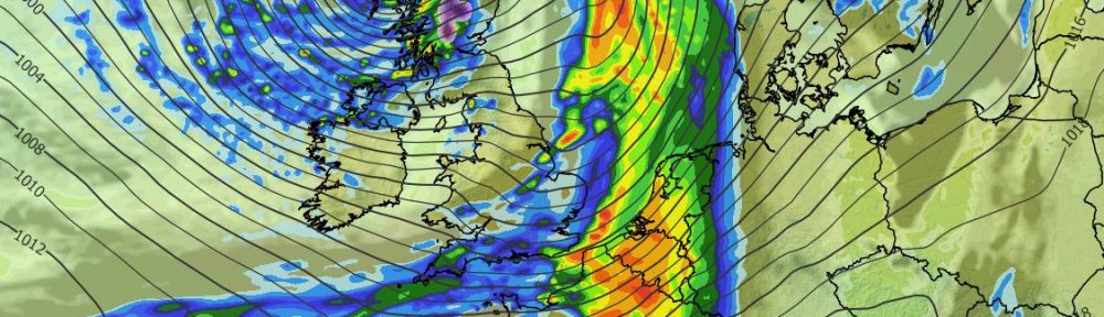
Our, the UK’s, first named-storm of the season will arrive Thursday night into Friday with 60-70mph gusts possible in the southwest with the Met Office issuing an Amber warning. For us, we will escape the worst of the conditions but it will be wet and windy for a time.
Another deep area of low pressure arrives this weekend, this time to the northwest. There is a possibility that this is also named. As it pulls away it could mean later on Saturday and especially Sunday is the windiest spell of the coming days.
There will also be a reasonable amount of rainfall associated with these lows.
Oh, and zero chance or any sign of snow, away from the Scottish Mountains, so ignore the usual media nonsense.
Thursday: A chilly start then a quiet spell before change but that said there will still be some showers around as well as some welcome sunny spells. Rain associated with Storm Austen will arrive overnight with the wind gusty for a time from the east. Max 12°C Min 7°C Max Gusts 30mph (overnight)
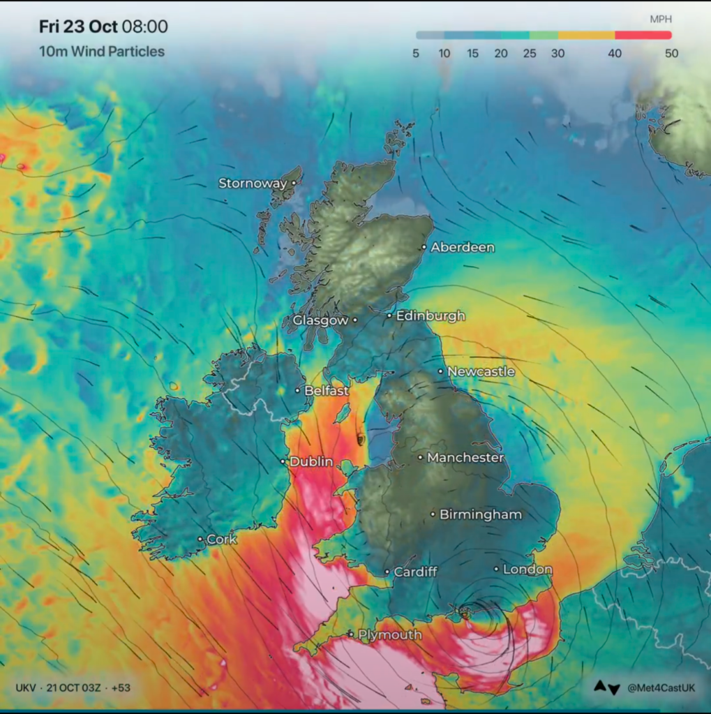
Friday: A lively day with rain, heavy at times for the morning and into the afternoon. Once this rain begins to clear and winds switch to a northwesterly direction, winds will increase and locally gust to gale-force. Clear spells into the evening and overnight with winds falling lighter. Max 11°C Min 5°C Max Gusts 35-40mph
Weekend: Going downhill.
Saturday: It should be a nice start on Saturday with sunny spells, but these will soon turn hazy with cloud thickening during the late-morning. At this stage it looks like heavy rain will arrive from the west from around lunchtime onwards, give or take an hour. Southerly winds will increase and again we could see some localised gale-force gusts. Clearer spells overnight with just a few showers but the wind will remain noticeable. Max 14°C Min 6°C Max Gusts 40mph
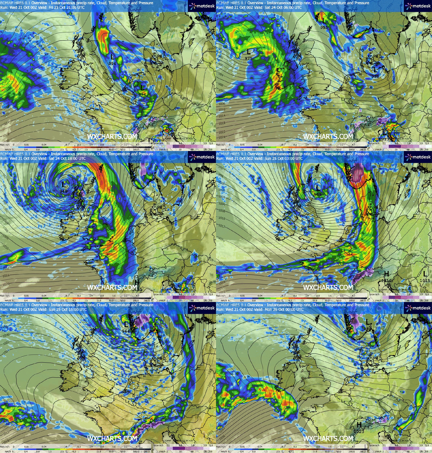
Sunday: This new area of low pressure will start to push away but it will still be deepening so we can expect a day of sunshine and showers and very windy conditions. Feeling particularly chilly. Max 11°C Min 6°C Max Gusts 35-45mph
Outlook: Next week looks to remain unsettled with perhaps a couple more low pressures before high pressure will hopefully drift up from the south or southwest and settle the weather down towards next weekend.
Follow @ChadWeather on X and Bluesky for the latest forecasts and warnings.
Thanks for reading.
Jon
Forecast Issued: Wednesday the 21st of October 2026 at 2:48pm.
Images: http://www.wxcharts.com, Met Office and @Met4CastUK on X.

