Cooler with low rainfall amounts and colder weather lurking on the horizon – Thursday 23rd February 2023 – Sunday 26th February 2023

Hi all,

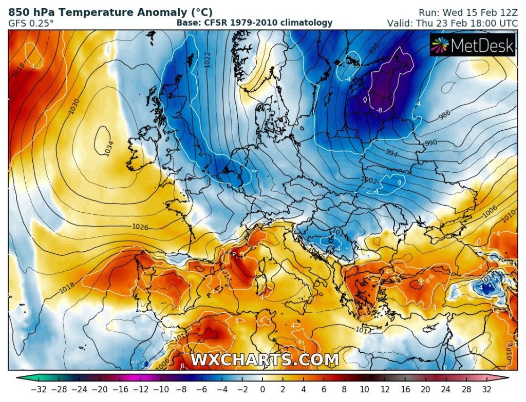
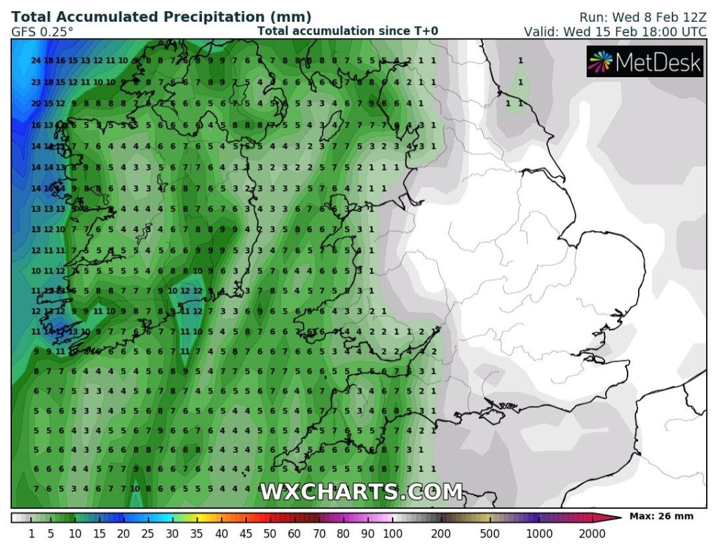
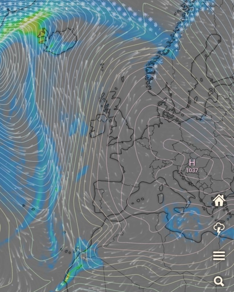
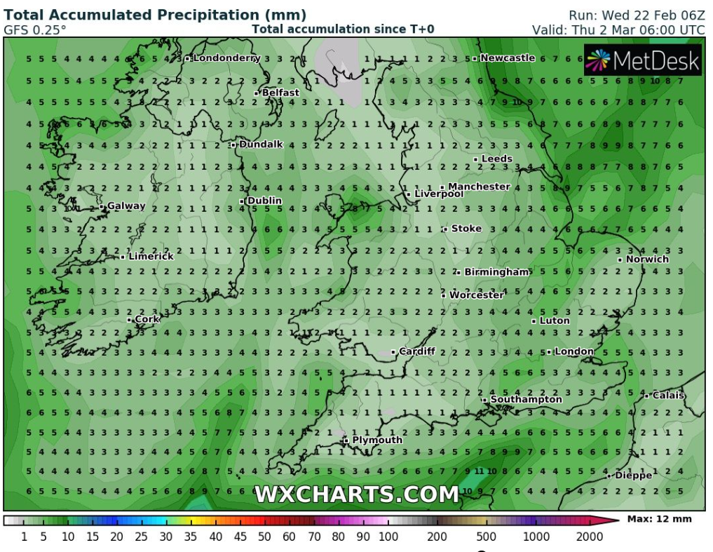
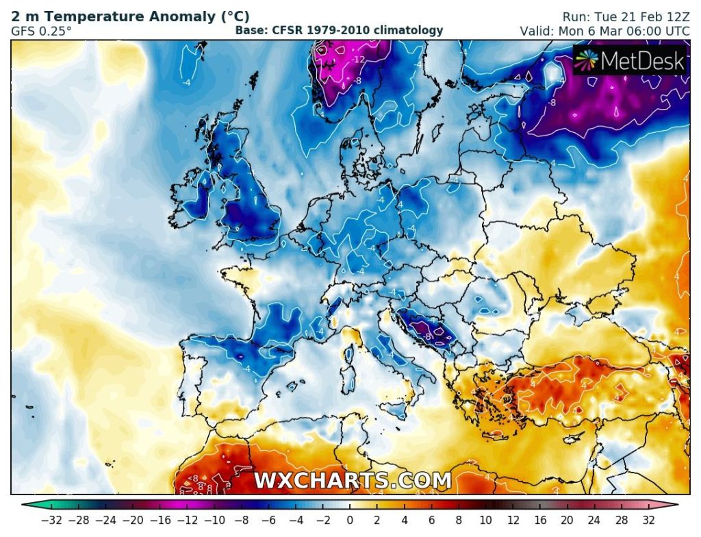
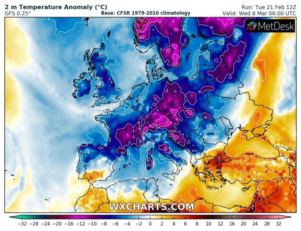
February is turning out to be a very dry month. Currently 15mm have fallen and not much in the forecast for the remainder of the month. The month’s average is about 90mm. After recent events, i.e. the SSW, Met Office – SSW, all the talk has been about a Beast from the East (BFTE), snow storms and blizzards to bring chaos to the UK. This is all media (BS!) speculation but there are signs, and these signs are growing, of the weather turning colder as we progress through the first week of March; which of course is the first month of Spring meteorologically-speaking.

Will there be a BFTE? No-one knows but don’t be surprised to see some frosts and snow back on the weather charts. One thing I like to do, is keep it real. No over-the-top, clickbait nonsense. Weather is very unpredictable looking ahead more than 5 days, even fewer days than that for snow, so look out for updates on Twitter.

The next 7 days sees little in the way of rainfall with only a couple of mms predicted.

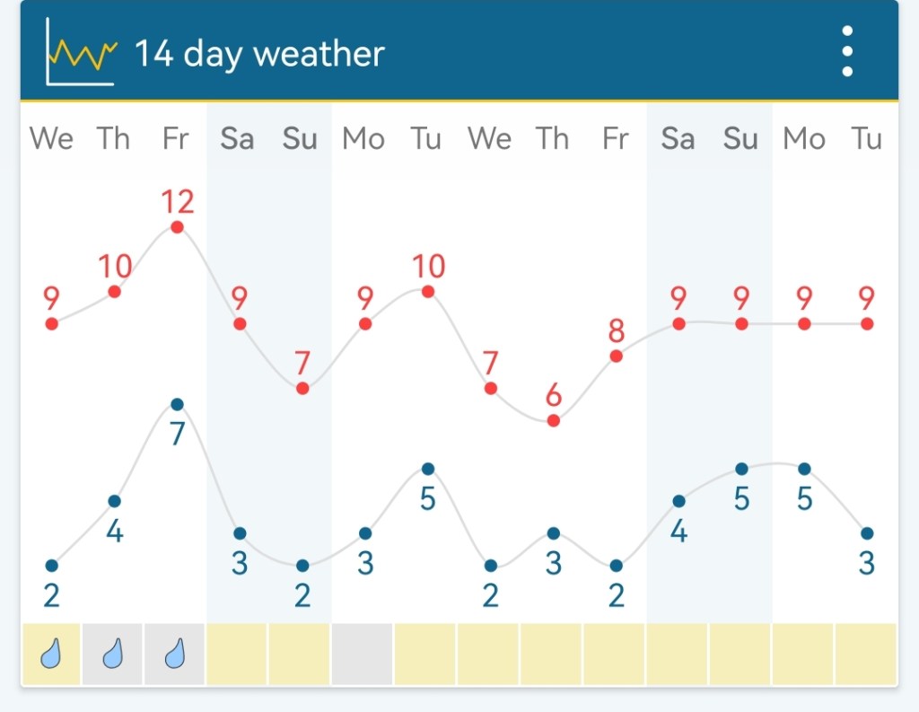
Thursday: A frosty start in places. We’re due some sunshine and after any early hazy-cloud clears it should be a decent day with plenty of sunny spells. UV levels might even sneak to 2! Spring is coming. Feeling pleasant in direct sunlight and shelter but maximum temperatures in single-digits. Max 8°C

Friday: Looks more of a cloudier day with areas of cloud drifting in on a steady north-easterly wind which will be gusty at times. Max 9°C

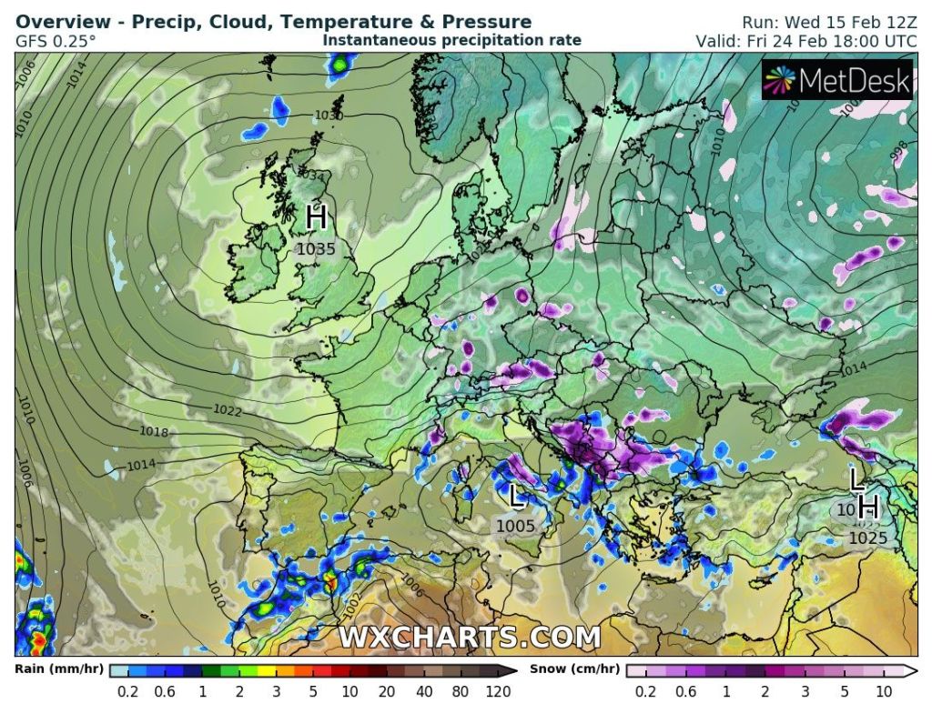
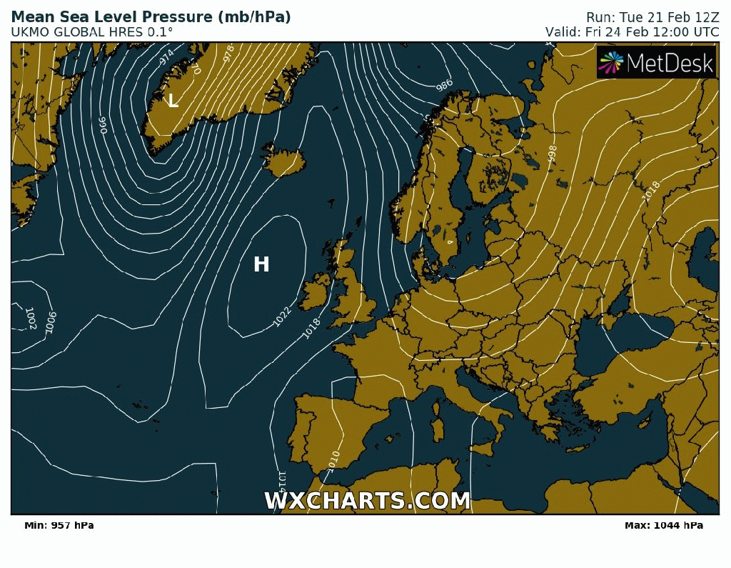
Weekend: High pressure to take control but more cloud than sunshine.

High pressure moves in from the west to dominate the weekend’s weather but don’t expect wall-to-wall sunshine. Mist and fog likely.

Saturday: Light winds and a misty/foggy start is possible which will lift into low-cloud and lead to another mostly cloudy day. Bright spells breaking out in the odd lucky spot. Feeling cold with a raw wind (wind-chill around 2°C). Max 7°C

Sunday: Little change. Patchy frost to start under any clear spells. Dry and chilly but not as windy as Saturday. Max 8°C

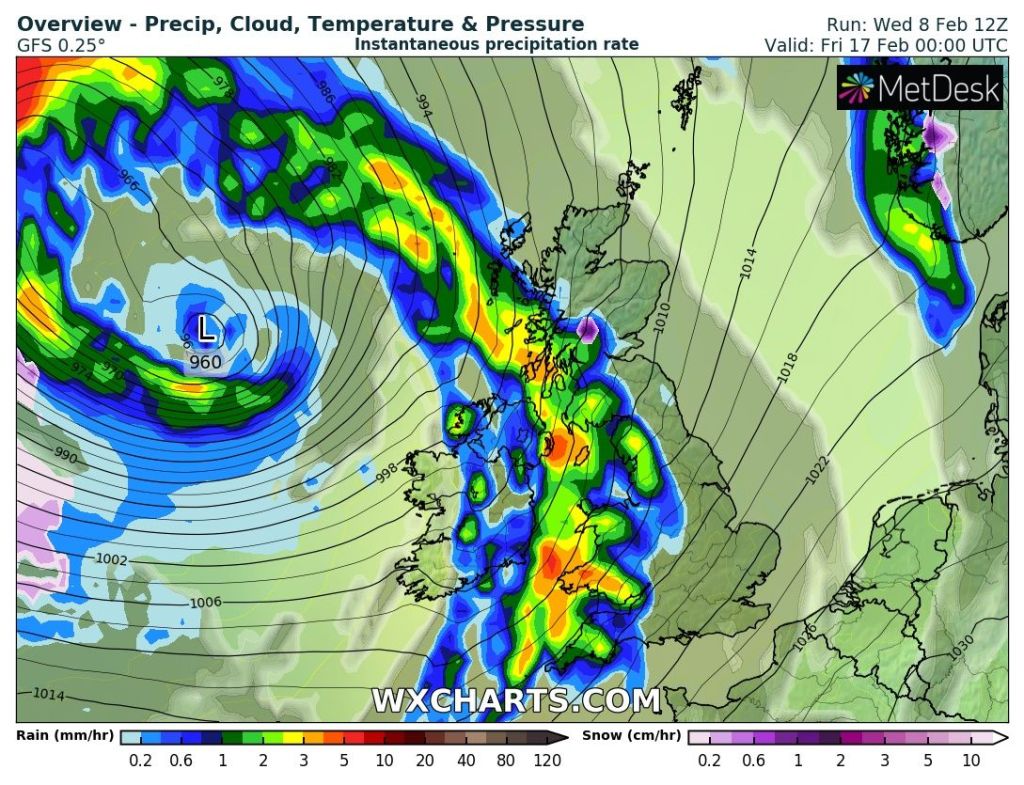
Outlook: Generally dry and cool with little much on the agenda until towards next weekend where it looks to turn a little colder, more unsettled and perhaps with some wintry showers, falling as snow on high ground. No BFTE or a need to stock-up on food just yet! Although grab those tomatoes when you can!

After the first weekend of March, it seems the first effects of the SSW will be felt as much colder air floods down from the Arctic or from the northeast. One to watch over the coming days.

Follow @ChadWeather on Twitter for the latest forecasts and warnings.

Thanks for reading.
Jon

Forecast Issued: Wednesday the 22nd of February 2023 at 6:20pm.
Images: http://www.wxcharts.com

Settled end to February – Thursday 16th February 2023 – Sunday 19th February 2023

Hi all,

It’s been a very dry February so far after all those days of rain in January. At this stage of February we should have had around 45mm of rain. Currently we’ve only had 3.4mm! Yes there will be some rain in the coming days but there’s no sign of any persistent rain on the horizon, so February will end with well-below average statistics. With some welcome sunshine towards the end of the month, it might be time for that first cut of the lawn.

No significant cold on the way but some chilly air from the north-west later next week but certainly no Beast from the East.

Thursday: A mostly cloudy day with patchy rain or drizzle in the morning easing away into the afternoon. Low-cloud and misty conditions on the tops. Mild for the time of year. Max 10°C

Friday: Any bright spells fading as a weakening band of patchy rain moves southeast. Brighter spells later in the day with the odd shower but well-scattered. Windy with 35-40mph, especially so on the eastern side of the hills. Mild. Max 12°C

Very mild on Friday then temperatures quite steady apart from a chilly spell midweek next week. No going into the freezer like the media portray.

Weekend: Weather-fronts close by.

Saturday: Early rain moves away introducing some fresher air. Remaining mostly cloudy with the odd bright spell here and there. Evening shower can’t be ruled out. Max 9°C

Sunday: The morning is expected to be overcast with some bright spells developing during the day but these are likely to be limited. Max 10°C

Outlook: No sign of anything snowy or significantly cold (despite what the media spout) although some chilly nights are expected later in the week. Monday and Tuesday seem to bring more of the cloudy conditions that we have been used to. A weak weather-front will move down from the north-west on Wednesday. This will introduce some wintry showers and cooler air afterwards. From Thursday onwards high pressure is expected to build from the west and then become anchored across the UK to end the final 5-6 days of February with dry, bright and settled conditions with some frosty nights.

High pressure is forecast to dominate for the final 5-6 days.

Follow @ChadWeather on Twitter for the latest forecasts and warnings.

Thanks for reading.

Jon

Forecast Issued: Wednesday the 15th of February 2023 at 9:35pm.

Images: http://www.wxcharts.com & Wetter&Radar.

High pressure still in control with plenty of dry weather – Thursday 9th February 2023 – Sunday 12th February 2023

Hi all,

Little change in the set up of the weather over the next week. High pressure to our south-east, and it’s a big strong one and it will continue to keep the unsettled weather away to our northwest. Any weather-fronts that do make it down through the region, like the one coming tonight, will weaken quickly and produce little rain.

Very little rainfall over the next 7 days.

Talks of SSW in the weather community at the moment. It’s now looking likely. This doesn’t guarantee a Beast from the East later this month/early-March but it can mean colder-than-average weather. Read more below from the Met Office’s blog. More about the possibility of colder weather from me next week.

https://blog.metoffice.gov.uk/2023/02/07/are-we-expecting-a-sudden-stratospheric-warming/

Thursday: After a weak band of patchy rain overnight, Thursday looks a reasonable day with some sunny spells and high-cloud at times. Perhaps cloudier towards evening. Breezy and temperatures just above average. Max 8°C

Friday: A mostly cloudy day with a steady breeze from the south-west. A warm-front will introduce slightly milder air. The cloud could be thick enough for some hill-drizzle. Max 9°C

Weekend: Milder but little in the way of sunshine and mostly dry.

Saturday: Again we can expect cloudy skies with hill-drizzle in a few spots. Some eastern parts might see the odd brighter spell which will help to lift temperatures. Max 11°C

Sunday: Little change. A south or south-easterly airflow, with a lot of dry and cloudy weather. Still mild but temperatures could be a little lower than yesterday. Max 10°C

High pressure stays close by as we go into next week without dragging in any cold air from the continent

Outlook: Little change and no sign of anything significantly cold or snowy and the week looks mostly dry. Some signs of more unsettled weather sneaking down from the northwest towards the end of the week.

After a lack of rainfall over the last few weeks, signs of a more unsettled second half to February looks possible.

Follow @ChadWeather on Twitter for the latest forecasts and warnings.

Thanks for reading.

Jon

Forecast Issued: Wednesday the 8th of February 2023 at 8:35pm

Images: http://www.wxcharts.com and Windy.com.

A decent Sunday then more high pressure but will it turn colder? – Thursday 2nd February 2023 – Sunday 5th February 2023

Hi all,

The third and final month of winter is here. It’s a month that can bring mild and moist weather with temperatures into double-digits but also bitterly cold, snowy weather from eastern Europe. We could well see both scenarios in the coming weeks but for now we remain above-average on the thermometer and I’m not mentioning those 4 words yet!

Thursday: A mostly cloudy day with the chance of some hill-drizzle. Breezy with temperatures above average. Max 11°C

Friday: Another mild day with further cloudy skies. Perhaps some brightness developing into the afternoon which will help to lift the temperatures. Breezy again. Max 12°C – perhaps 14°C in some local spots sheltered in the east.

Weekend: Becoming colder but brighter.

Saturday: Any bright start fading as cloud builds from the north-west and a weather-front moves south-east bringing some patchy rain into the evening. Patchy frost later in the night as skies clear. Max 11°C

Sunday: That weather-front is a cold-front so Sunday will be cooler but with it much brighter skies and with high pressure building we should see a good amount of sunshine. Some frost overnight. Max 8°C

Outlook: High pressure that builds over the UK on Sunday will slip away into the continent as the week goes on but still control our weather. It all depends where this high pressure sits, with what weather we see next. If it moves over Scandinavia then we could import some easterly winds meaning that it will turn much colder with the risk of snow flurries. If the high pressure slips further south we will be in a milder south to south-westerly airflow. Literally at the moment the outcome is uncertain but it’s probably favouring the milder weather 60:40. One thing to note is the week looks mostly dry with sunny spells and some overnight frosts. Updates on Twitter.

January 2023 Stats

Max 11.9°C (4th)
Min -2.5°C (17th)
Av. 4.9°C
Wettest 24.8mm (10th)
Av. Humidity 88%
Av. Barometer 1012.9 hPa
Max Gust 35.7mph
Av. Wind Direction WSW
Rain 132.4mm (119% of average)
Rain Registered Days 22
Dry Days 9

Follow @ChadWeather on Twitter for the latest forecasts and warnings.

Thanks,
Jon

Forecast Issued: Wednesday the 1st of February 2023 at 9:16pm.