Hi all,
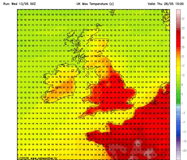
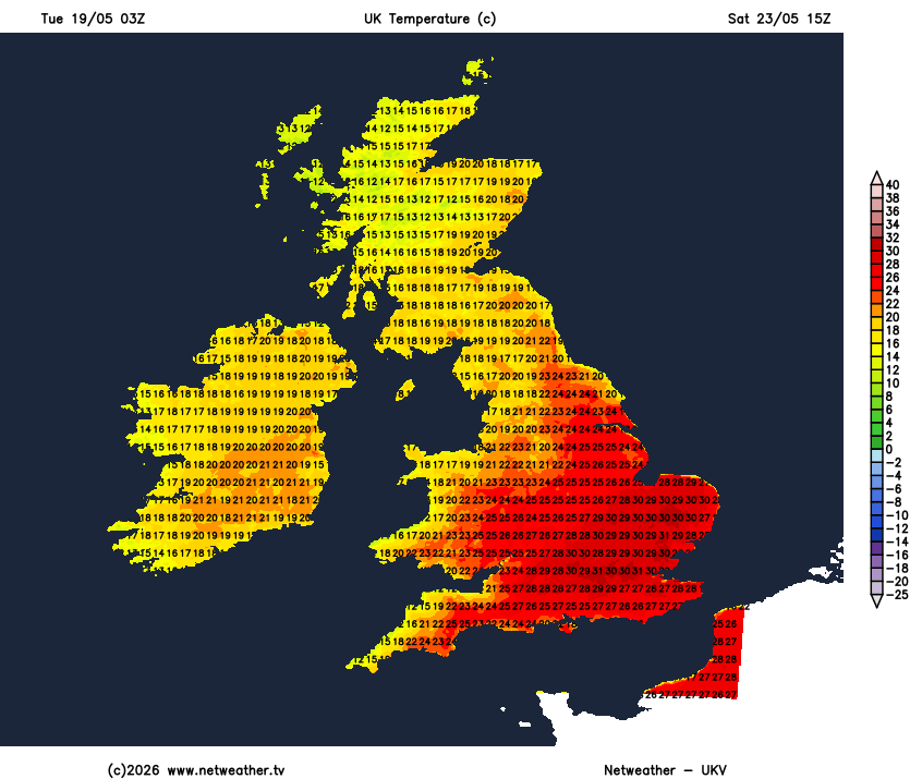
As summer approaches and a cool May draws to a close, temperatures are set to rise, with a possible heatwave on the way for parts of the region. As is always the case with heat wafting up from the south, it tends to be southern and southeastern parts of the UK that really see the heat ramp up, approaching 31°C.
In NW England parts of the region could see temperatures into the mid-to-late 20s, but it could be slightly cooler towards the coast and northwest.
Regardless of temperature UV levels are now high.
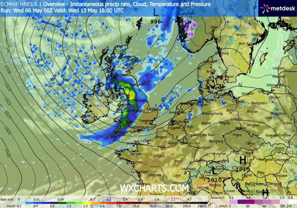
Thursday: A band of rain is expected to sweep through the region during the morning to be followed by bright spells and just a few isolated showers, which should start an ease away later. Notably warmer into the evening as skies clear and breezy. Max 21°C Min 11°C Max Gusts 20mph
Friday: It looks like a lovely day with plenty of hot sunshine with a refreshing southerly breeze which will be gusty at times. However, there could well be some hazy skies and high-cloud at times from the west. Max 24°C Min 14°C Max 25mph
BH Weekend: Eventually hot and mostly sunny.
Saturday: Sunny spells and very warm but temperatures a little down on Friday. Just a small chance of an isolated thundery shower later. Max 23°C Min 13°C
Sunday: Any clouds begin to melt away and it should turn warmer once again and it should remain dry. Feeling hot in the sunshine. Nights warm too. Max 25°C Min 14°C
Bank Holiday Monday: If you love the heat then it’s a cracking day with plenty of hot sunshine and dry. Max 27°C Min 14°C
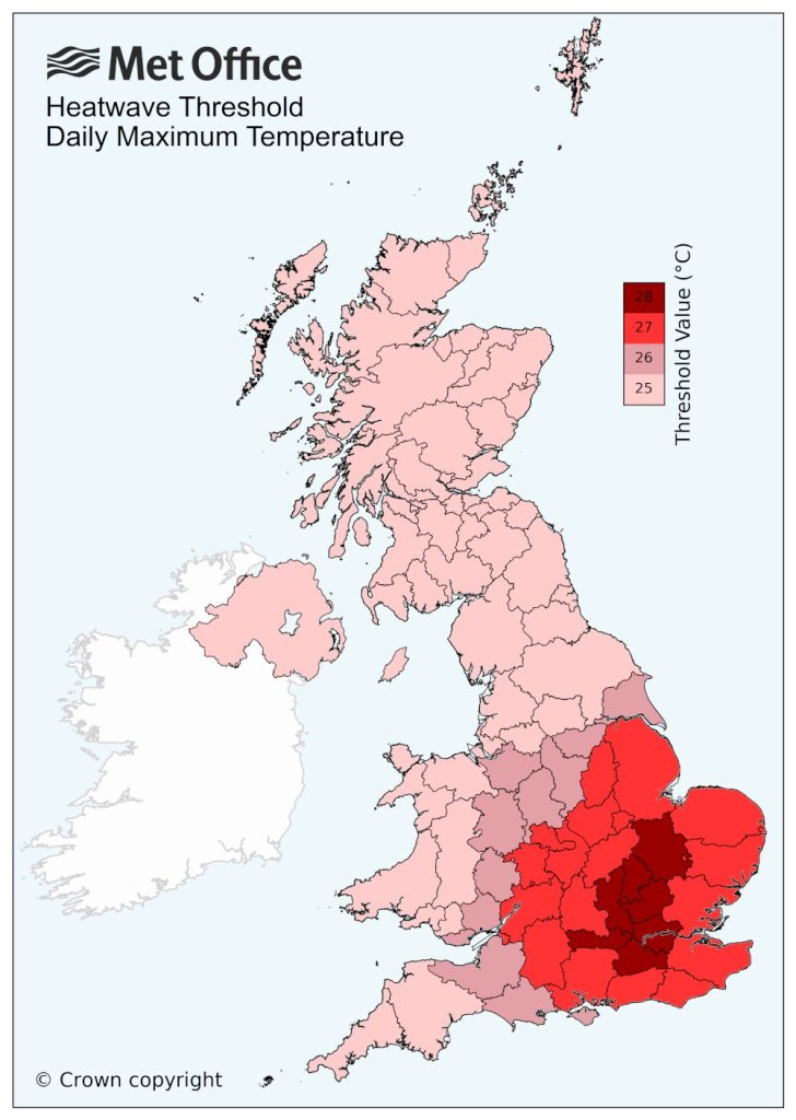
Outlook: High pressure will continue to dominate, and initially the week will be hot with temperatures likely to still be in the heatwave threshold. The high pressure is likely to change its position as the week wears on and introduces an easterly/northeasterly then westerly breeze. It will remain sunny and dry but temperatures due to this airflow will drop back several degrees to the early 20s with a thundery shower risk.
Follow @ChadWeather on X or Bluesky for the latest forecasts and warnings.
Thanks,
Jon
Forecast Issued: Wednesday 20th May 2026 at 8:32pm.
Images: http://www.netweather.tv & Met Office