Well and truly Autumnal. Will we see Storm Arwen? – Thursday 30th September 2021 – Sunday 3rd October 2021

Hi all,

The weekly blog returns, after I spent last week on the annual 4-day golfing holiday, this time to Cumbria and north Lancashire. Apart from the odd spit-spot in the wind we managed the whole trip without rain. I’m just glad we went last week and not this. At least next year, fingers crossed, I’ll be back in the Spanish warmth.

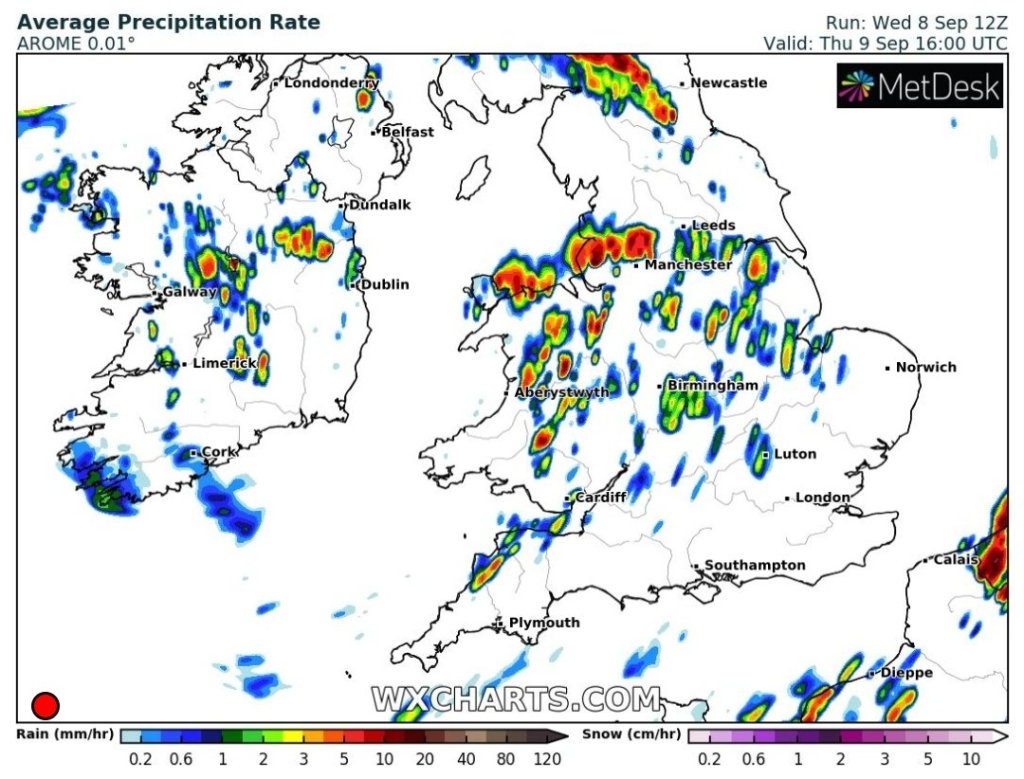
So, last week’s warm and mostly settled spell has come to an abrupt end this week, as rain and showers have piled in since Monday.

The last 10 days of temperatures and rainfall.

Thursday: Heavy rain for the morning and windy too. The afternoon sees the rain turn more showery and the winds will eventually ease. Cool. Max 14°C Min 11°C

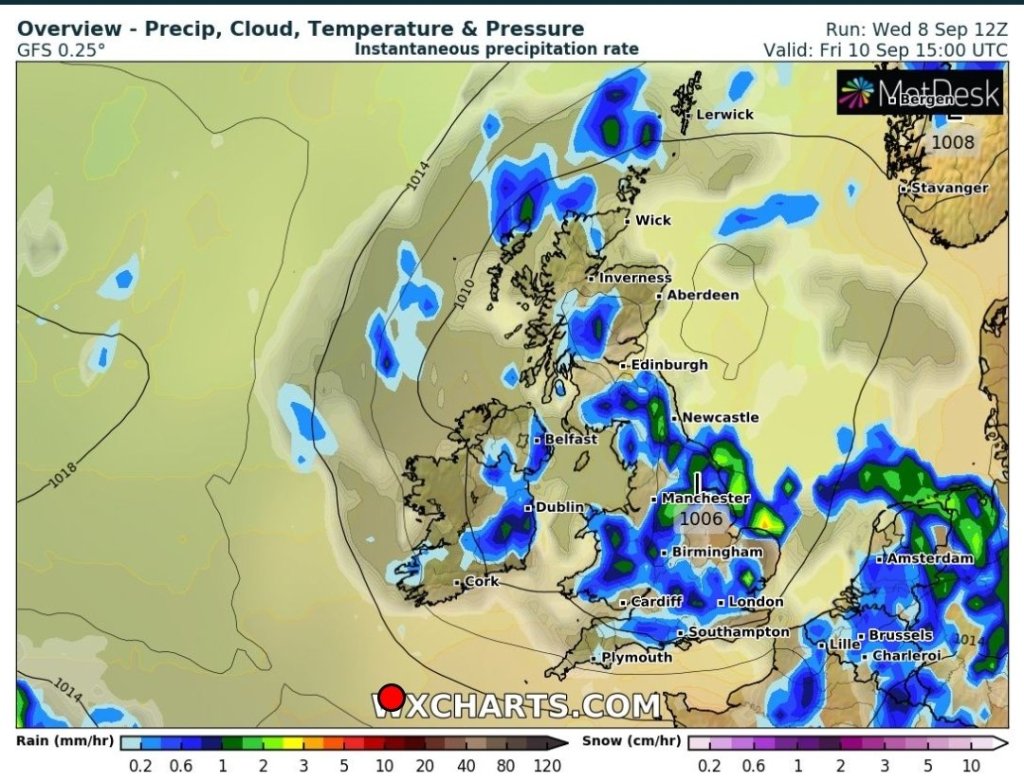
Friday: Another band of rain for the early hours and this will clear during the morning. Plenty of sunny spells expected after this but still some isolated showers. Windy and feeling fresh. Max 13°C Min 7°C

Weekend: More rain and wind on the way. How windy it gets is uncertain at this stage but the potential is there for our first named-storm of the season.

Saturday afternoon looking particularly windy and wet

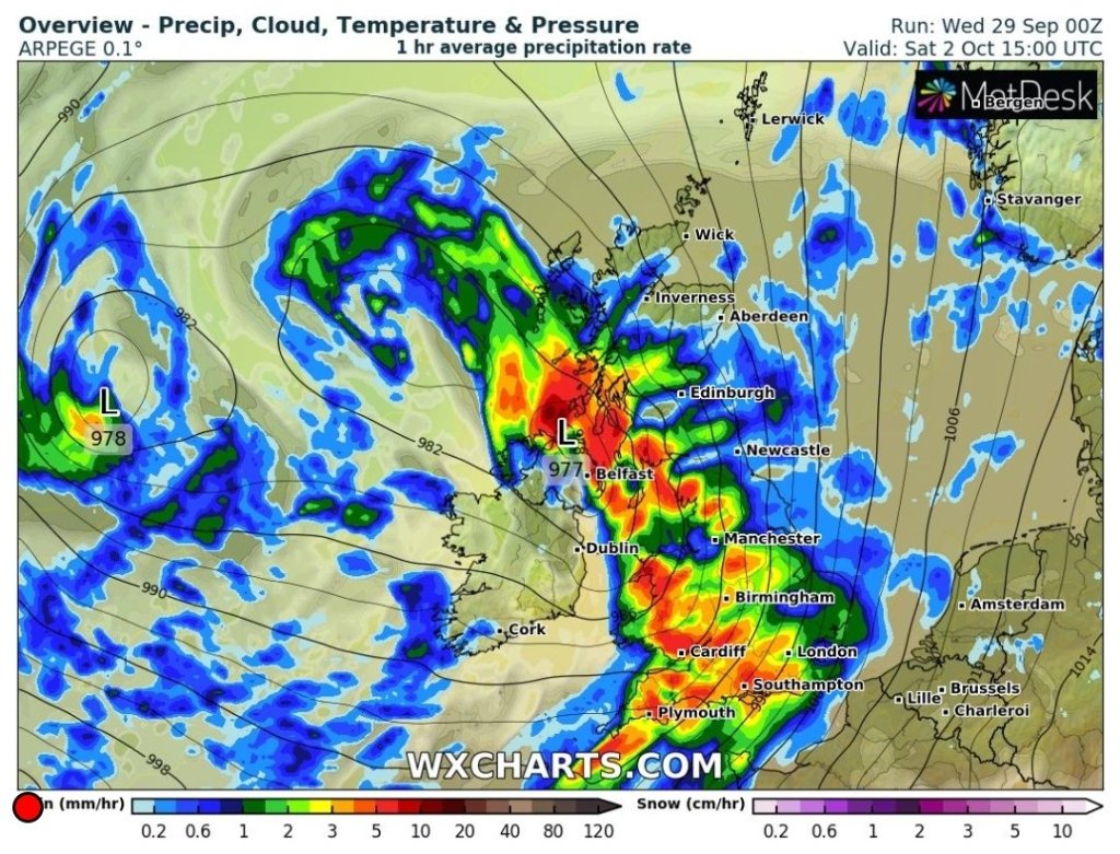
Saturday: A bright start with a few showers then wind and rain will spread ENE for the afternoon and evening. Potential for gales (gusts 35-45mph). Max 15°C Min 8°C

Sunday: Sunshine and showers. Some of these heavy and possibly thundery with hail. Windy with a risk of gales, 40-45mph gusts, during the morning. Max 13°C Min 7°C

*** How windy it is depends on how deep the low pressure becomes and its track. So keep an eye on Twitter for updates and possible warnings. ***

Outlook: Remaining unsettled with further rain or showers. With hurricane Sam affecting the Jet Stream there is a chance of high pressure building later in the week, bringing sunshine and a respite from the rain, but don’t hold your breath, as this could be short-lived and restricted to southern parts of the UK.

Follow @ChadWeather on Twitter for the latest forecasts.

Thanks,
Jon

Forecast Issued: Wednesday 29th September 2021 at 8:10pm
Image: http://www.wxcharts.eu

Some rain but quite warm – Thursday 16th September 2021 – Sunday 19th September 2021

Hi all,

There’s a bit of a battle-ground continuing across the UK. Low pressure is trying to get in from the Atlantic over the next few days but high pressure to the northeast continues to weaken the weather fronts as they arrive.

Thursday: Any early mist or fog will lift into low-cloud which will break to allow some sunny spells to develop. Feeling pleasantly warm. Max 19°C

Friday: A weather front will be moving in from the west but weakening as the day progresses. So after a dry start there will be some sunny spells. Cloud will thicken towards late-afternoon and some patchy rain is possible overnight. Breeze picking up. Warm. Max 20°C

Weekend: Some rain.

Saturday: Early cloud and a few showers will move away and hopefully the cloud will break to allow for some bright spells, but then more showers are likely to develop. Max 19°C

Sunday: Mostly cloudy with a few showers. Max 19°C

Outlook: Low pressure to the northwest of the UK will try to send bands of rain or showers southeast across the region. With high pressure to the northeast and southwest of the UK, this will act as a barrier, attempting to keep the fronts at bay and if any fronts do make it southeast across the region, the high will help to weaken them and turn any rain light and patchy. In between all of this, sunny spells and maximum temperatures remaining around average, 17-18°C. No sign of the first Autumn frost just yet or an Indian Summer.

Follow @ChadWeather on Twitter for the latest forecasts and weather warnings.

Thanks,

Jon

Forecast Issued: Wednesday the 15th of September 2021 at 10pm.

Thundery breakdown – Thursday 9th September 2021 – Sunday 12th September 2021

Hi all,

August, these days, turns out to be a poor month and 2021 was no exception with below average temperatures and a real lack of sunshine. That said, the rainfall amounts were below normal as the month ended with 10 dry days. But how did our Summer compare to recent Summers. I have data, for complete Summers, since 2013; so I’ll try and do some stats on this for next week’s blog.

Thursday: After two hot and humid days the weather breaks with low pressure drifting in bringing thundery showers with some localised downpours (warning in place). Early morning showers clear to a drier spell with some bright spells. Heavy thundery showers form during the afternoon. Cooler temperatures but still feeling muggy. Max 21°C

Thundery showers developing on Thursday afternoon

Friday: Mostly cloudy with some bright spells but showers developing as the day progresses, again heavy with the chance of hail and thunder and lightning. Max 19°C

Low pressure remains in control on Friday leading to further downpours

Weekend: A quieter weekend ahead.

Saturday: Light winds and although there will be plenty of cloud there will be some bright spells. Chance of a rogue shower in the hills. Max 19°C

Sunday: Little change albeit cooler. Mostly dry with some brightness. Max 17°C

Outlook: Ex-hurricane Larry will be mixing in with the Jet Stream so throws some uncertainty into our forecast. Latest model outputs suggests the low pressure swings to our NW allowing pressure to build. So a few days of settled weather with sunny spells, before a return to showery conditions with temperatures around normal. 

August 2021 Stats

Max 21.4°C (2nd)
Min 0.0°C (22nd)
Av. 15.0°C
Wettest 22.6mm (8th)
Av. Humidity 82%
Av. Barometer 1017.4 hPa
Max Gust 27.6mph (8th)
Av. Wind Direction W
Rain 70.6mm
Rain Registered Days 16
Dry Days 15

Follow @ChadWeather on Twitter for the latest forecasts and warnings. 

Thanks,
Jon

Forecast Issued: Wednesday the 8th of September 2021 at 9:05pm.
Images: http://www.wxcharts.com