Sunny spells and Showers – Thursday 29th April 2021 – Bank Holiday Monday 3rd May 2021

Hi all,

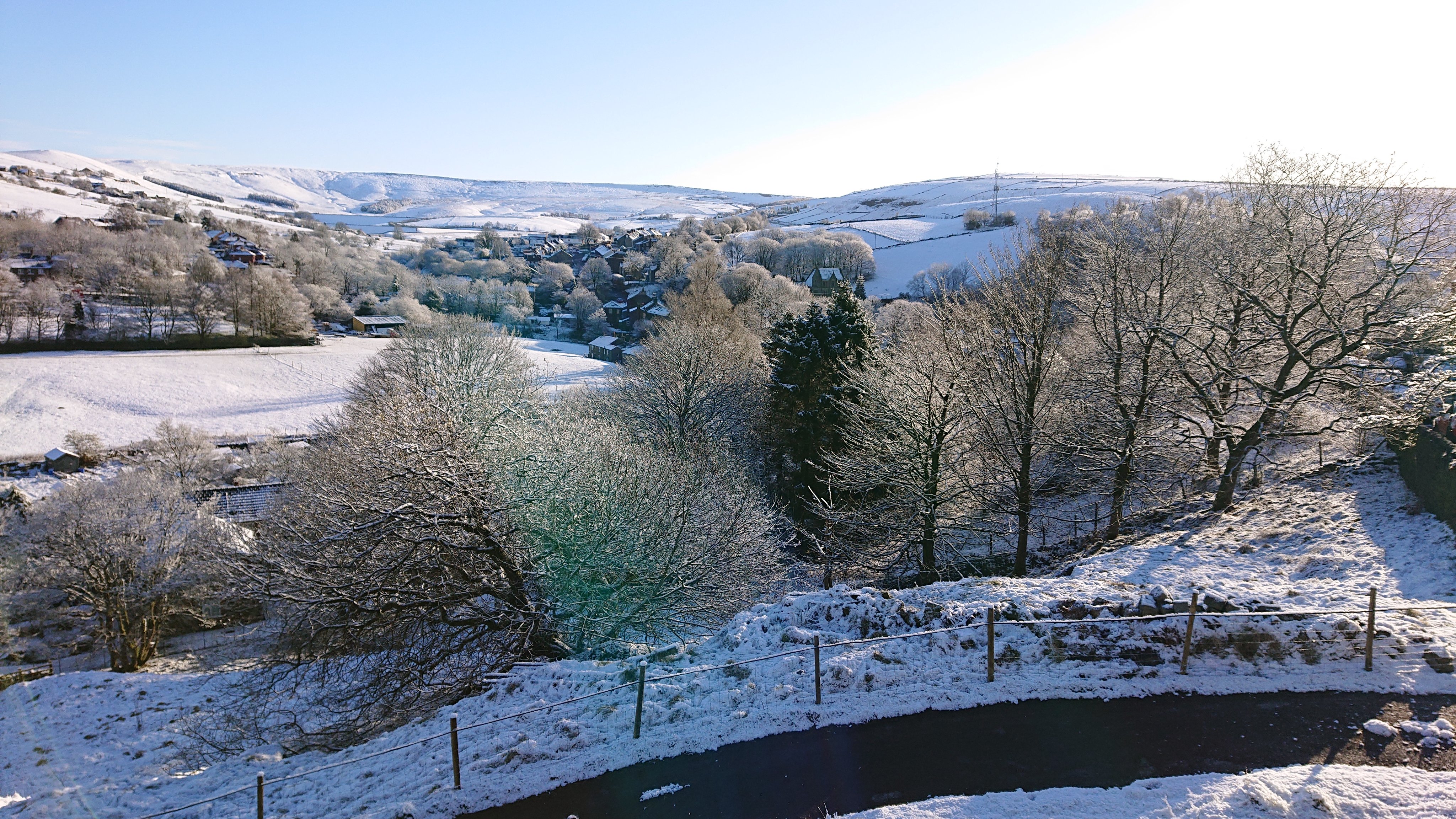
The dry spell has ended but what a decent spell of weather we had. OK the temperatures weren’t anything to raise an eyebrow at, but it was dry with plenty of getting-warmer-by-the-day sunshine. April is still on course to be one of the driest months I’ve ever recorded. With a Bank Holiday approaching, what next?

Temperatures will remain below average for the next week at least – no sign of the heatwave the media drivel on about

**UV levels now on the rise, and the sun is as strong as August, so remember sun-cream between 11am and 3pm.**

Thursday – A cold start with a touch of frost in places. Certainly a ground-frost so gardeners beware. Sunny spells with some isolated heavy showers developing. Max 10°C

Friday: Similar. Patchy frost to start, sunny spells and feeling pleasant in the sunshine but scattered heavy showers developing, some with hail and thunder and lightning. Max 11°C

Saturday: Bright spells and a few showers. The best of the sunshine during the morning after some ground-frost. Max 11°C

Sunday: Hopefully a good day. Sunny spells and fewer showers, so some areas escaping with a dry day. A little warmer. Max 13°C

Bank Holiday Monday: A bright start is expected with showery rain arriving from late-morning/lunch. Feeling cool and becoming windy. Max 10°C

Outlook: Staying cool then turning more unsettled with rain at times.

Follow @ChadWeather on Twitter for the latest forecasts.

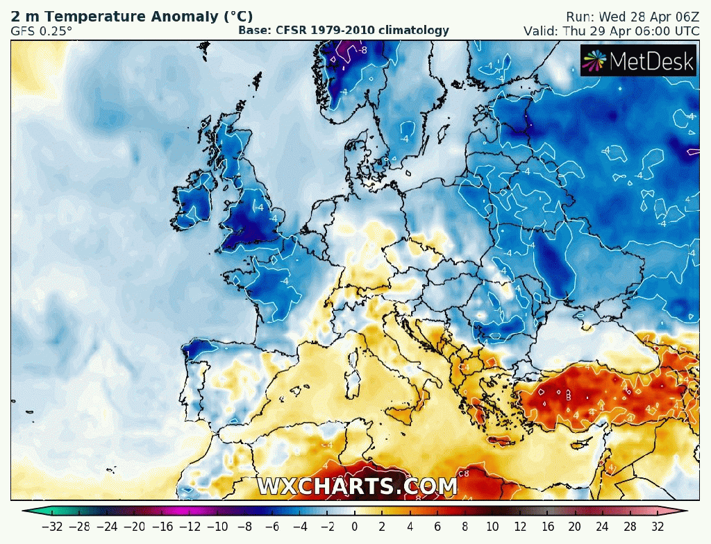
Forecast Issued: Wednesday the 28th of April 2021 at 8:05pm.
Image: http://www.wxcharts.com

Thanks,
Jon

Perfect Spring Weather -Thursday 22nd April 2021 – Sunday 25th April 2021

Hi all,

A cooler day today after a cold front moved through bringing fresher air and more in the way of cloudier skies as the recent sunny weather encountered a blip.

It’s been a very dry month and it’s still on course to be the driest April and any month that I have recorded ever. It’s not rained for 10 days now and it could even get to month-end without anymore measurable rainfall.

**Remember UV levels are now moderate to high and the sun is as strong as late-August so sun-cream is needed**

Thursday: High pressure regains charge of our weather. A cold start, with some mist and patchy frost then a glorious day. Light winds and warm sunshine. Max 16°C

Friday: Another cracker after a fresh start with some ground-frost. Becoming very warm under sunny skies and light winds. Max 18°C

Weekend: More sunshine but cooler.

Saturday: Sunny spells after early mist eventually lifts and a ground-frost to start. Plenty of sunny spells. Breeze picking up later. Max 16°C

Sunday: A little cooler and breezy and although we might start cloudy, sunny spells will develop. Max 14°C

Outlook: Remaining dry with variable amounts of cloud. Some cloudy mornings but brighter afternoons. It looks like low pressure will flirt with the fringes of the UK but we could well make it to the start of May without anymore rain.

Follow @ChadWeather on Twitter for your local forecasts.

Thanks,
Jon

Forecast Issued at 8:20pm on Wednesday the 21st of April 2021.

Time to start watering the garden – Thursday 15th April 2021 – Sunday 18th April

Hi all,

Wintry showers were in last week’s weekly blog but the amount of snow that fell in certain areas earlier this week was much more than expected. With Arctic air in place blue skies followed to give us some stunning scenery.

The outlook isn’t particularly cold but not warming up significantly either. But a lot of dry weather. This month is on track to be the driest I’ve ever recorded. Also some more frosts to come so gardeners beware.

Last Sunday morning in Saddleworth: Image: @SBoydUK


Thursday: Frost to start with some mist and fog. Sunny spells the order of the day with a little cloud bubbling up. Max 11°C

Friday: Chilly start with a ground-frost. Sunny periods developing but more in the way of cloud likely later. Max 11°C

Weekend: Sunnier Saturday

Saturday: Sunny spells developing with any mist/fog clearing slowly, which could lead to some areas not seeing the sunshine until the afternoon. Light winds and less chilly. Max 12°C

Sunday: Weather-fronts out west will spill cloud in across the region so apart from the odd bright spell it will a cloudier day. Dry once. Max 13°C

Outlook: More cloud with perhaps some patchy rain moving through on Tuesday. I’ll be surprised if we see any rain to be honest. Midweek high pressure builds again so back to sunny spells, cool nights and lots of dry weather. Temperatures perhaps up to 15°C

Follow @ChadWeather on Twitter for the latest weather forecasts.

Thanks,
Jon

Forecast Issued: Wednesday the 14th of April 2021 at 8:45pm

Arctic Air Moves On – Thursday 8th April 2021 – Sunday 11th April 2021

Hi all,

The very cold spell is nearly over after Arctic air spread sub-zero temperatures, a biting wind-chill and snow/graupel showers across the region earlier this week.

Werneth Golf Club on Bank Holiday Monday – Image from @dentonreds6805 on Twitter

Records broken

Tuesday ended up being the joint coldest day I’ve ever recorded for April, only a max of 4.6°C and Tuesday night the coldest April night ever recorded at -3.8°C (locally close to -6°C in the countryside). Also, the lowest dew point ever recorded for April was broken at -9.8°C here at Chadderton HQ.

Thursday: Some patchy rain to start (hill sleet). Some showers into the afternoon and plenty of cloud. Winds now from the west so the Arctic air is out of here. Milder. Max 10°C

Friday: A cold front will push some patchy rain through during the morning then a much-improved afternoon with sunny spells. Cooler. Max 8°C

Weekend: Settled but still below average temperatures.

Saturday: Sunny spells and dry after a frosty start. Odd wintry shower might break out especially close to the hills. Cold northerly breeze. Max 8°C

Sunday: Frost to start then a similar day. Plenty of sunny spells, odd rogue wintry shower on a cold north-easterly wind. Max 8°C

Outlook: A lot of dry weather to come, which is great news. Patchy frost at night. Sunny spells by day with temperatures slowly recovering into double-digits. UV levels now approaching 4, so any lengthy sunny spells means you can start to work on your tan.

Follow @ChadWeather on Twitter for the latest forecasts.

April 2021 Stats

Max 20.7°C (31st)
Min -1.7°C (3rd)
Av. 6.6°C
Av. Dew Pt 3.4°C
Wettest 24.6mm (10th)
Av. Humidity 81%
Av. Barometer 1021.1 hPa
Max Gust 34.5mph (11th)
Av. Wind Direction WSW
Rain 102.6mm
Rain Registered Days 14
Dry Days 17
Air Frosts 3
Snow Falling Days 1

Thanks,.
Jon

Forecast Issued: Wednesday the 7th of April 2021 at 11:50am