Hi all,
A quick blog today. Better than none I suppose :).
The heatwave continues (although some places didn’t reach the heatwave threshold today after a cloudy start) but there have been a few changes over the last few days where we have seen more of an easterly breeze develop, and be gusty. This obviously has not helped the wildfires with smoke spreading widely from east to west.
That breeze is still here but has dropped slightly and has certainly been noticeable in the morning and in the evenings making it feel cooler and less humid. Temperatures however, during the day have still been getting into the mid-20s, for most, and this is set to continue before cooler air arrives for the weekend.
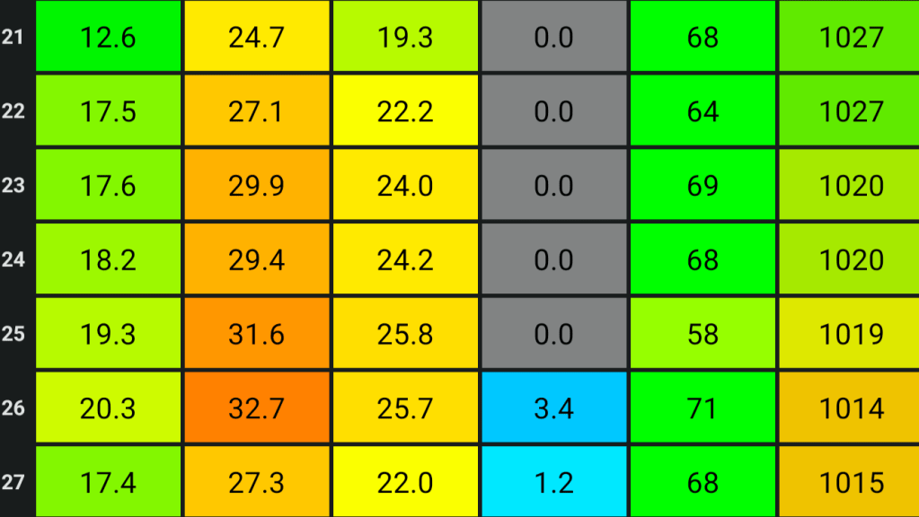
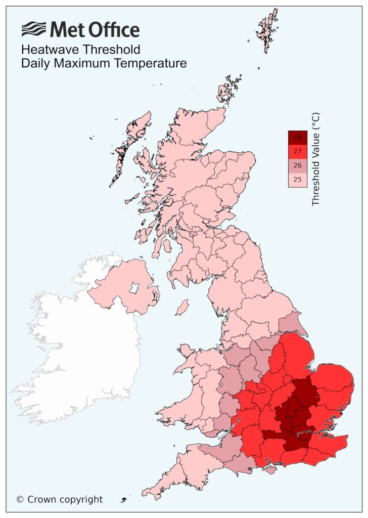
Remember for our area, away from the extreme south, we need three consecutive days of 25°C for it to be a heatwave. If you’re happy to round figures up then we have now had heatwave temperatures for 7 days. There was a cloudier start on Wednesday away from the west and some places in the east will not reach that 25°C, possibly including myself.
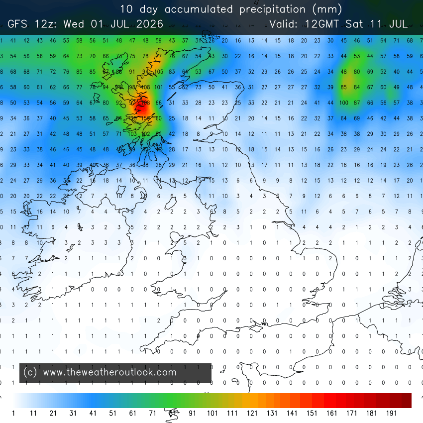
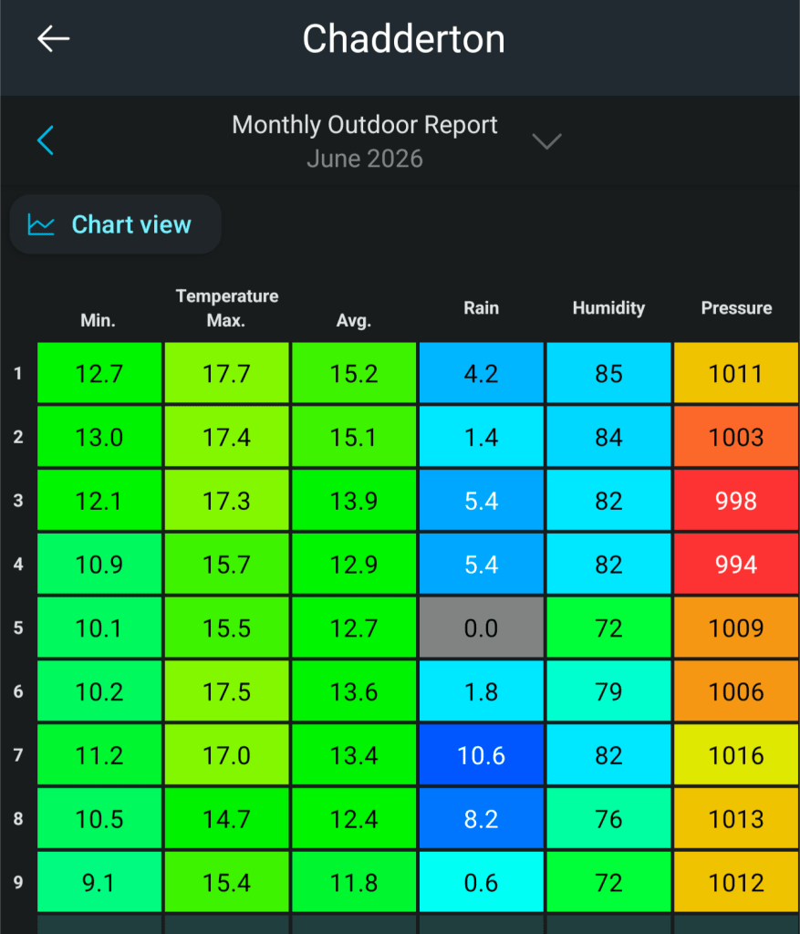
A lot of weather chat is about, when will rain return. Some places down south have not had rain for 28 days, up here at my weather station it hasn’t rained since the 2nd of July. At this stage it looks like there will be no rain in the next 7 days.

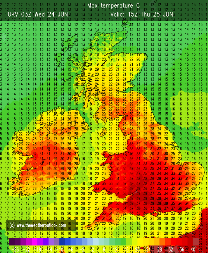
Thursday: There could well be some cloud in the east to start but it is not expected to be as widespread as Wednesday. Very little change to the weather we’ve been seeing recently, apart from maybe the wind will be a little bit lighter. Hot sunny spells, hazy at times and dry. Hottest in the west. Max 24-27°C Min 13°C Max Gusts 15mph
Friday: Yep, you’ve guessed it, it’s another dry day with plenty of hazy sunny spells, some fair-weather cloud bubbling up and perhaps, as the winds turn around to a more northerly or northeasterly direction, temperatures down slightly, especially noticeable overnight. Max 23-26°C Min 11°C Max Gusts 20mph
Weekend: Heatwave ends.
Saturday: Winds will eventually turn northerly and this will introduce less hot air. A dry day with sunny spells and just some cloud bubbling up. Max 21-22°C Min 10°C Max Gusts 15mph
Sunday: Rinse and repeat. Sunny spells, cloud bubbling up, and just a very low chance of a shower on the Pennines. Not as fresh overnight as recently. Max 22°C Min 14°C Max Gusts 20mph
Outlook: No rain expected next week until the weekend at the earliest and that is not certain either. So dry, with very warm to hot sunny spells and temperatures back up again into the mid-20s. High pressure still in charge.


Follow @ChadWeather on X and Bluesky for the latest forecasts and warnings.
Thanks as always, for popping by to read.
Thanks,
Jon
Forecast Issued: Wednesday the 15th of July 2026 at 5:46pm
Images: http://www.wxcharts.com & http://www.theweatheroutlook.com