Finally some changes – Thursday 27th January 2022 – Sunday 30th January 2022

Hi all,

What a boring rut the weather has got itself into. We can deal with day after day of blue skies, which parts from the country have had; but for us it’s been overcast, dull and dank and even very cold for a couple of days. Finally, we have some changes on the way, by that I mean some sort of weather with a bit of mobility.

Thursday: After some overnight rain it will be a breezy day with some sunny spells and just an isolated shower or two. Milder than recently. Max 10°C

Some rain moves SE overnight Wednesday/Thursday

Friday: A bright start then cloud tending to increase from the west with a few spots of light rain into the evening. Windy. Max 10°C

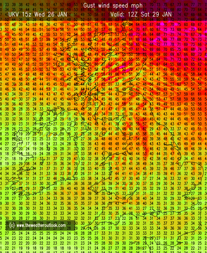
Weekend: Very windy for a time.

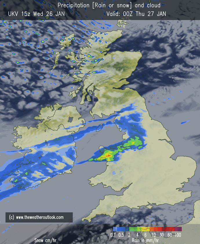
Saturday: Cloudy with a band of rain moving south-east through the region, weakening as it does so. Very windy with local gale-force gusts. Mild but cooler later. Max 11°C

Gusty on Saturday with local gale-force winds

Sunday: Cool with some brightness but mostly cloudy. Rain looks set to arrive into the evening. Not as windy. Max 8°C

Outlook: More changeable going into February with some areas of rain from the west and occasionally windy. Looks chilly for a day or two otherwise temperatures around or just above average. No sign of significant cold or any snow event.

Follow me on Twitter @ChadWeather for the latest forecasts and warnings.

Thanks,
Jon

Forecast Issued: Wednesday the 26th of January 2022 at 9:15pm
Images: http://www.theweatheroutlook.com

Enjoy Thursday’s Sunshine as Cloud Returns – Thursday 20th January 2022 – Sunday 23rd January 2022

Hi all,

We have seen high pressure after high pressure mostly in charge of our weather. During winter this can mean fog and frost and we’ve certainly seen a few of those conditions recently.

The disappointing side has been some persistent cloud topping over the high pressure from the north-west, becoming trapped across the region leading to cold, dank days.

Where sunshine has made an appearance we have had some wonderful winter sunshine. Looking at the forecast and outlook, I suspect February will be payback for all the uneventful weather.

Middle Naden Reservoir – Wednesday had some lovely sunny skies once the cold-front cleared.

So far in January we have only recorded 31.4mm of rain, way below the average and with little rainfall to come, this will turn out to be a very dry month.

Thursday: A frosty start then a decent day with sunny spells developing. Breezy the further west you are. Feeling chilly. Max 5°C

Friday: After a frosty start it looks like the sunshine won’t match Thursday as cloud topples in from the north-west again. Signs of us falling back into a pattern that we saw last week. Light winds and remaining dry, best of any sunshine in the east. Max 6°C

Weekend: Little change.

Saturday: A mostly cloudy day with limited brightness. Some areas seeing misty conditions throughout. Just the chance of some drizzle or light rain where cloud is at its thickest. Max 6°C

Sunday: A little cooler with the risk of some fog patches which could last all day. Due to the cloud-cover being mostly overcast again, frost unlikely. Max 5°C

Monday & the rest of the week: The stationary weather conditions continues with high pressure still controlling our weather. Due to a lot of cloud, frosts will be patchy or limited, and daytime sunny spells at a premium. Temperatures around or just above normal. No sign of any significant cold or snow, certainly not in January. The signs are there for rain and wind to return as we enter February, which I’m sure will be more of a mobile, eventful month weather-wise.

Follow me on Twitter at @ChadWeather for forecasts and warnings.

Thanks,
Jon

Forecast Issued: Wednesday the 19th of January 2022 at 8:45pm.

Foggy & Very Limited Rainfall for the Foreseeable – Thursday 13th January 2022 – Sunday 16th January 2022

Hi all,

What we need now is dry weather and a good spell of it, after recent bouts of rain, sleet and snow. It’s time to give our gardens and sport pitches a breather! And I have welcome news!

High pressure is set to dominate the weather for the foreseeable, so although to a weatherman the outlook is quite uneventful, we will need to look out for a few hazards. Some areas saw sunshine this week but now it seems the cloud and dense fog will take over.

Thursday: A misty or foggy start and where any clear skies have developed it will also be a frosty start. Sunny spells developing in places, but not for all, as some unlucky few stay stuck under fog or low-cloud all day. Max 5°C but more like 1°C where it stays foggy.

Friday: Very little change, if anything the fog could well be more widespread, therefore sunshine limited and feeling chilly. But importantly, dry with light winds. Max 4°C

Weekend: Dry and misty.

Very little to no rainfall to come over the next 7 days

Saturday: Cold but perhaps a bit more of a breeze as this high pressure slips away. Still the risk of fog and a dry and mostly cloudy day. If we can increase the breeze a bit then hopefully the cloud breaks and some brightness sneaks through, but this doesn’t seem likely. Max 4°C

Sunday: It looks like another high pressure will build in from the west to replace the one slipping away. With it, more of a westerly flow, so not as cold and hopefully less in the way of fog. More dry weather though so we can’t grumble although a nearby weakening weather-front could pop-up a shower. Max 7°C

Outlook: Very boring with a lot of settled weather. High pressure looks set to be around for the whole week, so the dry conditions continue, mostly cloudy skies with a bit of brightness. Any breaks overnight allowing for some frost/fog. Very little fluctuation in daytime (6°C) and night-time temperatures (2°C). Hints of something a little colder from the North later in the week.

Follow @ChadWeather on Twitter for the latest forecasts and warnings.

Thanks,
Jon

Forecast Issued: Wednesday the 12th of January 2022 at 8:50pm

Snow on the way – Thursday 6th January 2022 – Sunday 9th January 2022

Hi all,

Happy New Year to everyone. All the best for 2022 and hopefully a better year all round for us all.

After a cold start to December we ended it very mild with temperatures locally up to 15°C. It was the 5th mildest December in the last 10 years so nothing extreme either way.

Stats for the whole year vs. previous years coming soon…

A widespread harsh frost to start Thursday.

Thursday: A cold start with a widespread frost. Sunny spells for a time then cloud thickening. Rain, sleet and hill-snow will move east from around lunchtime. Snow amounts small but a couple of cms above 250M possible before it turns to rain and it turns slightly milder. Warning in place for the hills/Pennines. Max 5°C

A wedge of less cold air on Thursday afternoon.

Overnight Thursday into Friday: Turning colder again with showers becoming frequent and turning increasingly wintry. Warning in place.

Warning for Snow: Overnight Thursday into Friday morning.

Friday: Potential for some hefty snow showers for some during the morning. Some of the wintry showers falling as hail and sleet. The afternoon will tend to dry up as showers ease. Breezy and feeling sub-zero. Max 4°C

Snow showers expected on Friday morning. Accumulations of several cms possible; more on the hills.

Weekend: Rain returns.

Saturday: Cloudy with pulses of heavy rain arriving from the west. Perhaps some brief sleet/wet-snow for the hills. All this will turn more showery into the evening. Breezy and turning milder. Max 7°C

Periods of heavy rain pushing in on Saturday, as less cold air returns once again.

Sunday: Any morning showers easing and a drier day but mostly cloudy. Windy. Patchy rain arriving towards evening. Max 6°C

Outlook: Very mild for a time on Monday with temperatures into double-figures again. High pressure looks set to build this week, so plenty of dry weather. A lot of cloud though so frosts limited and temperatures above normal, 7-9°C.

High pressure eventually builds in next week.

December 2021 Stats

Max 13.3°C (30th)
Min -0.7°C (19th)
Av. 5.6°C
Wettest 25.2mm (8th)
Av. Humidity 90%
Av. Barometer 1011.7 hPa
Max Gust 34.5mph (7th)
Av. Wind Direction SW
Rain 128mm (102% of average)
Rain Registered Days 25
Dry Days 6
Snow Falling Days 5

Follow @ChadWeather on Twitter for the latest forecasts and warnings.

Thanks,

Jon

Forecast Issued: Wednesday the 5th of January 2022 at 7:05pm.

Images: http://www.theweatheroutlook.com