
Hi all,
Happy New Year to everyone. All the best for 2022 and hopefully a better year all round for us all.
After a cold start to December we ended it very mild with temperatures locally up to 15°C. It was the 5th mildest December in the last 10 years so nothing extreme either way.
Stats for the whole year vs. previous years coming soon…
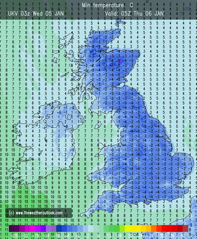
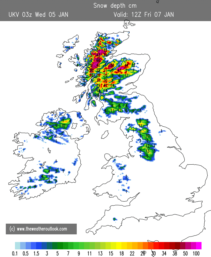
Thursday: A cold start with a widespread frost. Sunny spells for a time then cloud thickening. Rain, sleet and hill-snow will move east from around lunchtime. Snow amounts small but a couple of cms above 250M possible before it turns to rain and it turns slightly milder. Warning in place for the hills/Pennines. Max 5°C
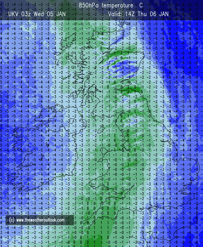
Overnight Thursday into Friday: Turning colder again with showers becoming frequent and turning increasingly wintry. Warning in place.
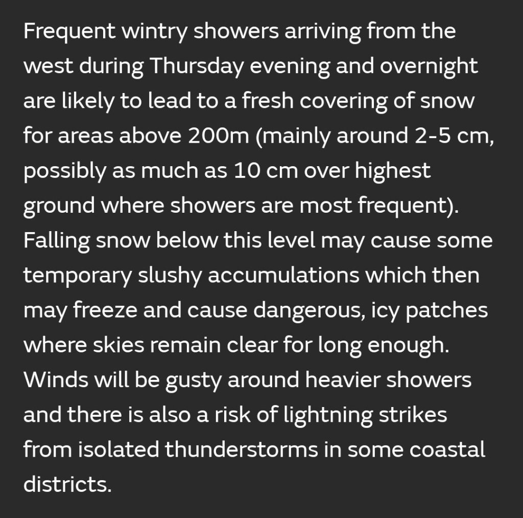
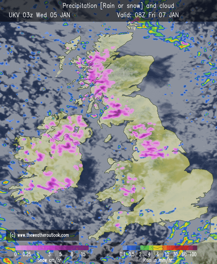
Friday: Potential for some hefty snow showers for some during the morning. Some of the wintry showers falling as hail and sleet. The afternoon will tend to dry up as showers ease. Breezy and feeling sub-zero. Max 4°C
Weekend: Rain returns.
Saturday: Cloudy with pulses of heavy rain arriving from the west. Perhaps some brief sleet/wet-snow for the hills. All this will turn more showery into the evening. Breezy and turning milder. Max 7°C
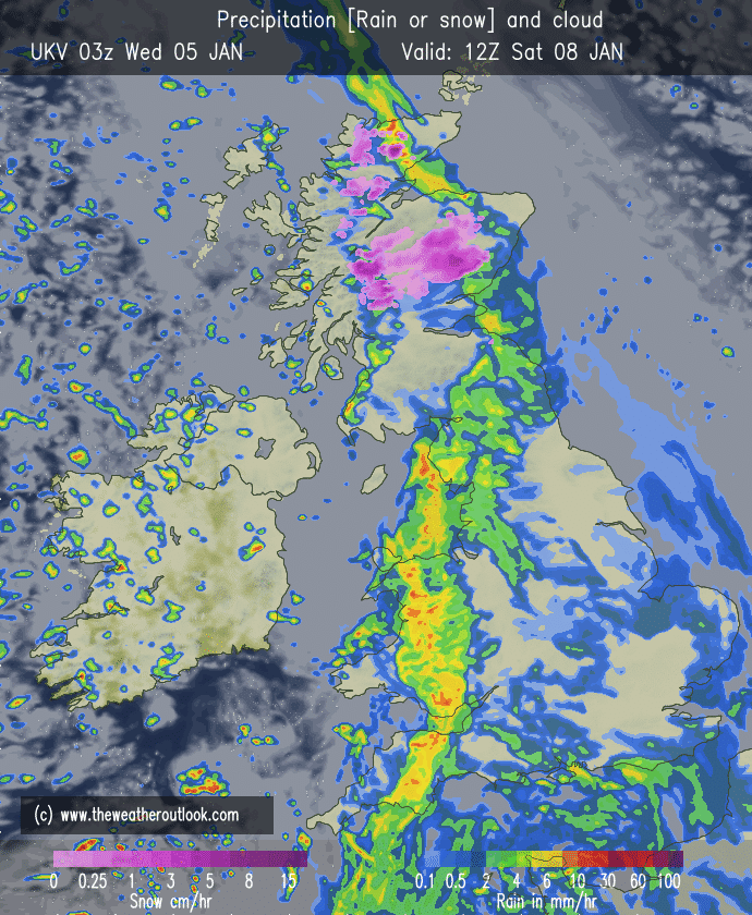
Sunday: Any morning showers easing and a drier day but mostly cloudy. Windy. Patchy rain arriving towards evening. Max 6°C
Outlook: Very mild for a time on Monday with temperatures into double-figures again. High pressure looks set to build this week, so plenty of dry weather. A lot of cloud though so frosts limited and temperatures above normal, 7-9°C.

December 2021 Stats
Max 13.3°C (30th)
Min -0.7°C (19th)
Av. 5.6°C
Wettest 25.2mm (8th)
Av. Humidity 90%
Av. Barometer 1011.7 hPa
Max Gust 34.5mph (7th)
Av. Wind Direction SW
Rain 128mm (102% of average)
Rain Registered Days 25
Dry Days 6
Snow Falling Days 5
Follow @ChadWeather on Twitter for the latest forecasts and warnings.
Thanks,
Jon
Forecast Issued: Wednesday the 5th of January 2022 at 7:05pm.
Images: http://www.theweatheroutlook.com
