Some rain coming but no sign of heatwave no. 4 – Thursday 23rd July 2026 – Sunday 26th July 2026

Hi all,

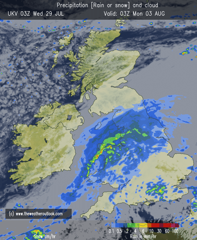
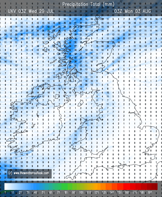
July has been very dry. Our average rainfall for July is 89.1mm. So far we have only had 4mm with the last measurable rainfall being on the 2nd of July (3.8mm). There is plenty of dry weather in the next 10 days but we will see some rainfall this weekend. It certainly won’t be as much as the fire-fighters and local golf clubs will be hoping for.

Some welcome rainfall this weekend but perhaps no more than 4-7mm

Thursday: Similar to recent days. A cloudy start with very warm sunny spells eventually breaking through. Pleasant temperatures. Low risk of a shower towards the hills and turning breezy later in the day. Max 23°C Min 12°C Max Gusts 20mph

Friday: Little change. Sunny to start but cloud will bubble up but some sunny spells continuing. Dry but with a keen west-to-northwesterly wind picking up later, especially out west and ahead of change. Max 22°C Min 12°C Max Gusts 25mph

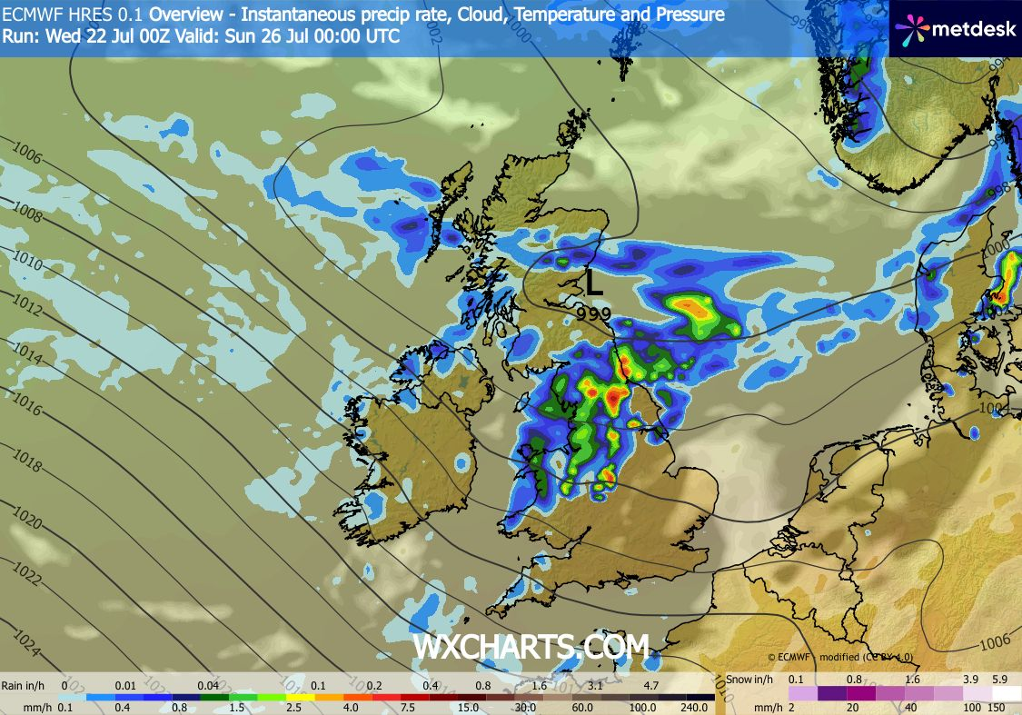
Weekend: First unsettled spell for a while.

Saturday: A dry start but cloud thickening and any brightness fading as patchy rain, with some brief heavier bursts, moves southeast through the region from mid-afternoon onwards. The rain and drizzle will continue to come in pulses overnight. Temperatures down but quite muggy especially overnight. Max 20°C Min 14°C Max Gusts 30mph

Sunday: Cloudy with still some patchy rain around for the morning. Bright spells for the afternoon but also with some showers at times. Another windy one at times. If temperatures don’t reach 20°C (rounded) this will be first time this has happened since July the 2nd. By our standards, that’s a decent run. Max 19°C Min 14°C Max Gusts 25mph

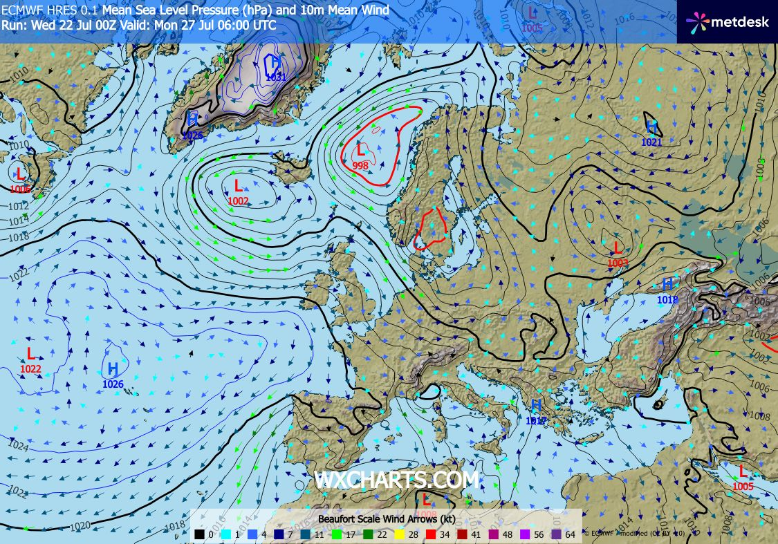
Outlook: High pressure to the southwest and low pressure close by to the northwest. This means we will continue to see temperatures around normal with a westerly airflow. Mostly dry with sunny spells but a risk of some rain and windy conditions later in the week. After that it looks like, at this stage, that high pressure will build and the second week of August could be very warm and sunny with an increased chance of seeing heatwave no. 4 but this far out it’s impossible to say.

Early next week remains mostly settled

That’s all for this week. Follow @ChadWeather on X and Bluesky for the latest forecasts and warnings.

Thanks,

Jon

Forecast Issued: Wednesday the 22nd of July 2026 at 6:18pm.

Images: http://www.wxcharts.com

The lack of rainfall continues – Thursday 16th July 2026 – Sunday 19th July 2026

Hi all,

A quick blog today. Better than none I suppose :).

The heatwave continues (although some places didn’t reach the heatwave threshold today after a cloudy start) but there have been a few changes over the last few days where we have seen more of an easterly breeze develop, and be gusty. This obviously has not helped the wildfires with smoke spreading widely from east to west.

That breeze is still here but has dropped slightly and has certainly been noticeable in the morning and in the evenings making it feel cooler and less humid. Temperatures however, during the day have still been getting into the mid-20s, for most, and this is set to continue before cooler air arrives for the weekend.

Remember for our area, away from the extreme south, we need three consecutive days of 25°C for it to be a heatwave. If you’re happy to round figures up then we have now had heatwave temperatures for 7 days. There was a cloudier start on Wednesday away from the west and some places in the east will not reach that 25°C, possibly including myself.

A lot of weather chat is about, when will rain return. Some places down south have not had rain for 28 days, up here at my weather station it hasn’t rained since the 2nd of July. At this stage it looks like there will be no rain in the next 7 days.

My golf course, Heaton Park, has very scorched and parched fairways.

Thursday: There could well be some cloud in the east to start but it is not expected to be as widespread as Wednesday. Very little change to the weather we’ve been seeing recently, apart from maybe the wind will be a little bit lighter. Hot sunny spells, hazy at times and dry. Hottest in the west. Max 24-27°C Min 13°C Max Gusts 15mph

Friday: Yep, you’ve guessed it, it’s another dry day with plenty of hazy sunny spells, some fair-weather cloud bubbling up and perhaps, as the winds turn around to a more northerly or northeasterly direction, temperatures down slightly, especially noticeable overnight. Max 23-26°C Min 11°C Max Gusts 20mph

Weekend: Heatwave ends.

Saturday: Winds will eventually turn northerly and this will introduce less hot air. A dry day with sunny spells and just some cloud bubbling up. Max 21-22°C Min 10°C Max Gusts 15mph

Sunday: Rinse and repeat. Sunny spells, cloud bubbling up, and just a very low chance of a shower on the Pennines. Not as fresh overnight as recently. Max 22°C Min 14°C Max Gusts 20mph

Outlook: No rain expected next week until the weekend at the earliest and that is not certain either. So dry, with very warm to hot sunny spells and temperatures back up again into the mid-20s. High pressure still in charge.

High pressure to the northwest introducing a cooler airflow this weekend
Very dry outlook

Follow @ChadWeather on X and Bluesky for the latest forecasts and warnings.

Thanks as always, for popping by to read.

Thanks,

Jon

Forecast Issued: Wednesday the 15th of July 2026 at 5:46pm

Images: http://www.wxcharts.com & http://www.theweatheroutlook.com

Another heatwave with little to no rain – Thursday 9th July 2026 – Sunday 12th July 2026

Hi all,

Another month and another heatwave on the way. Temperatures this time will just be a notch down on the previous heatwave and so will the humidity and dew points. However, dew points look set to be around the mid-teens so do expect it to be quite humid especially in the mornings and in the evenings.

Summer – Av. temps since 2013 here in Chadderton

At this stage it looks like Friday will be the hottest day with temperatures getting into the 30s. During this lengthy spell of very warm to hot weather, there is going to be little to no rain. However, there is a chance of an isolated thunderstorm on Friday.

During this hot spell, there will be a change in wind direction which is likely to bring some cloud in from the North Sea overnight which will need to burn off during the morning.

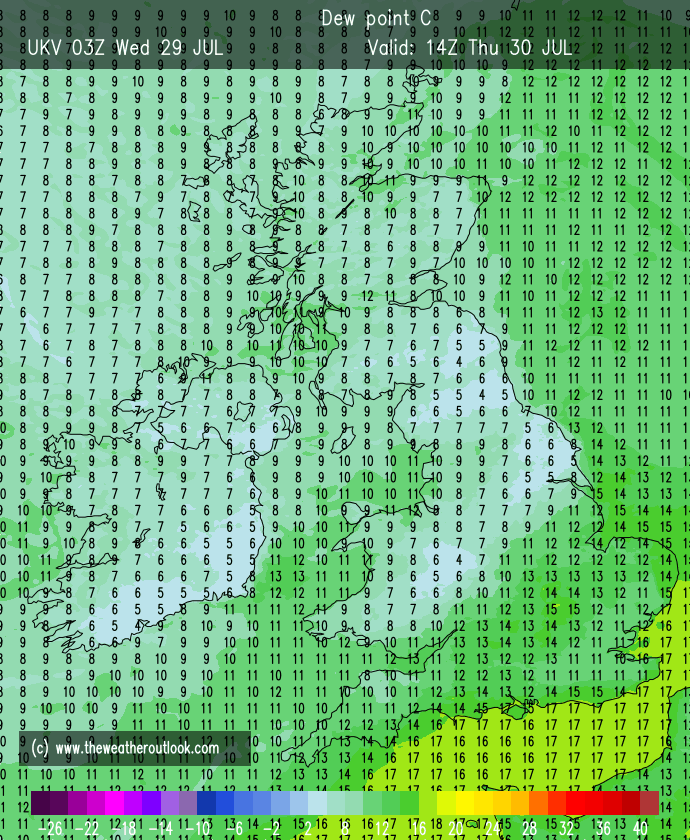
A very dry week ahead

Don’t forget that UV levels are high.

Thursday: A cracking day with plenty of sunny skies after early cloud in the west from the Irish Sea burns off. Feeling hot and a little humid with light winds and remaining warm overnight. Max 29°C Min 17°C

Friday: Likely to be the hottest day of the week, but some fair-weather cloud could bubble up at times with the low risk of a late-afternoon or evening shower or thunderstorm. Feeling pretty humid but there will be an afternoon breeze which will have now switched easterly. Max 31°C Min 17°C Max Gusts 20mph

Weekend: Temperatures down a touch due to wind direction.

Saturday: There could well be a little cloud (low risk of a shower) from the east to clear in the morning then another very warm to hot day with sunny spells but a more noticeable breeze from the east. Not as hot as Friday. Max 29°C Min 16°C Max Gusts 25mph

Cooler in the east on Saturday with the wind off the North Sea

Sunday: Some eastern parts could start cloudy but this will soon burn off and then another glorious day with sunny spells and an easterly breeze and very warm. Temperatures will be highest in the west. A little cooler overnight. Max 23-26°C Min 13°C Max Gusts 25mph

The easterly wind will see eastern parts of the UK see temperatures below average, so head here to get some relief from the heat

Outlook: High pressure staying in control. So the dry weather continues with plenty of very warm or possibly hot conditions.  There could well be a change later in the week as we approach Thursday and the days that follow with a breakdown of the high and some thundery showers creeping up from the south/southwest.

7-day heatwave forecast

Follow @ChadWeather on X and Bluesky for the latest forecasts and warnings.

Thanks as always for popping by to read.

Thanks,

Jon

Forecast Issued: Wednesday the 8th of July 2026 at 5:35pm

Images: http://www.wxcharts.com

Temperatures rising and not much rainfall – Thursday 2nd July 2026 – Sunday 5th July 2026

Hi all,

So be honest how many of you actually enjoyed the heatwave last week? With record dew points and an oppressive feel it was not for me. Money was spent on new fans but all they did was blow around hot air and I really struggled to sleep for at least 4 or 5 days. Purchasing an air-con unit may not be far away.

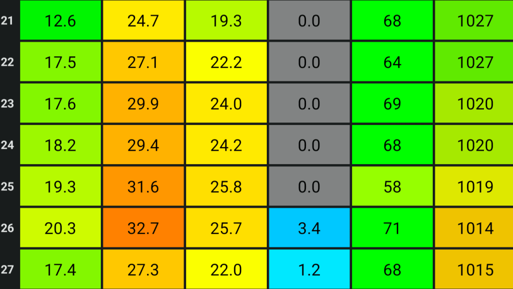
Below are the maximums and minimums that were recorded during the heatwave and as you might have seen, the old dew point record (20.7°C) was smashed. Also, I recorded my 3rd hottest day since records began (August 2012). In this country, it’s rare to see a dew point over 20°C. It’s humid enough when dew points start to get into the mid-teens, but last week this was one of the main reasons why it felt so awful.

Min | Max | Av. | Rain | Av. Humidity| Av. Pressure

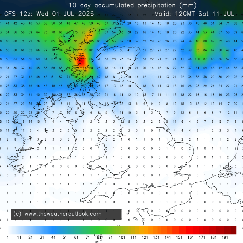
Not long soon after that heatwave ended, there were already long-range weather charts showing another heatwave on the way and some charts did show temperatures close to 40°C or above. Of course, looking at a chart this far out should always be taken with a pinch of salt and since then those high temperatures have downgraded.  Also, the heatwave that is coming to parts of the UK is not expected to be as widespread as it was looking to be. That said, places in the south will still see temperatures close to or above 30°C for possibly 7 days. Also, looking ahead there will be occasional cloudy spells and patchy rain from the north or west but there is not much in the way of total rainfall for the foreseeable.

Very little rain in the next 10 days.

UV levels remain high.

Thursday: Perhaps a few showers to start then sunny spells developing. Quite windy at times but feeling warm in the sunshine. Max 20°C Min 12°C Max Gusts 30mph

Friday: A decent day with sunny spells hopefully becoming more widespread later in the day. Feeling warm and breezy at times. Cloud increasing overnight. Max 22°C Min 13°C Max Gusts 20mph

Weekend: Variable cloud, thickest in the morning.

Saturday: Cloudy to start, risk of drizzle especially on high ground followed by brighter spells. Windy.  Max 22°C Min 14°C Max Gusts 30mph

Sunday: A very similar day, cloudy to start, a bit stubborn to break up, but eventually sunny spells will break through and feeling warm. A risk of some patchy drizzle or rain early on. Otherwise a dry day ahead. Max 23°C Min 14°C Max 25mph

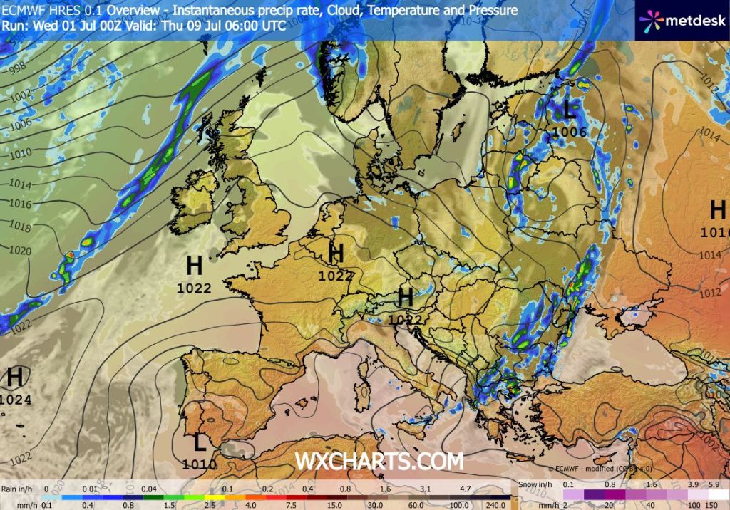
Outlook: High pressure to our south, which will be bringing a heatwave to southern parts of the UK, should start to drift eastwards. This will allow for the warmer air to drift northwards so I’m expecting a few days next week of temperatures close to the mid-20s. Depending on these values, would decide whether we meet the threshold for a heatwave. It looks like we will probably have 2 or 3 days of sunny hot weather, but then the weather will break down from the west later in the week with cloud and rain eventually returning.

High pressure in charge for most of the UK

Follow @ChadWeather on X and Bluesky for the latest forecasts and warnings.

Thanks,

Jon

Forecast Issued: Wednesday the 1st of July 2026 at 6:15pm

Images: http://www.theweatheroutlook.com & http://www.wxcharts.com