Hi all,
Finally some warmer weather on the horizon. This time next week I might have dug the shorts out and be planning a BBQ. Of course this is all down to the forecast panning out as planned over the next 6-8 days. We deserve something settled, sunny and warm so fingers crossed.
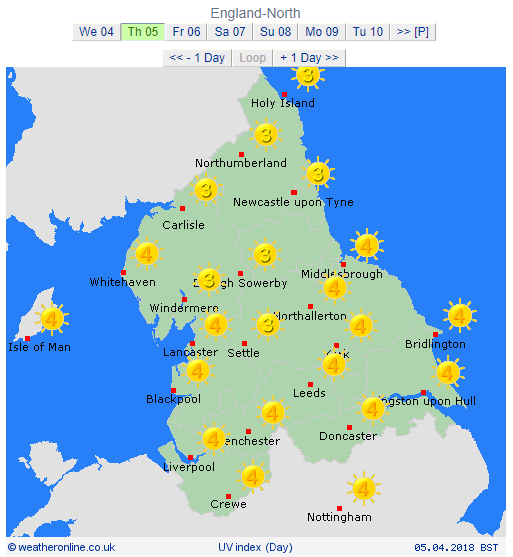
Thursday: A mostly cloudy day with a cool easterly breeze still affecting the region. This might drag in some drizzle or light rain at times, especially during the morning. Cold. Max 9°C
Friday: Little change. Hopefully less in the way of drizzle and some brightness breaking through here and there as we enter the afternoon. A touch less cold. Max 12°C
Weekend: Mostly dry, slowly warmer.
Saturday: Dry but mostly cloudy, thickest the further west you are. Just a chance of some isolated patchy drizzle for the morning. Milder. Max 14°C
Sunday: Bright spells and again most areas dry. Southerly winds helping to lift the temperature and we should see some warm sunny spells late in the day. Max 16°C
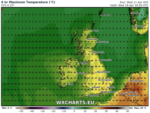
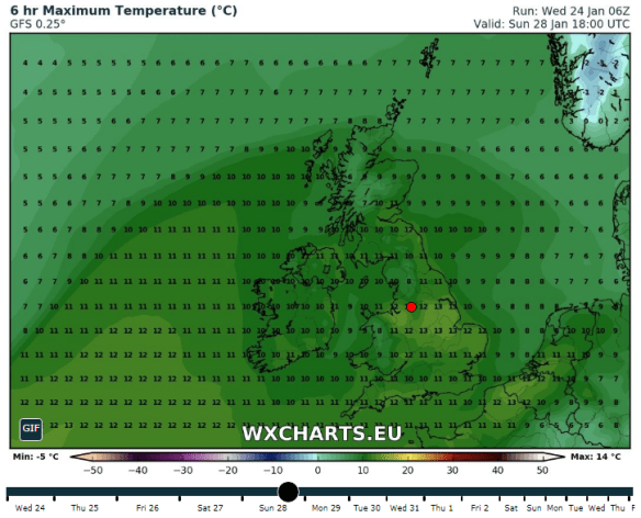
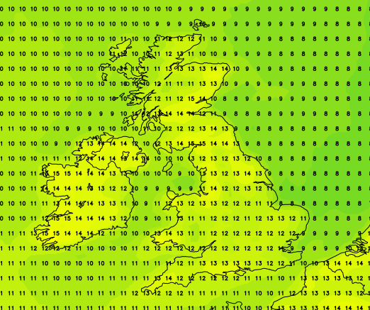
Temperatures up to 20°C by Wednesday next week
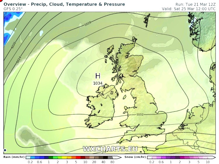
Outlook: High pressure building and dragging warmer air up from the south/southeast. Cloudier and breezier in western areas otherwise sunny spells and warming up nicely. I’m not promising wall-to-wall sunshine but more so sunny intervals. UV levels in the sunshine up to 4/5, so time to work on your tan and sun-cream routine. We could well sneak a 20°C by midweek and see our warmest weather since August 2017, if we beat 20.2°C. How long will it last? This warm spell looks set to break over the weekend.
Forecast issued at 9:45am on Wednesday the 11th of April 2018.
Images: http://wxcharts.eu
Thanks,
Jon