Hi all,
What a shame (some of you won’t agree) that we had the perfect subzero temperatures for snow on Tuesday but the band of snow that pushed in from the northwest was only light. Even after 6 hours of continous light snowfall it hardly settled and the amounts were minimal. Ah well. Next please……
Thursday: Cloudy with patchy rain slowly arriving during the late-afternoon and evening and becoming much milder for a time. Overnight a spell of more heavier rain as a cold front comes through. Max 7°C
Friday: We return to the colder air filtering down from the northwest. With it some wintry showers so expect hail, sleet, some snow and even thunder and lightning. There could be a prolonged spell of showers during mid-morning. It should turn drier during the afternoon. Max 5°C
Weekend: Unsettled and turning colder.
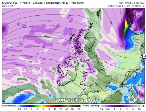
Wintry showers on Sunday as we turn colder
Saturday: A cold start then becoming cloudy with rain arriving and becoming quite windy. The rain could start off as sleet or snow above 250M but it won’t last too long. Max 7°C
Sunday: Back to square one. Colder with wintry showers, again heavy and possibly thundery. The showers will give a covering of snow in places, especially above 200M. Feeling bitter with a cold northwesterly wind. Max 5°C
Outlook: Remaining cold and changeable. A risk of some windier spells and when they come along it will be briefly milder.
January 2018
Max 12.1°C (24th)
Min -0.7°C (20th)
Av. 4.4°C
Wettest 18mm
Windiest 52mph
Rain 133.2mm
Rainy Days 24
Dry Days 7
Air Frosts 2
Snow Falling Days 6
Snow Lying Days 4
Follow @ChadWeather on Twitter for the very latest weather updates.
Thanks,
Jon
Forecast Issued: Wednesday the 7th of February 2018 at 11am.
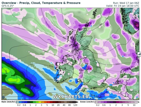
Images: http://wxcharts.eu