Thursday 26th July 2018 – Sunday 29th July 2018

Hi all,

We’ve had some rain over the last week but we continue to be drier than average. Although there is some more rain on the way, the outlook doesn’t bring much and very warm weather will continue into August with a few hot spells at times.

Thursday: A hot day with hazy sunny spells. It will remain dry and humid. Max 29°C

Friday:  Possibly dry to start with some sunny spells. Frontal systems will arrive making the air unstable. This will set off some heavy downpours with a risk of some torrential thunderstorms, especially over the Pennines and the east of the region. Not everywhere will see one. Not as hot but still humid. Max 25°C

Weekend: Fresher for all.

Saturday: Any early showers clearing to a fresher day with plenty of sunny spells. Just the chance an afternoon shower might develop over the hills. Max 20°C

Sunday: A  bright start but cloud will increase from the southwest bringing a risk of some showers or spells of patchy rain. This is still not certain so watch out for updates. Max 21°C

Outlook: Sunny spells and a few showers early next week then perhaps becoming humid and hot again. The chart below shows the heat predicted for the 3rd of August.
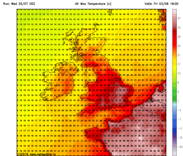
HOT HOT FRI 0308

Some high temperatures again as we enter August – 36°C possible down south

Don’t forget sun-cream!

Follow @ChadWeather on Twitter for the latest forecasts.

Forecast Issued: Wednesday, July the 25th at 12:45pm.
Image: https://www.netweather.tv/

Thanks,
Jon

Thursday 18th January 2018 – Sunday 21st January 2018

Hi all,

We are halfway through winter and we were reminded this week with snow returning to some parts as well as plenty of hail and some thundersnow. After last week’s dank slow-weather days we are back up and running with plenty to talk about. There is some more snow on the way.

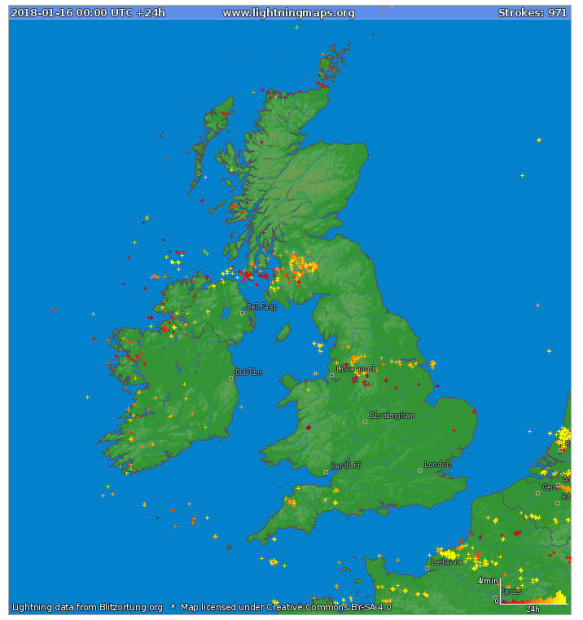
Lightning 160118

Lightning Strikes: Tuesday saw thunder and lightning, giving some of us thundersnow

Thursday: The early hours and early morning will be very windy with 50-55mph gusts across the region as a low pressure moves through. The thinking was that this system would be named but it is now less intense and therefore hasn’t been christened. It will briefly become milder but during the morning winds will die down somewhat and it will become colder again. After all that we will see a day of sunshine and frequent thundery wintry showers which will fall as snow above 200M. Max 5°C

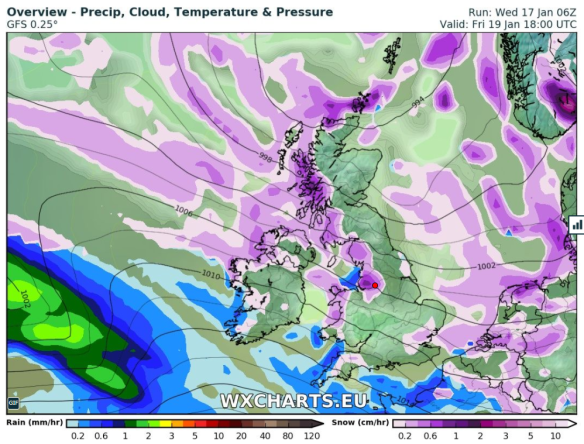
Snow showers on Friday

Wintry showers, including some snow, will be blown in again on Friday

Friday: A colder day and windy with more wintry showers feeding in. Again, these could be thundery with hail and snow. Snow showers expected almost anywhere but especially on higher ground where it is likely to settle. Max 3°C

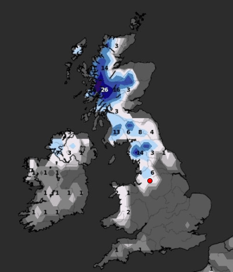
Snow Depth cm by the end of Friday

Predicted snow depth (cm) by the end of Friday

Weekend: Saturday’s the day!

Saturday: A frosty start with snow-cover in places from yesterday’s showers. However a decent day ahead. Dry with sunny spells and cold. A perfect winter’s day. Max 4°C

Sunday: A cold start and perhaps briefly dry. Rain (timings still uncertain at this stage) will then move in from the west preceeded by snow in places, especially on the hills and Pennines, but all areas seeing it turn to rain as it becomes slowly milder later. A thaw of any remaining lying snow. Max 7°C

Outlook: Temperatures average for the time of year but with our weather favouring coming in from the Atlantic, we can expect some spells of rain at times. Chilly nights with some patchy frost.

Follow @ChadWeather on Twitter for frequent weather updates.

Thanks,
Jon

Forecast issued: 10:15am on Wednesday the 17th of January 2018
Images: https://www.lightningmaps.org and http://wxcharts.eu