Settled end to January – Thursday 26th January 2023 – Sunday 29th January 2023

Hi all,

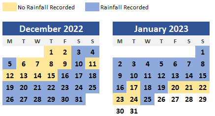
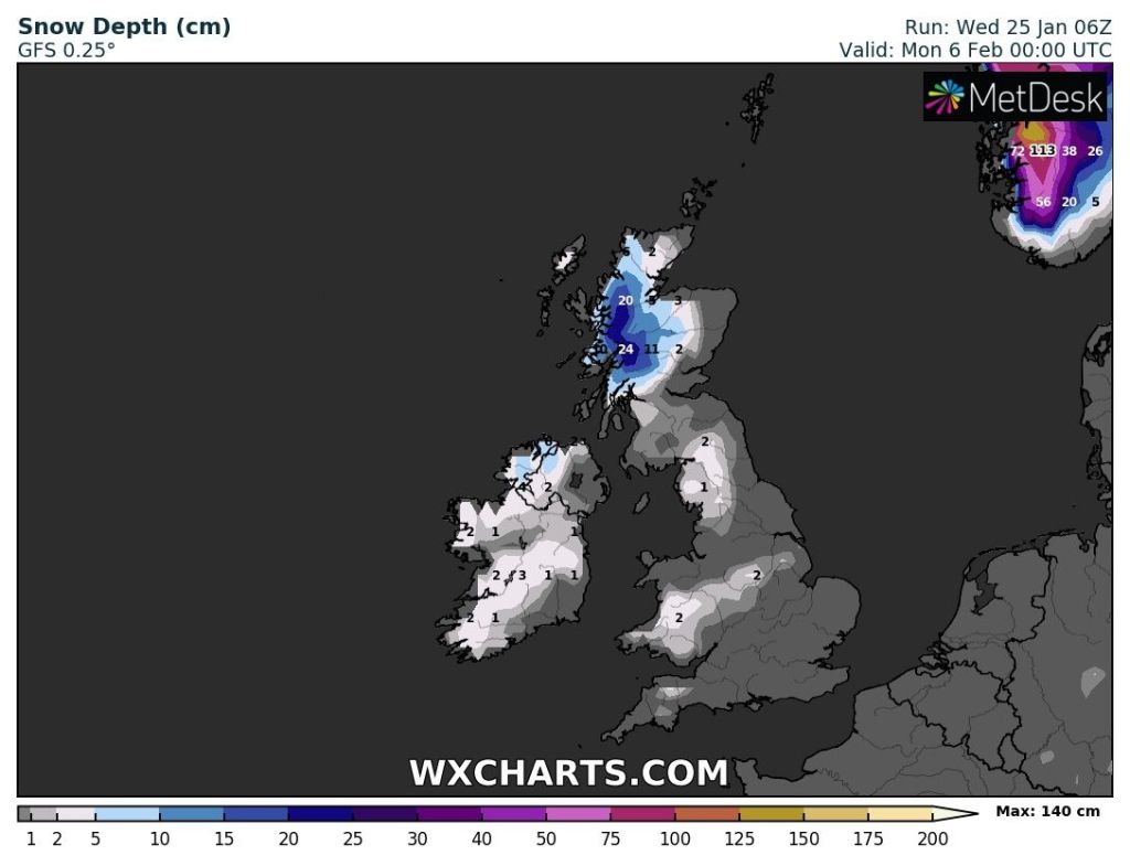
We’re in a quieter weather pattern now with little rainfall, although Wednesday did deliver a couple of millimetres. Temperatures are not too cold nor too mild and a cut-off Jet Stream means there aren’t any low pressure systems racing directly across the country bringing wind and rain. There’s a lot of press stories about snow incoming, as is the norm at this time of the year, but there’s no sign of that in this forecast.

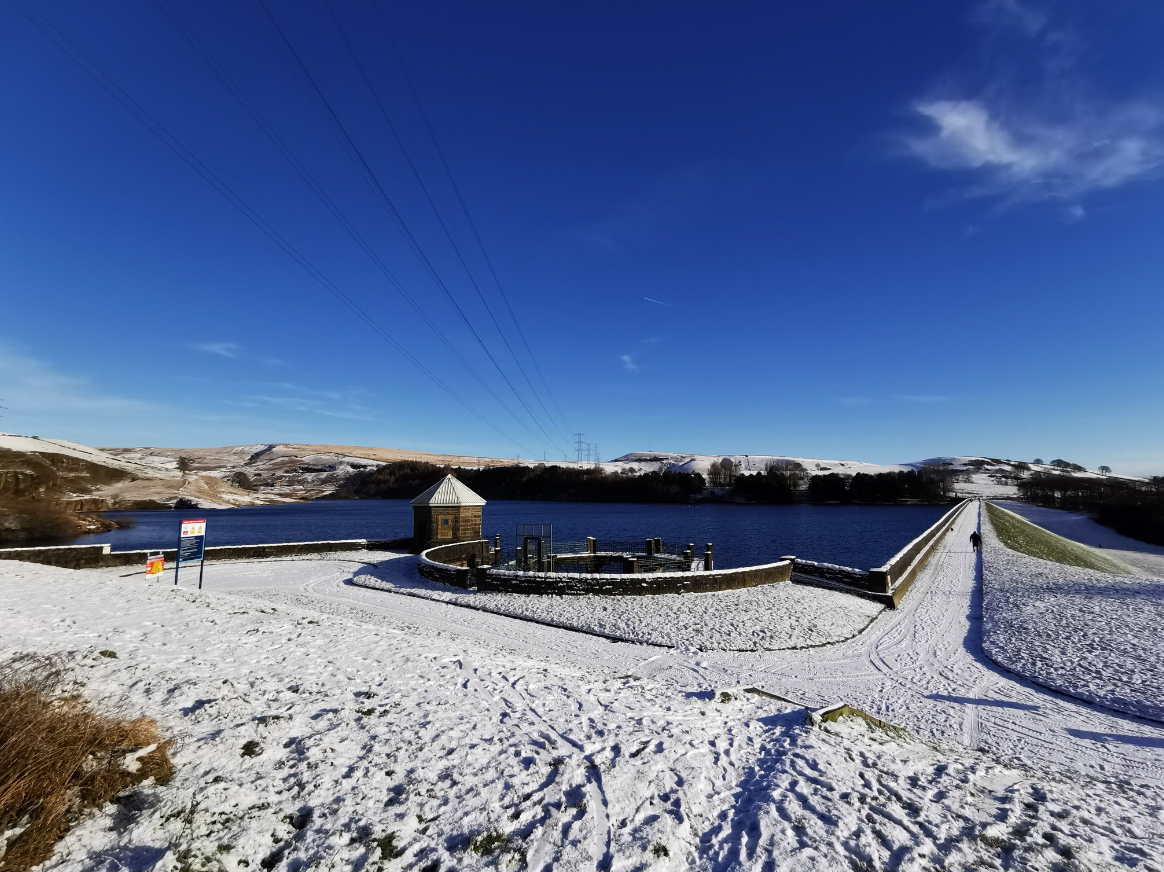
Weather Stats – Winter Rainfall

70% of the total days so far this winter have seen rainfall recorded.

Thursday: After a gloomy day for most of Wednesday, today will be much better with plenty of sunny spells after a patchy frost to start. Some cloud at times drifting in from the east. Max 7°C Min 0°C

A cold-front moved SE on Wednesday bringing clearer skies and slightly cooler air, hence a frosty start to Thursday.

Friday: Another chilly start with patchy frost and also some mist or fog patches. Some bright spells for the morning but it’s expected to become more cloudier into the afternoon. Cool. Patchy frost overnight where cloud-breaks appear. Max 6°C Min 1°C

Weekend: A lot of cloud expected.

Saturday: A chilly day with little in the way of brightness with a mostly overcast sky. Light winds. No frost likely. Max 5°C Min 3°C

Sunday: Cloudy with the breeze picking up later in the day with 25-30mph gusts. Cloud could be thick enough for some local drizzle. Not much brightness expected. Milder later. Max 8°C Min 6°C

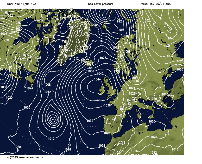
Outlook: Not much happening. High pressure anchored to the west will keep low pressures at bay. Some weather-fronts will slip around the high and topple into the UK but they will weaken. Temperatures around normal throughout the week with frosts unlikely due to cloud-cover. Signs of unsettled weather returning into the second week of February but no sign of any major snowfall or significant cold despite what the tabloids print.

Wintry showers from the NW around the end of the first week of February is the nearest we’ll come to snow between now and then.

Follow @ChadWeather on Twitter for the latest forecasts and warnings.

Thanks,

Jon

Forecast Issued: Wednesday the 25th of January 2023 at 5:05pm.

Image: http://www.wxcharts.com

Slowly milder, quieter & most importantly, drier – Thursday 19th January 2023 – Sunday 22nd January 2023

Hi all,

Rainfall record: We went 32 days running with measurable rainfall. The record to beat was/is 33 days from Oct-Nov 2013. Now here’s where it gets interesting. Yesterday, day 33, it snowed and due to being cold the snow didn’t melt so the “rainfall” amount was 0mm. Today snowmelt occurred leading to measurable “rainfall”, 0.4mm to be precise. It also snowed during the early hours of today, Wednesday. So, although we didn’t have a rainfall measurement on Tuesday we technically still haven’t had a dry day since December 15th. It looks like Friday will certainly be our first dry day for over a month.

Hope you all enjoyed the snowfall (a few of my snaps below). Certainly made everywhere pretty but the colder air is on its way out, eventually, and after days and days of rain, there is a drier spell on the way, and boy do we need it.

Greenbooth Reservoir – 3cm fell here – Wednesday 18/01/2023
Greenbooth Reservoir – Wednesday 18/01/2023 – this featured as a backdrop on the national BBC weather forecast later that morning 🙂
Greenbooth Reservoir – Wednesday 18/01/2023

Thursday: We start the day with a weather warning in place for snow and ice thanks to wintry showers. These showers are likely to fall as snow inland but will soon decay away leaving a cloudy morning. Sunny spells will develop into the afternoon leaving a dry day and then a cold and frosty night ahead. Max 3°C Min -2°C

Friday: Mist or fog patches to start which will lift into low cloud and then sunny spells developing quite widely which could be a little hazy. Max 4°C Min -3°C

Weekend: Eventually less cold and not as sunny.

Saturday: Milder air is pushing in hard from the west but it will take another day to reach us. Sunny spells developing after a frosty morning. Cloud increasing into the evening meaning a frost isn’t likely. Cold. Max 4°C Min 2°C

Sunday: The change is here. Southerly winds in place and this will drag in a lot of cloud. Cold to start but very slowly milder as the day wears on. Some patchy drizzle here and there. Max 7°C Min 5°C

Outlook: High pressure will begin to dominate so a lot of dry weather but it looks to be a cloudy-high. So a lot of dull days with misty/foggy conditions developing overnight. The cloud might be thick enough for pockets of drizzle but the majority will be dry and this relief from relentless rain looks set to last for the rest of January.

High pressure builds next week and will anchor across the UK – Dry, often cloudy with localised fog

Follow @ChadWeather on Twitter for latest forecasts and warnings.

Thanks,
Jon

Forecast Issued: Wednesday the 18th of January 2023 at 8:07pm
Image: http://www.netweather.tv

Colder spell on the way, risk of snow showers – Thursday 12th January 2023 – Sunday 15th January 2023

Hi all,

What a horrible spell of weather we are experiencing right now. Today marks day 27 in-a-row of measurable rainfall. During that time we’ve had 174mm of rain! This equates to around 158% of the average. The second half of December and the first third of January, have quite simply, been a disgrace!

Thursday: Early rain/showers will eventually fade away to bring a drier spell during the second half of the morning. Showers will return into the afternoon, some heavy. Milder again but windy once more, especially overnight with a risk of localised 50-60mph gusts for a short time. Get those bins secured! Max 10°C

Early hours of Friday morning could be lively

Friday: After a very windy night it will stay windy with showers being driven in on a strong westerly. Cooler once again. Max 7°C

Weekend: More rain before turning colder.

Saturday: There will be a spell of rain in the morning, that will turn showery. Showers will continue into the afternoon with the risk of hail and thunder. Again, it will be windy making it feel chilly. Max 7°C

Sunday: Sunday seems to be the day that we switch to colder air and with this the showers will start to turn wintry but will also ease later in the day. As what seems to be the norm recently it will be windy and with this wind-chill it will make it feel around 0°C. Any overnight showers could leave some snow on the hills. Locally frosty overnight too. Max 5°C

Outlook: Monday and Tuesday look particularly cold with temperatures struggling to 4°C. Weather-fronts/troughs slipping in from the west or northwest will bring spells of wintry showers which could lead to a covering of snow in places, especially on higher ground. The nights will be cold too with the return of some frosts. It looks like from the middle of the week onwards temperatures will recover a little bit, meaning the showers will not be as wintry and you never know we just might slip in a dry day along the way, which is massively overdue.

Wintry showers to bring some snow-cover early next week?

Follow @ChadWeather on Twitter for the latest warnings and forecasts.

Thanks,
Jon

Forecast Issued: Wednesday the 11th of January 2023 at 7:30pm.
Images: http://www.theweatheroutlook.com & http://www.wxcharts.com
Cover Image: @GazDean1 on Twitter

Yet more wind and rain – Thursday 5th January 2023 – Sunday 8th January 2023

Hi all,

Happy New Year to you all and all the best for 2023.

I’ve not had time to collate the statistics for 2022 yet and I’m still working on putting together all of my weather data since August 2012 which will be made available for anyone to view. Watch this space.

As for the here and now the new year has started off how 2022 ended. Mild, wet and occasionally windy. It’s been relentless this rain and today is day 20 in a row of measurable rainfall and that number will continue to rise.

Thursday: A bright start but cloudier as the day progresses with a few showers. Rain overnight. Breezy. Mild. Max 12°C

Friday: After overnight rain it will turn drier with a few bright spells, so a better day. A little cooler. Breezy. Cloudier towards evening. Max 9°C

Weekend: Little change.

Saturday: Cloudy with a band of heavy rain moving through during the morning, which could be squally. Bright spells and some showers follow. Windy at times and still mild. Max 10°C

Sunday: An area of low pressure will dominate so it’s a windy and very showery day, perhaps with hail and thunder and lightning. A little cooler. Max 8°C

Outlook: The Jet Stream will remain active and control our weather driving areas of low pressure across the Atlantic to our shores. So windy at times with spells of rain or showers and mild. Odd cooler slot in between weather systems. Hints of something more settled and cooler after that but certainly no sign of any wintry conditions.

Low pressure after low pressure bringing rain and wind over the next 7-10 days

December 2022 Stats

Max 13.3°C (19th)
Min -8.0°C (15th)
Av. 3.2°C
Wettest 18.2mm (31st)
Av. Humidity 90%
Av. Barometer 1011.3 hPa
Max Gust 29.9mph
Av. Wind Direction SSW
Rain 94mm (74% of average)
Rain Registered Days 20
Dry Days 11

Follow @ChadWeather on Twitter for the latest forecasts and warnings.

Thanks,

Jon

Forecast Issued: Wednesday the 4th of January 2023 at 5:05pm

Image: http://www.wxcharts.com