Some snow followed by welcome sunshine – Thursday 24th February 2022 – Sunday 27th February 2022

Hi all,

What a wet and wild week that was, with storms Dudley, Eunice and Franklin bringing disruptive winds and high rainfall totals, leading to localised flooding. You’ll be glad to know that we are in for a more settled few days once we get past a blast of cold snowy air from the northwest.

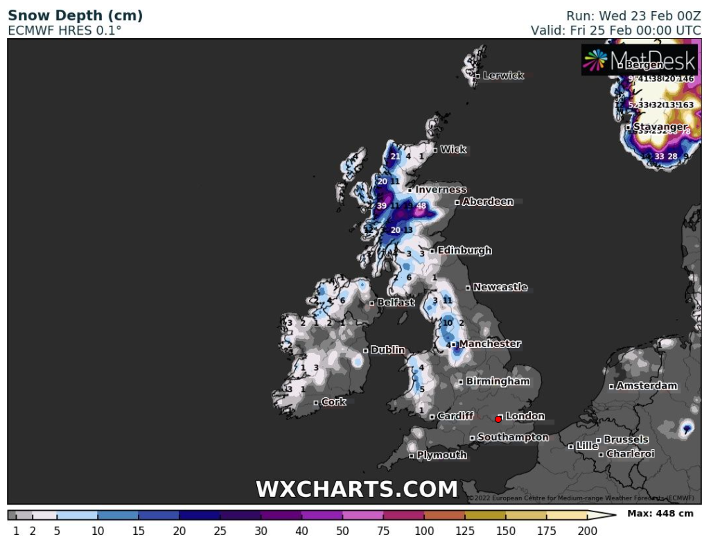
Thursday: Windy especially during showers which will be wintry in nature. Expect thunder & lightning, hail, sleet & some snow, even to lower-levels for a time. Biting wind & much colder.

Hail, sleet and snow showers on Thursday

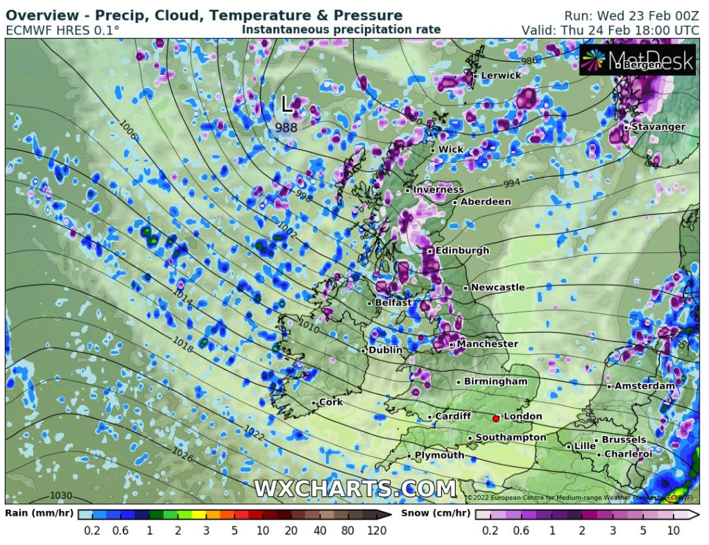
Snow amounts: 1-3cms can’t be ruled out especially at 150-300M and even up to 5cm above 300M, especially in areas seeing frequent snow showers. Gusts of 35-40mph making it feel sub-zero. Max 5°C

This prediction seems over the top to me but certainly the potential for a few cms of snow in places by the end of Thursday

Friday: Well this has been long overdue. A decent day with plenty of sunny spells across the region. It will also be dry and with lighter winds, it will not feel as cold. Max 8°C

Weekend: The best one for a while.

Saturday: A dry day with sunny spells. A little bit on the breezy side but much improved on last weekend. Max 9°C

Sunday: Another dry day but with more cloud, we will see more in the way of bright spells rather than sunny spells. Max 9°C

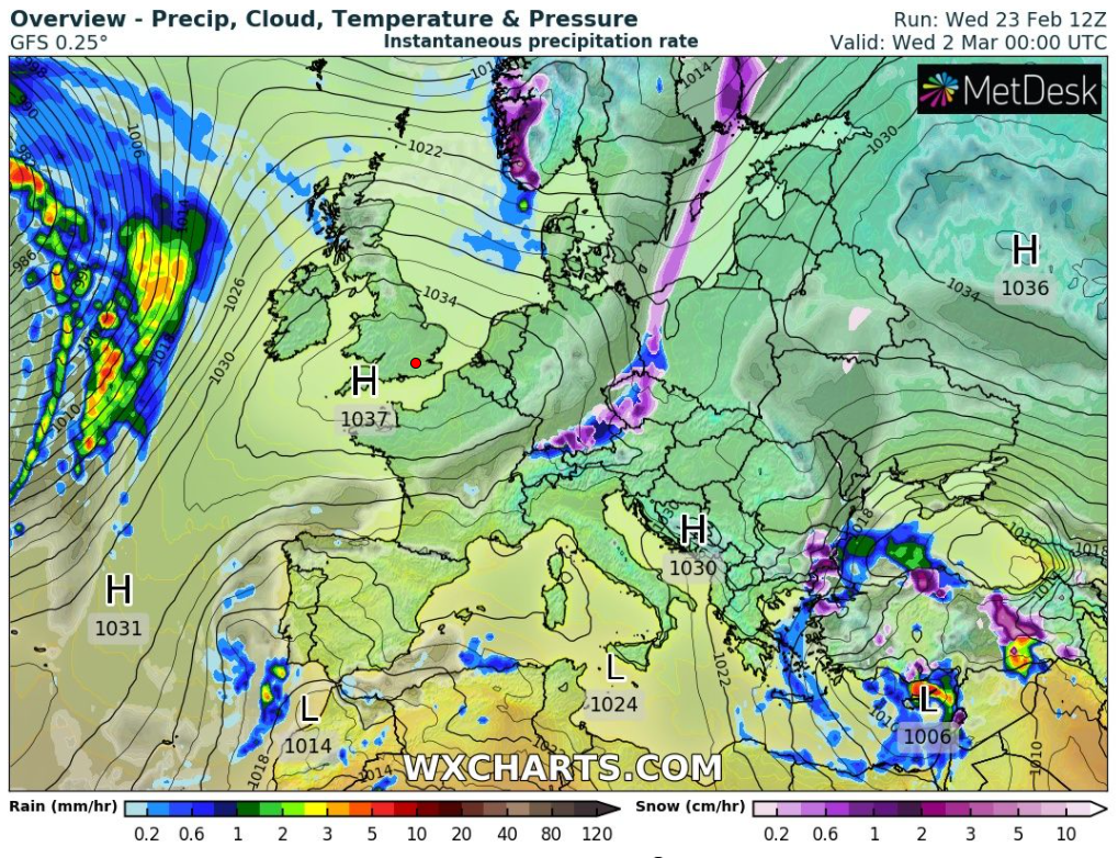
Outlook: Cloudy with some rain expected on Monday, but after that, high pressure to our south looks to keep us settled for a few days and any bands of rain from the northwest will weaken. So good news, we will get a rest from the relentless rain and storms. Still no signs of any proper cold as we enter Spring.

High pressure will be around at times later next week, finally settling down the weather

Follow @ChadWeather on Twitter for the latest weather forecasts and warnings.

Thanks,
Jon

Forecast Issued: Wednesday the 23rd of February 2022 at 5:15pm.
Images: http://www.wxcharts.com

Deadly Storm Eunice to batter UK – Thursday 17th February 2022 – Sunday 20th February 2022

Hi all,

Remember in January, how I mentioned how uneventful the weather was and how February would be payback time. Looks like you have me to blame for the miserable conditions that we are experiencing.

In the first 16 days of February we have measured rainfall on every single day and we are standing at 84mm for the month, well above average. Also, we are experiencing milder-than-average temperatures. The winters now, certainly don’t feel like the winters of my youth, with a distinct lack of snow and cold spells.

At the time of writing this forecast, we are currently experiencing Storm Dudley, which to be fair is a typical lively winter storm system. But Friday will see a rarer event, with a rapidly deepening area of low pressure, that will be damaging and dangerous to parts of England and Wales.

Although it is set to be very windy and hazardous, it looks like we will miss out on the more damaging 80-90mph gusts which are modelled to arrive across the south-west and southern parts of England and Wales on Friday, but there looks to be a sting in the tail as winds change direction.

Thursday: A windy day, especially early on. Sunshine and blustery showers, some heavy with hail and thunder and lightning. Wintry on the tops too. Max 6°C

Friday: Storm Eunice is here. The latest data puts the storm slightly further south. This means lower wind gusts for the morning with the strongest gusts saved for the afternoon, with 70mph possible quite widely, as winds swing north-westerly. Another shift in its track is possible. An very unsettled day for us, which looks to start not too windy. Heavy rain followed by wintry showers and some more prolonged rain, sleet and snow later as winds veer north-westerly. Winds look to be at their strongest mid-afternoon. Max 7°C

Winds look to be at their strongest for us as they veer WNW/NW on the back edge of the low. Gusts to 75mph can not be ruled out.

Weekend: More wind and rain. Sorry.

Saturday: Further bouts of showers which could be wintry (hill-snow) and thundery at times. Remaining windy making it feel cold. Some of the showers falling as snow above 300M. Max 6°C

Sunday: Another very windy day, and don’t be surprised to see another named-storm, Storm Franklin, as we see more rain followed by showers across the region with strong and gusty winds; 50mph possible. Milder. Max 10°C

Outlook:  The unsettled weather will continue during the week after a respite on Monday, when it is looking drier with some bright spells thanks to a ridge of high pressure. Conditions look set to improve towards next weekend with high pressure trying to build in from the south-west of the UK. No sign of any below average temperatures. It’s starting to feel like Autumn lasts 6 months.

Follow me on Twitter at @ChadWeather for the latest forecasts and warnings.

Thanks for reading.
Jon

Forecast Issued: Wednesday the 16th of February 2022 at 9:10pm
Image: http://www.theweatheroutlook.com

Chilly with some sunshine before weekend rain – Thursday 10th February 2022 – Sunday 13th February 2022

Hi all,

More tabloid clickbait nonsense being printed this week. Decent snowfall to come in parts of Scotland over the next few days but we aren’t going to be ‘buried under 30cm’ of snow on my watch. If only.

I’m a snow-lover, and love frosty mornings and that crisp-feel to a winter’s day but we certainly had more snow when I was a lad, as well as colder nights. I know winter hasn’t finished with us yet but I’m actually starting to look forward to Spring now. Being able to get out in the garden, cutting the lawns and feeling some warmth from the sun can’t come quickly enough. Sunsets are now after 5pm. Springtime will soon be here.

Thursday: Colder air has now arrived from the northwest. Sunny spells with some wintry showers blown in on a brisk biting wind. These will fall as hail, sleet and snow above 250M. Harsh frost to come overnight. Max 5°C Min -4°C

Friday: A decent day with plenty of sunny spells after a very frosty and possibly foggy start. Lighter winds with the sun turning hazy later. Max 6°C Min 2°C

Weekend: High pressure slips away. Windy with periods of rain.

Saturday: A cold and bright start but cloud and wind increasing from the west quickly as rain moves in during the day and it becomes milder. Max 8°C Min 6°C

Sunday: Mild and staying unsettled with further rain or showers and windy. Max 10°C Min 5°C

Outlook: The westerly flow of wind and spells of rain or showers looks set to continue. At this stage no sign of any proper cold, a Beast from the East or sledge-able snowfall. I feel a chilly March could be on the cards.

Follow @ChadWeather on Twitter for the latest forecasts and warnings.

Thanks,
Jon

Forecast Issued: Wednesday the 9th of February 2022 at 6:55pm.

Image: Rochdale canal (09/02/2022).

Short-lived Wintry Showers – Thursday 3rd February 2022 – Sunday 6th February 2022

Hi all,

The final winter month has arrived and still we wait for a proper cold spell which are becoming few and far between these days. January did have a few sunny days but equally overcast days with little eventful weather after a wet start.

We did manage to close out the month with a couple of named-storms but we missed the carnage which was mostly felt to our north and north-east where gusts of 80-90mph were recorded away from elevation.

As mentioned it was a wet start and also a wet final few days but overall we only saw 43% of the average rainfall last month. So as well as drier-than-average and it was milder with a lack of very cold spells and snowfall. What will February bring? Long-range models suggest drier-than-average again, although this is borderline with plenty of rain on the cards just to our northwest. Fine margins.

Thursday: Mostly cloudy with some patchy rain during the morning. A few bright spells later and windy with 35mph gusts. Again, very mild for the time of year but change arrives overnight with a squally cold-front passing through the region during the early hours. Max 10°C

Friday: A weather-front earlier in the night will bring a much colder polar airflow with sunny spells and wintry showers with some sleet and snow. Expect hail and a chance of thunder and lightning. Feeling cold in a strong, gusty and biting wind. Max 5°C

Colder air arrives during the early hours of Friday.

Weekend: Milder once again.

Saturday: Slowly becoming milder and generally overcast with some patchy rain or drizzle. Max 8°C

Sunday: Heavy rain early followed by a few showers. Windy with 35-40mph gusts but remaining mild. Max 9°C

Outlook: High pressure close to the south of the UK, slipping a little further east, and rain-bearing fronts to the north-west means we will be sandwiched in the middle. Mostly cloudy days, staying mild for most with the threat of rain now and again. Chance it turns even milder later. The search for a decent cold spell continues. Snow at Easter no doubt.

Follow @ChadWeather on Twitter for the latest forecasts and weather warnings.

January 2022 Stats

Max 13.6°C (1st)
Min -2.1°C (6th)
Av. 4.6°C
Wettest 11.2mm (8th)
Av. Humidity 88%
Av. Barometer 1024.8 hPa
Max Gust 41.4mph (31st)
Av. Wind Direction WSW
Rain 44.8mm (43% of average)
Rain Registered Days 18
Dry Days 13
Air Frosts 6
Snow Falling Days 5

Thanks,
Jon

Forecast Issued: Wednesday the 2nd of February 2022 at 6:55pm.

Image: http://www.wxcharts.com