
Hi all,
The poor month of June continues but temperatures have cranked up a notch compared to recent weeks and with that so has the humidity, so it’s feeling rather muggy at times. This theme will continue over the coming days, with most of the rain to our northwest and heat to our southeast.
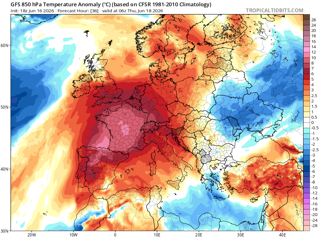
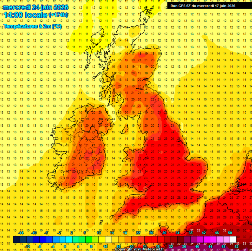
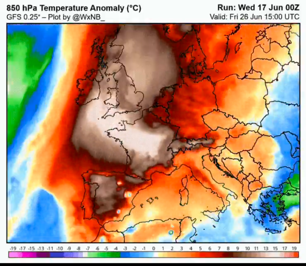
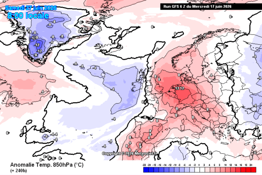
As you will have read, there is a heatwave coming to parts of Spain and France, where temperatures could exceed 40°C. Some of this heat will affect parts of England, mostly the southern and southeastern parts where temperatures could reach the mid-30s for a day or two. Luckily, if you’re like me and hate the heat, we’re not expecting to see any of those values up here in the northwest but we could see a couple of days close or in the mid-20s.
We’ve had a lot of rain during June, but it looks like the second half of June will not be as wet.
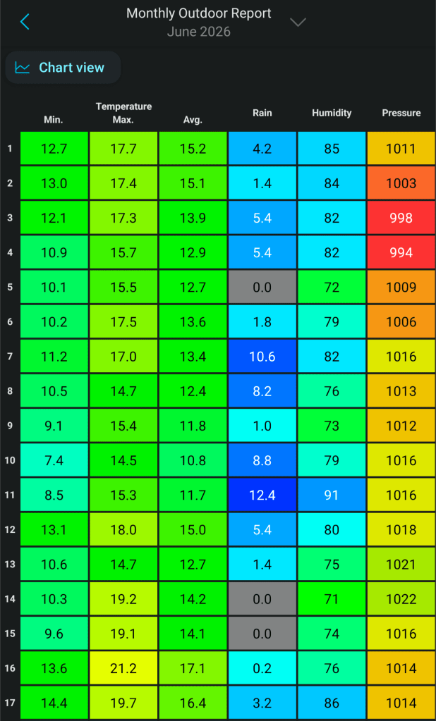
As always, don’t forget that UV levels are high at this time of year or even very high. So don’t forget to slap on that sun-cream if you’re out in the sun for any length of time.
Thursday: A very warm and humid day to come with plenty of sunny spells (cloudy the further west you are) and a wind picking up into the afternoon. Low chance of a shower later. A warm night follows. Max 25°C Min 16°C Max Gusts 20mph
Friday: Another very warm day, bright spells and increasingly windy. A cold-front will be moving through the region later in the day so it will cloud over towards evening with some rain or showers. Max 24°C Min 13°C Max Gusts 25mph
Weekend: Decent and becoming warmer again.
Saturday: Because a cold-front has gone through, it will be fresher with a westerly wind but it’ll still feel very warm in the sunny spells. Again the chance of a shower, especially early on, otherwise dry. Max 21°C Min 11°C Max Gusts 20mph
Sunday: Looks like a cracking day for Father’s Day. Light winds, very warm once again and plenty of hot sunshine. A humid one for sleeping. Max 24-26°C Min 15°C
Outlook: At this stage it looks like temperatures will remain close to the mid-20s for Monday and Tuesday, so if we do have 3 days of 25°C or more, then it will be classed as a heatwave. There will be a risk of some thunderstorms on Monday but after that high pressure should strengthen, and midweek onwards with the wind turning back to a westerly direction temperatures should return back to the early-20s but conditions should be settled with lots of dry weather and warm sunny spells.
Follow at @ChadWeather on X and Bluesky for the latest forecasts and warnings.
Thanks as always, for popping by to read.
Thanks,
Jon
Forecast issued: Wednesday the 17th of June 2026 at 4:53pm.
Images: http://www.tropicaltadbits.com, http://www.meteociel.fr & @WxNB_ on X.
