Another named-storm this weekend? As wind and rain mostly dominate – Thursday 22nd October 2026 – Sunday 25th October 2026

Hi all,

Our, the UK’s, first named-storm of the season will arrive Thursday night into Friday with 60-70mph gusts possible in the southwest with the Met Office issuing an Amber warning. For us, we will escape the worst of the conditions but it will be wet and windy for a time. 

Another deep area of low pressure arrives this weekend, this time to the northwest. There is a possibility that this is also named. As it pulls away it could mean later on Saturday and especially Sunday is the windiest spell of the coming days.

There will also be a reasonable amount of rainfall associated with these lows.

Oh, and zero chance or any sign of snow, away from the Scottish Mountains, so ignore the usual media nonsense.

Thursday: A chilly start then a quiet spell before change but that said there will still be some showers around as well as some welcome sunny spells. Rain associated with Storm Austen will arrive overnight with the wind gusty for a time from the east. Max 12°C Min 7°C Max Gusts 30mph (overnight)
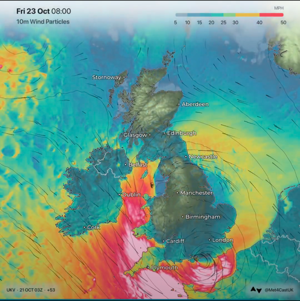
The strongest of the winds from Storm Austen will affect the southwest and southern coast. Image from @Met4CastUK on X.

Friday: A lively day with rain, heavy at times for the morning and into the afternoon. Once this rain begins to clear and winds switch to a northwesterly direction, winds will increase and locally gust to gale-force. Clear spells into the evening and overnight with winds falling lighter. Max 11°C Min 5°C Max Gusts 35-40mph

Weekend: Going downhill.

Saturday: It should be a nice start on Saturday with sunny spells, but these will soon turn hazy with cloud thickening during the late-morning. At this stage it looks like heavy rain will arrive from the west from around lunchtime onwards, give or take an hour. Southerly winds will increase and again we could see some localised gale-force gusts. Clearer spells overnight with just a few showers but the wind will remain noticeable. Max 14°C Min 6°C Max Gusts 40mph
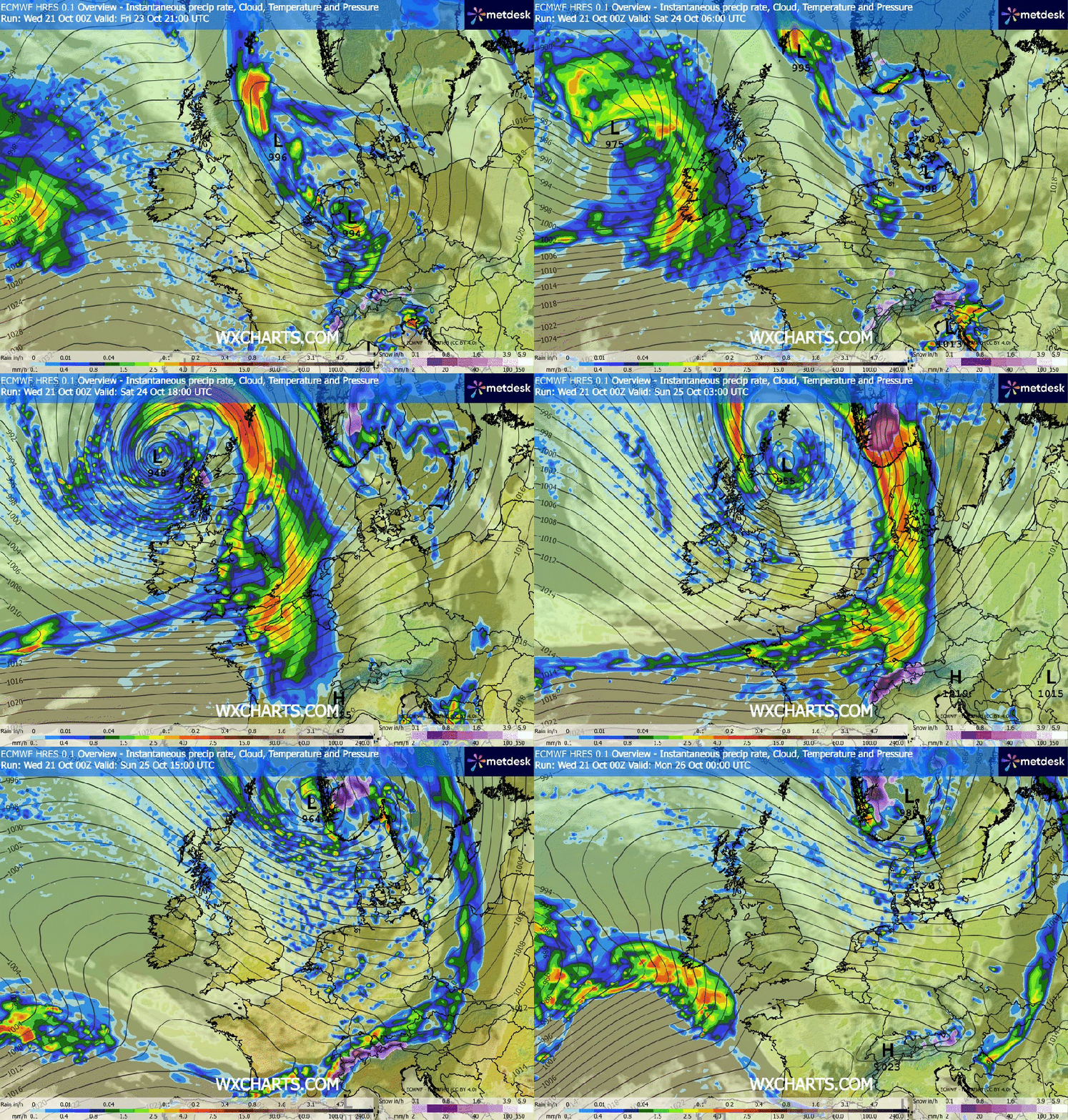
Too far out to confirm at this stage but another area of low pressure into the weekend could well be deep enough to warrant a warning and again another named-storm.

Sunday: This new area of low pressure will start to push away but it will still be deepening so we can expect a day of sunshine and showers and very windy conditions. Feeling particularly chilly. Max 11°C Min 6°C Max Gusts 35-45mph

Outlook: Next week looks to remain unsettled with perhaps a couple more low pressures before high pressure will hopefully drift up from the south or southwest and settle the weather down towards next weekend.

Follow @ChadWeather on X and Bluesky for the latest forecasts and warnings.

Thanks for reading.

Jon

Forecast Issued: Wednesday the 21st of October 2026 at 2:48pm.

Images: http://www.wxcharts.com, Met Office and @Met4CastUK on X.
Cooler than recently but milder air will return – Thursday 8th October 2026 – Sunday 11th October 2026

Hi all,

The Weekly Blog is back this week, although it will be a short one as I have, again, had another busy day. Hopefully I can get back on track next week.

Plenty of sunshine around on Wednesday after morning rain but it has turned cooler and fresher and this will be more noticeable overnight where we could see a localised ground-frost. There has been a lot of talk in the media recently about this cold spell, but to be honest it’s literally only lasting a day and slightly milder air will creep back in. It’ll soon be the time for the stupid snow stories.

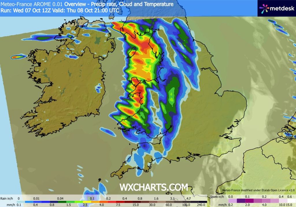
Thursday: A cold start with a touch of ground-frost in rural spots, then plenty of sunny spells for the morning, but cloud will thicken into the afternoon from the west and then some heavy rain will arrive into the evening and overnight. Max 13°C Min 9°C Max Gusts 25mph

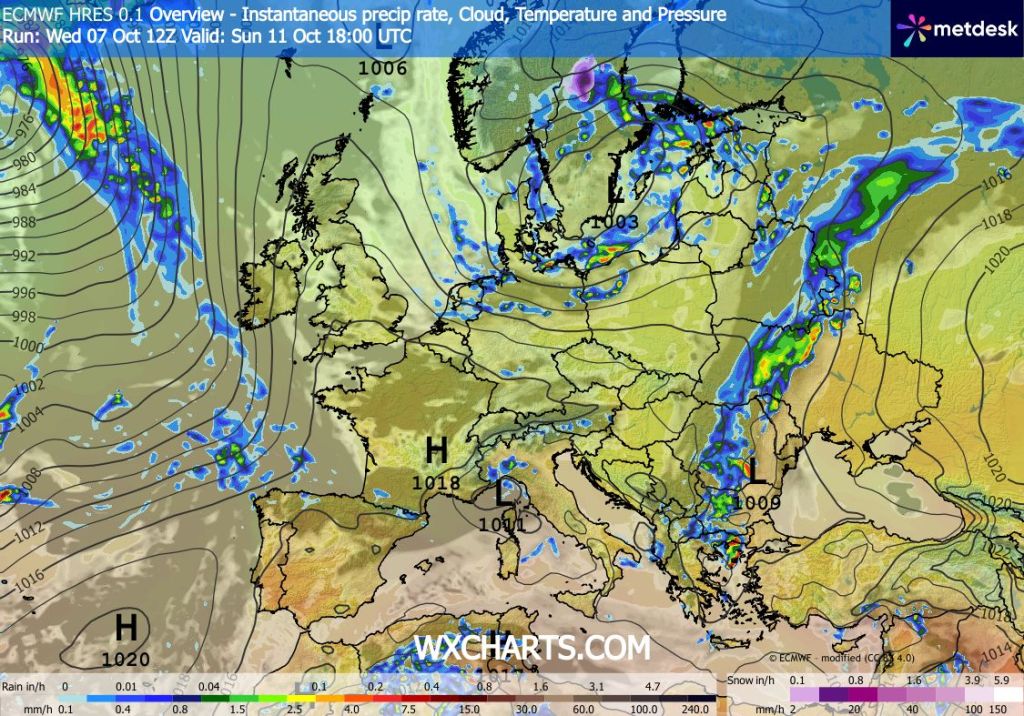
Some heavy rain to come later on Thursday evening

Friday: A wet morning with some heavy rain. This will eventually move away and brighter skies will arrive from the west again. It will be a windy day and milder air will now be back in place. Max 15°C Min 9°C Max Gusts 35mph

Weekend: Improving into Sunday.

Saturday: With a northwesterly airflow we can expect a day of bright spells and some frequent showers coming in on a very gusty wind. Max 13°C Min 8°C Max Gusts 35-40mph

Sunday: A few showers around to start the day but a ridge of high pressure will build in which will kill off the showers. Sunny spells into the afternoon. Cool overnight. Lighter winds. Max 14°C Min 7°C Max Gusts 20mph

A ridge of high pressure will build in on Sunday killing off the morning showers

Outlook: Unsettled at times with bands of showery rain coming in from the west. It will also be breezy at times but with a west or occasionally a southwesterly airflow, temperatures will be on the mild side, so slightly above average.

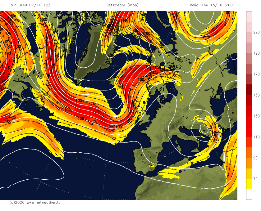
Next week the Jet Stream will be over the UK, especially northwestern parts

Follow @ChadWeather on X and Bluesky for the latest forecasts and warnings.

Thanks,

Jon

Forecast Issued: Wednesday the 7th Oct 2026 at 8:56pm

Images: http://www.wxcharts.com & http://www.netweather.tv