Hi all,
High pressure has mostly dominated the weather over the last two weeks. Unfortunately we’ve had an easterly feed dragging in some cloud from the North Sea, which along with some mist and dense fog for a time, has been stubborn to clear. Where we have seen some sunshine it’s been pleasant. It’s been a dry period too with rainfall only measured on one of the last 14 days. So far in November only 0.4mm of rain has fallen.
Plenty of cold, dry and sunny weather to come this week but rain will return next week.
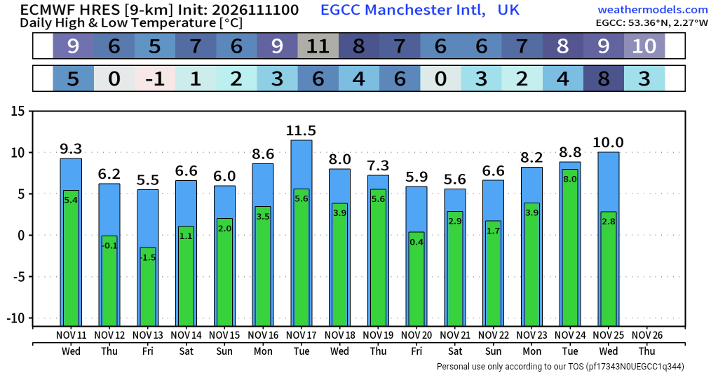
Thursday: A frost to start then a lovely day with blue skies and a brisk northerly wind for a time. Colder air has sunk southwards for our first cold spell of Autumn. Coldest daytime highs since March. Widespread frost overnight as winds fall light. Max 7°C Min -4°C Max Gusts 15mph
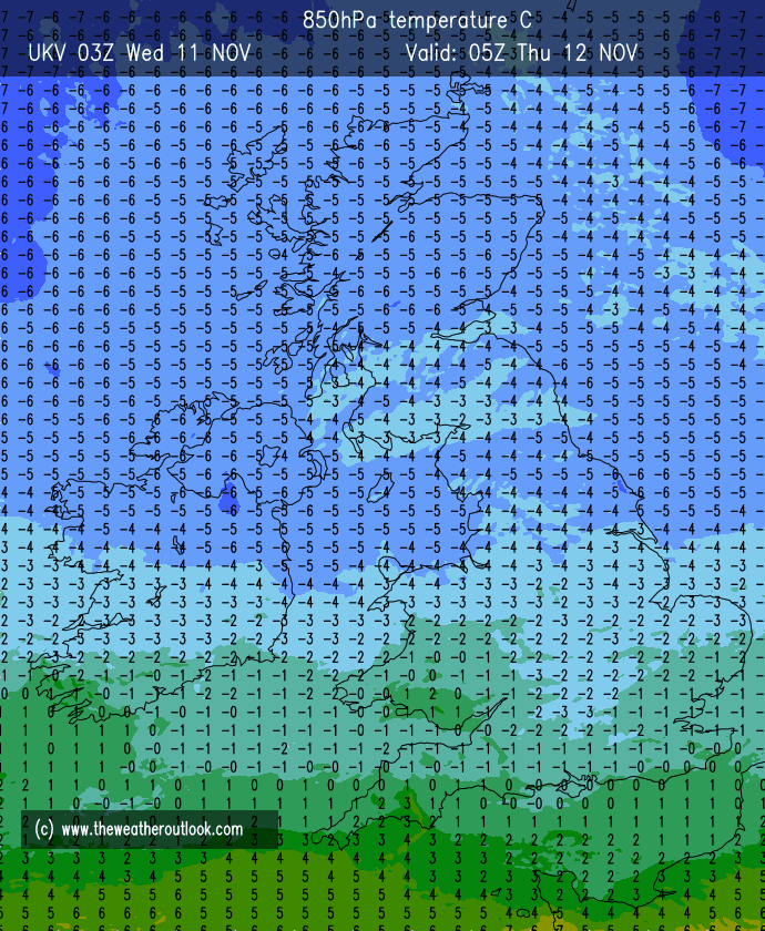
Friday: Another great day after a frosty and cold start with sunny spells which could turn hazy later. Remaining cold on the thermometer but there will still be some warmth from that sun. Frost returning after dark but perhaps not as cold as the previous night with some high-cloud. Max 5°C Min -2°C
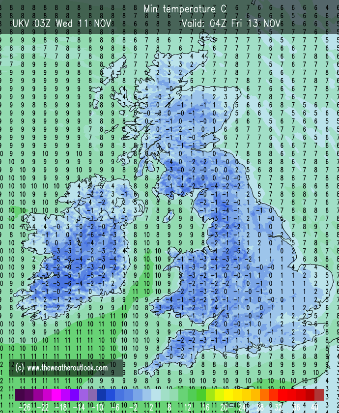
Weekend: Changes slowly arriving.
Saturday: A frost to start and hazy sunny spells developing. Feeling cold as a southerly wind strengthens, a sign of change. Cloudier overnight meaning any frost becomes patchy and is gone by Sunday morning. Max 6°C Min 1°C Max Gusts 20mph
Sunday: Breezy with mostly cloudy skies. Dry for the morning but a risk of some patchy rain arriving later in the day. Feeling chilly in that wind despite being less cold. Max 8°C Min 3°C Max Gusts 20mph
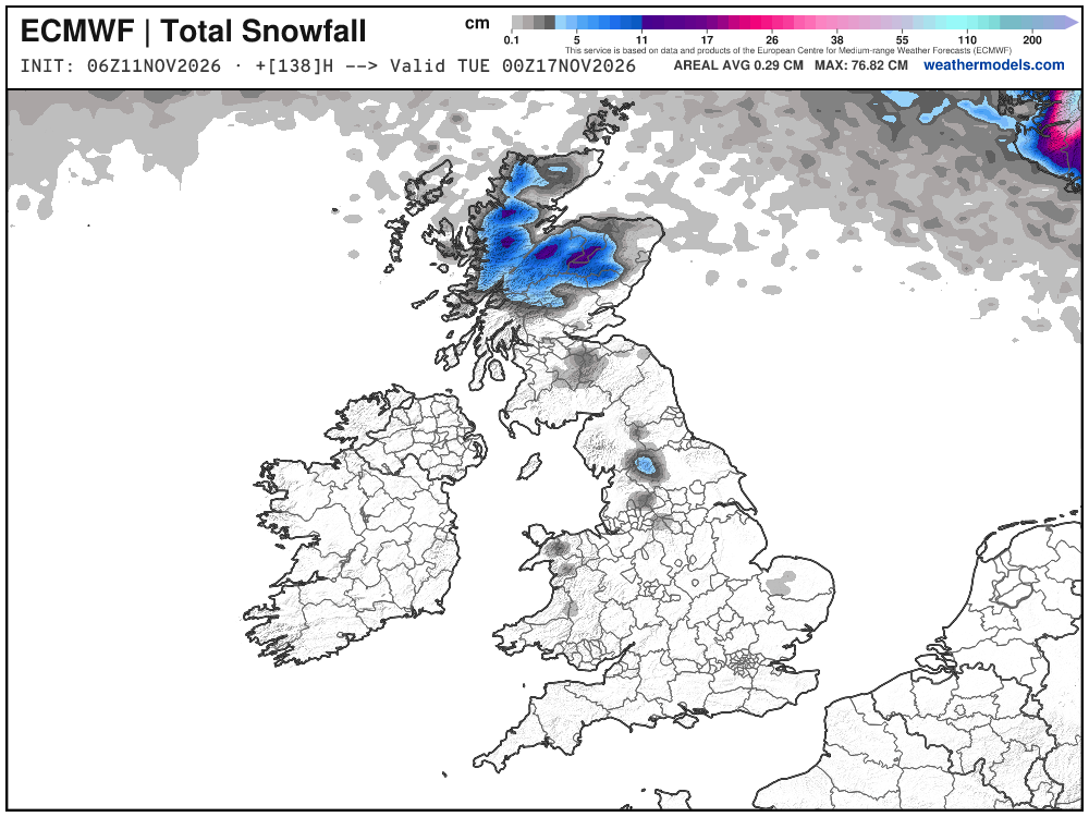
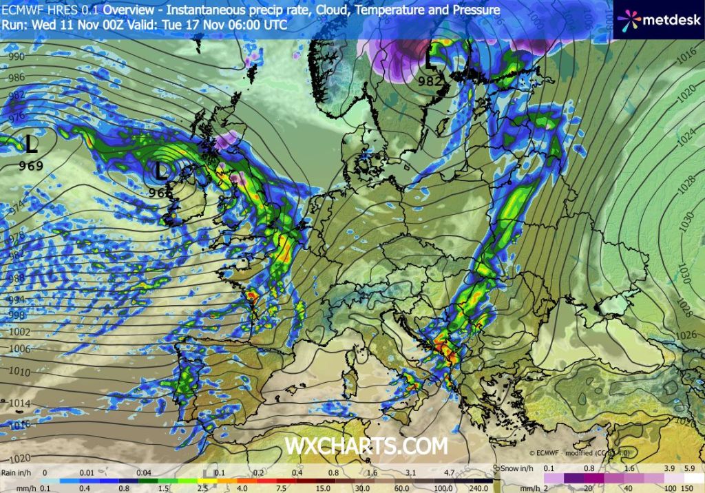
Outlook: Low pressure and the Jet Stream control (most) of next week’s weather, so becoming milder, windier and wetter. However, this milder spell might be short-lived with cooler/colder temperatures arriving once again.
Some long-term predictions are starting to favour a cold start to December but as always, it’s pretty much impossible to tell what the weather will be like in 3 weeks’ time, but look out for social media updates.
Thanks,
Jon
Forecast Issued: Wednesday the 11th of November 2026 at 3:56pm.
Images: http://www.wxcharts.com, http://www.weathermodels.com & theweatheroutlook.com.

