
Hi all,
It’s been a very dry February so far after all those days of rain in January. At this stage of February we should have had around 45mm of rain. Currently we’ve only had 3.4mm! Yes there will be some rain in the coming days but there’s no sign of any persistent rain on the horizon, so February will end with well-below average statistics. With some welcome sunshine towards the end of the month, it might be time for that first cut of the lawn.
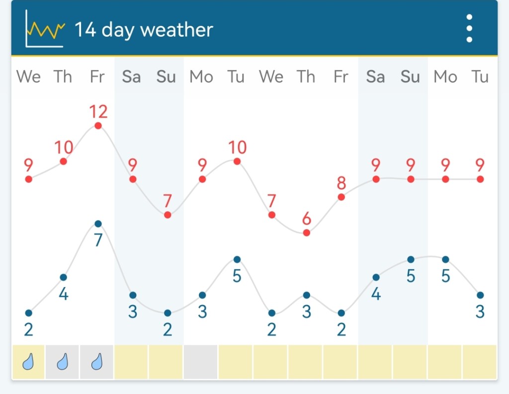
Thursday: A mostly cloudy day with patchy rain or drizzle in the morning easing away into the afternoon. Low-cloud and misty conditions on the tops. Mild for the time of year. Max 10°C
Friday: Any bright spells fading as a weakening band of patchy rain moves southeast. Brighter spells later in the day with the odd shower but well-scattered. Windy with 35-40mph, especially so on the eastern side of the hills. Mild. Max 12°C
Weekend: Weather-fronts close by.
Saturday: Early rain moves away introducing some fresher air. Remaining mostly cloudy with the odd bright spell here and there. Evening shower can’t be ruled out. Max 9°C
Sunday: The morning is expected to be overcast with some bright spells developing during the day but these are likely to be limited. Max 10°C
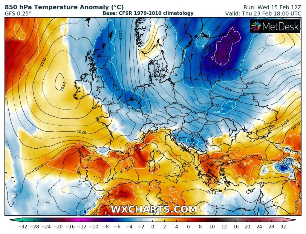
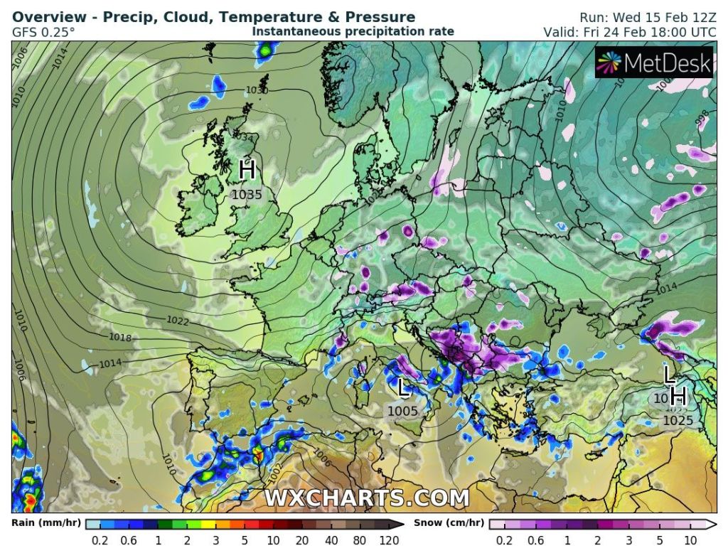
Outlook: No sign of anything snowy or significantly cold (despite what the media spout) although some chilly nights are expected later in the week. Monday and Tuesday seem to bring more of the cloudy conditions that we have been used to. A weak weather-front will move down from the north-west on Wednesday. This will introduce some wintry showers and cooler air afterwards. From Thursday onwards high pressure is expected to build from the west and then become anchored across the UK to end the final 5-6 days of February with dry, bright and settled conditions with some frosty nights.
Follow @ChadWeather on Twitter for the latest forecasts and warnings.
Thanks for reading.
Jon
Forecast Issued: Wednesday the 15th of February 2023 at 9:35pm.
Images: http://www.wxcharts.com & Wetter&Radar.
