Hi all,
I think it’s safe to say that Summer 2022 was decent. Plenty of dry weather with very warm sunny spells and a lot of settled conditions. Most notable was the record-breaking July heatwave (36.6°C) and the well below-average rainfall. We also had much more warmer evenings than usual and even a nice August (normally a bad month). With it being settled we did lack in thunderstorm activity but we could well see some action over the coming week.
Summer 2022 delivered only 39% of the average rainfall.
June 2022 31.6mm (av. 79mm)
July 2022 35mm (av. 92mm)
August 2022 38mm (av. 95mm)
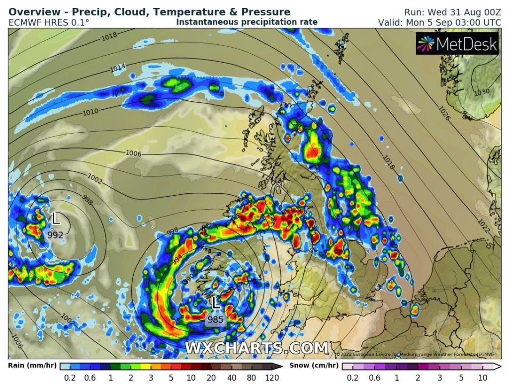
Meteorological autumn starts on Thursday and we’ll squeeze in another decent day but then it’s all about low pressure and an unsettled theme. Exact timings and the finer details of the coming days will change, so always look out for updates on Twitter.
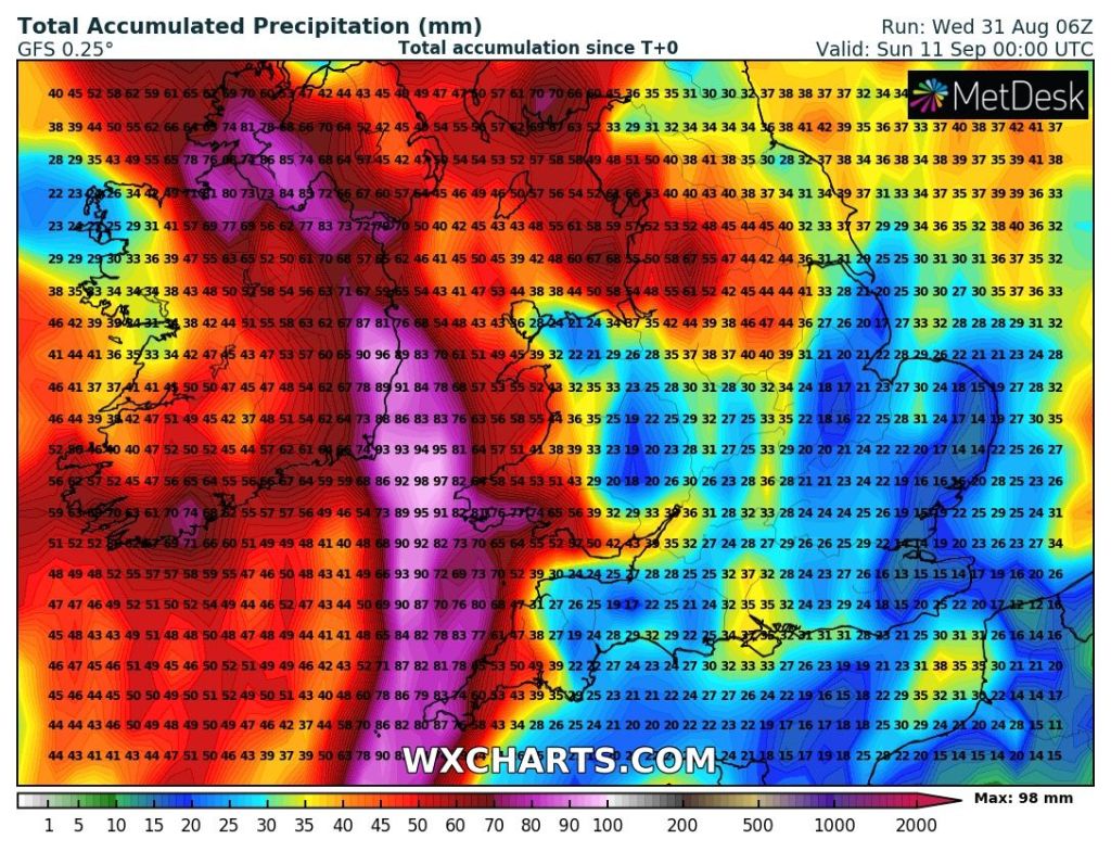
As is the nature of showers, some areas will see more rain than others but the general overall thinking is; 40-50mm of rainfall is likely in the first 10 days of autumn. These totals could be higher in some spots if we see some torrential thundery showers develop.

Maximum UV levels are now down to medium between 10am-3pm.
Thursday: Low pressure is beginning to develop to the west of the UK but it won’t influence us just yet. So another mostly dry day with warm sunny spells. Outside chance of a shower later, especially over the hills. Winds still quite breezy. Max 22°C
Friday: The low will creep closer and a squeeze in the isobars will mean another breezy or even windy day. Sunny spells and feeling warm but isolated beefy showers are expected later in the day. Max 21°C
Weekend: Turning more unsettled.
Saturday: A showery day, some likely to be thundery as the atmosphere becomes more unstable. There could well be a band of more persistent rain strewn across the region but the location of this at this stage is uncertain. Breezy. Max 20°C
Sunday: Bright spells, especially to start, then heavy and again possibly thundery showers will develop and becoming widespread. These showers could well be more focused to the south and west. Still feeling quite warm in any sunshine but like previous days it will be windy. Max 20°C

Outlook: Low pressure remaining pretty much in charge with spells of bright spells and showers, some beefy with thunder and lightning. It will tend to become a little cooler as the week goes on with maximum temperatures back into the teens.
Follow @ChadWeather on Twitter for the latest forecasts and warnings.
Thanks,
Jon
Forecast Issued: Wednesday the 31st of August 2022 at 1:15pm
Images: http://www.wxcharts.com
