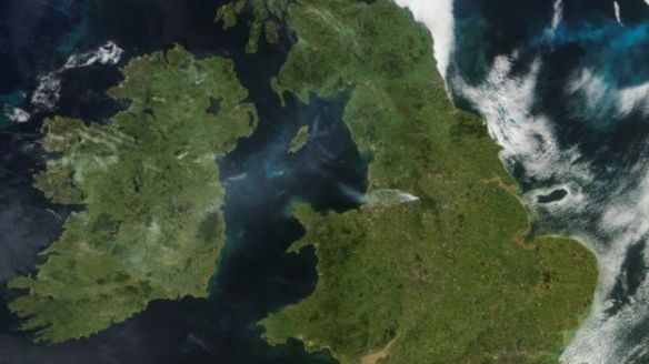
Thursday 21st June 2018 – Sunday 24th June 2018

Hi all,

We have some very warm, even hot weather on the way, which could well go down as a heatwave (the av. max. temperature for late-June is 19.5°C). Good news if you like it hot. Bad news for gardeners and growers though, as there is very little, if any, rain in the forecast for the next 10-14 days. Expect to see temperatures around 30°C for some places in the UK next week.

Thursday: A chilly start and much fresher with a cool northwesterly airflow. Dry with sunny spells and breezy. Max 17°C

Friday: High pressure builds from the west. Sunny spells with fair-weather cloud bubbling up during the day. Dry. Max 19°C

Weekend: Sunday sees the start of the temperature rise.

Saturday: Sunny to start but cloud will develop duiring the day. Dry with sunny spells and light winds. Max 18°C

Sunday: Much warmer with pleasant sunny spells. Dry. Max 23°C

Heatwave 31

Predicted Maximum Temperatures for midweek next week –  30°C possible

Outlook: High pressure in charge and temperatures rising. We look likely to develop a southeasterly flow which will drag in hot air from the continent. We could be seeing values of 25-28°C quite widely. This is expected to continue throughout the week with no sign of any significant rain. As well as some hot sunshine during this period we will see some variable cloud at times. At this stage it looks like the weather will become cooler from around the 2nd of July.

Remember at this time of year the sun is very strong, UV levels are HIGH at 7 or higher, so apply sun-cream if you’re planning to be out in it for a while, otherwise you will burn regardless of what the temperature is.

Follow @ChadWeather on Twitter for the latest forecasts.

Thanks,
Jon

Forecast issued: Wednesday the 20th of June at 10am.
Image: https://www.netweather.tv/

Thursday 14th June 2018 – Sunday 17th June 2018

Hi all,

I’m back, after a wonderful week in Kos with days of hot sunshine, temperatures into the 30s and even a storm one evening to top it all off. I was hoping the weather in the UK would have been awful while I was away but it’s continued to be reasonable. Now I’m back so is the Jet Stream and a change in our weather pattern.

The lack of rain is certainly starting to have an effect on the local reservoirs and gardens. Some welcome rain ahead but long-term for the rest of June I’m thinking not enough. Some media report a 3-month heatwave. They’ve clearly had too much vodka or sun, or perhaps both :).

Jetstream

The Jet Stream is back

Thursday: A change to something we haven’t seen for a while. The Jet Stream will bring in an active area of low pressure, a little unseasonal for the time of year. Any morning rain will clear quickly leaving bright spells and a few scattered showers. It will also be very windy, especially during the morning with a warning in place for gusts to 55mph. Apart from the wind not a bad day at all just feeling cooler. Max 17°C

Friday: A quieter day with mostly cloudy skies, some bright spells and the odd shower here and there. Max 17°C

Weekend: Sunday looks the best.

Saturday: Another weather front will come in from the west with a band of rain then hefty showers, some of which could be thundery later. Breezy for a time. Max 16°C

Sunday: Drier with pleasant sunny spells developing. Most places a little warmer and drier but we can’t rule out a scattered shower. Max 18°C

Outlook: Patchy rain and cloud on Monday, after that high pressure will start to build again from the southwest, nudging the Jet Stream further north again, so becoming settled with warm, sunny intervals.

Follow @ChadWeather on Twitter for the latest forecasts.

Thanks,
Jon

Forecast issued: Wednesday the 13th of June at 6pm.
Image: https://www.netweather.tv/


Thursday 24th May 2018 – Bank Holiday Monday 28th May 2018

Hi all,

You guys must be loving me at the moment. It’s not often I deliver good news but it’s another blog and another week of decent summer-like weather on the way, but, we have to discount Friday in that claim.

Remember at this time of year the sun is as strong as mid-July, UV levels are HIGH at 6/7, so apply sun-cream if you’re planning to be out in it for a while, otherwise you will burn regardless of what the temperature is.

Thursday: Warm with bright spells and dry. We will still have the steady breeze from the northeast and with that, more cloud than we have been seeing recently. That said, it will still be feeling pleasant in any sunshine. Max 20°C

Friday: A day off from the decent weather. Cloudy with rain during the morning coming in from the east. Some of this could be heavy and thundery. A bit brighter later but with a few scattered beefy showers. Much cooler. Max 15°C

Extended Weekend: Sun-cream and BBQs are on the menu.

Saturday: Some cloud leftover from yesterday with perhaps a scattered early shower to start the day. The sun will get to work on this cloud, allowing it to break up and return us to what we are getting accustomed to. Sunny spells and dry for the rest of the day. Also, notably warmer again but still breezy. Max 20°C

ukmaxtemp

Sunday: Sunny and dry with temperatures rising. Feeling muggy and humid later as we drag in air from France. Hot in places. Max 24°C but this could go a degree or two higher.

Bank Holiday Monday: Very warm with plenty of strong sunshine. A chance of evening thunderstorms breaking out [one to watch]. Max 23°C

Throughout the forecast we will keep a steady breeze which will help you to cool off during the day but also make it a little cool in some of the evenings.

Outlook: Downpours and thunderstorms will introduce fresher air but this should be followed by sunny spells and mainly dry conditions once again.

Follow @ChadWeather on Twitter for the latest forecasts.

Thanks,
Jon

Forecast issued at 8:10pm on Wednesday the 23rd of May 2018
Image: https://www.netweather.tv/