It was a wet and wild weekly blog last week but even after two more named-storms in the Atlantic since then, we haven’t seen any disruptive weather like other parts of the UK have experienced. Some parts of Ireland are still without power after Storm Éowyn.
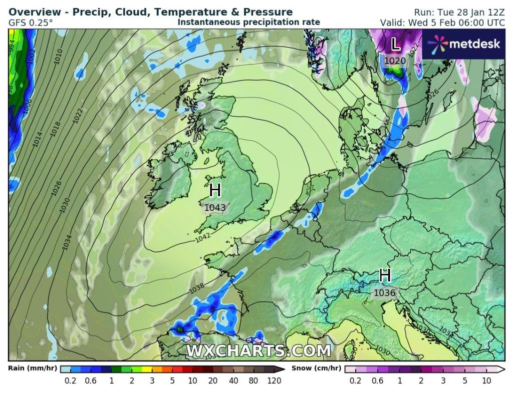
Not much happening over the coming days. A mixture of some reasonable days with bright or sunny spells and equally some cloudy days. The latter will be when weather-fronts are coming through the region but weakening all the while as it comes up against high pressure which will have developed over continental Europe. Nothing significantly cold, very snowy or very wet in the next 7 days.
Thursday: A widespread frost to start, although there’s a chance of some cloud bringing a light shower out west, then a decent day with sunny spells, perhaps turning hazy later. That sun is starting to get some warmth in it now and we should start to record UV levels very soon. Breezy later and cloud thickening overnight means another frost is unlikely. Max 7°C Min 1°C
A ridge of high pressure will bring a nice Thursday
Friday: Cloudy and breezy to start after rain during the early hours (wintry on the tops with the chance of a dusting of snow in places) eases away. Bright spells follow, eventually, and winds will ease. Still chilly but nothing particularly cold. Max 7°C Min 2°C
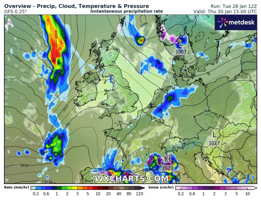
During the early hours of Friday, a weakening band of rain could give some snow on the highest routes.
Weekend:Mostly dry but risk of mist.
Saturday: A misty start and this could lift into low-cloud in places which will struggle to clear. Other places seeing bright spells. Dry. Max 7°C Min 3°C
Sunday: Cloudier but I’m hopeful it will be another dry day during daylight hours, with limited brightness even though a weather-front will come in from the west, it is likely to decay. Possible hill-drizzle towards evening. Temperatures similar. Max 7°C Min 2°C
High pressure, especially into next week to our east/southeast, will help to kill/decay advancing weather-fronts and keeping high rainfall amounts at bay.
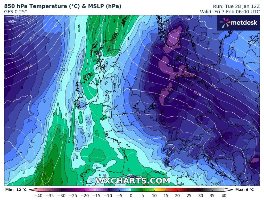
Outlook: Looks like high pressure will be the most dominant of weather but some weakening weather-fronts will sink southeast bringing patchy rain. No sign of anything significantly cold just yet but some models hint at an easterly as we enter the second week of February. Believe it when I see it.
Next week will see dry spells and some patchy rain. Just for fun but some models hint at much colder air from the east into February. An outlier for now but we always have our eyes on the east in February; just in case.
Follow @ChadWeather on X and Bluesky for the latest forecasts and warnings.
Thanks,
Jon
Forecast Issued: Wednesday the 29th of January 2025 at 4:41pm.
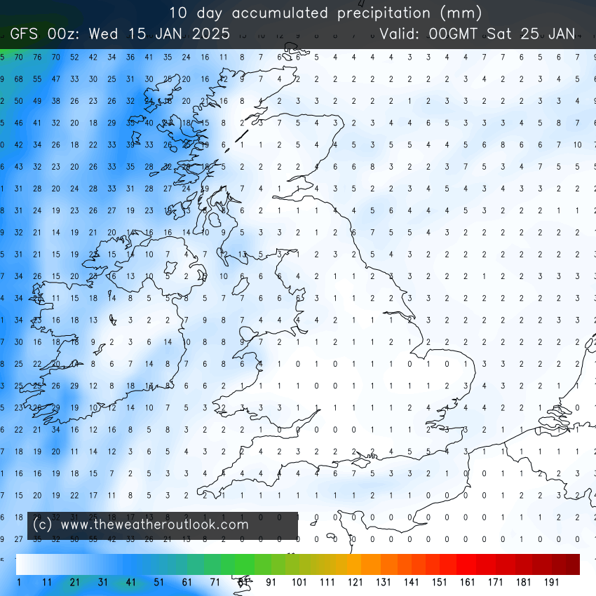
Since the deluge of New Year’s Eve/New Year’s Day and the 5th of the month, rainfall amounts over the past couple of weeks have been suppressed, but it’s not been exclusively dry and bright. We’ve seen many days cloudy, dull, foggy and damp with extensive drizzle and patchy rain. The weather hasn’t been that mobile over the past 10 days due to high pressure being close by, bringing benign conditions. With a more active Jet Stream on the way, we are set to see unsettled weather return from Thursday onwards and as some might say, ‘we are back to the norm’.
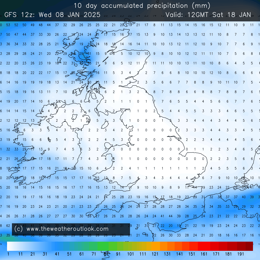
January 2025 so far. Some rain but overall totals are low over the last 2 weeks.
Thursday: Thursday will start bright and cold but cloud will soon thicken from the west and rain is expected from mid-morning and this will last into the afternoon, probably towards the evening in a few places. After a relatively calm start, it will be a windy afternoon with 40mph gusts, but remember this is not Storm Éowyn, as that will be coming on Friday. Max 7°C Min 3°C
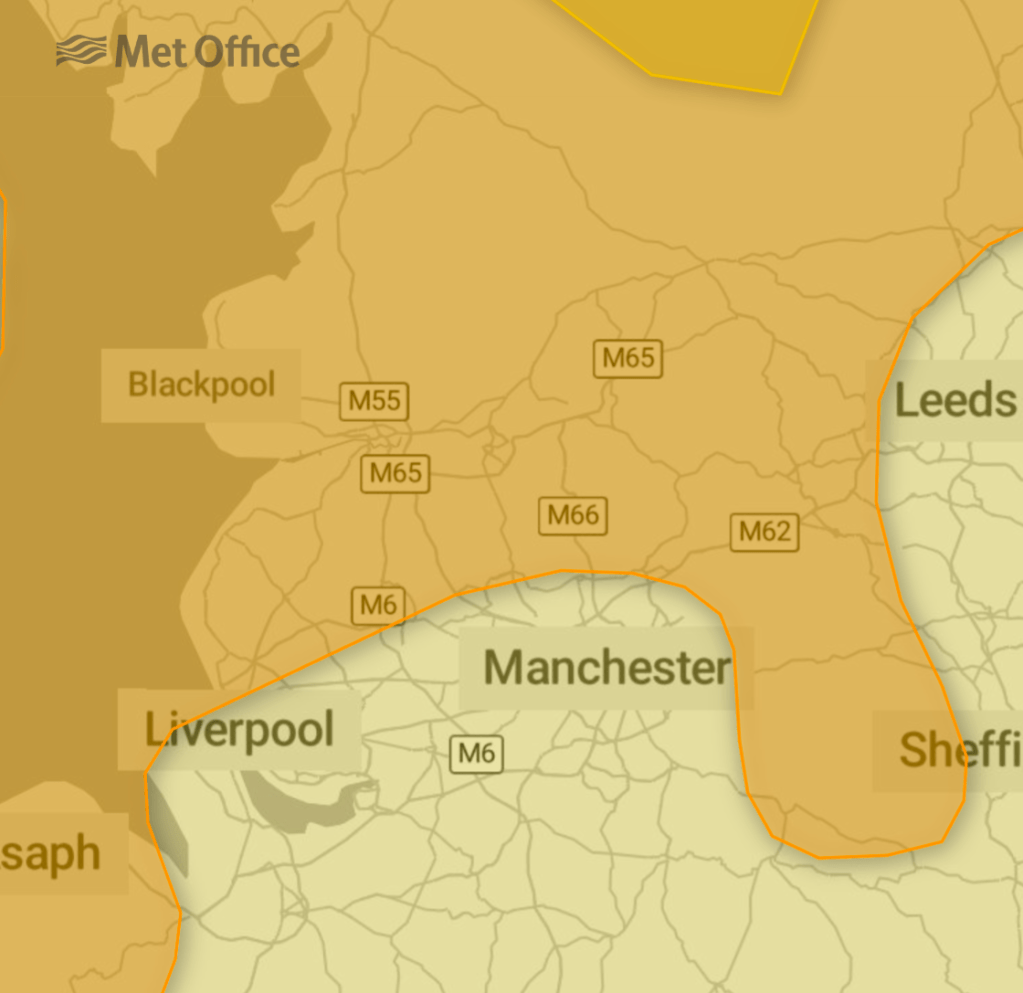
Yellow and amber warnings in place
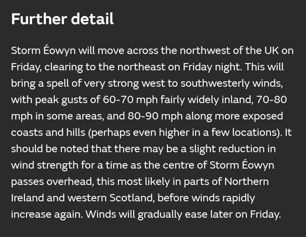
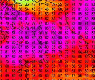
Friday: Most of the recent named-storms that we have had, have seen the strongest winds occur during nighttime, when most people are at home. This storm will bring the strongest winds during the daytime, which means disruption will be high across parts of the UK. Yes, we will mostly miss the worst of the winds but I’m still expecting gusts, widely, of 45-65mph and on coasts and hills in excess of 75 mph, locally higher.
Currently parts of the region are split into two warning areas. An amber warning and a yellow warning. I for one would certainly stay at home if I was in the amber warning area.
With it expected to be a wild day, if you can stay at home and don’t need to travel, then do so.
Parts of the UK most at risk are Northern Ireland, Southern Scotland and parts of North Wales, Northern England and the far North West of England. These areas could see gusts in excess of 80-90 mph. There will be people that need to travel or just ignore these warnings and unfortunately it would not surprise me to see some fatalities. The conditions are going to be so bad.
At the time of writing there has not been a red warning issued by the Met Office, but it would not surprise me if they do issue one. Take this storm seriously. It will be one of the strongest for many years for some areas, whereas other areas, nothing more than a typical winter storm.
This storm has been formed by the recent cold plunge in America, where cold air has met tropical air. The temperature gradient has kick-started the Jet Stream, which then picks up an area of low pressure out in the Atlantic and because it’s very active, top speeds of 250-265mph, the area of low pressure deepens rapidly, hence this powerful storm (winds of 120-140mph out to sea).
Aside from the wind, the weather won’t actually be too bad. Early rain clears to sunny spells and the odd shower. Winds drop off significantly into the night allowing a frost to form. Max 8°C Min 0°C
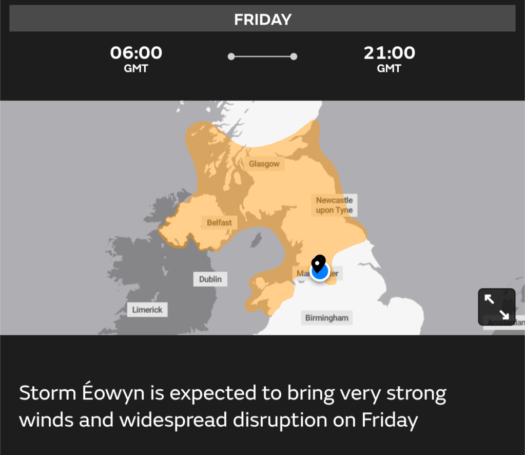
UKV Data Model: Winds gusts at midday across the region. High enough to cause disruption and damage.
ECMWF High-res Data Model: Animation of the storm and the maximum wind gusts.
Weekend: Saturday’s best.
Saturday: We have a bit of a respite with a ridge of high pressure, albeit brief on Saturday. This means it will start chilly with a frost in places, but then we should have a day of sunny spells and dry conditions and it will be much calmer with lighter winds compared to Friday. Cloud increasing later into the evening. Max 6°C Min 1°C
Sunday: Hopefully a dry start and we might squeeze out most of the morning dry but cloud will thicken from the west again, as another area of low pressure arrives. Rain is expected into the afternoon and evening and winds will increase again, nothing like Friday, but 40mph gusts are still possible. Feeling cold, especially with the wind but turning slightly milder overnight. Max 7°CMin 5°C
Outlook: Remaining unsettled with spells of cloud, wind and rain. Temperatures around average so feeling particularly chilly when windy and some cool nights, but not many frosts are expected due to the cloud cover and breeze. Any good news I hear you say? Hopefully by next weekend there are signs that the weather may settle down again, so fingers crossed! No sign of anything significantly cold or snowy.
Follow @ChadWeather on X and Bluesky for the latest forecasts and warnings.
Thanks,
Jon
Forecast issued on Wednesday the 22nd of January 2025 at 4:10pm.
High pressure is close by this week, so controlling our weather, but with light winds and at this time of the year this can bring stubborn cloud or fog but also depending on your position relevant to the high, sunny spells.
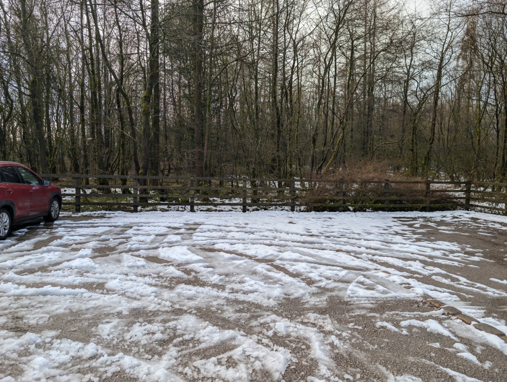
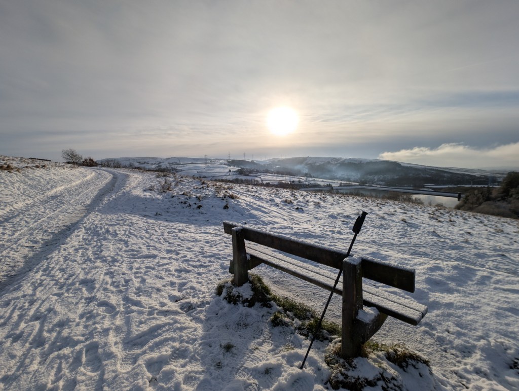
Snow still remains thawing on higher ground today
The weather has settled down recently after a lengthy cold and snowy spell. It will snow again this winter no doubt and be very cold but I bet we don’t see a week of cold and snow again this winter, even though the long range weather models are predicting a very cold spell. Those spells seem to be getting more rare these days.
For the here and now, more fog has been around these past 24-36 hours but this should shift as the breeze picks up and drier air arrives. And, with the stubborn cloud to our southeast and rain-bearing clouds to our far northwest; it looks like we will see some decent sunny spells for a day or two. Enjoy it if you manage to get out and about.
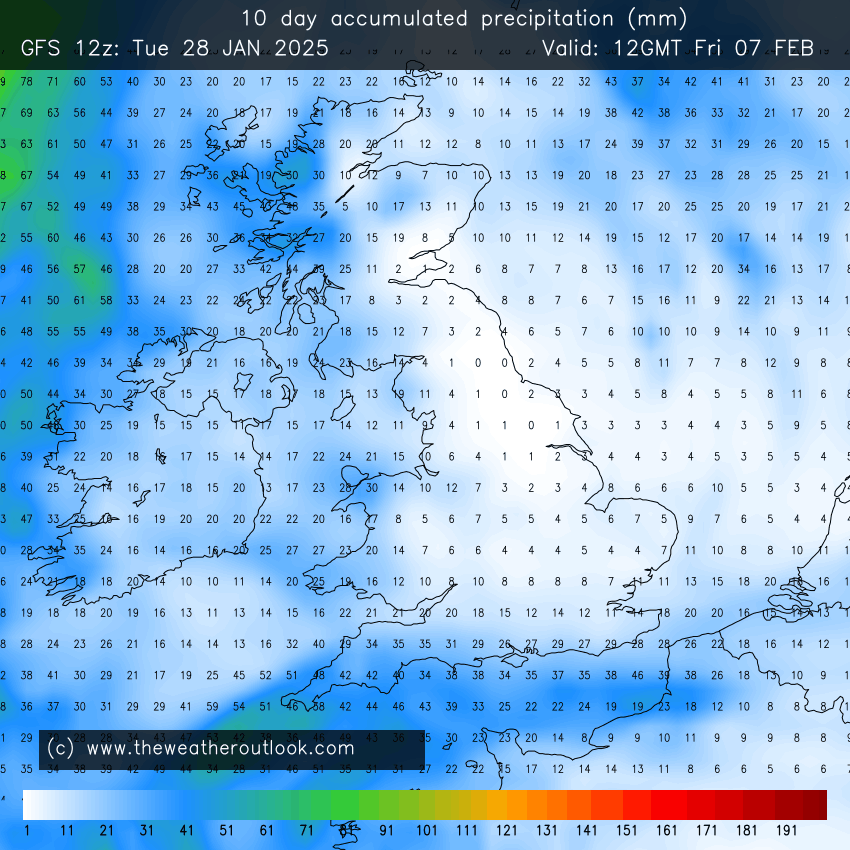
Low rainfall amounts over the next 10 days
Thursday: A cold start with a widespread ground-frost and an air-frost in places. Plenty of mid-winter sunny spells on offer and feeling pleasant in the sun. Cloud will increase into the evening and the southerly breeze will pick up so the night will be frost-free. Max 7°C Min 3°C
Friday: Looks like a mostly cloudy day with some breaks. Clear spells overnight leading to a cold one. Max 8°C Min 1°C
Weekend:Colder.
Saturday: We drag in colder air from the near continent. After a cloudy start sunny spells should break through. Breezy. Max 5°C Min 0°C
Sunday: A few bright spells for the morning but the general thinking is that a weakening weather-front moves in from the west with very little or no rain on it at all. Cold. Max 4°C Min 1°C
Mild across most of Europe next week so no sign of anything significantly colder within the more reliable timeframe
Outlook: After that weak weather-front decays another high pressure builds in, so a bit of a repeat of what we are seeing this week. Plenty of dry conditions, some bright spells but some low-cloud coupled with foggy days can’t be ruled out. Towards the end of the week it currently looks favourable for the Atlantic to return, so spells of wind and rain. Of course this far out, nothing is certain and some models go the opposite with much colder air filtering in from the east. The battle of mild vs. cold could well be on.
Another high pressure close by next week
Thanks for reading and follow @ChadWeather on X and Bluesky for the latest forecasts and warnings.
Thanks,
Jon
Forecast Issued: Wednesday the 15th of January 2025 at 10:50am.
Hello. My weekly blog is back after a 2-week break over the Christmas period. I hope you all had a great holiday and I wish you all the best for 2025.
It’s been an eventful 2 weeks with heavy and persistent rain on New Year’s Eve and New Year’s Day. I recorded the most rainfall ever in a 24-hour period. In fact, 68mm of rain fell in just 18 hours, bringing horrendous flooding to parts of the region.
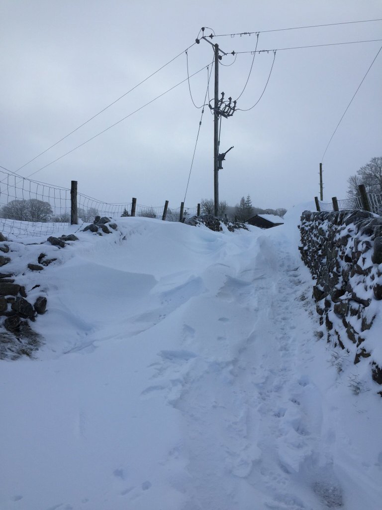
More recently the weather has turned much colder and we are now into our fifth day of lying snow in some places. It’s not often these days that we get snow, let alone see snow falling day-after-day. And I can’t remember the last time that Manchester airport had delays for three days in a row for snow on the runway.
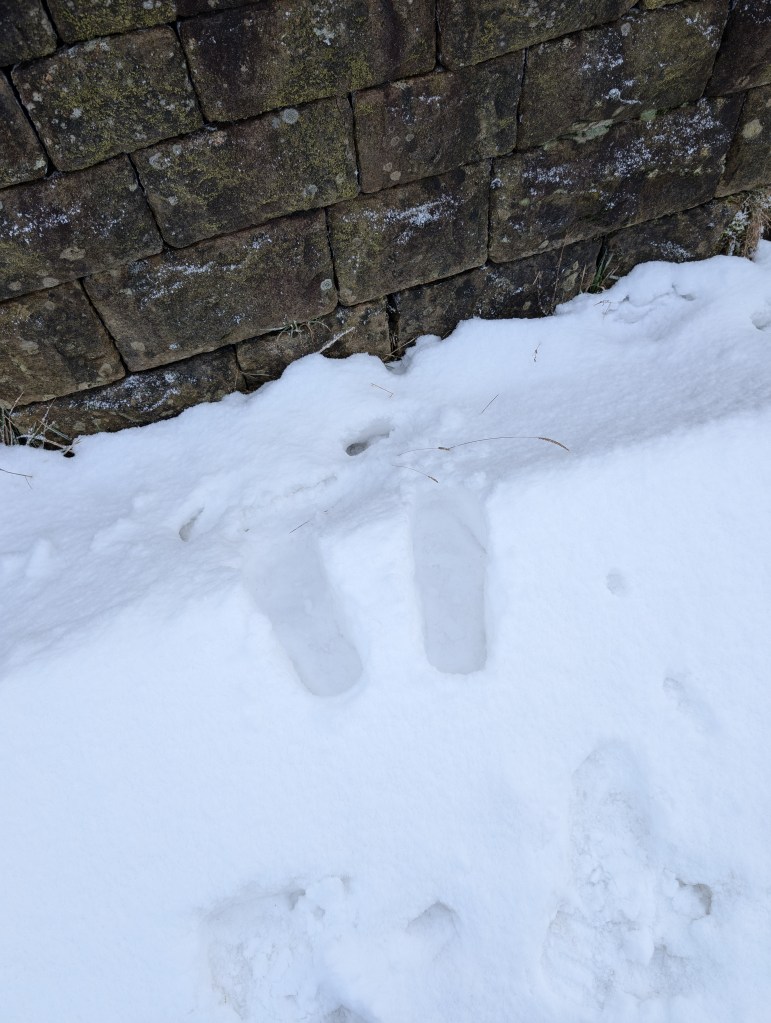
The first initial snowfall was accompanied by some strong winds which led to drifting on the hills where depths were recorded of 1-2ft. Normally, when we get a warning for snow, which in this case was not just a yellow warning but an amber warning; a lot of us expect it to be a false alarm, especially on low ground where normally it’s rain or sleet that arrives. But this time even lower ground managed to get some snow with several inches in places. Here in Chadderton I managed 2.5 inches (6cm) and enjoyed Sunday morning out sledging.
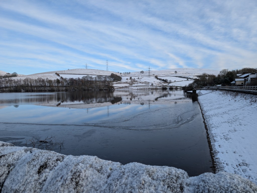
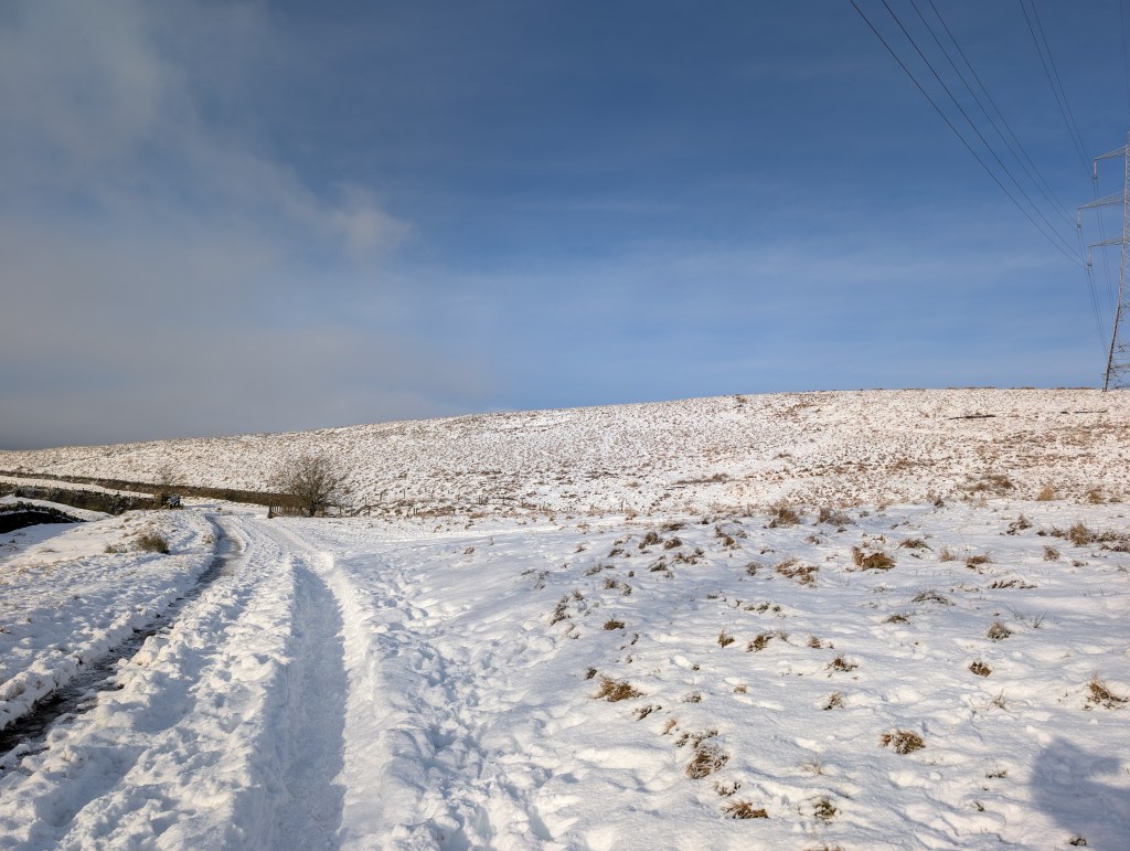
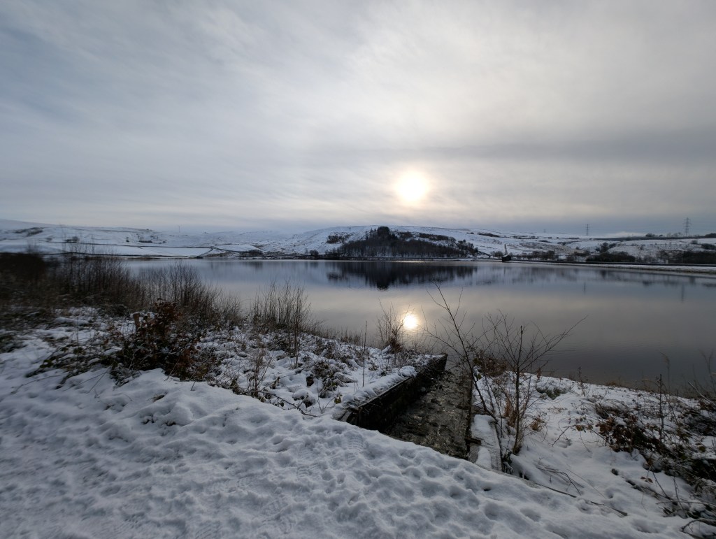
I hate the cold when it’s wet but I love the cold when it’s sunny and especially when we have some snow. So I’ve enjoyed the last few days and I managed to get out and about on Wednesday to Ogden reservoirs and the scenery was stunning.
So, when will the cold go?
It is set to remain cold until into the weekend. With clearing skies over the next couple of nights, temperatures will plummet and because we have snow-cover in some areas, this will help to lower the temperature further and I would not be surprised to see rurally in the hills, -10°C and in Northern England or Scotland a low between -15°C and -20°C.
Snow has fallen over several days since Saturday night
Thursday: A harsh frost to start with plenty of ice. There could also be the odd freezing fog patch. Hopefully, once cleared, it should be a nice day with plenty of sunshine, albeit a bit hazy. There will be some wintry showers but these should be way out to the west. Temperatures struggling to get above freezing and after dark another severe frost will set in and temperatures could get close to negative double-figures rurally and where we have snow-cover. Max 1°C Min -9°C
Friday: Dry with hazy bright or sunny spells after a very cold start. Cloud will thicken later but it should remain dry with another frost overnight but not as cold as recently due to more in the way of cloud. Max 2°C Min -3°C
Weekend: Slowly but surely milder air will start to push the cold away into the continent.
Milder air will start out to the southwest of the UK as we enter the weekend and then eventually push across the whole of the country bringing a thaw.
Saturday: A slight frost to start and then it should be a mostly cloudy day making it feel cold with limited bright spells. There is a weather-front moving in from the west slowly, which is going to bring milder air and initially this might have some light sleet and snow on it. But at this stage this is expected to decay as it pushes into the region so not much in the way of precipitation is expected. The breeze will pick up which will make it feel colder than what it is but still a chilly day overall. Max 3°C Min -1°C
Sunday: Sunday looks like the day of change but the majority of the day should still be cold and cloudy. Winds will pick up later in the day and will eventually switch to a milder southwesterly direction. Chilly especially in the wind, but overnight temperatures will start to rise as milder air pushes in from the Atlantic. Max 4°C Min 3°C
Outlook: Much milder with temperatures returning close to double figures. The first part of the week is expected to be cloudy. Perhaps thick enough for drizzle at times but a lot of dry weather and the second half of the week should see more in the way of sunshine. Snow is not expected. In fact not much rain is expected either with a lot of dry weather due to high pressure being in charge.
Even with milder air arriving next week; not much rain is expected. We could certainly do with a dry spell once this snow thaws out.
Follow @ChadWeather on X and Bluesky for the latest forecasts and warnings.
Thanks,
Jon
Forecast Issued: Wednesday the 8th of January 2025 at 6:08pm.