Some welcome sunshine for a change – Thursday 27th February 2025 – Sunday 2nd March 2025

Hi all,

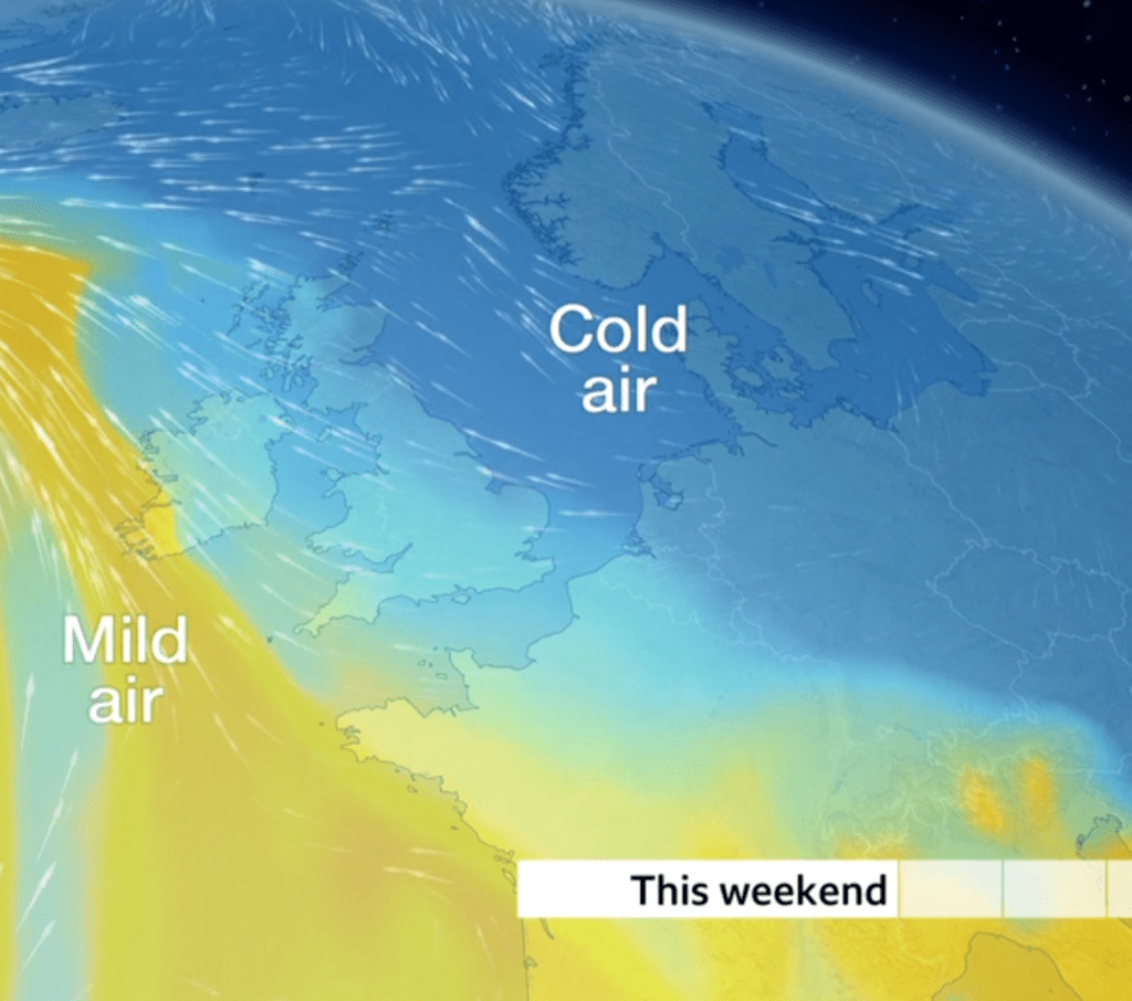
Meteorologically-speaking winter comes to a close this week, but we all know that a cool start to Spring is nothing unusual. And the outlook suggests as such. There will be some welcome sunshine over the coming days with high pressure in charge and winds lighter than recently. There could well be some stubborn mist and fog which will keep areas cold, whereas areas with sunshine, will really start to feel some strengthen in that sun now.

Very little rain over the next 5 days

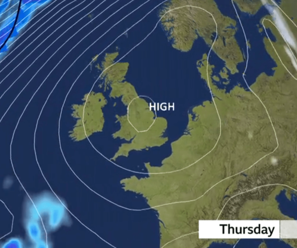
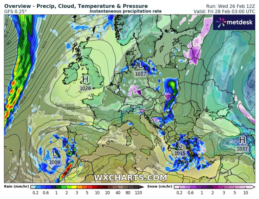
Thursday: High pressure will start to build from the southwest. This means a better day in prospect with sunny spells and any early showers will decay. It will be quite breezy into the afternoon, but winds will fall light overnight. Cold overnight under clear skies which should be good for seeing the 7-planet alignment. It will also mean some areas of fog will develop and we will have a frost. Max 9°C Min -1°C

Friday: The high pressure will now establish itself across the region and with light winds the fog to start could be stubborn to clear in places but when it does clear or if you start the day without the fog, it should be a lovely day with plenty of sunny spells and just some fair-weather cloud bubbling up. Light winds and pleasant if you manage to get out and about in the sunshine. Another chilly night ahead with areas of mist and fog with a patchy frost. Max 9°C Min 0°C

High pressure to end this working week

Weekend: High pressure in control of the weather.

Saturday: The high pressure will drift a little bit further to the south which will allow a bit more in the way of cloud at times, but we should still see some sunny spells and it will be dry with slight frost to start. Light winds. Not as cold overnight. Max 9°C Min 2°C

Sunday: it should be another dry day but cloud amounts will start to increase as we see more of a westerly airflow across the region. So we can expect bright spells with some thicker cloud at times which just might be thick enough for a bit of drizzle on the hills later in the day. Breezy later and no frost expected overnight. Max 10°C Min 4°C

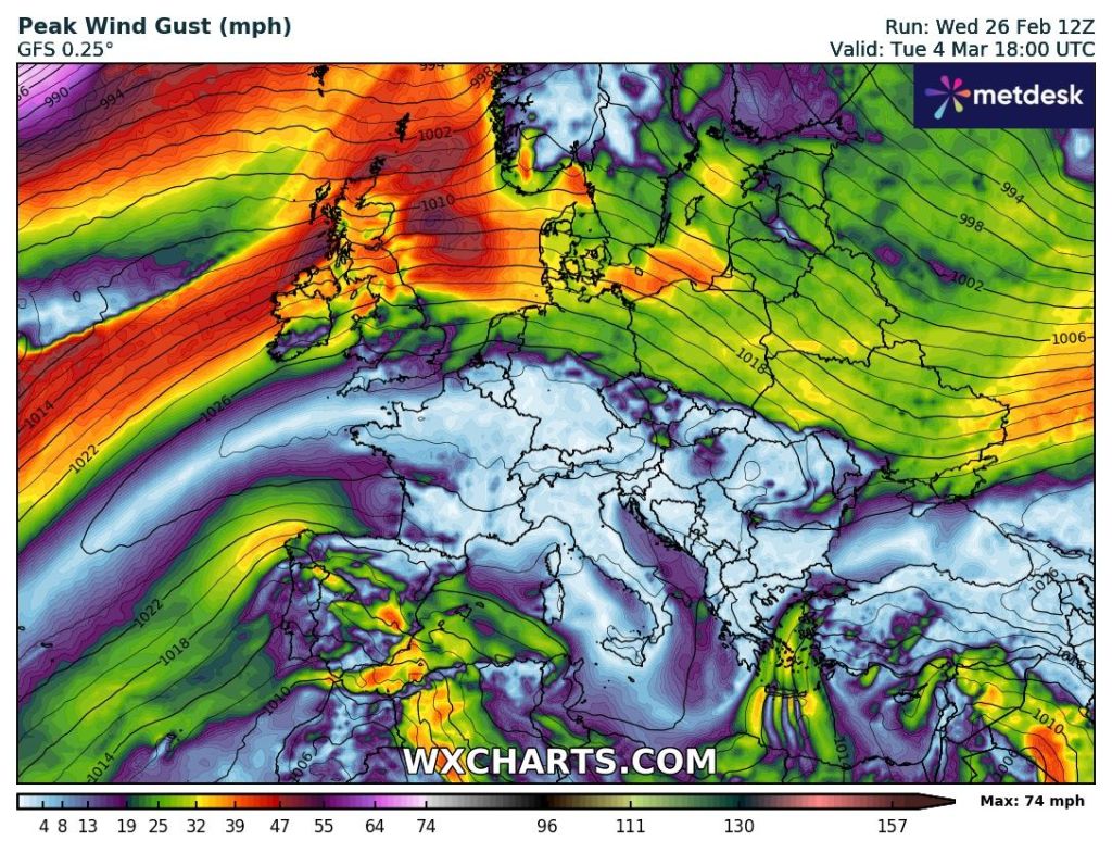
Outlook: The high pressure that will have brought us the recent settled spell, will now start to slip even further south into France. This means winds will come in off the Atlantic and with a squeeze in the isobars, it will turn quite windy into Monday and Tuesday. This will also bring more in the way of cloud with the odd shower possible but equally some bright spells in between.

More of a westerly wind to start next week as the high slips south

At this stage, midweek does look quite promising with the cloud breaking up, allowing for some decent spells of sunshine, but this far out, as always, don’t hold your breath. Later in the week we could see a return to unsettled weather from the southwest. But one thing for sure, next week shows no sign of any significant cold to start Spring or any significant warmth with temperatures just hovering around average and no storms expected.

Follow @ChadWeather on X and Bluesky for the latest forecasts and warnings.

Thanks,

Jon

Forecast Issued: Wednesday the 26th of February 2025 at 6pm.

Images: http://www.wxcharts.com

Much milder but with occasional wind and rain. Cooler into next week – Thursday 20th February 2025 – Sunday 23rd February 2025

Hi all,

After the events of this week, it’s just a short blog with some quick highlights of the coming week’s weather.

I’ll try and do a few more posts on X and Bluesky to keep you updated on the change to more unsettled weather but milder conditions.

Temperatures well-above average on Thursday & Friday

I bet most are glad it’s turning less cold, and that the biting wind is going. Looks like Thursday and Friday will see temperatures reach values that we’ve not seen for two months. Who’s ready for Spring? I know I am.

Thursday: Much milder air has arrived and with it some strong and gusty winds at times. We will see some bands of showery rain move through, with the chance of some thunder & lightning. Later in the day brighter skies and a few showers will come in from the southwest. Very mild but the edge taken off the temperatures due to the strength of the wind. Max 14°C Min 9°C Max Gusts 35-40mph

Bands of showery rain on Thursday with a risk of thunder and lightning

Friday: Similar with rain at times, some heavy after a bright start. Very windy with a strong southerly. Mild once again but cooler overnight. Max 13°C Min 6°C Max Gusts 40-45mph

Very windy on Friday

Weekend: Saturday looks best.

Saturday: A brief ridge of high pressure will give a better day. Sunny spells, odd shower and not as windy. Max 11°C Min 6°C Max Gusts 20mph

Sunday: Another weather-front with strong winds and periods of rain. Max 11°C Min 6°C Max Gusts 40-45mph

Outlook: Cooler and still unsettled with bright spells and showers. Occasionally windy.

Cooler next week

Follow @ChadWeather on X and Bluesky for the latest forecasts and warnings.

Thanks,

Jon

Forecast Issued: Wednesday 19th February 2025 at 8:47pm

Images: http://www.wxcharts.com

When will this dank and benign weather end – Thursday 13th February 2025 – Sunday 16th February 2025

Hi all,

High pressure to our east has been stubborn and with its positioning, has fed in biting but not significantly cold, easterly and northeasterly winds. Not only has this brought extensive cloud, and hill-fog, but also bouts of mizzle and on the very highest routes, some wet-snow. All-in-all it’s been a miserable week or so.

So when will all this doom and gloom end? Good question. Over the next couple of days we should start to see more in the way of drier weather compared to seeing drizzle, but I’m still expecting a lot of cloud. With the wind changing direction to a southeasterly introducing slightly drier air, there’s a good chance that the cloud will thin and break in places, so some bright spells will sneak through. This means overnight where we do have some clear spells, especially in the west, there’s likely to be some frost. Daytime temperatures are going to remain chilly but should start to pick up next week.

When I say should, this is down to what happens with the weather pattern next week. Different computer models were suggesting different outcomes. For example, high pressure that’s been blocking to our east and northeast over the past week stays firm, meaning we stay in a similar pattern, whereas in other scenarios the high is shunted away to the east and the Atlantic weather systems start to make their way onto our shores once again. In this case we will be switching the wind to a more southwesterly direction and hence increasing the temperature close to double-figures. With the Atlantic back in the game we could well see some spells of wind and rain.

So, uncertainty next week but for now, slow changes.

Remaining cold this weekend. Image BBC Weather.

Thursday: After a cloudy start I’m hopeful, especially the further west you are, that some sunny spells will break through. Dry but a cold wind, still from the east. Patchy frost where clear skies appear overnight. Max 5°C Min -1°C

Friday: Wind swinging a little southeasterly but still cold and brisk. Cloudy with some breaks but dry. We’ve not seen much rainfall this month despite the lack of sunshine. Max 5°C Min 1°C

Weekend: Little change.

Saturday: It’s likely to be a little cloudier with bright spells limited. The cloud could be thick enough at times in the east to produce some drizzle once again. Feeling cold. Max 4°C Min 1°C

Sunday: Very similar conditions expected. Max 5°C Min 1°C

Outlook: Uncertain. Slightly more favourable now that it will slowly turn milder with the cold staying away in eastern Europe and no big freeze expected. There’s a good chance that we will see temperatures back into double-digits.

A switch to milder southwesterly air is now favourable for next week

Follow @ChadWeather on X and Bluesky for the latest forecasts and warnings.

Thanks,

Jon

Forecast Issued: Wednesday the 12th of February 2025 at 4:22pm.

Images: BBC Weather & http://www.wxcharts.com

Colder air is on the way but plenty of dry and at times, cloudy conditions – Thursday 6th February 2025 – Sunday 9th February 2025

Hi all,

January was quite a cold month and wet with 108mm of rain. The overall average temperature was +3.1°C. We managed a high of 11.0°C (16th). By contrast we pretty much saw temperatures at zero or below, overnight, on the first 12 days of the month.

One thing to note about the 108mm of rain is: most of this fell over 3 days. 30.2mm (1st), 27mm (5th), and 13mm (27th). So realistically January had plenty of dry days. In fact 9 days dry and a further 9 days with <= 1mm of rain.

We also saw some snow which caused disruption at Manchester airport, 4 days out of 5. And enough snow for me to enjoy some sledging.

January 2025 Stats

February has started with rain falling on 4 out of the first 5 days but drier days are ahead; but colder. How cold? Read on for the full outlook.

Thursday: It’ll be a frosty start with perhaps a few mist patches and once these are clear, it’ll be a lovely winter’s day with plenty of sunshine and light winds. Another frost overnight with a higher risk of mist or fog forming. Max 7°C Min -1°C

Hello High. Plenty of sunshine on Thursday. In fact that will be 3 nice Thursdays in a row. Image: BBC Weather

Friday: Another cold start with fog in places and a frost once again, albeit not as cold as Thursday. The mist might lift into low-cloud in places and be a bit stubborn to clear, but once it does another day of bright or sunny spells, variable cloud and feeling just a little cooler. Cold wind. Max 6°C Min -1°C

Weekend: Colder air from the east.

Saturday: It’s likely to be a cloudier start which will take some shifting, but eventually, especially west of high ground, some sunny spells will break through. Another dry day with the temperature coming down a notch and not windy. Max 5°C Min 0°C

Sunday: A patchy frost to start where areas have seen some clear spells overnight. Otherwise, the easterly flow has dragged in some cloud. So a cloudier day is expected and feeling colder due to the lack of brightness. Any sunshine is likely to be in the west and southwest. But at least it’s dry with just the outside chance of some snow flurries where cloud is thickest. Max 5°C Min 0°C

Outlook: There’s been a lot of talk about significant cold coming from Russia. Even though we start the week with an easterly feed and temperatures below average, the weather is expected to stay in a similar pattern with similar temperatures for the remainder of the week and a lot of dry conditions. There just might be the odd shower drifting in from the east which could be wintry but there will also be a notable wind-chill.

A noticeable wind-chill next week

It’s a long way off at the moment, but the models were hinting, earlier this week, that some significant cold was coming from the east, as we head towards next weekend, but yesterday the models did a U-turn. This could chop and change over the coming days. But at this stage and so far out, deep-cold is favouring a no-go. So stay tuned to my updates on social media. Of course the media have already got a hold of this, so you’re bound to see over the top sensational headlines in the tabloids.

For next weekend the current thinking is that the deep-cold will not make it westward to our shores.

Follow @Chadweather on X for the latest forecasts and warnings.

Thanks,

Jon

Forecast Issued: Wednesday the 5th of February 2025 at 5pm.

Images: http://www.wxcharts.com & BBC Weather.