Hi all,
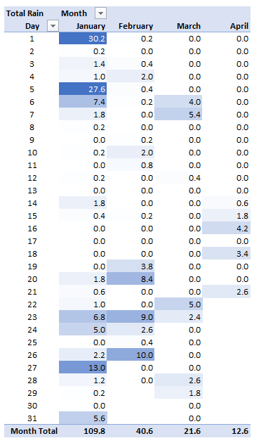
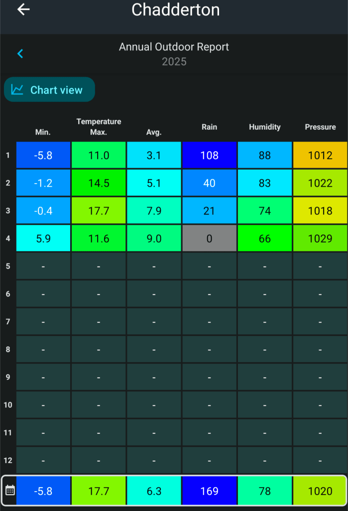
We’ve had more decent weather this week. It really has been a good spring so far and very dry. We are well-below average rainfall since the start of February.
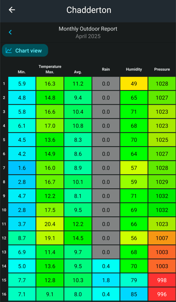
The last day of April saw my warmest April day on record. My data goes back to 2013. The max was 25.9°C recorded at 4:49pm.
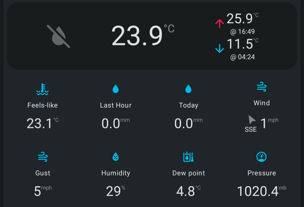
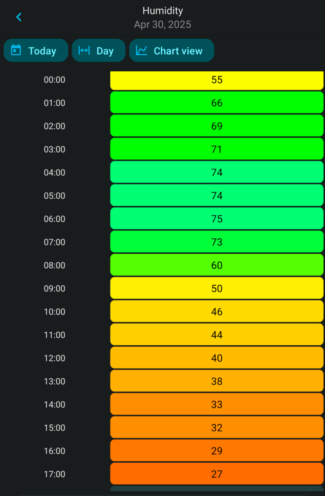
Humidity levels have been low too. Perfect drying weather.
For the NW of England it’s been the driest Feb-Apr period since 1938. Thanks to @kevirlam on X for this stat.
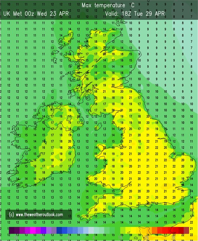
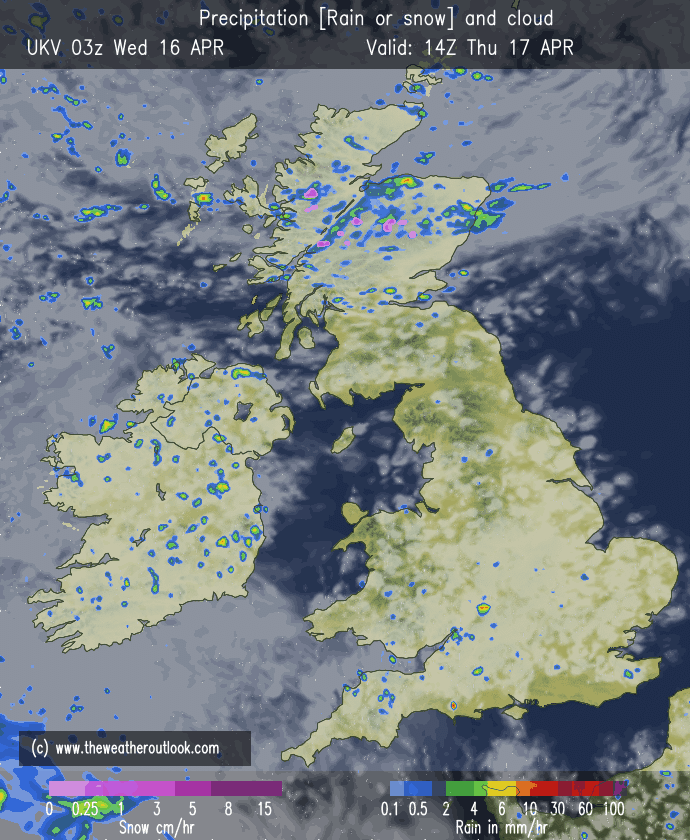
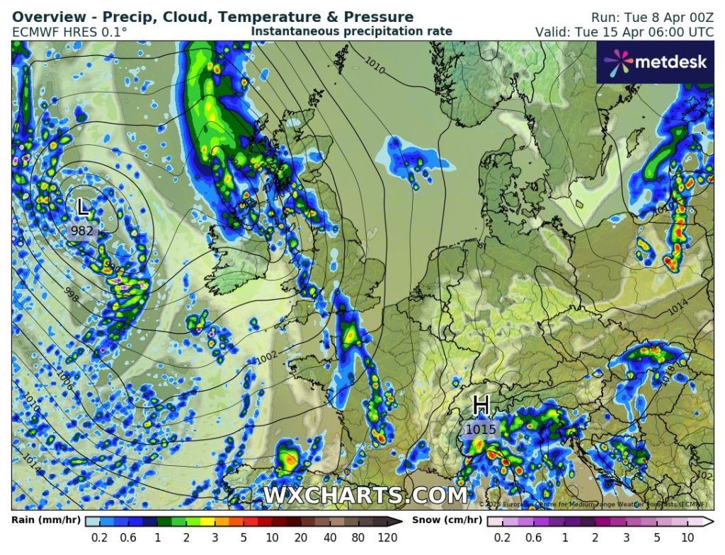
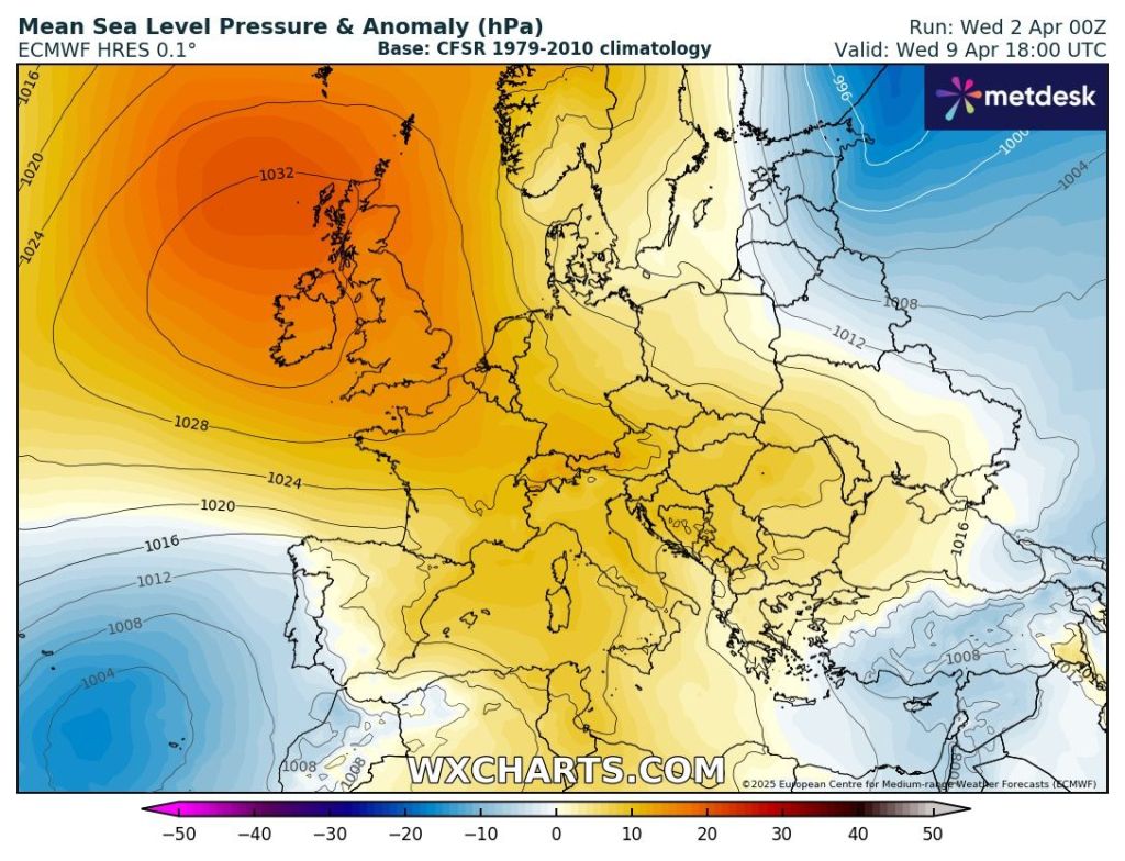
Thursday: Hot, with sunny spells and feeling more humid. It will be the last summer-like temperatures of this week as temperatures will cool off as a weakening cold-front comes down from the northwest. There will also be another weather-front to the south of the UK. So, the air will be a little bit more unstable on Thursday and with the heat there is just a chance (15%) that we see some isolated showers breaking out which could be locally heavy and thundery. Currently this is more likely to happen to the south of our region. Max 26°C Min 8°C
Friday: It looks like we’ll be in the middle of decaying weather-fronts, so a dry day is expected with plenty of sunny spells. Cooler than recently which some of you will be thankful for and dry. Cool overnight. Max 20°C Min 6°C
Long Weekend: Question marks over the bank holiday.
Saturday: Looks like a decent day with bright spells, dry and light winds. Temperatures still above average so feeling pleasant out there but a cool wind developing later. Cold night. Max 19°C Min 4°C
Sunday: Some uncertainty but it looks like a pool of colder air will drift in from the north/northeast with some thicker cloud making it feel chilly. Western areas could well hang on to some sunshine and temperatures warmer here. Winds will be gusty. Max 12-16°C Min 5°C Max Gusts 25mph

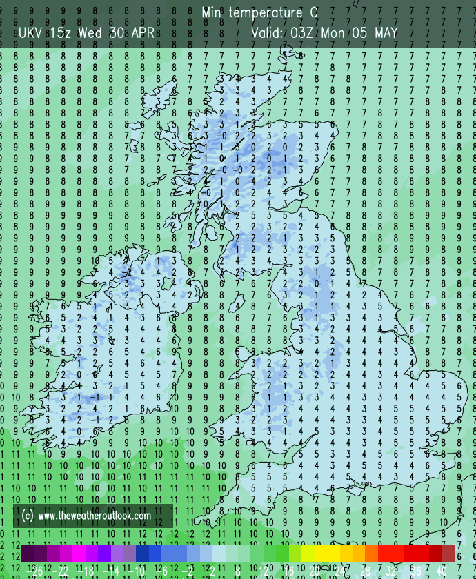
Bank Holiday Monday: Looks chilly with cloud dragged in on a cold wind from the northeast. Should remain dry. Warmer to the sheltered west/southwest. Cold night. Max 13°C Min 3°C
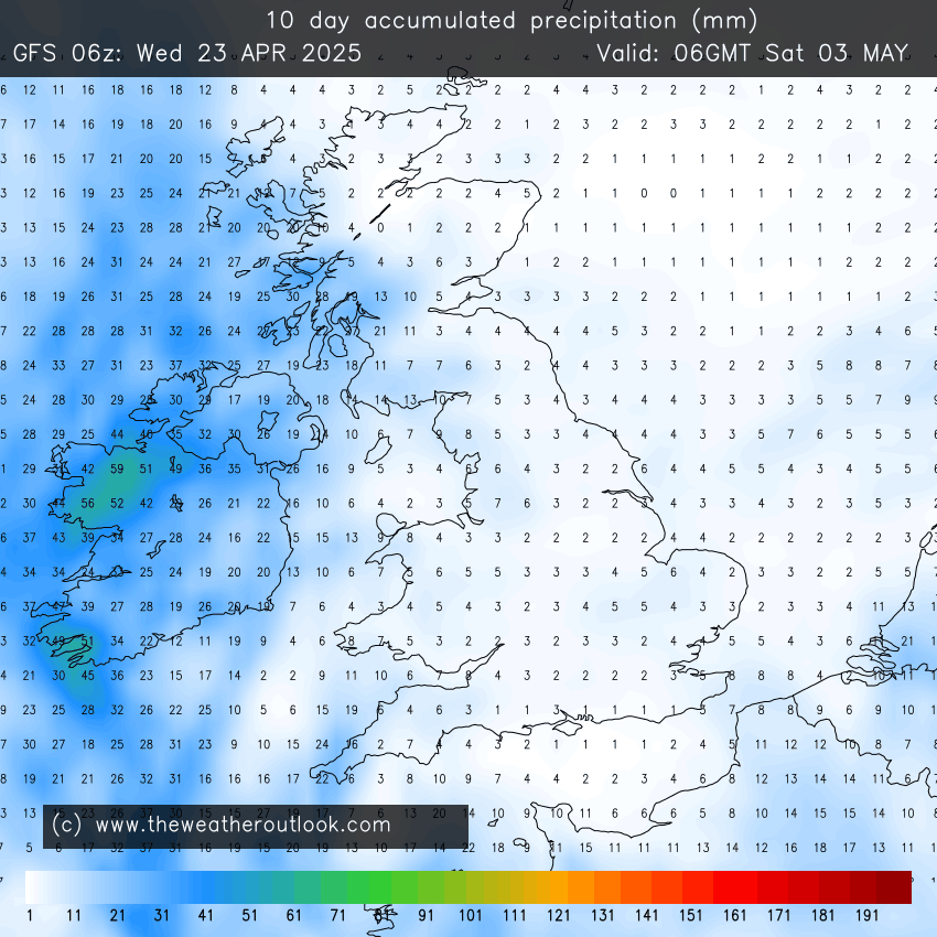
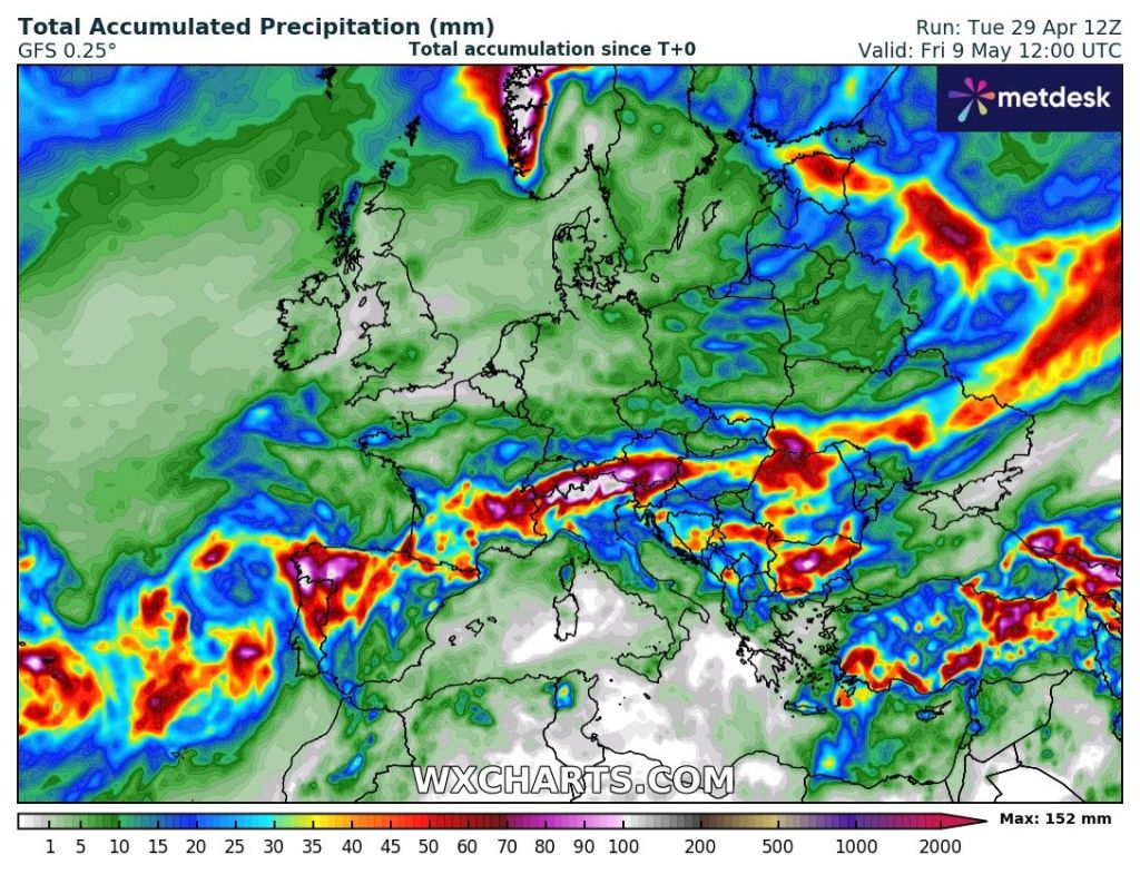
Outlook: A lot of dry weather and temperatures slowly recovering. Days of bright or sunny spells. The wait for unsettled weather with plenty of rain goes on.
Follow @ChadWeather on X and Bluesky for the latest forecasts and warnings.
Thanks,
Jon
Forecast Issued: Wednesday the 30th of April 2025 at 8:35pm.
Images: http://www.wxcharts.com & http://www.theweatheroutlook.com