Hi all,
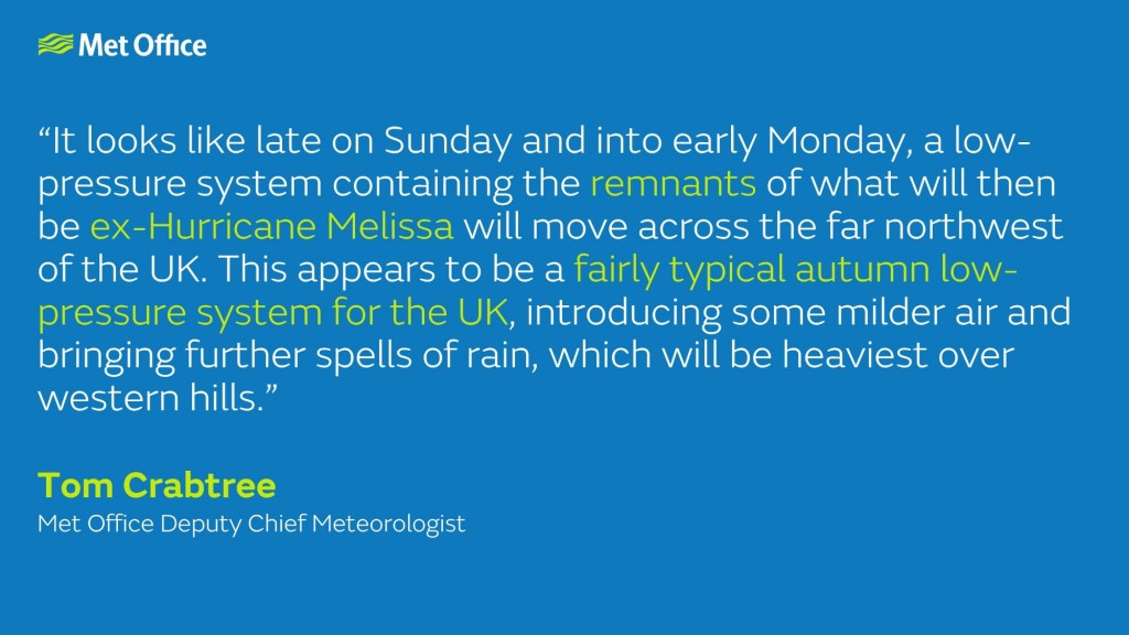
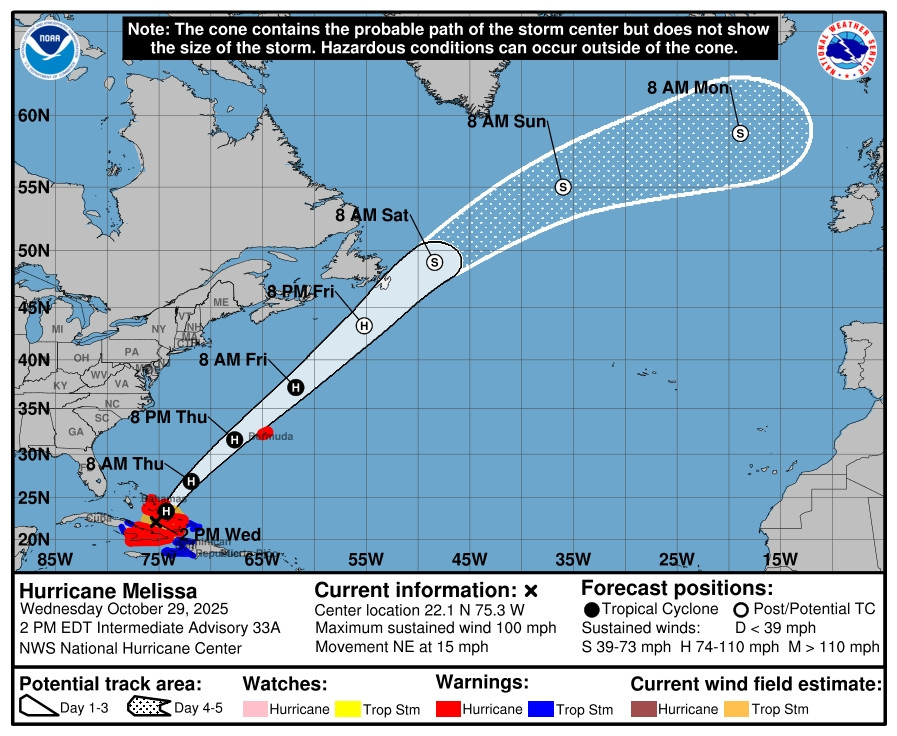
The unsettled theme will continue over the coming days. Ex-hurricane Melissa will affect the Jet Stream next week (no doubt the media will pick up on this). No sign of any wintry weather, just mild at times and wet spells for the foreseeable.
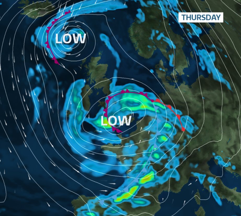
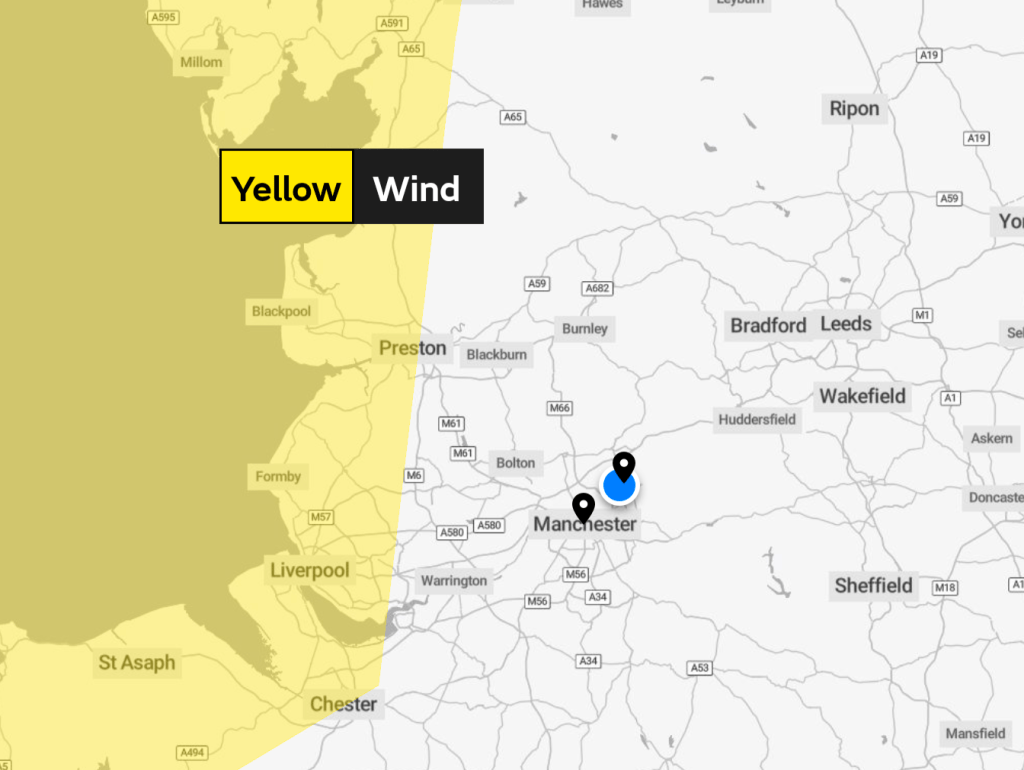
Thursday: A chilly start with perhaps a few localised areas of mist and fog and ground-frost. It should be a decent day for most of it, but cloud will thicken into the afternoon and evening after a morning of sunny spells. Rain will arrive before the end of the day and also into the evening. It will become quite windy and also be turning milder. Max 11°C Min 9°C Max Gusts 30mph
Friday: Rain will have gone through the region overnight, always a bonus to have rain overnight rather than during the daytime. That said, there will be a few showers around as well as sunny spells. These showers more likely later in the day spreading up from the southwest with the odd heavy one and perhaps a rumble of thunder. Winds now coming from a warmer direction. Max 15°C Min 8°C Max Gusts 25mph
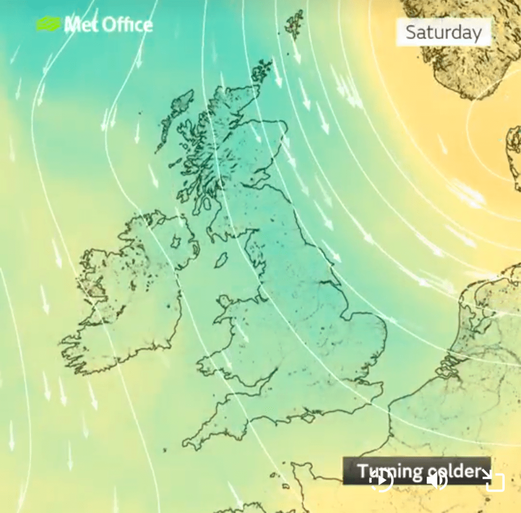
Weekend: Cooler with rain or showers to dodge.
Saturday: There’s likely to be some rain around during the morning which will turn showery into the afternoon. It will tend to be drier during the evening if you’re heading to a local bonfire, but I cannot rule out showers continuing into the evening. Cooler. Max 11°C Min 6°C Max Gusts 30mph
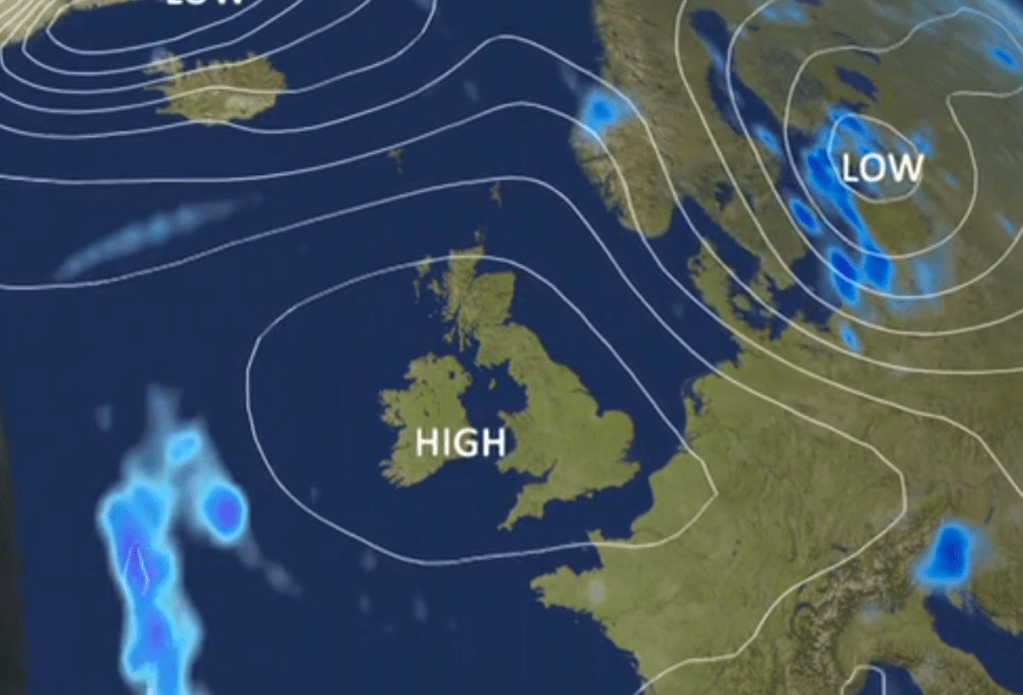
Sunday: Sunday looks a better day, bright spells and a bit of a lull from recent days. So not as windy but still breezy and just a shower or two. Max 10°C Min 6°C Max Gusts 20mph
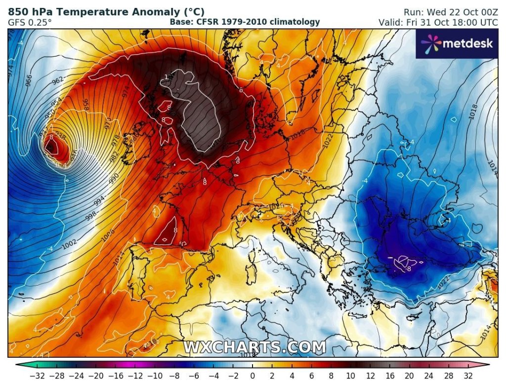
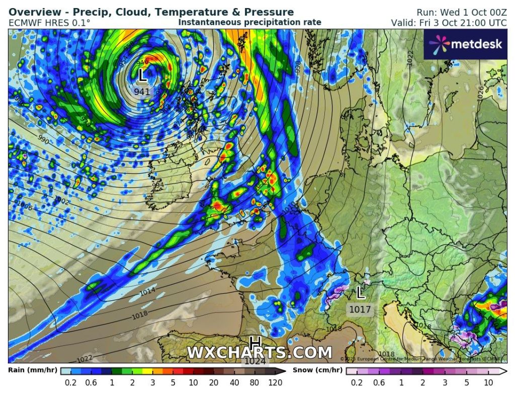
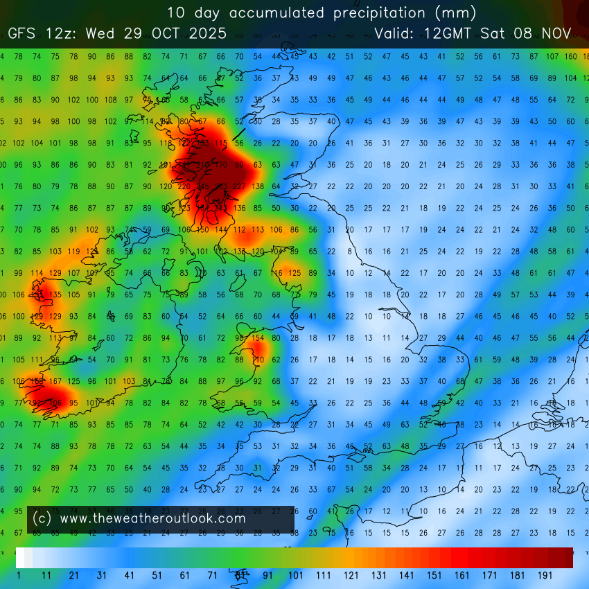
Outlook: Unfortunately, it does look like the Jet Stream will remain active next week so we can expect a mixture of unsettled conditions with rain at times and a few areas of low pressure bringing this rain and wind. But also, a few calmer spells in between with bright spells and a few showers. So similar to what we’ve had over the last 2 weeks. The remnants of ex-hurricane Melissa will get picked up by the Jet Stream and this will develop into a low pressure system coming in from the west, but at this stage it looks likely to track towards Iceland and northwest Scotland early in the week.
Follow @ChadWeather on X and Bluesky for the latest forecasts and warnings.
Thanks,
Jon
Forecast Issued: Wednesday the 29th of October 2025 at 6:43pm
Images: http://www.theweatheroutlook.com, Met Office and the National Hurricane Center.