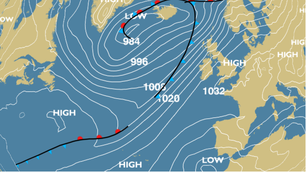
Thursday 5th November 2015 – Sunday 8th November 2015

Hi all,

November? Already? WOW! Where has 2015 gone? One thing for certain, it doesn’t feel like November out there. It’s been very mild but is that trend set to continue?

Thursday will start cloudy and mild with some hill-fog. Mainly dry for most of the morning apart from localised showers then rain, heavy at times spreads up from the southwest as we approach midday. A very wet and breezy afternoon. For the evening bonfires the rain looks set to clear around 7pm but with some drizzle to follow. Mild. Max 15°C.

Another band of rain whizzes across the region on Friday with showers following on behind. Again very mild and windy at times. The evening is looking a little bit drier so a better night for a bonfire and fireworks. Max 15°C.

The weekend will start lively with no let up in the weather steaming in from the Atlantic.

Saturday gives another repeat performance. Heavy rain and windy weather spreads in from the southwest followed by blustery showers. There is some uncertainty about the timing and exact position of the strongest winds but it’s very possible that we could see gusts to 40-50mph so stay tuned to Twitter for updates. Hopefully the winds ease slightly into the evening. Another mild one but feeling cooler because of the wind. Max 15°C.

A better morning is expected on Sunday with lighter winds and a mainly dry picture. However it looks all change again into the afternoon with strong winds and rain racing in. A little cooler with bright spells. Max 13°C.

Looking ahead and next week remains unsettled with further spells of wind, possible gales especially on Monday, and further rain. The mild weather holds on before slowly becoming cooler.

For the very latest on your local weather follow @ChadWeather on Twitter.

Thanks for reading.

Jon

Thursday 29th October 2015 – Sunday 1st November 2015

Hi all,

Guess what? We had some brief snow on one of the highest mountains in Scotland but what about the rest of us. Nothing of course. In fact some areas in Scotland and SE England saw 20°C this week. Not bad going that for late October.

Off Trick-or-treating or to a bonfire this weekend, then it’s not looking too bad.

Thursday will start wet with a band of heavy rain moving from west to east. The afternoon will be much better with sunny spells and drier conditions. Max 13°C.

We drag up very mild air again on Friday and after a few morning showers the afternoon should be drier but staying generally cloudy. Temperature above average. Max 16°C.

Similar to the last two days sees Saturday start cloudy with a little rain or drizzle about. This soon clears to a day of bright or sunny spells. Light winds as a ridge of high pressure builds from the south. Max 14°C.

Sunday is likely to start misty or foggy and a little chilly. Not a bad day in store with bright spells at times. Light winds and a little cooler. Max 13°C.

Next week doesn’t see much change with mostly dry weather around, some milder spells with light winds. Certainly no sign of an early winter chill.

Thanks for reading.

Jon

High pressure builds in later this weekend settling the weather down once more.

High pressure builds in later this weekend settling the weather down once more. Photo: BBC Weather.

Thursday 22nd October 2015 – Sunday 25th October 2015

Hi all,

Well would you believe it. The newspapers, sorry trash-mags, are at it again. “It’s going to snow next week”; “It’s going to be the coldest, snowiest winter for 50 years” and of course what we all want “A White Christmas”. What a load of nonsense, putting it politely. It’s nothing but guesswork and in a word ‘lies’ in order to sell papers and get everyone talking. In truth, no-one knows what this coming Winter will be like and yes I personally would love a White Christmas and several feet of snow; but all I can do is hope. There are no facts and proof that all the media stories hold any truth.

So, no snow on the horizon just yet 🙂 but what can we expect the coming 4 days and into next week.

A cloudy start to Thursday with some local drizzle or light rain around. Generally a drier picture after that with sunny spells. Feeling cooler than Wednesday with the odd afternoon shower possible. Breezy. Max 13°C.

Friday will be quite similar. A little ridge of high pressure settles things down, so bright spells and mainly dry. Just a very low risk of an isolated shower. Light winds. Max 13°C.

The weekend will not start well as a band of rain spreads in from the north-west on Saturday with some heavy bursts and gusty winds. This will sink south and leave some drizzle behind it for a few hours. Eventually drying up into the late-afternoon or evening. Gusty south-westerly winds for a time then switching back north-westerly and easing slightly. Not much difference in temperatures to previous days but it will turn cooler later on. Max 13°C.

A colder feel to Sunday with bright spells and some scattered showers. A chilly breeze across the region but looking a better day than Saturday. Temperatures down a notch. Max 11°C.

Looking ahead into next week the Atlantic is pretty much back in charge bringing spells of wet and windy weather but with sunny spells and drier interludes either side of low pressure systems.

To keep up to date with your local weather, follow @ChadWeather on Twitter.

Thanks for reading.
Jon

Thursday 15th October 2015 – Sunday 18th October 2015

Hi all,

High pressure remains in charge of our weather and is established away to our east introducing cold winds. Of course no snow, crazy media talk as usual, but some parts of Eastern Europe have seen an early snowfall. Looking ahead little change. 

A cold and possibly foggy start to Thursday with a touch of ground frost. A day of sunny spells to follow with a chance of a shower in the east. Cold breeze. Max 13°C.

Friday is likely to see more in the way of cloud and a shower or two can’t be ruled out. Again some bright spells and a cold east to northeast breeze. Max 13°C.

I wish I could promise something more interesting over the weekend but I can’t. 

Saturday and Sunday similar days. Sunny spells at times but also a lot of cloud coming in on a chilly northeasterly wind. Any cloud breaks overnight will lead to mist and fog patches and a local ground frost. Max 11-13°C.

No immediate change on the horizon (boring) but it won’t be long before the high pressure slips away and we see a more unsettled theme return. 

Follow @ChadWeather on Twitter for all your local weather updates. 

Thanks for reading. 

Jon

Thursday 8th October 2015 – Sunday 11th October 2015

Hi all,

After a lengthy settled spell, some autumnal conditions returned earlier this week but as we enter this forecast period, high pressure slips over the UK. A lot of media have been banging on about ex-hurricane Joaquin racing across the Atlantic towards the UK. At this moment, the deep area of low pressure is likely to dart towards France and northern Spain, so not affecting the UK. 

After a muggy few days it’s now cooler and fresher and this will be felt on Thursday with a chilly start with local ground frost. A reasonable day follows with sunny spells and mainly dry. Low risk of a shower. Max 15°C.

The nice weather continues on Friday with it being dry with plenty of bright spells. Light winds as well so not feeling too bad. Max 15°C.

Mainly dry weather over the weekend but cloud amounts will be variable and a cool breeze from the east will pick up.

Saturday will be bright after a cold start with some mist or fog patches slow to clear. Feeling fresh in the afternoon breeze. Showers or rain could sneak in from the east overnight especially over the hillier areas. Max 14°C.

Sunday brings bright spells and turning dry after some early showers. Again a cool breeze. Max 14°C.

Looking ahead it seems the high pressure will stay close by keeping it mainly dry with bright spells. If Joaquin changes path then so will next week’s forecast, so keep your eye on Twitter.

September 2015 Stats: Warmest 20.5°C; Coldest 5.8°C; Wettest 16.8mm; Windiest 28mph; Total Rainfall 46mm.
To keep up to date with your local weather, follow @ChadWeather on Twitter.

Thanks,
Jon

Thursday 1st October 2015 – Sunday 4th October 2015

Hi all,

Just a quick one this week as I’m off to catch a plane to Spain to enjoy some sunshine and temperatures into the late-20s. 😉🍻☀️

High pressure has dominated our weather for ages and this will continue but a change is on the way next week. 

Thursday will dawn cold and possibly misty. Any cloud will break up to give another day of warm sunny spells. Max 16°C.

Not much change into Friday but the high will start to move a little and this means a bit more in the way of cloud but again bright spells coming through. Max 15°C.

The weekend will see more cloud get trapped under the high pressure. This will result in less cold nights but the days will contain less sunshine and therefore be cooler. 

Saturday and Sunday will see plenty of dry weather but also plenty of cloud. Not too bad in any sunnier spots but certainly chilly and feeling like October where the cloud persists. Max 13-15°C

Next week sees a slow change to unsettled conditions with rain coming in from the west and back to the more usual Autumnal conditions. 

Thanks for reading and follow @Chadweather on Twitter for local weather updates.

Jon

Thursday 24th September 2015 – Sunday 27th September 2015

Hello all,

Not much going on lately on the weather front and we look to end the month on a static note. It’s likely October will provide a more lively autumnal feel. 

Thursday will be a breezy day across the region with showers. Some of these possibly heavy with a rumble of thunder. These showers become more scattered later in the day. Feeling cool. Max 14°C.

High pressure starts to build from the southwest into Friday. This will give us a day of bright spells after some early showers. Max 14°C.

The high pressure centres itself over the country over the weekend so plenty of dry weather. 

A chilly start to Saturday with local mist or fog patches. A day of sunny spells to follow and dry. Pleasant in the sunshine. Max 15°C.

Not much change into Sunday. Some of the mist/fog might be slow to clear in some places and lift into low cloud. Bright spells and again dry. Max 16°C but cooler where low cloud persists. 

Into next week it looks like the high pressure stays put bringing dry bright days and cold nights where skies remain clear. These clear skies will also bring the risk of mist, fog and ground frost. Temperatures should pick up slightly during the week. Later in the week there is some uncertainty whether the Jet Stream takes control and the settled weather gives way to showers or longer spells of rain. Only time will tell. 

Follow @ChadWeather on Twitter for all your local weather updates.

Thanks for reading. 

Jon

Thursday 17th September 2015 – Sunday 20th September 2015

Hi all,

After a settled week last week with some welcome pleasant September sunshine our weather returned to the norm with some Autumnal conditions. These are set to continue but it does show signs of settling down for the weekend.

Thursday will start chilly with some local mist patches. These will clear away and leave a day of bright spells and with the odd shower. Max 15°C.

On to Friday and a similar outlook. Sunshine and showers. Some of these could be on the heavy side though with a rumble or two of thunder. They ease later in the day as a ridge of high pressure builds from the west. Max 16°C.

So how’s the weekend looking? Dry and settled, so we can’t grumble.

Saturday might be cloudy at first but bright or sunny spells will develop. Still a risk of an isolated shower in the morning. Overall a dry picture and lighter winds. Max 16°C.

As we enter Sunday, much of the same. Sunny spells and pleasant in any sunshine. Mainly dry and temperatures still a little cooler than they should be at this time of the year. Max 16°C

Any clear spells over the weekend would see some chilly nights with temperatures into single-figures and with a risk of localised mist or fog.

Looking ahead into next week and we have little change in the temperatures but maybe a change to more showery conditions once again, possibly as early as Monday. 

August 2015 Stats: Warmest 25.6°C (22nd); Coldest 7.7°C (16th); Wettest 28.8mm (14th); Windiest 30mph (4th); Total Rainfall 71.2mm.

To keep up to date with your local weather follow @ChadWeather on Twitter.

Thanks,
Jon

Thursday 10th September 2015 – Sunday 13th September 2015

Hi all,

We have been enjoying a decent spell of weather lately with light winds, pleasant sunny spells and more importantly dry. A couple more days to come but then the change to a more usual September pattern will begin.

Possibly a cloudy start to Thursday but with the breeze from a south-easterly direction we will drag in some drier air which will aid cloud breakages and more sunshine will follow. Plenty of sunshine arriving and although we will have a breeze it will feel warm. Max 20’C.

A similar day for Friday but a blustery wind. Remaining dry, plenty of sunshine and again we’ll see pleasant temperatures. Max 20’C

The weekend can only mean one thing. Rain returns.

A disappointing day on Saturday as we lose the dry and sunny weather. Rain spreads in from the west on a cool breeze with heavy showers following on behind. Max 17’C.

Sunday shouldn’t be too bad for most of the day. Bright spells and the odd shower during the day. However, more rain is due later in the day with breezy conditions. Cool. Max 16’C.

Looking ahead to next week and with the Jet Stream positioning itself back over us we can expect bands of showery rain throughout the week, as well as a cool and breezy set-up (see image, source http://www.ukweatherforecast.co.uk).

Low pressure and rain expected into next week.

To keep in touch with your local weather, follow @ChadWeather on Twitter.

Thanks for reading.

Jon

Thursday 3rd September 2015 – Sunday 6th September 2015

Hi,

Me again. Where on earth is this year going? My youngest is now 1. I’m now….. another year older…. and meteorologically speaking, summer is over. As one tweeter stated this week; “did it ever arrive?”.

It’s been a poor summer and after a reasonable start it eventually turned into a typical British one with plenty of rain and no notable lengthy warm spells. 

Roll on winter I say, I’m actually glad the nights are closing in and I am already thinking about will it, or won’t it. Yes the snow question. But first off, let’s do Autumn

We have high pressure to our west and this is set to eventually settle down our weather over the coming 7 days.

On Thursday we have a cool north to northwesterly airflow across the region. This, like the last few days, will introduce some showers. Some bright spells but not that many around to lift the temperatures. Max 14°C.

A cool start to Friday with most places in single-figures. A similar day to yesterday but with showers becoming less frequent. Some bright spells and a cool breeze. Max 15°C

As we go into the weekend the high pressure starts to topple in from the west. It looks like we have a band of showers moving south early on Saturday but once these are through it should be fresh with bright spells. Max 15°C.

Sunday looks a dry day with the high pressure now killing off the shower-threat. Some sunny spells but plenty of cloud still possible. Pleasant in any sunshine as it is, still early September after all, but temperatures still cool for the time of year. Max 16°C.

Looking ahead and the high pressure could take control of our weather for all of next week. So plenty of dry weather around and settled. Cloud breaks are important as during the day they lead to pleasant sunshine but at night chilly temperatures. Later in the week, the high has the potential to slip east allowing a southerly or southeasterly airflow to develop across the country. If this happens, temperatures will begin to rise and we could be into the 20s again (see image). A long way off but maybe a final chance of a BBQ? 


For all your local weather updates follow @ChadWeather on Twitter. 

Thanks for reading. 

Jon