
Hi all,
Further unsettled weather coming later this week and we are now back into a more typical autumn with daytime temperatures struggling to get into double-figures; Wednesday only peaked at 8.5°C.
After over half-an-inch of rain here and up to an inch in some places on Tuesday, we’ll see more of the same on Thursday and we have a warning in place.
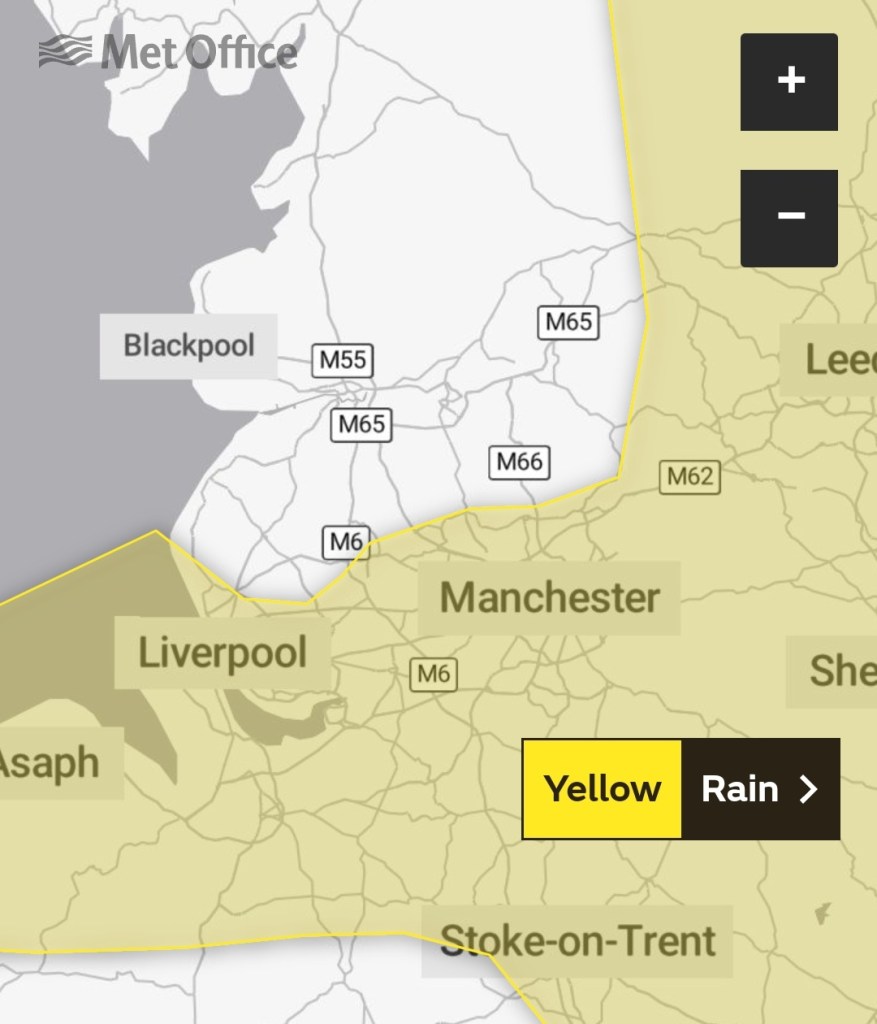
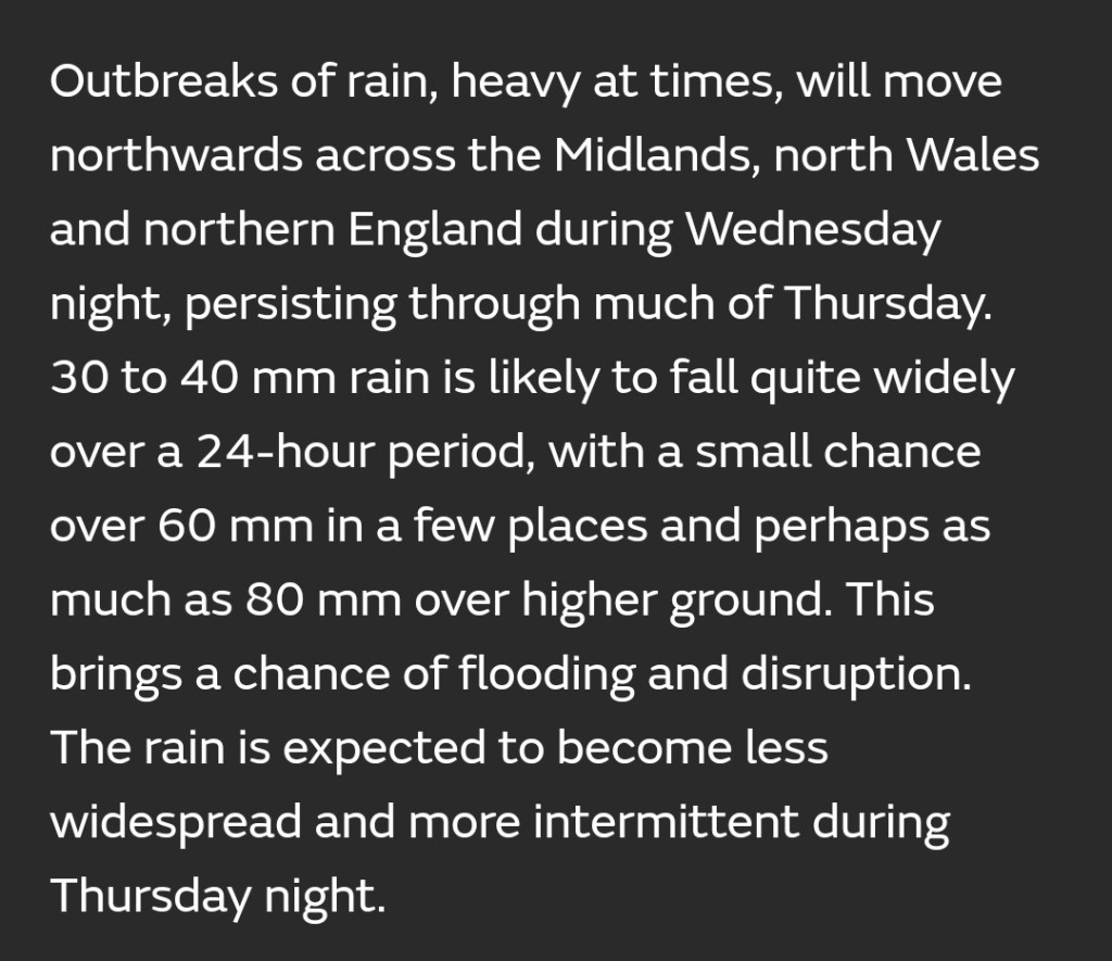
Thursday: Cloudy with periods of rain with heavy bursts at times. Breezy and a cool feel with a north-westerly airflow. It should turn drier slowly as the evening wears on. Max 10°C
Friday: Westerly winds quite strong and gusty. Another unsettled day with frequent showers and limited bright spells. Max 9°C
Weekend: Saturday’s the best day.
Saturday: A cold start with a localised ground-frost and a few mist patches. A dry day with bright or sunny spells. Rain will arrive overnight, or even late-evening. Max 9°C
Sunday: Morning rain moving on to be followed by showers, which could contain hail. Windy and feeling cold with temperatures likely to struggle. Max 8°C
Outlook: Perhaps a respite on Monday before the week turns unsettled once again with bouts of rain/showers and wind as low pressure takes charge. We will be on the north side of the Jet Stream so temperatures cool but generally around average. Long gone are those late-teens temperatures.
Follow @ChadWeather on Twitter for the latest forecasts and warnings.
Thanks,
Jon
Forecast Issued: Wednesday the 16th of November 2022 at 4:50pm.
Images: Met Office & http://www.wxcharts.com
