
Hi all,
After a wet October it’s been quite a wet start to November too. We’re in for some mainly dry days now but it will be very windy too, and, as mentioned, very mild. Signs of it turning a bit cooler next week and with it the possibility of severe gales in places and yet more rain.
Thursday: After a very mild night the day will continue on the warmer-than-average front with moist southwesterly winds. These winds will be gusty, 30-35mph and will bring plenty of cloud. Risk of some drizzle, especially on the hills. Max 16°C
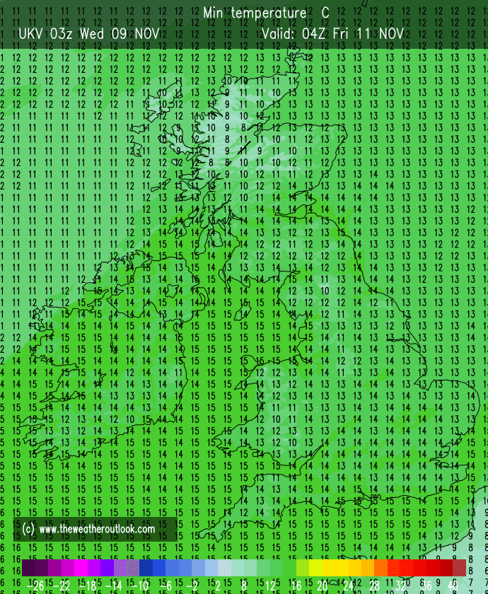
Thursday night’s minimum temperatures could well be record-breaking for November across parts of the UK, especially sheltered from the wind and in favourable locations.
Friday: Another very mild and cloudy day with gusty winds. It should be dry for most and hopefully some bright spells later in the day as cloud breaks from the south. Max 16°C
Weekend: Sunnier Saturday.
Saturday: A southeasterly wind will bring in slightly cooler air and also drier air leading to a dry day with plenty of sunny spells developing. Sounds like a day in the garden to get it ready for winter. Max 13°C
Sunday: Bright morning but cloud increasing as the day wears on. Fresh breeze. Max 13°C
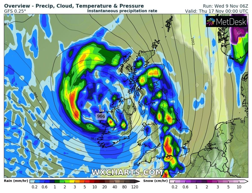
Outlook: Becoming increasingly unsettled with low pressures coming in off the Atlantic. These will need monitoring as there is a risk of them becoming deep and bringing spells of heavy rain and gales or even severe gales. After a mild start it looks set to become cooler or even colder with max temperatures around 9-11°C.
Follow @ChadWeather on Twitter for the latest forecasts and warnings.
Thanks,
Jon
Forecast Issued: Wednesday the 9th of October 2022 at 5:35pm
Images: http://www.wxcharts.com
