
Hi all,
It’s been a cold week, very cold at night and snow fell across the region during Tuesday. I know it’s winter and nothing new but we don’t get these wintry spells as often as we used to. Certainly feels that way, so whether you love the snow or crisp winter sunshine it’s nice to have a seasonal spell of weather, rather than the relentless rain and wind. Well, unfortunately the latter is set to return with the potential for some very windy days over the next 7 days.
I’ve spent today walking around Heaton Park. Frost or snow on the ground, Arctic air blue skies and little to no wind make for the best days. We definitely don’t get many days like today that’s for sure! Got to make the most of it.

So, after little rainfall over the last 15 days, including 7 dry days, rain is set to return to bring a wet 4 or 5 days next week.

Thursday: Last night could well have been the coldest night of the winter so far with lows of -8°C rurally. This is helped when snow-cover is present, cooling the air further. Despite the cold and frosty start it will be another stunning day with wall-to-wall sunshine. There is a chance of some snow showers through the region into the late-evening. Another cold night to come. Max 2°C Min -5°C

Friday: Frosty start then another dry day with sunny spells becoming hazy later as the wind swings southwesterly and change is on the way. Patchy frost in the evening lifting later as temperatures slowly rise and cloud rolls in. Max 4°C Min 1°C

Weekend: Milder and wetter.
Saturday: Cloudy but hopefully staying dry for the morning. Drizzle then patchy rain will move in during the afternoon. Less cold, temperatures rising steadily during the day, but with it becoming windy it will still feel cold. Max 6°C Min 5°C
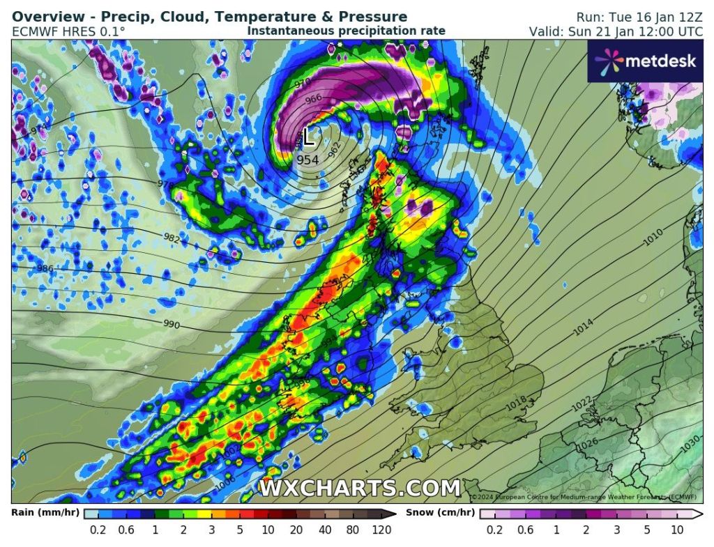
Sunday: Mostly cloudy then a deep area of low pressure will bring much milder temperatures, wind and rain. Warning already in place. Max 11°C Min 8°C

Outlook: Temperatures above normal, especially on Tuesday where we could see values scrape into the teens. A wet week with rain or showers at times and turbulent with Tuesday night into Wednesday showing up as being potentially very windy with gusts to 50 mph. Hopefully high pressure will build back in for a drier and sunnier end to the month.
Follow @ChadWeather on X for the latest forecasts and warnings.
Thanks,
Jon
Forecast Issued: Wednesday the 17th January 2024 at 2:50pm.
Images: http://www.charts.com, http://www.theweatheroutlook.com & the Met Office
