
Hi all,
The miserable summer continues and although it’s been muggy at times this week, especially on Tuesday, there’s been quite a bit of rainfall and Tuesday saw most places see up to an inch of rain followed by evening thunderstorms in the west.
High pressure is going to try its best to squeeze in from the west as we head towards the weekend but it won’t establish itself fully over the UK; so it’s not going to be exclusively dry even though the weather will settle down a little bit. Looking ahead, no sign of any summer heat returning just yet, but perhaps a hint of something a few degrees warmer in about a week’s time.
Thursday: Unfortunately, a weak weather-front will establish itself across the region. We can expect a cloudy day with patchy rain here and there and some drizzle during the morning. During the afternoon the patchy rain and drizzle should turn into scattered showers with the odd heavy one. Max 17°C Min 11°C
Friday: It should be a better morning on Friday with a few bright spells but cloud will bubble up as the day wears on and there will be the odd scattered shower but some places will stay dry. We’ll have a cooler airflow now so it won’t feel as muggy as it has done earlier in the week. Max 17°C Min 11°C
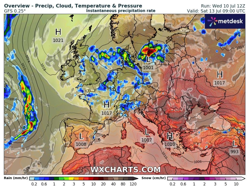
Weekend: High pressure close by but we can still expect showers.
Saturday: High pressure to the northwest of the UK. Low pressure over in Europe. In between a little bit of instability meaning a bright start but clouds will bring the odd scattered shower into the afternoon, which could be heavy. Max 17°C Min 10°C
Sunday: Little change really, bright spells for the morning, clouds bubbling up later producing some scattered showers, which could be heavy again and thundery. Not much change in the maximum temperature. Max 18°C Min 11°C
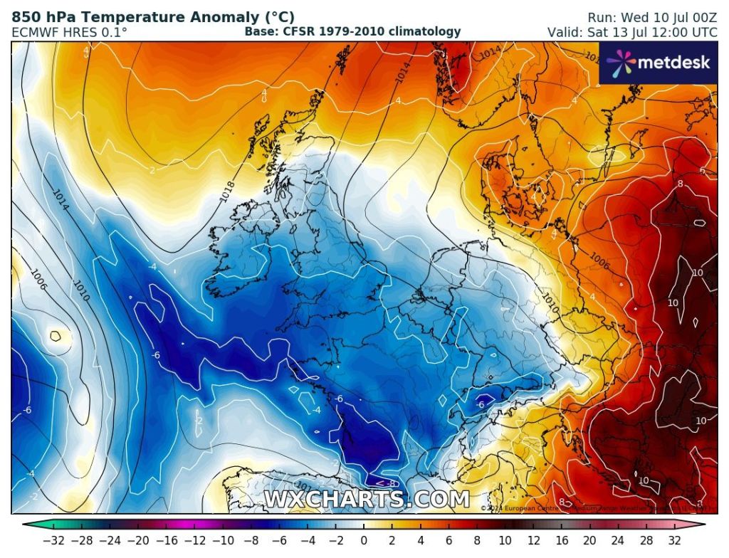
Outlook: It looks like it will remain changeable throughout the week. Bright spells and showers developing and temperatures likely to stay just below average. Later in the week there are hints that maybe a little bit of warmer air will waft up from the south, but with this being 7 to 9 days away there is still a lot of uncertainty on this occurring. The wait for our summer heat in July continues.
Follow @ChadWeather on X for the latest forecasts and warnings.
Thanks,
Jon
Forecast Issued Wednesday the 10th of July 2024 at 9:15pm
Images: http://www.wxcharts.com
