Enjoy the rest of this week – Thursday 19th September 2024 – Sunday 22nd September 2024

Hi all,

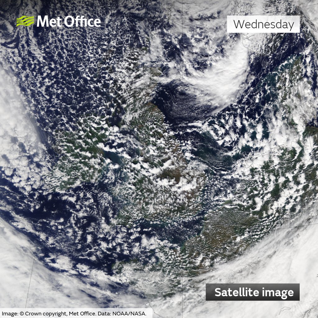
It’s been fabulous this week once early-morning mist, fog and low-cloud cleared. It felt lovely and warm in the sun and with light winds, for me this is the perfect weather and temperatures. The rest of this week will see the sunshine remain, especially into the afternoon but the wind is set to increase and we have a change on the way, which will be most noticeable on Sunday, or Monday.

Here’s how 2024 is shaping up so far. September’s average is currently close to the June average.

Thursday: High pressure still in control but it will be drifting further northeast allowing a northeasterly wind to develop. A cloudy start in some spots, mostly in the east, but this will eventually burn off and it’ll be another lovely day with sunny spells developing widely. Max 20°C Min 11°C

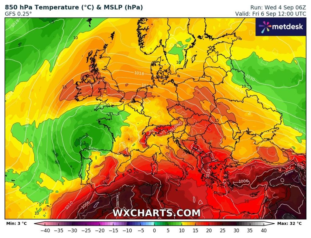
Friday: Cloud will have encroached again overnight, perhaps low enough to give some patches of mist/fog. So, away from the far west, you can expect a cloudy start to Friday. Again, as the day goes on this will break up and warm sunny spells will break through. The northeasterly wind will be strong and gusty at times, but not as windy to the west. Low pressure will be approaching the UK from the south with a little bit of instability. There is the outside chance of a late-in-the day shower, most likely on the Pennines. Max 20°C Min 12°C

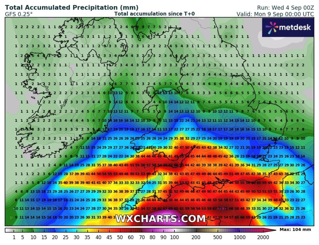
Weekend: Eventually unsettled with a risk of downpours?

Saturday: Cloudy/misty start with sunny spells developing. Warm but windy and the risk of a shower increasing as the weather begins to break. Max 20°C Min 13°C

Sunday: Low pressure drifting up from the south. Sunny spells for the morning then showers are likely to develop, some potentially heavy and thundery. Cooler and still that keen northeasterly wind. Max 18°C Min 9°C

Risk of showers this weekend. Still some uncertainty on how far north they will get. We might not see them until Monday.

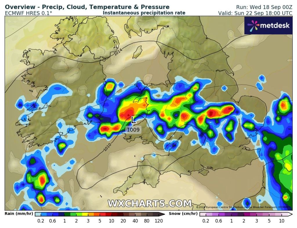
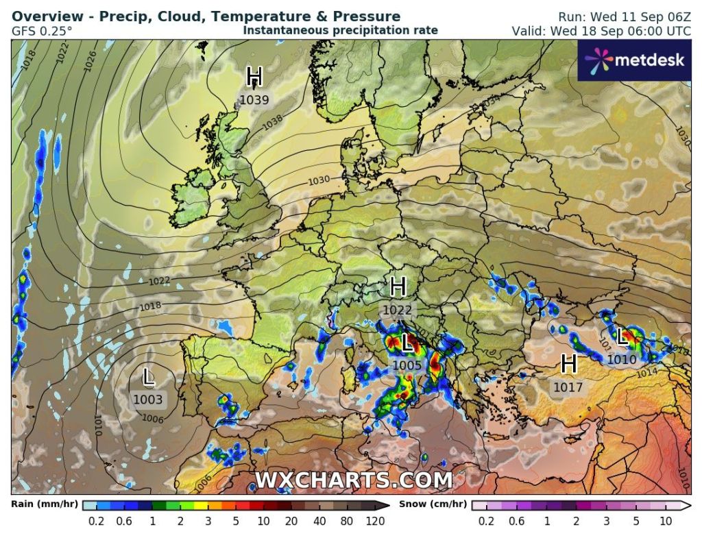
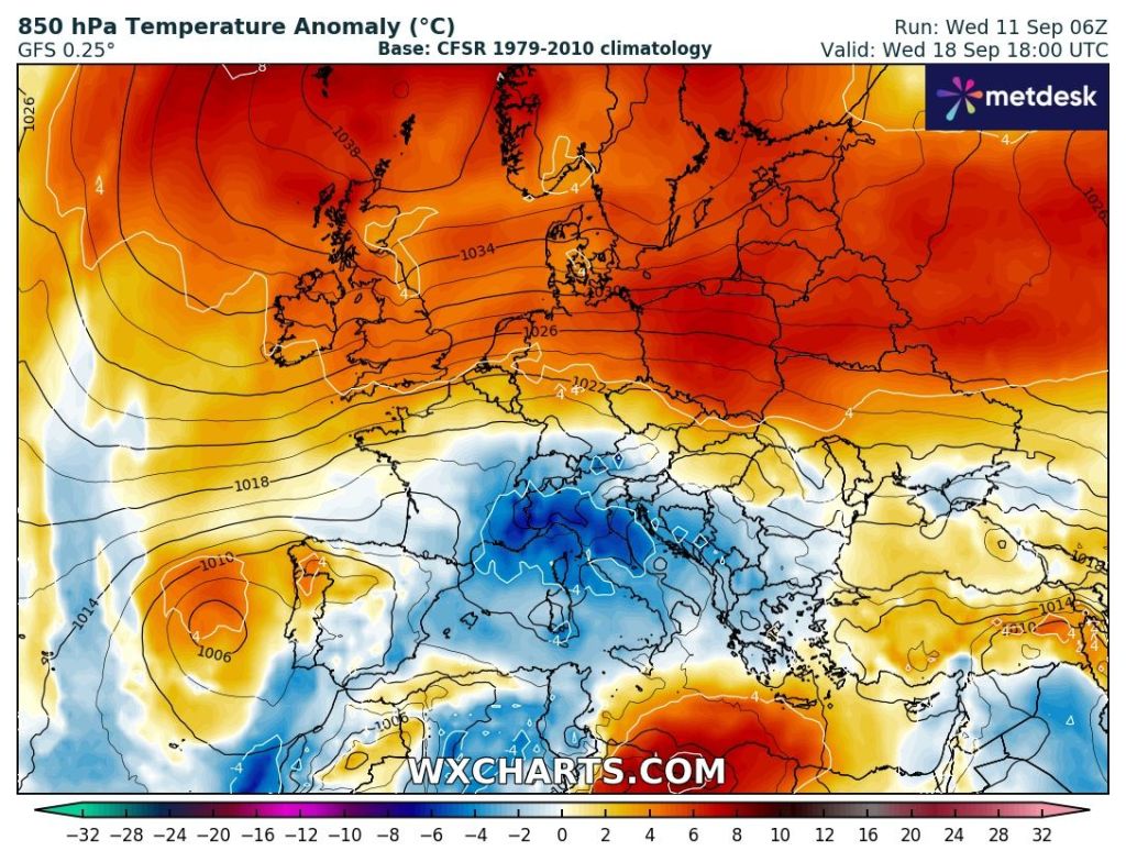
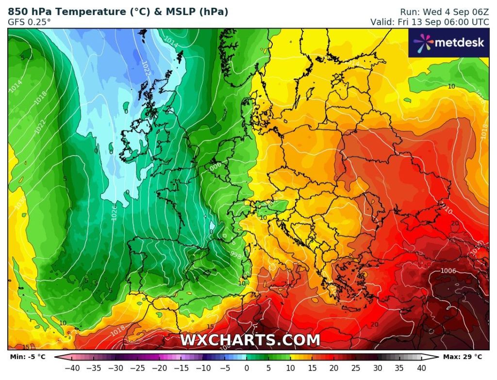
Outlook: The Jet Stream looks set to return to the UK bringing spells of showery rain or longer spells of rain and wind. In between some brighter spells. We will eventually lose the brisk northeasterly and southwest to westerly winds will return, driving low pressure systems across the region.

Follow @ChadWeather on X for the latest forecasts and warnings.

Thanks,

Jon

Forecast Issued: Wednesday the 18th of September 2024 at 7:30pm

Images: http://www.wxcharts.com

Turning less cold and drier. High pressure next week bringing sunshine – Thursday 12th September 2024 – Sunday 15th September 2024

Hi all,

Autumn has got going this week, with our first airmass from the Arctic, bringing cooler temperatures and cold nights. Also, an area of low pressure introduced an unsettled spell of sunshine and showers. With an unstable atmosphere and a northwesterly airflow, the Irish Sea is good at brewing showers and on Wednesday we certainly had plenty of those, as a trough delivered over half-an-inch of rain in places, as well as some hail and thunder.

Sunshine and shower-clouds on Wednesday, just like April.

Thursday: There will be showers to start the day along the coast feeding into the Cheshire Gap. Inland it will be a sunny start but chilly with perhaps a touch of ground-frost in rural spots. Another windy day with sunny spells, and showers will develop inland but there will be nowhere near as many as Wednesday. There’s even a chance some areas could escape dry throughout the day. Still chilly but less cold air is on the way, but before that we will see a ground-frost overnight, or perhaps an air-frost rurally. Max 13°C Min 0°C

Friday: High pressure is building in from the southwest so this will kill off any remaining showers and it should be a mostly dry day with winds easing and not as cold as recently. After a sunny start cloud will spill in from the southwest. Max 14°C Min 8°C

Weekend: Milder but risk of rain on Sunday.

Saturday: Breezy and dry with sunny spells which are likely to be hazy at times. Warmer as we’ve now introduced a southwesterly airflow. Max 18°C Min 11°C

Sunday: A cloudier day as a weakening weather-front sinks south bringing some patchy rain. Breezy and feeling a little cooler with the lack of sunshine. Max 17°C Min 11°C

A weakening weather-front moving through on Sunday could bring some patchy rain

Outlook: It’s looking increasingly likely that high pressure will build across the UK bringing sunnier weather, drier conditions and temperatures rising back up close to 20°C, so above-average. It looks set to drift north later in the week meaning we introduce quite a gusty easterly wind taking the edge off the temperature.

High pressure next week with temperatures above-average but a nagging easterly wind later

Follow @ChadWeather on X for the latest forecasts and warnings.

Thanks,

Jon

Forecast Issued: Wednesday the 11th of September 2024 at 4:45pm.

Images: http://www.wxcharts.com & The Met Office

No heatwave but warmer and windy for a time – Thursday 5th September 2024 – Sunday 8th September 2024

Hi all,

Summer has come to a close. I need to pull my finger out and get my data all sorted so I can compare seasonal data with ease. But, as you may have seen, summer was cooler-than-average, the coolest since 2015 and also drier-than-average. And to top it off, duller-than-average too. All 3 months in fact, had below-average rainfall after a wet Spring.

Chadderton: Data for 2024 so far

Thursday: Interesting set-up with a cut-off low pressure sitting to the south of the UK. This means we will see a northeasterly airflow. The low will deliver a wet day to our south. For us, some sunny spells, windy at times and any sun/brightness turning hazy as cloud increases from the south. Feeling cool in the wind but turning humid later. Showers possible overnight. Max 19°C Min 15°C

Weather warnings in place for heavy and persistent rain down south.

Friday: Another windy day, with gusts of 30-40mph not out of the question. Despite the wind it will be sunnier with some decent spells of sunshine expected and temperatures will rise rapidly, as will the muggy-feel to the weather, especially at night. Max 24°C Min 16°C

Much warmer airmass this Friday.

Weekend: Not all plain sailing.

Saturday: Overnight showers may have pushed up from the south but once these clear it should be a day of sunny spells and again windy conditions but not as gusty as Friday. Temperatures down a little. Max 22°C Min 15°C

Sunday: Looks a similar day to Saturday but with the showers coming during the daytime. Odd one could be heavy and thundery. Breezy. Max 21°C Min 14°C

Outlook: Littered with uncertainty but it’s siding towards a more unsettled week, after early ridges of high pressure, and possibly cooler with a northerly airflow slipping in for a day or two later in the week. Overall not too much rainfall expected.

Next Friday hints of something cooler from the north or northwest.

Follow @ChadWeather on X for the latest forecasts and warnings.

Thanks,

Jon

Forecast Issued Wednesday the 4th of September at 5:14pm

Images: http://www.wxcharts.com