Plenty of dry weather but sunshine limited until next week – Thursday 31st October 2024 – Sunday 3rd November 2024

Hi all,

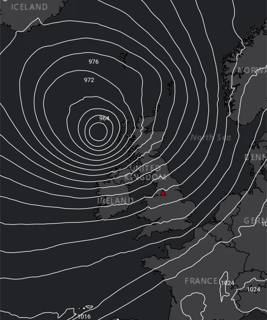
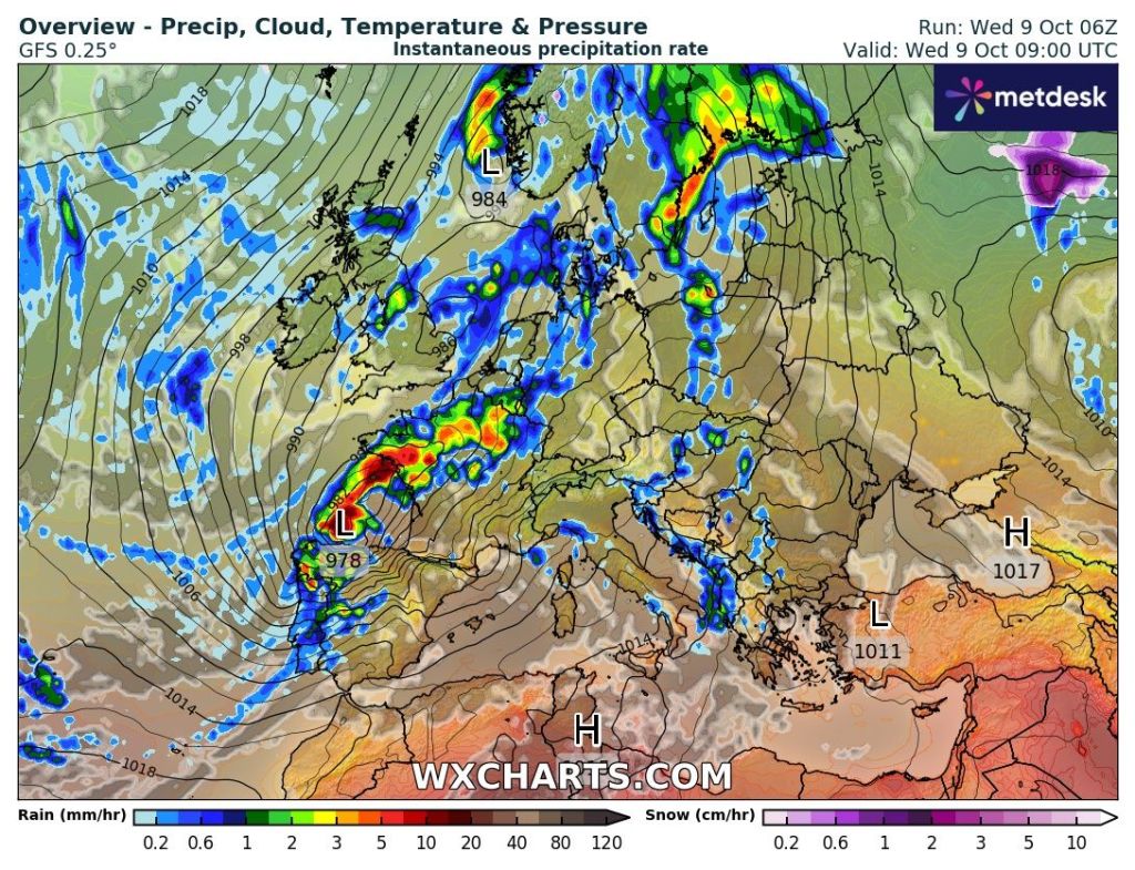
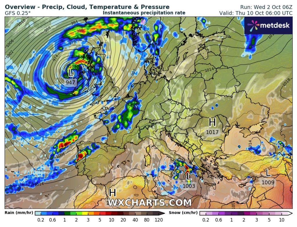
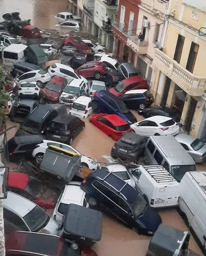
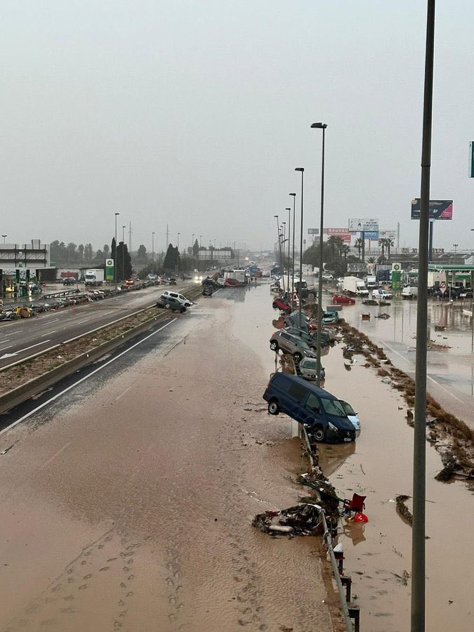
I visited Spain in September and the area was desperate for rain and this week the rain came; but too much, in such a short space of time in parts of eastern Spain. 343mm fell in 4 hours in one location and over a year’s worth of rain fell in over 8 hours (500mm). With the land so dry and arid, this volume of water immediately ran off surfaces, into the streets turning them into dirty, raging rivers. The loss of life is of no surprise.

Unfortunately, since weather warnings don’t always come true, a lot will have ignored warnings. Whether it’s a yellow, amber or a red warning, you should always read it and take onboard the risk. It could save your life, whatever country you’re in.

Valencia, Spain – the morning after the relentless thunderstorms and in some spots tornadoes were reported.

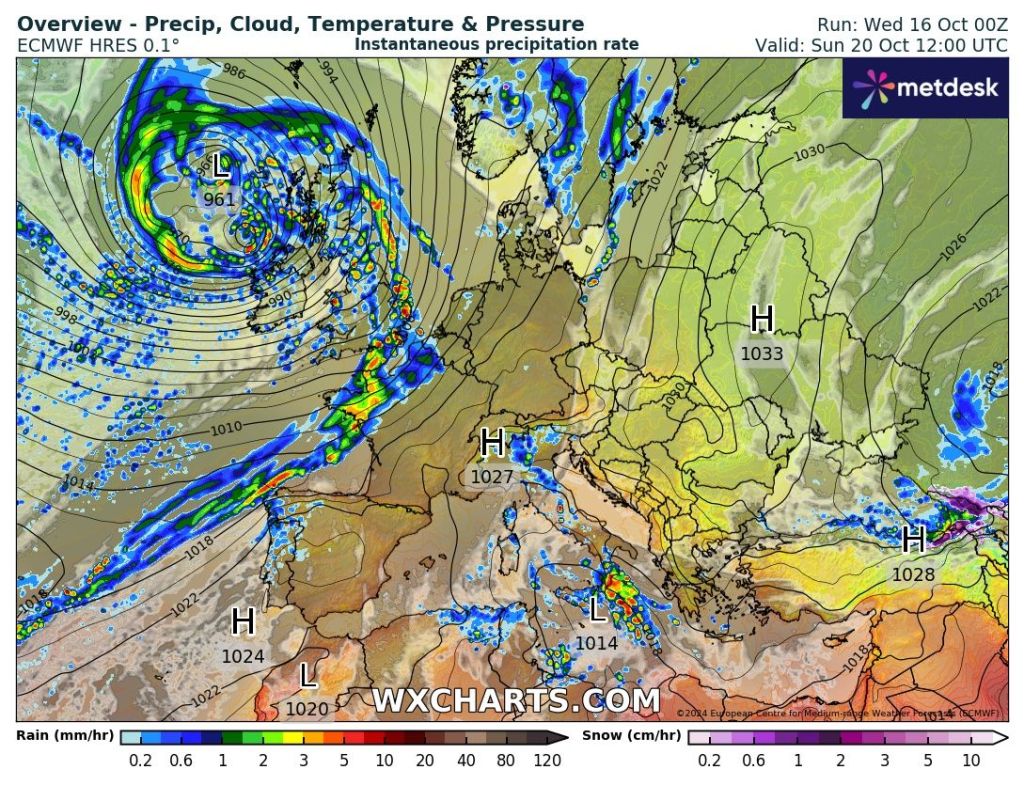
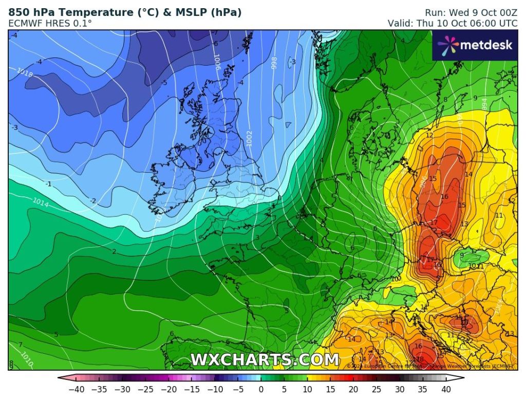
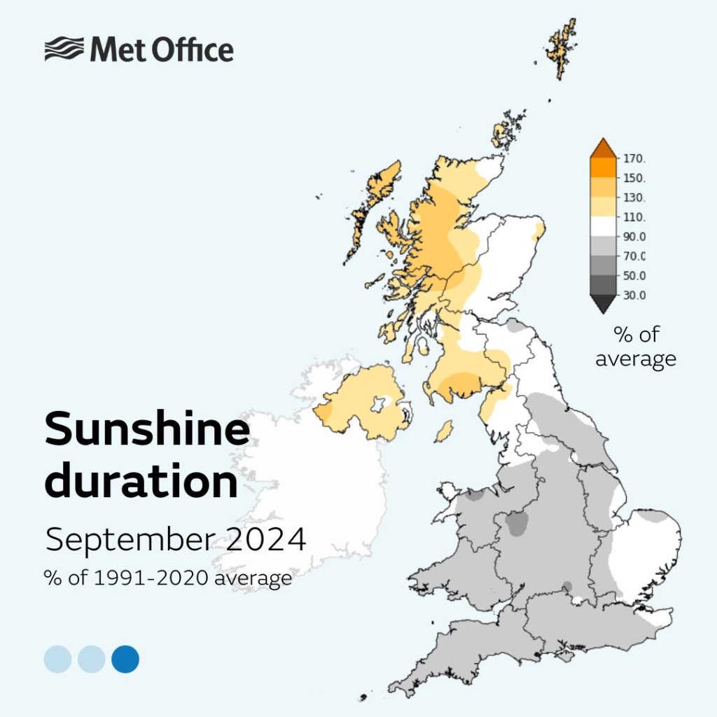
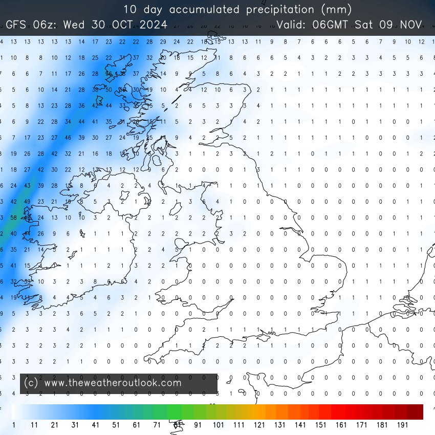
Luckily our weather is now in a much more settled, benign and boring pattern with high pressure in control. Unfortunately it’s a “cloudy high”. Cloud gets trapped under the high and circles around it, hard to shift now that the sun is lacking in strength at this time of the year. With high pressure in place at least there’s plenty of dry weather to be had, apart from drizzle where cloud is at its thickest.

Thursday: I’m hopeful we see a drier day than Wednesday after it was drizzly in places. A mostly cloudy day with perhaps some bright spots here and there. Dry for most but again I can’t rule out some pockets of drizzle. Max 14°C Min 8°C

Friday: Rinse and repeat for Friday. Little change. Max 14°C Min 8°C

Weekend: Hopefully some sunny spells by Sunday. Some local low-cloud bringing some mist and fog patches, especially on the hills.

Saturday: Cloudy, dry and a little cooler. Slight southeasterly breeze. Max 13°C Min 7°C

Sunday: Cool with sunny spells developing after a cloudy start. Another dry day. Colder night than recently where clear spells persist. Max 12°C Min 5°C

Outlook: High pressure staying in control. Dry weather aplenty. Variable amounts of cloud during the day with some sunny spells. A sunnier week than this week looks likely. Cold nights where skies clear with some localised ground-frost and mist or fog patches. No rain expected all week.

A very dry 10 days ahead.
High pressure in charge next week. Any significantly colder air kept at bay.

Follow @ChadWeather on X for the latest forecasts and warnings.

Thanks,

Jon

Forecast Issued: Wednesday the 30th of October 2024 at 5:20pm.

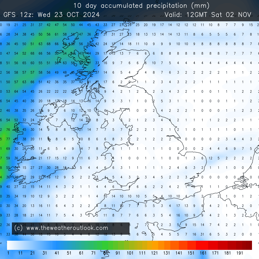
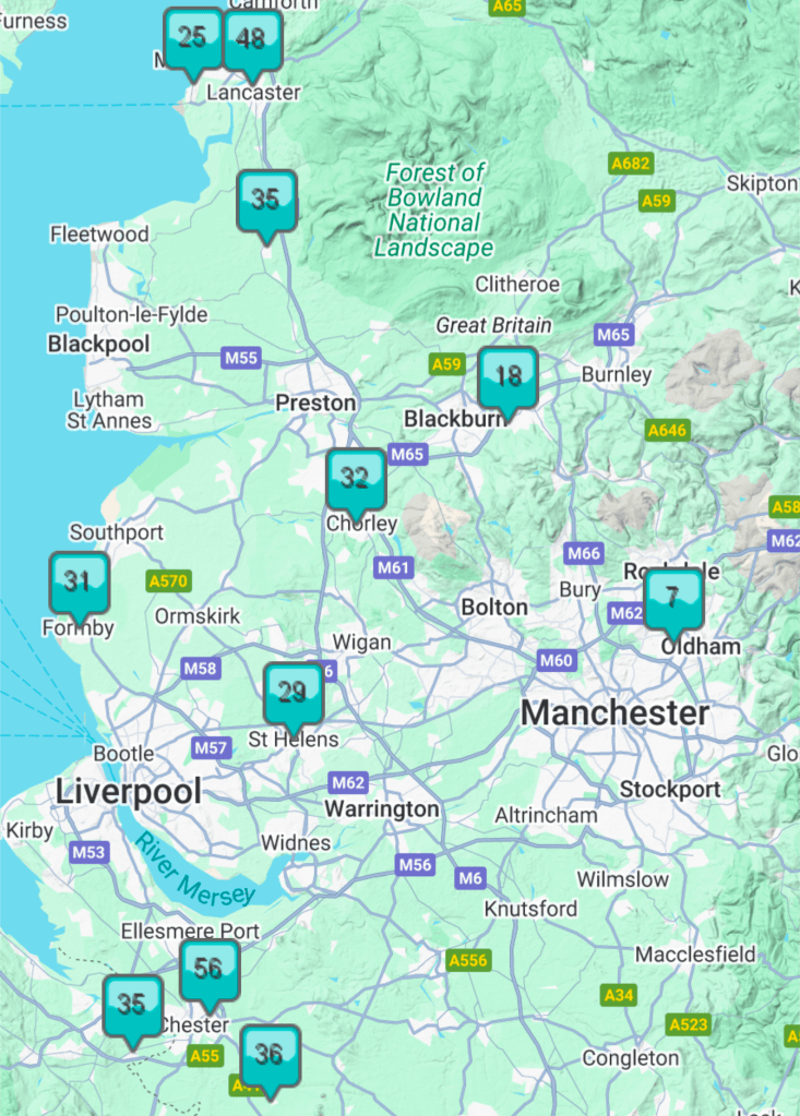
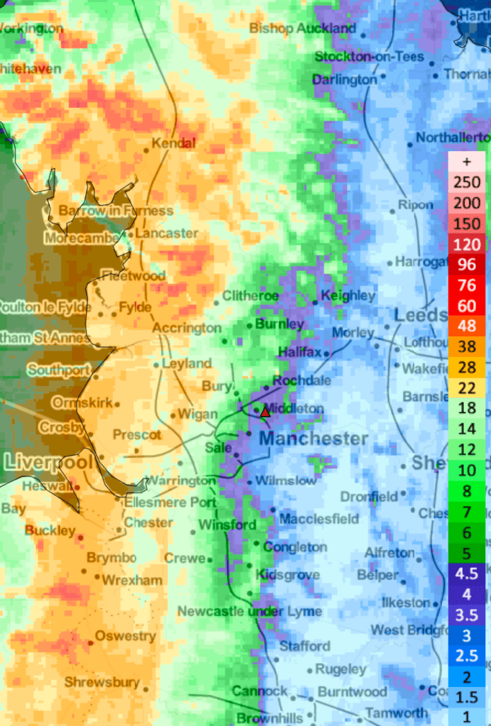
Images: BBC Weather, http://www.theweatheroutlook.com & http://www.wxcharts.com

Low pressure to return but will it last? Outlook showing low rainfall amounts – Thursday 24th October 2024 – Sunday 27th October 2024

Hi all,

Really busy day today, so not much input into the weekly blog apart from a quick outlook. Good really as there is a lot of uncertainty going into the weekend so seems a bit pointless spending a lot of time trying to pin down a forecast when it’s difficult to know what’s going to happen.

Thursday: Another dry day on the cards during daylight hours with cloud coming and going. Some bright spells and mild for the time of year but increasingly windy. Odd shower possible from the south after dark. Max 16°C Min 11°C

Friday: The high pressure to our southeast/east slips away which allows low pressure, albeit a bit slack to drift in from the west. Scattered showers developing during the day but a bit hit-and-miss. Not as windy but not as much brightness as Thursday. Max 16°C Min 8°C

Low pressure, although nothing like Storm Ashley arrives as we head into the weekend.

Weekend: Uncertain forecast.

Saturday: It looks like this low pressure will end up decaying (some uncertainty but that looks favourable) leaving a legacy of cloud but mostly dry conditions. Sunny spells developing into the afternoon. Max 15°C Min 7°C.

Sunday: A bit cooler but hopefully another reasonable day with bright or sunny spells and a little cooler. Max 14°C Min 8°C

Outlook: Monday’s looking like a cloudier day as a weakening weather-front/low comes in from the west with any rain on it easing. After that it looks like high pressure builds to the SE of the UK meaning plenty of dry weather, albeit cloudy at times.

Not much rainfall being projected for the next 10 days. Not exclusively dry, but no high rainfall totals on the horizon.

No sign of any SNOW so ignore those media clickbait nonsense stories and if anyone tells you snow is coming, set them straight.

Follow @ChadWeather on X for the latest forecasts and warnings. Thanks as always for reading.

Thanks,

Jon

Forecast Issued: Wednesday the 23rd of October 2024 at 7:45pm

Images: http://www.wxcharts.com and http://www.theweatheroutlook.com

Milder for a time with some sunshine before turning unsettled over the weekend with the potential for Storm Ashley to affect the UK – Thursday 17th October 2024 – Sunday 20th October 2024

Hi all,

We had some chillier weather this past week but milder air has returned and there’s no sign of anything significantly colder or warm and sunny (Indian Summer). Wednesday was very mild but also very wet in places.

A clear west/east split on Wednesday. Persistent and heavy rain out west has brought 2 inches of rain and flooding.

Thursday: Early cloud and any rain will move away to the north then a decent day. Very mild with some sunny spells, albeit hazy at times. Temperatures above average but slightly fresher air compared to Wednesday.Windy. Max 17°C Min 9°C

Friday: A misty start with low-cloud. Some hazy bright spells for a time before rain, patchy at first, comes in from the west towards evening. Winds increasing, gusting 35mph later.  Max 16°C Min 10°C

Weekend: Hopefully not a bad Saturday then the chance of a named-storm.

Saturday: Rain during the early hours soon clearing to a day of sunny spells but a breezy with the chance of a shower. Max 15°C Min 9°C

Sunday: One to watch. Currently looks like a deep area of low pressure will track across the northwestern half of the UK. Expect a very windy day with heavy rain during the morning, followed by blustery showers into the afternoon. Max 15°C Min 9°C

A selection of charts showing Sunday’s deep low pressure, which could be named, bringing rain then blustery showers.

Outlook: Remaining mild. Changeable with some spells of showers or rain. In between bright or sunny spells. Colder towards next weekend.

Follow @ChadWeather on X for the latest forecasts and warnings.

Thanks,
Jon

Forecast Issued: Wednesday the 16th of October 2024 at 5:40pm

Images: http://www.wxcharts.com

Colder with more in the way of sunshine but milder unsettled conditions set to return – Thursday 10th October 2024 – Sunday 13th October 2024

Hi all,

It’s been a wet one today, much wetter in places than was forecast. Some areas seeing nearly an inch of rain falling in the first 12 hours of Wednesday. Good news, drier but colder weather is on the way.

I mentioned “Kirk” last week. The remnants of ex-hurricane Kirk was then named Storm Kirk (they keep their original hurricane name) and it hit northern parts of Portugal and Spain and also France. You can see it clearly on the graphic above.

Thursday: There could well be a cloudy start but this will soon clear to the south as brighter skies filter down from the north with colder air. A decent day in prospect, although fresh, especially in the breeze with plenty of sunny spells into the afternoon. Overnight we can expect a localised ground-frost. Max 11°C Min 2°C

Colder air from the north as we enter Thursday

Friday: Some localised mist and the ground-frost to start, then a day of sunny spells with a bit of cloud bubbling up at times. Low chance of a shower. Cold in the wind which will be gusty. Max 12°C Min 3°C

Weekend: Risk of showers but plenty of drier weather.

Saturday: Chilly and windy with bright spells and a few showers brewing. Max 12°C Min 2°C

Sunday: I do think there’s a chance of a few showers. Otherwise another cool day. Quite breezy but plenty of dry weather knocking around with sunny spells. Not as cold overnight. Max 12°C Min 6°C

Outlook: High pressure close by at first, which should bring mostly dry conditions with some sunshine. Temperatures will pick up a little as well, making their way back into the mid-teens. From midweek it looks like rain-bearing clouds will return from the west.

After a reasonable start to next week, it looks like the rain will return midweek onwards.

Follow @ChadWeather on X for the latest forecasts and warnings.

Thanks,

Jon

Forecast Issued: Wednesday the 9th of October 2024 at 5:32pm.

Images: http://www.wxcharts.com

Settled with sunshine then unsettled once again with perhaps the remnants of ex-hurricane Kirk next week – Thursday 3rd October 2024 – Sunday 6th October 2024

Hi all,

I’m back after a fantastic 5-day break in Spain golfing. 27-34°C then back to 12°C and localised flooding. Bit of a shock but no surprise. I really do detest the weather in this country sometimes, but at least the coming days are better.

2024 so far. September 2024 saw 118% of the average rainfall. Mostly down to a wet end on Monday the 30th.
September 2024 stats from the Met Office

High pressure is now building so we will see some welcome sunshine and drier conditions. Unfortunately, low pressure from the west will slip in later over the weekend, returning the weather to unsettled conditions. You will have heard a bit of talk in the media about ex-hurricane Kirk and it looks like that will come close or even be across the UK by this time next week. For now, it is too early to say.

Thursday: High pressure in charge leading to a decent day with sunny spells. Sunniest in the morning once mist/fog clears and a cold start with a patchy ground-frost. Some fair-weather cloud into the afternoon but remaining dry. Pleasant in the sunshine away from the breeze. Max 16°C Min 6°C

Friday: Another reasonable day with plenty of sunny spells after early mist clears. Feeling pleasant in the sunshine. Unfortunately, it will still be a bit breezy taking the edge off the temperature. Max 16°C Min 8°C

Weekend: Change is waiting out in the Atlantic.

Saturday: Low pressure out west will be tightening the isobars and this means a strong and gusty south or southeasterly wind. After a sunny start cloud will increase from the west for the afternoon and into the evening, showers or patchy rain is likely. Milder overnight. Max 15°C Min 11°C

Sunday: Milder but still windy with showers. Max 18°C Min 11°C.

Outlook: The first couple of days seem to bring sunshine and showers, so a little unsettled. Breezy too. Lots of uncertainty from midweek as some models are hinting at a deep area of low pressure, which would be the remnants of ex-Hurricane Kirk (cue the media OTT articles). One to watch over the coming days to see where this storm tracks. At this stage I can’t confirm if it will indeed bring impacts to the UK.

The remnants of ex-hurricane Kirk. A deep area of low pressure next week (Wed-Thu).

Follow @ChadWeather on X for the latest forecasts and warnings.

Thanks,

Jon

Forecast Issued: Wednesday the 2nd of October 2024 at 4:45pm.

Images: Met Office and http://www.wxcharts.com