
Hi all,
I’m back after a fantastic 5-day break in Spain golfing. 27-34°C then back to 12°C and localised flooding. Bit of a shock but no surprise. I really do detest the weather in this country sometimes, but at least the coming days are better.

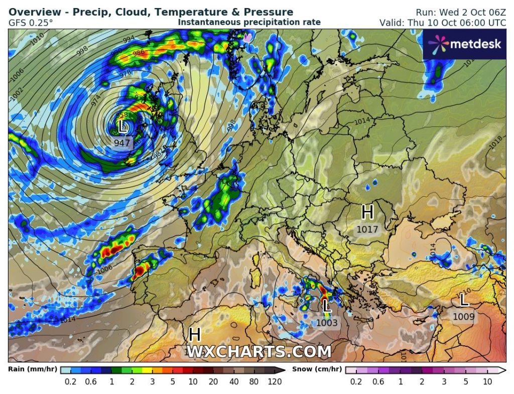
High pressure is now building so we will see some welcome sunshine and drier conditions. Unfortunately, low pressure from the west will slip in later over the weekend, returning the weather to unsettled conditions. You will have heard a bit of talk in the media about ex-hurricane Kirk and it looks like that will come close or even be across the UK by this time next week. For now, it is too early to say.
Thursday: High pressure in charge leading to a decent day with sunny spells. Sunniest in the morning once mist/fog clears and a cold start with a patchy ground-frost. Some fair-weather cloud into the afternoon but remaining dry. Pleasant in the sunshine away from the breeze. Max 16°C Min 6°C
Friday: Another reasonable day with plenty of sunny spells after early mist clears. Feeling pleasant in the sunshine. Unfortunately, it will still be a bit breezy taking the edge off the temperature. Max 16°C Min 8°C
Weekend: Change is waiting out in the Atlantic.
Saturday: Low pressure out west will be tightening the isobars and this means a strong and gusty south or southeasterly wind. After a sunny start cloud will increase from the west for the afternoon and into the evening, showers or patchy rain is likely. Milder overnight. Max 15°C Min 11°C
Sunday: Milder but still windy with showers. Max 18°C Min 11°C.
Outlook: The first couple of days seem to bring sunshine and showers, so a little unsettled. Breezy too. Lots of uncertainty from midweek as some models are hinting at a deep area of low pressure, which would be the remnants of ex-Hurricane Kirk (cue the media OTT articles). One to watch over the coming days to see where this storm tracks. At this stage I can’t confirm if it will indeed bring impacts to the UK.
Follow @ChadWeather on X for the latest forecasts and warnings.
Thanks,
Jon
Forecast Issued: Wednesday the 2nd of October 2024 at 4:45pm.
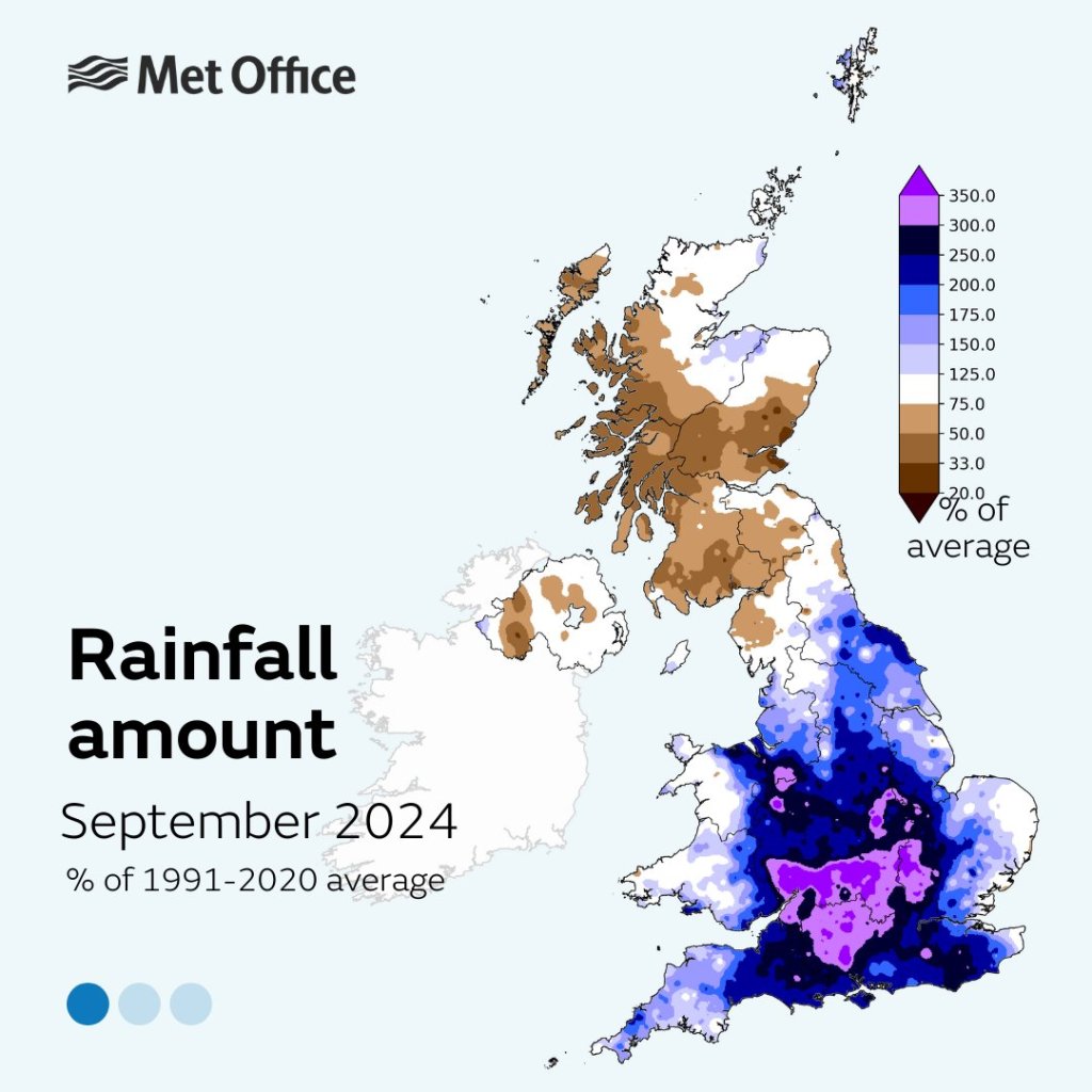
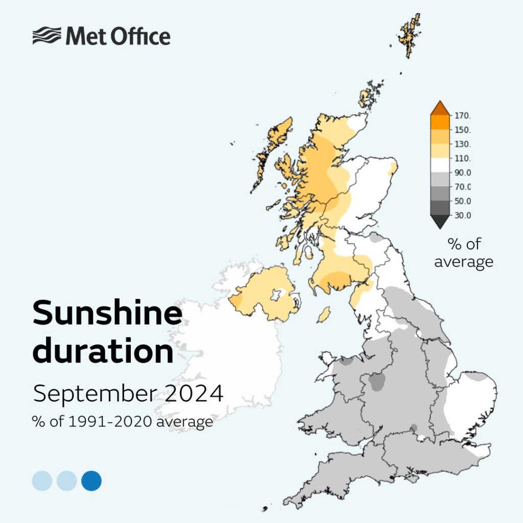
Images: Met Office and http://www.wxcharts.com
