After the snow and floods – what next? – Thursday 28th November 2024 – Sunday 1st December 2024

Hi all,

We enter meteorological winter in this forecast but after some snow last week; is there anymore on the way? No. And to be fair, very little sign of anything particularly cold apart from some chilly nights once we get another very mild spell out of the way.

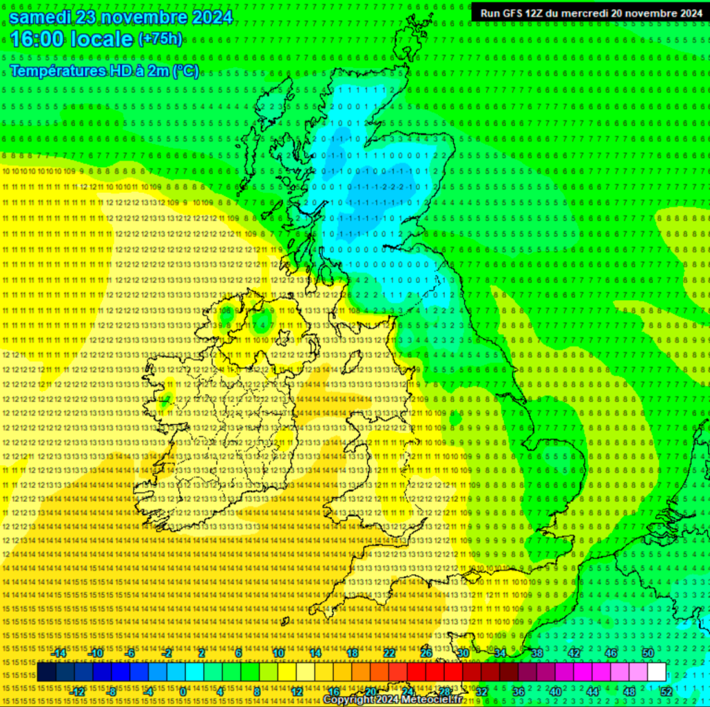
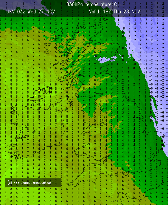
After last week’s snow, much milder air pushed in and introduced a rapid-thaw, leading to localised flooding. Plus, add 2-3 inches of rain on top of that too. Temperatures continued to climb Saturday night and managed to be steady at 14°C overnight. A couple of degrees higher down south. Exceptional for the time of year.

A widespread frost Wednesday night so deicer at the ready on Thursday morning

Thursday: A cold and frosty start with some patchy fog and ice. A decent but cold day with plenty of late-autumn sunshine on offer. Clear spells continue overnight but the wind will increase and this will help to drag in milder air from the southwest, so no frost overnight. If anything temperatures will rise during the night albeit slowly.  Max 6°C Min 5°C

A milder airmass arrives overnight Thursday

Friday: Weather-fronts will be gathering out west but we’ll have another dry day with bright or sunny spells. Notably windy taking the edge off the slightly milder temperatures. Max 10°C Min 8°C

Weekend: Very mild and eventually wet.

Saturday. A windy and mostly cloudy day but it should remain dry for daylight hours. Some bright spells. Max 13°C Min 10°C

Sunday: Those rain-bearing fronts out west are likely to slip in across the region bringing periods of rain which will become showery in nature as a ridge of high pressure builds from the west, decaying the rain-band. Still mild but a cooler night. Max 13°C Min 6°C

Outlook: A brief ridge of high pressure should mean Monday and Tuesday are drier but cooler with plenty of cloud and some brightness. After that it looks like the low pressure systems in the Atlantic will win out bringing spells of wind, rain and milder conditions, with short bursts of cooler air and some bright spells after the lows clear into the North Sea.

Long-term there were some hints at colder-than-average air returning for mid-December. If this trend looks more favourable I’ll post some thoughts on social media.

Follow @ChadWeather on X and Bluesky (search Oldham Weather) for the latest forecasts and warnings.

Thanks,

Jon

Forecast Issued: Wednesday 27th November 2024 at 6:18pm.

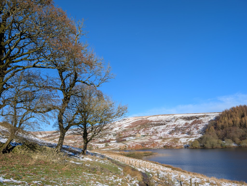
Images: http://www.theweatheroutlook.com & a photo from my trip to Hebden Bridge on Wednesday.

Very cold with further chances of snow before wind, rain and milder temperatures arrive – Thursday 21st of November 2024 – Sunday 24th of November 2024

Hi all,

After a very dry first half of November, things have turned much colder this week and our first taste of winter arrived before the season has even started. We saw some snow on Monday night which was mostly wet-snow but it gave several cms in places and it’s remained on the hills as temperatures have struggled to only a few degrees above freezing.

It’s set to stay much colder-than-average for the majority of this week with a chance of some snow showers on Wednesday and Thursday night, especially so the latter.  This could give another dusting in places.

I took a trip to Greenbooth and Naden reservoirs on Wednesday. It was stunning.

The weather is all set to change as we head into the weekend as a deep area of low pressure takes control from the Atlantic bringing strong winds and rain, preceded by some snow. Temperatures will creep up and we will be back into double-digits later on Saturday and into Sunday.

Thursday: Very cold and not as sunny as recently, as we drag in some cloud from the Irish Sea. This cloud could produce some wintry showers during the day, but there is a more active setup into the evening with a trough favoured to bring some sleet and snow showers. Several cms of snow can’t be ruled out even in low-lying areas before the showers turn more sleety later on. There is a bit of uncertainty around this trough, so look out for my posts during Thursday. Max 3°C Min -2°C

Friday: Sunny spells, with the odd wintry shower decaying away. Cloudy later as that change from the Atlantic begins. Max 4°C Min -1°C

A trough will bring some sleet and snow showers Thursday night, mostly out west (rain along the coast) but these might drift more inland so don’t rule out another cover of snow from this.
Possible named-storm, Storm Bert, on Saturday. Strong winds, rain preceded by snow and much milder air arriving.

Weekend: Turning milder but wet and windy after early snowfall.

Saturday: Snow is possible for a time in the morning, especially on higher ground. But soon the snow will turn back to rain and it will become very windy {possible named-storm}. The heavy rain will give way to hefty showers. It will be a slow process but much milder into the late-evening. Gusts to 50mph during the day can’t be ruled out so a warning for wind might be issued. Max 11°C Min 9°C

Some snow will precede the rain on Saturday morning
Much milder air will replace the cold Arctic air during Saturday

Sunday: Remaining very windy with sunshine and showers. Very mild. Max 12°C Min 7°C

Outlook: Still windy on Monday with showers. The low pressure then moves away into the North Sea and a brief ridge of high pressure will build and it will turn cooler once again for a couple of days but with some welcome sunny spells. Later in the week, low pressure will return, introducing milder conditions again with southwesterly winds, but also some periods of rain or showers. No snow is expected next week.

Follow @ChadWeather on X for the latest forecasts and warnings. I am also on Bluesky so you can also follow there.

As always, thanks for reading.

Thanks,

Jon

Forecast Issued: Wednesday the 20th of November 2024 at 5:06pm.

Images: http://www.wxcharts.com & http://www.meteociel.com

Colder weather is coming, especially so into next week, but will we see snow? – Thursday 14th November 2024 – Sunday 17th November 2024

Hi all,

Winter isn’t coming just yet, but the feel of it is. Lots of media “articles” (which I hinted would be the case after I posted that chart last week) about snowfall.

Colder, yes. Much colder-than-average, yes. The coldest weather for 8 months, yes. Risk of wintry showers here, yes. Snow for the hills and mountains of Scotland and parts of Northern England, yes.  Widespread snow for most of the UK? Unlikely and impossible to say this far out.

Thursday: High pressure still in charge but it’s now a bit similar to what we had last week. Plenty of cloud, low-cloud at that with hill-fog. Light winds and perhaps some brightness early on. Max 11°C Min 8°C

High pressure still there on Thursday but it will be pushed away this weekend to be replaced by low pressure by Sunday

Friday: Generally cloudy but much windier as weather-fronts start to gather out to the northwest Atlantic bringing a squeeze in the isobars. Can’t rule out some drizzle, especially late-on and on higher ground. Max 11°C Min 7°C

Weekend: A change in airmass is coming.

Saturday: Any bright spells fading as cloud thickens and a weather-front comes down from the northwest. This will bring a narrow band of rain and it will feel cool, exaggerated by the gusty wind. Colder air slips in overnight. Max 10°C Min 3°C

Rain on Saturday. Not much but it will bring a change to colder air in its wake.

Sunday: Some bright spells and feeling colder, especially in the wind. Chance of showers, as a low pressure builds, which could be wintry on higher ground. Any clear spells overnight will lead to a patchy frost. Max 8°C Min 1°C

Colder air from the Arctic is currently being forecast to spread south across the country into the start of next week

Outlook: Even colder air continues to dig in as we enter the new working week. Straight from the Arctic. The weather pattern is then uncertain as we have no defined high or low pressure over us. We can expect cold days, frosty nights and where we do see the odd shower during the day, it will be wintry.

As for more of a chance of some persistent snow, then we would need all the ingredients to come together. In other words, a low slipping in across the region bringing more general heavy rain to southern England but snow on its northern edge. Fine margins, especially since we’re still in November and autumn.

There were hints of a low pressure bringing snow on its northern edge for next Wednesday or Thursday but the latest trend suggests the precipitation will stay further to the south into France.

So for now, ignore any media reports of several inches of snow coming next week. Look out for my posts on X. I can’t see it happening myself. I would expect us to stay in the cold weather for all of the week with sub-zero nights and well below-average temperatures during the day with wintry showers. Then, as we head towards the end of next weekend, a slow change to something less cold.

Snow depth maps for next week. Take with caution as this is 10+ days away and it’s more unlikely than likely. Snow in the forecast is more reliable closer to the event. Sometimes even 24 hours out it can be tricky to pinpoint and we can still be wrong.

Follow @ChadWeather on X for the latest forecasts and warnings.

Thanks,

Jon

Forecast Issued: Wednesday the 13th of November 2024 at 4:43pm.

Images: http://www.wxcharts.com

Quiet is an understatement with little sign of change until next week – Thursday 7th November 2024 – Sunday 10th November 2024

Hi all,

Anticyclonic gloom. If you don’t know what that is, you do by now. It’s when we have an area of high pressure in charge but cloud gets trapped within that high pressure and it can’t lift and break. Meaning the days are dull, overcast, dank and usually with a bit of mizzle.

The worst type of weather in my opinion and this is just relentless. When is it going to end? I hear you ask. Not anytime soon unfortunately but the good news is, plenty of dry weather will be knocking around apart from pockets of drizzle and just perhaps some light rain. Very little rain over the next 10 days.

Thursday: Very little change. Dry with plenty of cloud with only a subtle difference of a breeze picking up, which just might break up the cloud in western parts allowing for some brightness into the early afternoon. Mild for the time of year. Max 14°C Min 8°C

Friday: Rinse and repeat. Cloudy after a misty start. Again the breeze might help break up some of the cloud. Don’t bank on it though. Some patchy rain or drizzle later in the day. Max 13°C Min 7°C

Weekend: Nothing exciting.

Saturday: Another dull day looks likely with plenty of thick cloud but mostly dry. Brightness like gold-dust. A little cool. Max 12°C Min 9°C

Sunday: Another weakening weather-front is possible from the west, bringing some patchy rain, if any at all, later in the day, after another cloudy one. Max 13°C Min 9°C

Outlook: Promising, in terms of more dry weather as another high pressure builds across the UK bringing settled conditions. Initially, with more of a westerly airflow, we should clear the overcast conditions so sunny spells seem more likely. As the week goes on, little change, dry and temperatures around normal but cloud amounts could increase again with cloudier days back on the cards.

More high pressure next week

Follow @ChadWeather on X for the latest forecasts and warnings.

Thanks,

Jon

Forecast Issued: Wednesday the 6th of November 2024 at 9:05pm.

Images: http://www.wxcharts.com