Some windy days coming up and a look at the weather for Christmas Day – Thursday 19th December 2024 – Sunday 22nd December 2024

Hi all,

December, these days, always seems mild. Much colder years ago and this December has been no different. Temperatures on Wednesday morning were into the teens in some places. A White Christmas is on-hold for another year.

A very mild start to Wednesday morning. Temperatures we are seeing more and more frequently in Decembers.
December 2024’s average temperature is the second mildest I’ve recorded since my records began.

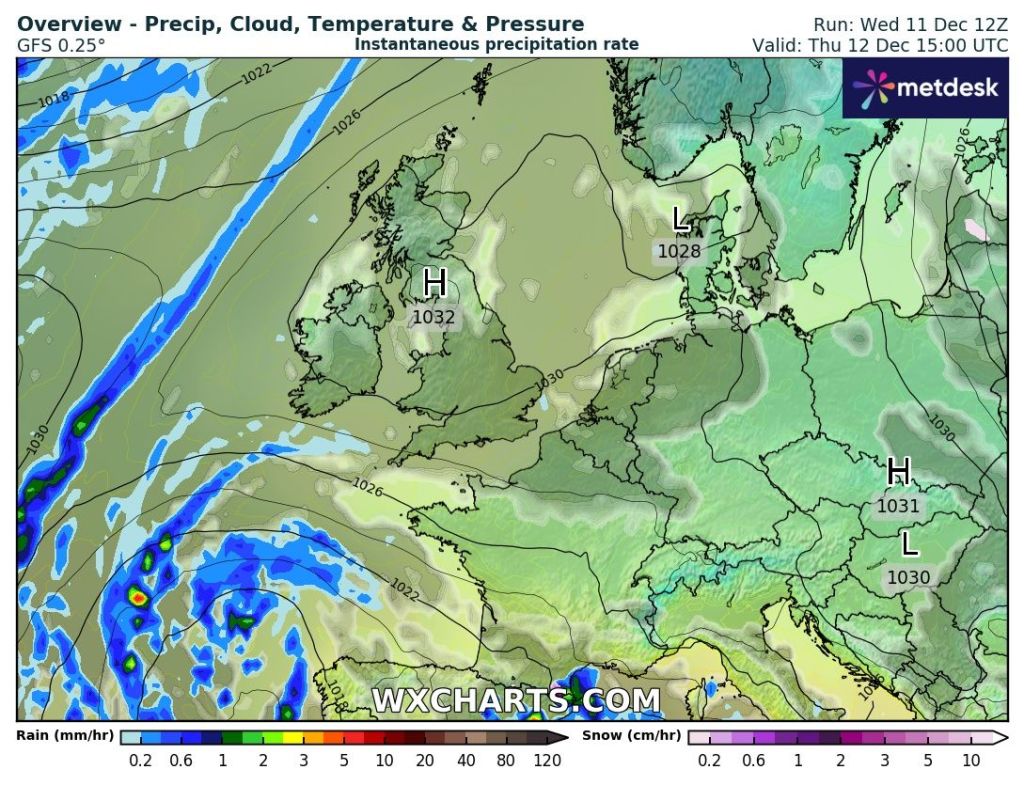
Thursday: Much colder air now in place with a fresh west-to-northwesterly airflow. A decent day though with sunny spells and most showers out to the west, which could fall as hail. Windy, making it feel colder (like 0°C). Ground-frost developing later but lifting as cloud arrives later in the night. Max 6°C Min 3°C

Friday: Back to the mild and wet. Cloud thickening during the morning with rain pushing east late-morning and into the afternoon. Drier into the evening. Windy. Max 9°C Min 6°C

Weekend: Very windy at times, some wintry showers and eventually colder.

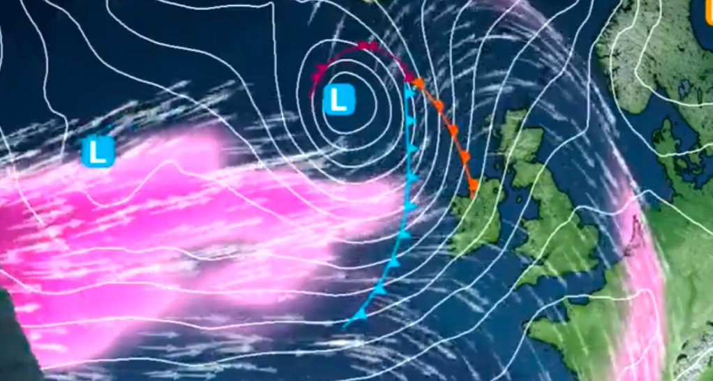
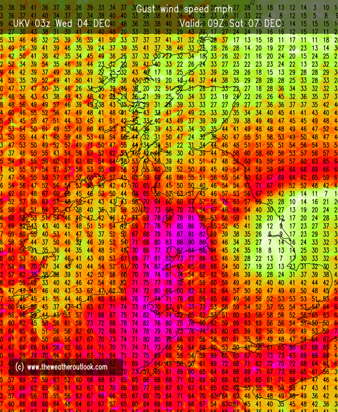
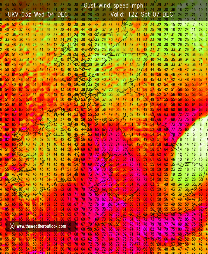
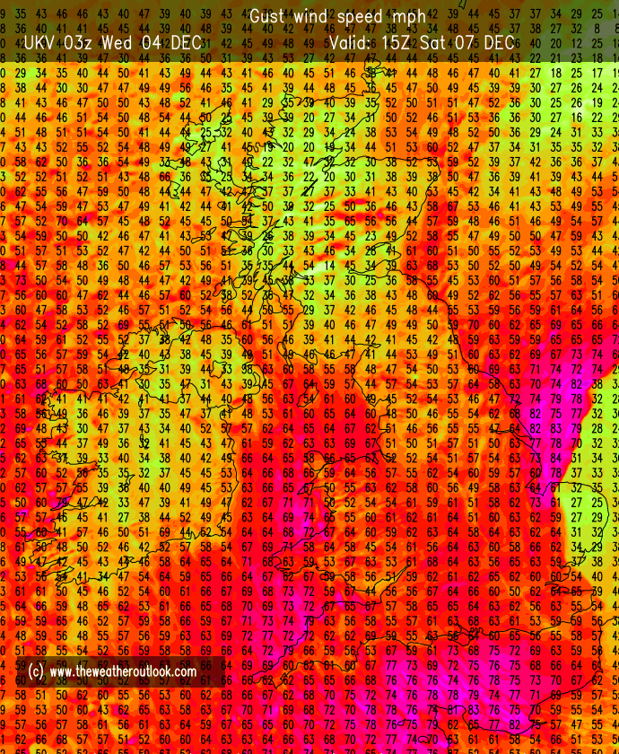
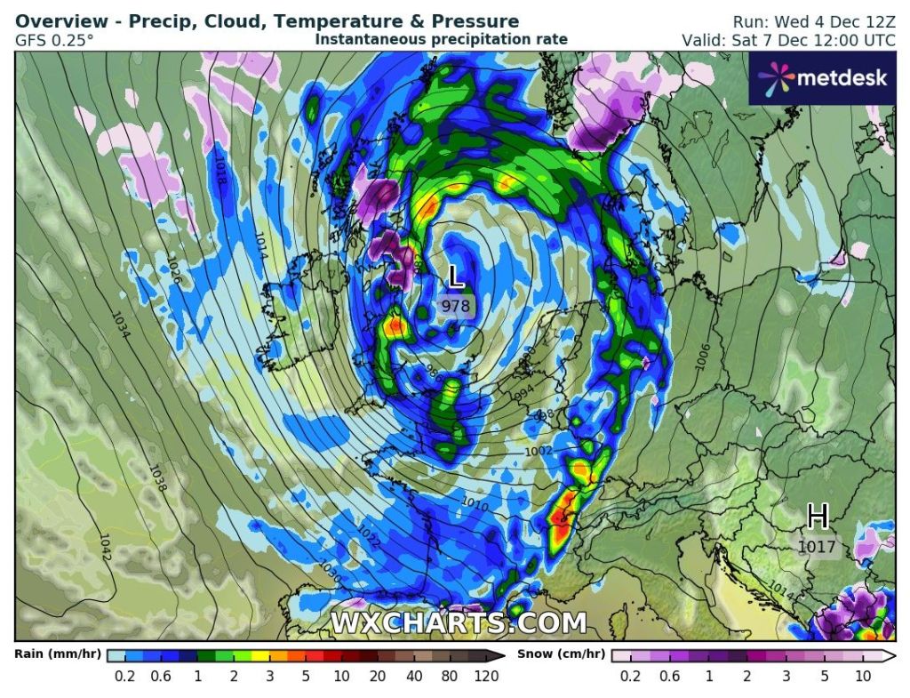
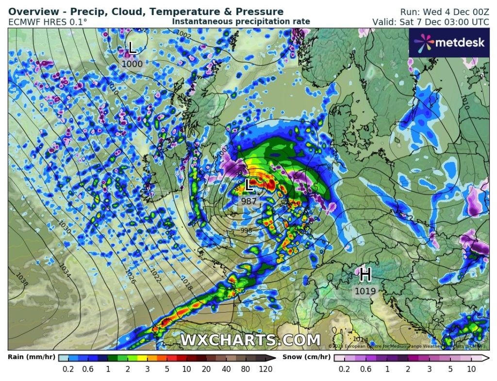
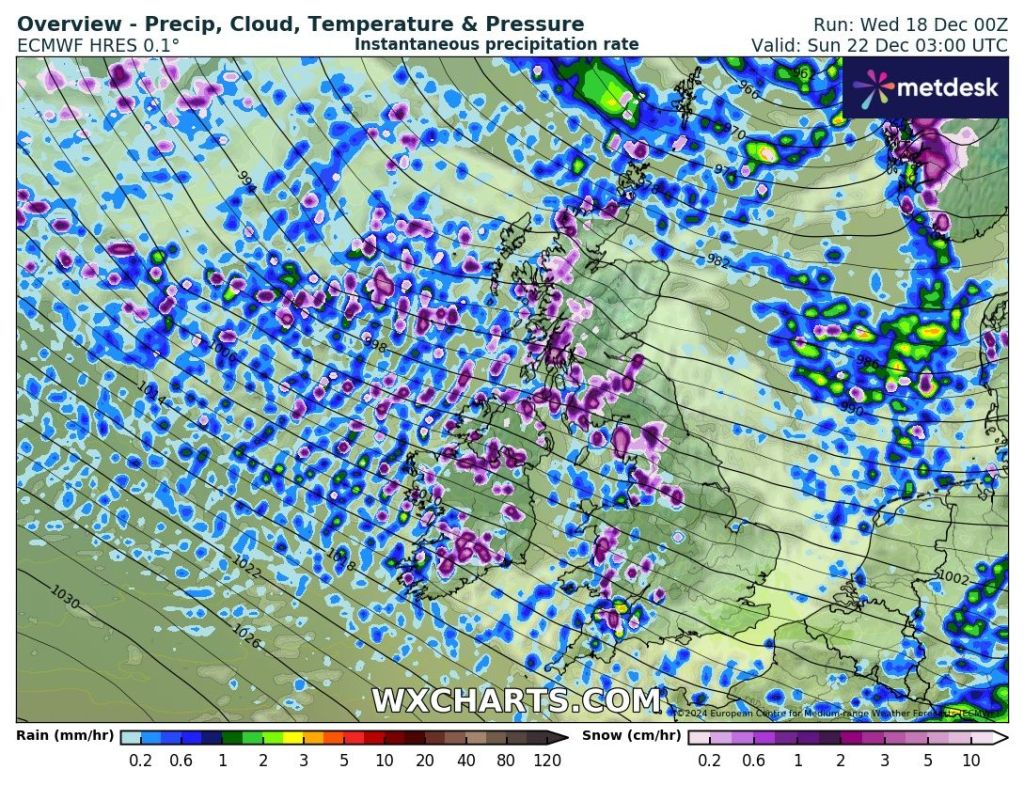
Saturday: A weather-front will bring some patchy rain from the north-west during the morning, turning showery later. Tightly-packed isobars means a strong and gusty wind will be present, with gusts to 50mph. Possible warning could be issued but as for a named-storm, this for now, seems unlikely. Max 10°C Min 4°C

Sunday: Colder air will have followed in behind those showers and with it again being a windy day (45mph), the wind-chill will be notable (0°C). Generally cloudy with some showers, which could be wintry on the tops and fall as hail in places. Max 6°C Min 4°C

Packed isobars this weekend = very windy.

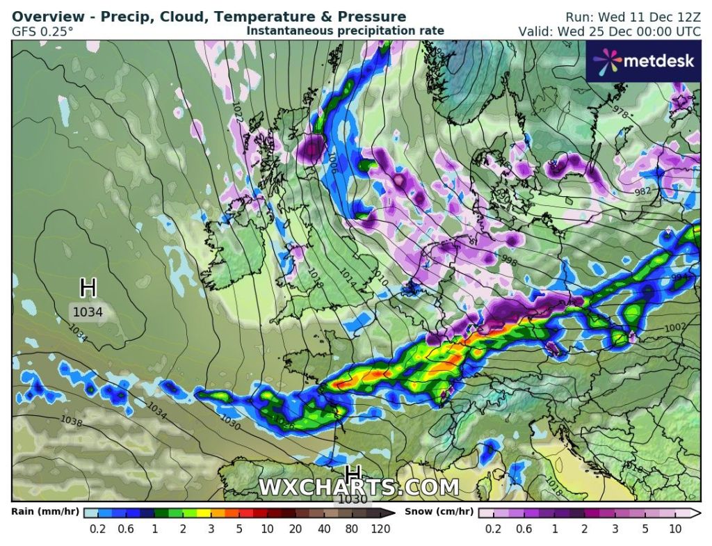
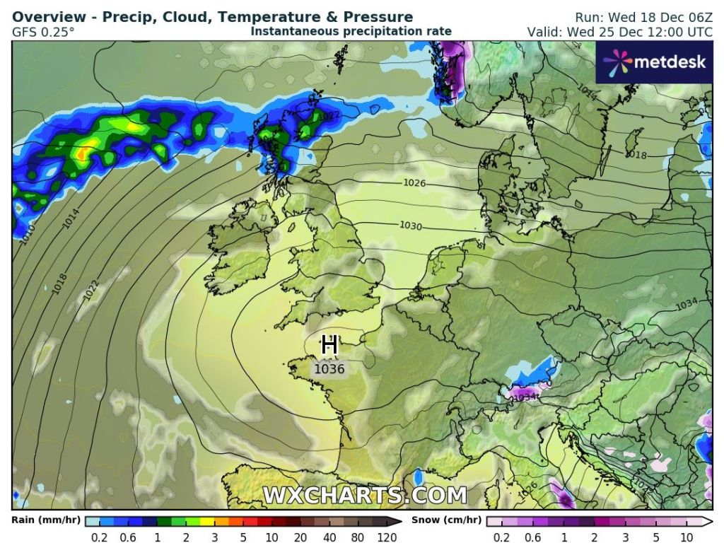
Outlook: Damp and mild at first but hopefully drier for Christmas Day with high pressure building leading to some bright spells and mild with temperatures of about 10-12°C. The following days look good; dry with sunny spells developing and feeling pleasant in any sunshine with light winds and maximum temperatures into double-figures. No chance of a White Christmas.

High pressure for Christmas Day. Mild with bright spells and dry.

Follow @ChadWeather on X and Bluesky for the latest weather forecasts and warnings.

Thanks,
Jon

Images: http://www.wxcharts.com
Forecast Issued: Wednesday the 18th of December 2024 at 6:40pm

Overcast and uneventful but change is coming – Thursday 12th December 2024 – Sunday 15th December 2024

Hi all,

More anticyclonic gloom this week but at least this time it won’t last that long. That said, after a slight change over the weekend, we could well be back to overcast skies next week until the Atlantic returns bringing more unsettled weather. As we approach the festivities we could well see some colder air come down from the north.

Thursday: Very similar to recent days. Cloudy skies and perhaps thick enough for some hill-drizzle. Otherwise, mostly light winds, dull and dry. No frost due to cloud-cover. Max 7°C Min 3°C

High pressure has been in charge this week. But it’s been a “cloudy high”.

Friday: A bit of rinse and repeat. Overcast. Perhaps the odd splash of rain and winds turning southwesterly later. Max 8°C Min 3°C

Weekend: Turning milder.

Saturday: Early cloud and patchy rain will sink southeastwards with bright spells following on behind. Cloudy late-evening. Breezy. Max 8°C Min 6°C

Sunday: Milder with plenty of cloud and reasonably windy. Misty on the hills. Max 12°C Min 7°C

Outlook: Monday/Tuesday look mostly dry, windy and cloudy. Temperatures just creeping into double-figures. It is then expected to turn more unsettled later in the week. As we approach Christmas the long-range forecast suggests slightly colder with plenty of wintry showers. Don’t rule out a snowflake falling on the 25th just yet.

Wintry showers on Christmas Day?

Follow @ChadWeather on X and Bluesky for the latest forecasts and warnings.

Thanks,

Jon

Images: http://www.wxcharts.com

Forecast Issued: Wednesday 11th December 2024 at 9:05pm

Turning colder and potentially very windy. Storm Darragh for parts of the UK can’t be ruled out – Thursday 5th December 2024 – Sunday 8th December 2024

Hi all,

Winter is here but the temperatures have been a bit up-and-down over the last few days. Currently we’re cold and milder air will again return for Thursday. And yes, you’ve guessed it, colder air returns after that, but this time it’s set to stay. This won’t be proper cold (yet!) but certainly more seasonal with wintry showers, frost and a notable wind-chill.

A powerful Jet Stream will drive our weather over the coming days. Image: Met Office.

Thursday: Not a bad morning with dry spells and some hazy sunshine. Cloud increasing and heavy rain arrives for the afternoon, risk of localised flooding. Also turning windy, potentially 40-50mph later in the night (warning in place). Mild but cooler again overnight. Max 13°C Min 5°C

Friday: We turn colder once again with sunny spells and wintry showers feeding down on a northwesterly wind which will be gusty at times. Max 8°C Min 1°C

Weekend: Some uncertainty but a chance of some strong winds or potentially some hill-snow.

Risk of disruptive winds on Saturday. All depends where the low tracks (the centre is noticeable on the charts).

Saturday: At the time of writing, a low pressure system is expected to come in from the west and deepen across the UK. There is still some uncertainty on the track and it could track across the central part of the country, meaning we will see some strong winds, rain followed by hill-snow. If it is to track further south along the south coast, then it’d be a day similar to Friday with sunny spells and a few scattered wintry showers and obviously not as windy. It could be our next named-storm. Max 5°C Min -1°C

Different models predict different positioning for the deep low on Saturday. A few miles can make a big difference in whether we see very strong winds and even hill-snow.

Sunday: Wherever the low tracks, it will be out of the way by Sunday and we can expect winds to start to turn to a more northerly direction and it will feel cold. Sunny spells and any wintry showers should become confined to any coastal regions. Frost at night. Max 6°C Min 0°C

Outlook: With high pressure out to the west, eventually a northeasterly airflow will develop and it is going to be turning colder with sharp overnight frosts and a few wintry showers but some decent sunny spells. As the week progresses, if the high pressure can start to position itself to the north of the UK, we could start to feed in more of an easterly breeze which again will keep temperatures on the cold side but mostly dry with overnight frosts.

Follow @ChadWeather on X and Bluesky for the latest forecasts and warnings.

Thanks,

Jon

Forecast Issued: Wednesday 4th December 2024 at 5:25pm

Images: http://www.wxcharts.com, The Met Office & http://www.theweatheroutlook.com