Cooler air and some rain for a time then improving. Promising outlook – Thursday 27th March 2025 – Sunday 30th March 2025

Hi all,

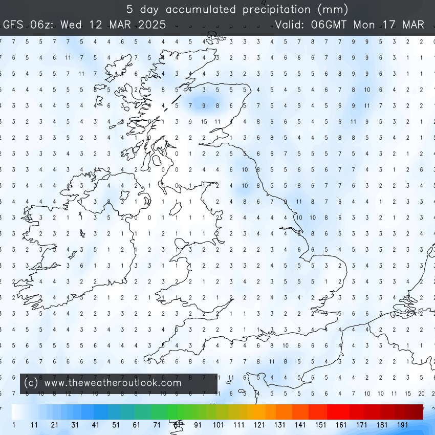
March is not far off coming to a close and the first month of Spring has been dry. Much drier-than-average. Even so, recent rain has been welcomed by the gardens.

Even with rain arriving into Friday, I’m expecting March 2025 to be the driest March I’ve ever recorded. Data started in 2013.

I have a feeling it’s going to be a warm and humid summer with reasonably-high thundery activity. We shall see.

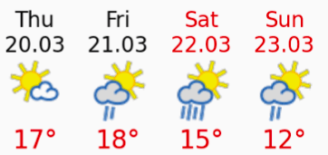
Thursday: After a cloudy start and with high pressure still in charge we can expect some sunny spells. It’ll feel pleasant in any brightness but it will tend to cloud over later in the day and it will be a windy one later with gusts to 30mph. A band of rain will sink southeast overnight. Max 15°C Min 6°C Gusts 30mph

Some rainfall is due overnight Thursday into Friday but again not high amounts.

Friday: Any early rain will push away and introduce colder air as the winds swing to more of a northwesterly direction. It will then be a day of bright or sunny spells and some blustery showers which could well produce some hail and perhaps some thunder and lightning. Feeling cold especially in the wind and temperatures will just struggle to double figures. Risk of frost overnight. Max 11°C Min 1°C Gusts 30mph

Weekend: High pressure returns eventually.

Saturday: Still windy with a weak weather-front coming through the region bringing the odd shower or two. Temperatures up a little. Max 12°C Min 5°C Gusts 25mph

Sunday: It’s looking better for Mother’s Day albeit breezy. Dry, as high pressure builds back in and some pleasant sunny spells. Just the wind taking the edge off the temperature but it will be warmer. Max 16°C Min 5°C Gusts 20mph

Later next week, depending on the airflow. Temperatures could bring the highest values of the year so far.

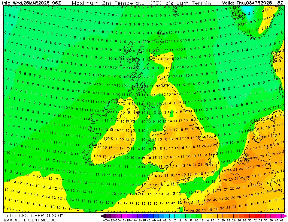
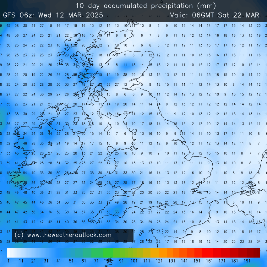
Outlook: There have been some ups and downs regarding next week; but there now seems to be more of an agreement that it will be nice with high pressure in charge. So cool nights but pleasantly warm by day with sunny spells and fair-weather cloud. Some models predict a waft of warm air coming up from the south and if we keep a southerly or southeasterly airflow we could see temperatures approaching the 20°C mark. Look out for updates on social media.

We could be seeing temperatures well-above average as we go through next week as well as more dry conditions.

Follow @ChadWeather on X and Bluesky for the latest forecasts and warnings.

Thanks,

Jon

Forecast Issued: Wednesday 26th March 2025 at 6:41pm.

Images: http://www.wxcharts.com & http://www.wetterzentrale.de

Warm then cloud and cooler temperatures to return with some rain – Thursday 20th March 2025 – Sunday 23rd March 2025

Hi all,

The sunshine is back and eventually temperatures will rise day-by-day but it’s only set to last for a couple of days so make the most of it.

Wednesday was a glorious day on Heaton Park Golf Course. It’s really dried out now which is no surprise as we have only measured 3 days with rain falling in the last 3 weeks. Those greens are getting fast.

It’s been a drier-than-average few weeks now and March has only seen 3 days of recorded rainfall. We are only sitting on 9.4mm of rain which is very dry for the time of year.

March so far. Cold nights and very dry.

We’ve had some cold nights so the frost and dew has dampened the ground but I’ve started to water my plants and grass seed which I don’t do often in March.

So is there any significant rain on the way? Good question. Yes this glorious weather is set to break into the weekend but rainfall amounts seem to vary and will come via showery rain, rather than bouts of heavy rain.

Some rain (welcome rain some may say) over the next 5 days but not a lot

Thursday: Any early cloud will clear to leave a day of warm sunshine which could be hazy at times. With lighter winds it will feel really pleasant with temperatures getting into the late-teens. Dry. Cool overnight. Max 19°C Min 7°C

Friday: Low pressure will be drifting up from the southwest. This means the weather is set to break, but it looks like we will get through Friday with another warm and dry day with sunny spells. However, it will be much windier than recently with gusts to 30mph, which will take the edge off the temperature. After dark and overnight there is a risk of some showers breaking out and drifting up from the southwest. Max 18°C Min 9°C

Warmer on Thursday and Friday

Weekend: Low pressure close by but not a washout.

Saturday: Low pressure, albeit slack, will be in control of our weather now, so we can expect some showery rain at times on Saturday but also some bright spells. It will still be quite mild however with temperatures just above average. Still breezy but not as windy as Friday. Max 15°C Min 8°C

Sunday: Any showers or drizzle is expected to become confined to the south, so we can expect a drier day, but with plenty of cloud. The breeze will now be coming in from a cooler northeasterly direction. Temperatures back to normal. Max 12°C Min 4°C

Outlook: For the first half of the week, high pressure will build in. Although it will only be a ridge, this means we can expect a dry day on Monday and after a cloudy start, sunny spells should break through.

It’s a bit tricky to forecast the rest of the week because it’ll be a battle, between weak areas of high pressure and occasionally small areas of low pressure. To summarise this means bright spells, but with also the likelihood of showers breaking out. Temperatures to remain about average in the early teens, but with the hint of it cooling off a bit more later in the week.

Follow @ChadWeather on X and Bluesky for the latest forecasts and warnings.

Thanks as always for reading.

Jon

Forecast Issued: Wednesday 19th March 2025 at 5:45pm

Images: http://www.wxcharts.com & meteoblue.

Colder air is back but signs of a warm-up once again – Thursday 13th March 2025 – Sunday 16th March 2025

Hi all,

What a beautiful weekend that was. I hope you made the most of it. I certainly did with a walk on the tops to the B-29 crash site on Saturday and then several hours gardening on the Sunday. Love days like that. But March is a fickle month and we’re back to the colder air now with a brisk northerly airflow.

Showers are going to affect the northeast coast and at times when the wind is strong enough, some of these showers will feed down into the region. These showers will be well-scattered so we can expect some sunny spells this week and quite a lot of dry weather and not much rainfall over the next 5 days.

Despite showers, not much rainfall is expected over the coming 5 days. It’s been drier-than-average for the last 6 weeks.

High pressure is going to build this weekend but at the moment it looks like it could well be a cloudy-high especially on Sunday. Once the high moves away into Europe, it looks like we will return to a southwesterly airflow later next week and the temperatures will respond. Getting well back into double-figures.

There is certainly no sign of any 500-mile wall of snow or significantly cold temperatures :).

No strong winds in this forecast nor particularly cold nights but there will be some localised frosts especially early on.

Thursday: After a bright start with a patchy frost, cloudy will increase during the day again and there will be the odd shower around which could be wintry on the hills. A cold wind. Max 8°C Min 0°C

Friday: Pretty much a similar day; cold start with some patchy frost then sunny spells for a time before cloud bubbles up again and the odd shower is possible, but not as many showers are expected compared to previous days. Max 8°C Min 1°C

Weekend: High pressure building killing off the risk of any showers.

Saturday: A chilly start and perhaps some bright spells for the morning but cloud will tend to fill the skies as the day goes on but it should stay dry with high pressure built across the UK. Max 9°C Min 2°C

Sunday: Light winds with high pressure in charge, but if we do see a bright start, it will soon cloud over and this will hang around for the day. Dry with light winds. Max 10°C Min 3°C

High pressure for the weekend but cloudy at times

Outlook: The high pressure that arrived for the weekend is expected to drift away to the east. This will allow southwesterly/southerly winds to return introducing milder weather and eventually the risk of some showery rain approaching from the Atlantic.

Wetter weather from the southwest seems to be the likely outcome later next week

Follow @ChadWeather on X and Bluesky for the latest forecasts and warnings.

Thanks,

Jon

Forecast Issued: Wednesday the 12th of March 2025 at 5:13pm

Images: http://www.wxcharts.com & http://www.theweatheroutlook.com

The reasonable weather continues with a blip on Friday before colder weather returns – Thursday 6th March 2025 – Sunday 9th March 2025

Hi all,

It’s been a dry and decent enough start to Spring/March and this weather is set to continue, bar Friday, with temperatures climbing briefly.  One caveat is it will be windy at times.

The tabloids have been churning out the snow/Beast from the East headlines again this week and it couldn’t be further from the truth. No sign of significant cold but as we all know. Wintry conditions can return easily in the month of March.

Just a quick blog this week after playing golf today and also it’s the wife’s birthday, so limited time.

Thursday: Becoming windy with pleasant sunny spells. More in the way of cloud later in the day with some unstable air bringing the risk of showers, mostly into the evening. Much milder and even feeling warm if you can find shelter. Max 16°C Min 9°C

Friday: A blip. Cloudy with some showery rain. Not as windy and not as “warm”. Max 13°C Min 8°C

Next 10 days rainfall amounts: Most of this coming on Friday

Weekend: Warm spells of brightness.

Saturday: Warmer again with sunny spells, the chance of a shower out west. Breezy. Max 16°C Min 6°C

Sunday: Not bad despite the wind. Plenty of warmish sunny spells. Turning colder overnight. Max 15°C Min 5°C

Outlook: Colder next week with brisk east or northeasterly winds. Early risk of a few showers,  otherwise mostly dry, with increasing sunny spells. Cold overnight with some frost.

Colder air from the east or northeast next week

Follow @ChadWeather on X or Bluesky for the latest forecasts and warnings.

Thanks,

Jon

Forecast Issued: Wednesday the 5th of March 2025 at 6:13pm