
Hi all,
What a beautiful weekend that was. I hope you made the most of it. I certainly did with a walk on the tops to the B-29 crash site on Saturday and then several hours gardening on the Sunday. Love days like that. But March is a fickle month and we’re back to the colder air now with a brisk northerly airflow.
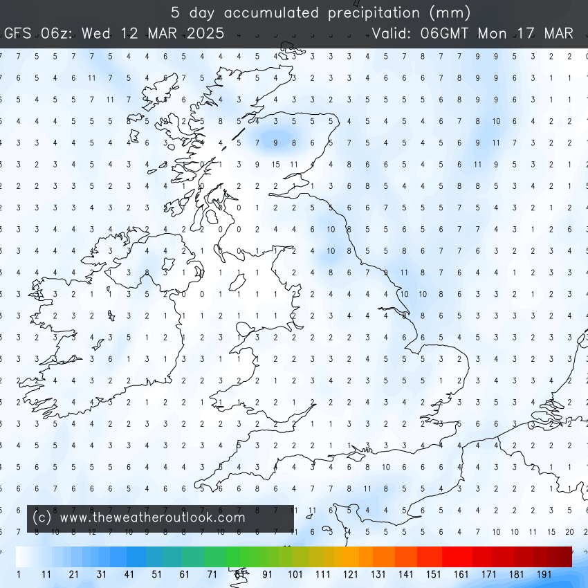
Showers are going to affect the northeast coast and at times when the wind is strong enough, some of these showers will feed down into the region. These showers will be well-scattered so we can expect some sunny spells this week and quite a lot of dry weather and not much rainfall over the next 5 days.
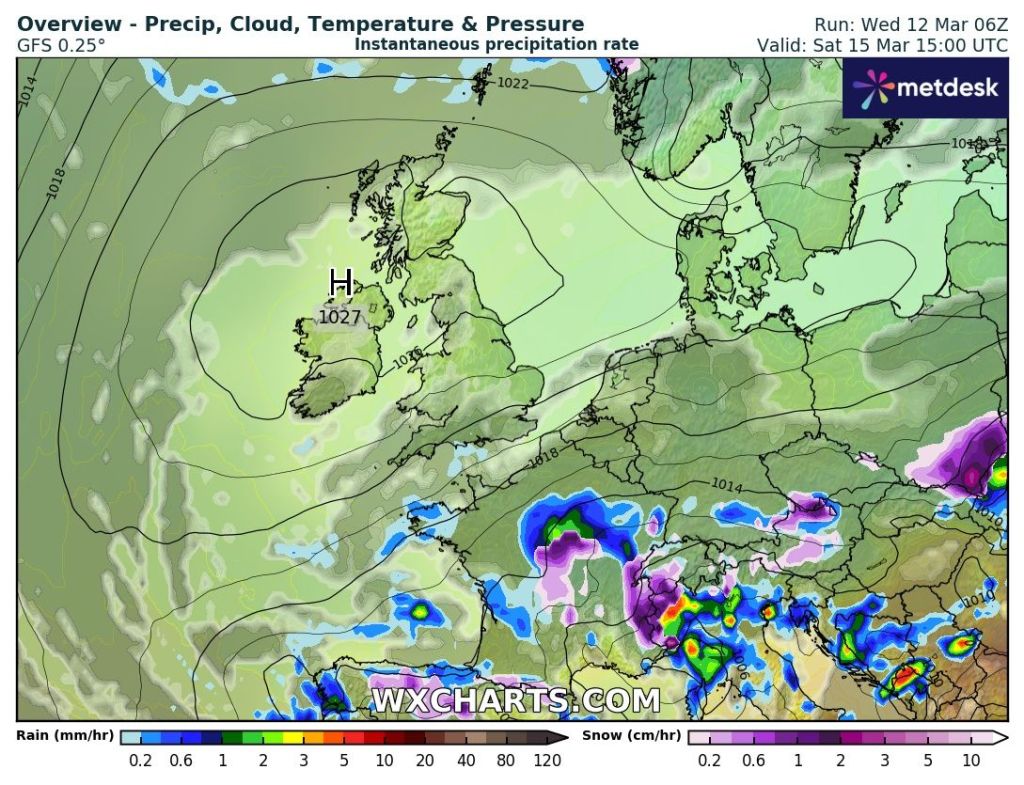
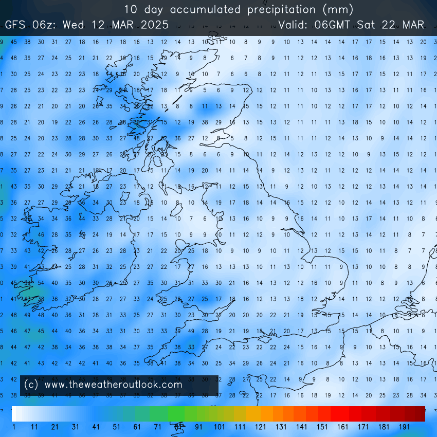
High pressure is going to build this weekend but at the moment it looks like it could well be a cloudy-high especially on Sunday. Once the high moves away into Europe, it looks like we will return to a southwesterly airflow later next week and the temperatures will respond. Getting well back into double-figures.
There is certainly no sign of any 500-mile wall of snow or significantly cold temperatures :).
No strong winds in this forecast nor particularly cold nights but there will be some localised frosts especially early on.
Thursday: After a bright start with a patchy frost, cloudy will increase during the day again and there will be the odd shower around which could be wintry on the hills. A cold wind. Max 8°C Min 0°C
Friday: Pretty much a similar day; cold start with some patchy frost then sunny spells for a time before cloud bubbles up again and the odd shower is possible, but not as many showers are expected compared to previous days. Max 8°C Min 1°C
Weekend: High pressure building killing off the risk of any showers.
Saturday: A chilly start and perhaps some bright spells for the morning but cloud will tend to fill the skies as the day goes on but it should stay dry with high pressure built across the UK. Max 9°C Min 2°C
Sunday: Light winds with high pressure in charge, but if we do see a bright start, it will soon cloud over and this will hang around for the day. Dry with light winds. Max 10°C Min 3°C
Outlook: The high pressure that arrived for the weekend is expected to drift away to the east. This will allow southwesterly/southerly winds to return introducing milder weather and eventually the risk of some showery rain approaching from the Atlantic.
Follow @ChadWeather on X and Bluesky for the latest forecasts and warnings.
Thanks,
Jon
Forecast Issued: Wednesday the 12th of March 2025 at 5:13pm
Images: http://www.wxcharts.com & http://www.theweatheroutlook.com
